
Heat expands across the Desert Southwest, Plains, Mississippi Valley and Midwest into Monday. Fire weather concerns continue for portions of the Intermountain West. Active monsoonal moisture fuels thunderstorms over the Southwest with possible flash flooding. Tropical cyclone Fausto in the Pacific, should weaken as it approaches Hawaii; Dangerous surf, swells and rip currents are expected. Read More >
Hastings, NE
Weather Forecast Office
Observed Precipitation Maps
These maps should update daily by mid morning. Please check timestamps in bottom right of each image.
Click to expand images.
Data Source: National Weather Service AHPS
| 24 Hour | 48 Hour | 72 Hour |
 |
 |
 |
| Last 7 Days | Last 30 Days | Last 90 Days |
 |
 |
 |
|
Percent of Normal Last 7 Days |
Percent of Normal Last 30 Days |
Percent of Normal Last 90 Days |
 |
 |
 |
|
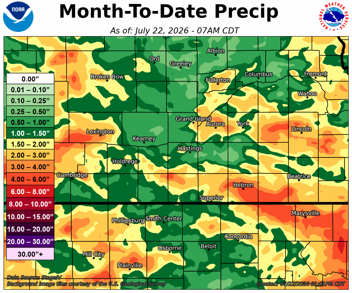
Month to Date |
Year to Date Percent of Normal |
Since October 1st Percent of Normal |
 |
 |
 |
More Maps:
Archive of Monthly & Annual Precip Maps
Snowfall Analysis (Winter Months Only)
Nebraska Statewide Precip/Snow Maps
Hazardous Weather
Submit A Storm Report
Storm Prediction Center
Local Storm Reports
Experimental Graphical Hazardous Weather Outlook
Forecasts
Area Forecast Discussion
Fire Weather
Aviation Weather Center
Experimental Probabilistic Precip Amount Forecast
Winter Weather
Winter Storm Severity Index
Experimental Winter Storm Outlook
Wet Bulb Globe Temp
Activity Planner
Current Conditions
Current Area Observations
Text Products
Satellite
Rivers and Lakes
Local 24 Hour Precip Maps
Local Archived Precip Maps
NWPS Precipitation Analysis
Local Snowfall Maps
Snowfall Analysis
Snow Cover
Climate
Local Database (NOWData)
Local Climate Webpage
Hastings/G. Island Records
Local Historical Tornado Info
U.S. Drought Monitor
Grand Island - Daily
Grand Island - Monthly
Hastings - Daily
Hastings - Monthly
Kearney - Daily
Kearney - Monthly
Ord - Daily
Ord - Monthly
US Dept of Commerce
National Oceanic and Atmospheric Administration
National Weather Service
Hastings, NE
6365 North Osborne Drive West
Hastings, NE 68901-9163
402-462-4287
Comments? Questions? Please Contact Us.

