A significant heat wave is underway for the Intermountain West, Northern Plains, and Upper Great Lakes, peaking in intensity through midweek and lingering across parts of the Northern Plains and Midwest until this weekend. In southwest Texas, excessive rainfall may bring a risk for potentially life-threatening flash and arroyo flooding through Thursday. Read More >
If you have any photos you would like to share, please feel free to post them to our Facebook or Twitter pages, or send them to our webmaster e-mail account at: w-gid.webmaster@noaa.gov. Please let us know where the photo was taken, and at least an approximate time. Thanks!
|
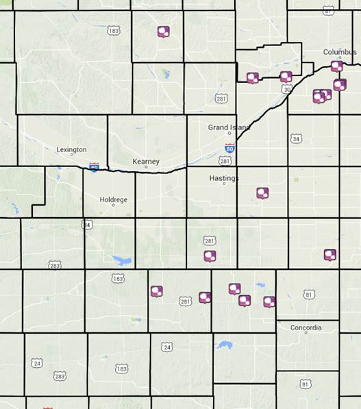
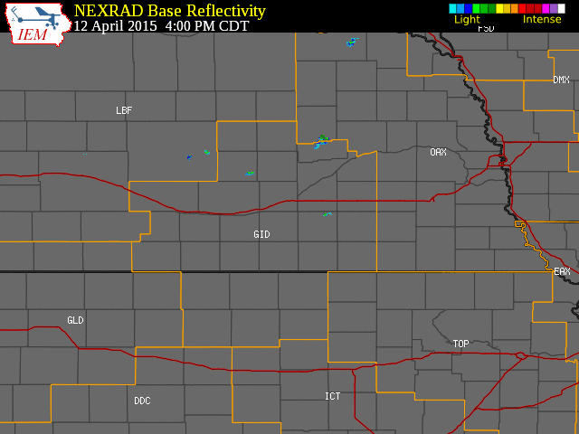
The NWS Hastings coverage area is located within the orange outlined area labeled "GID".
(Click Radar Loop To Enlarge)
|
 |
|
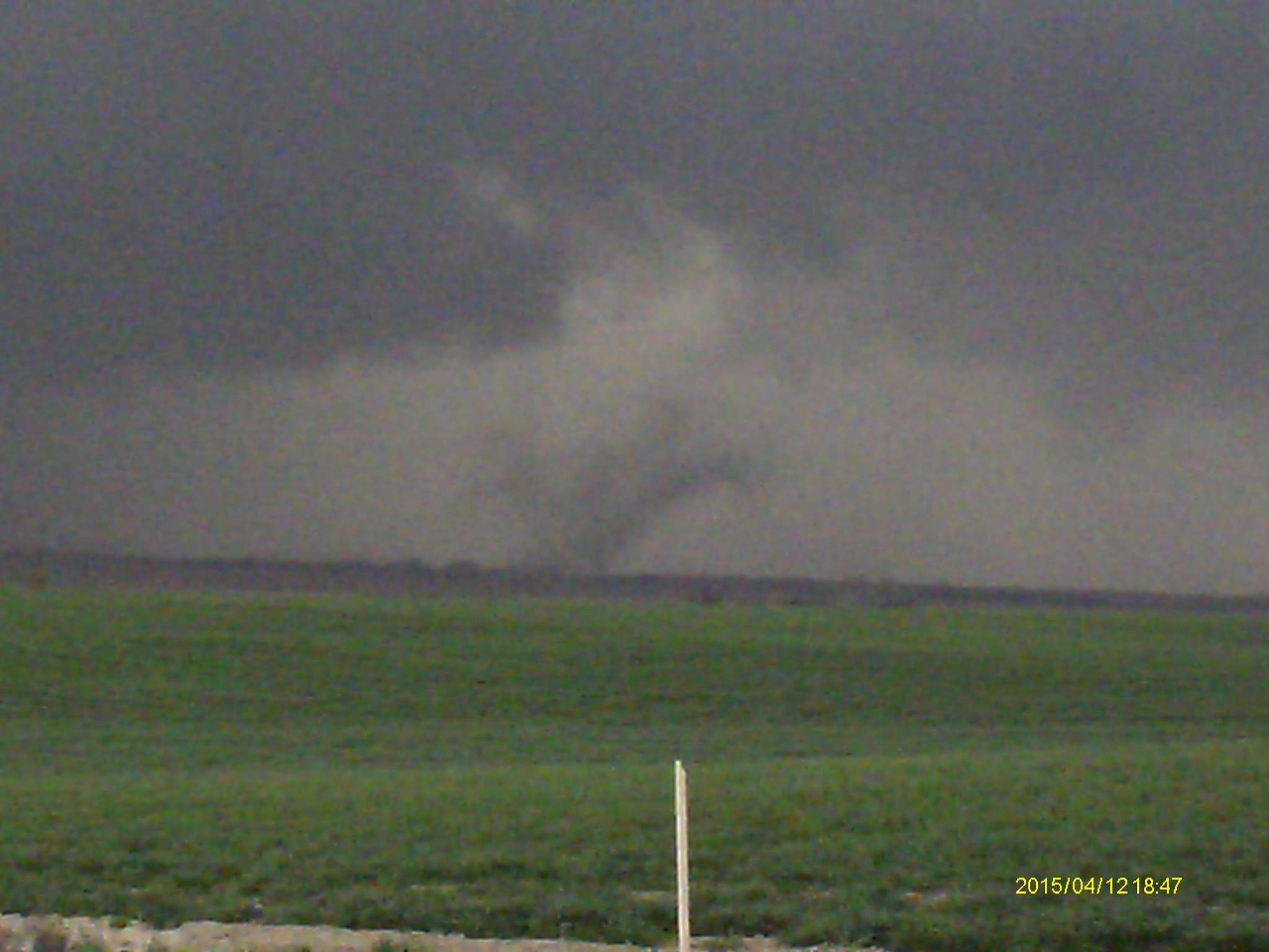
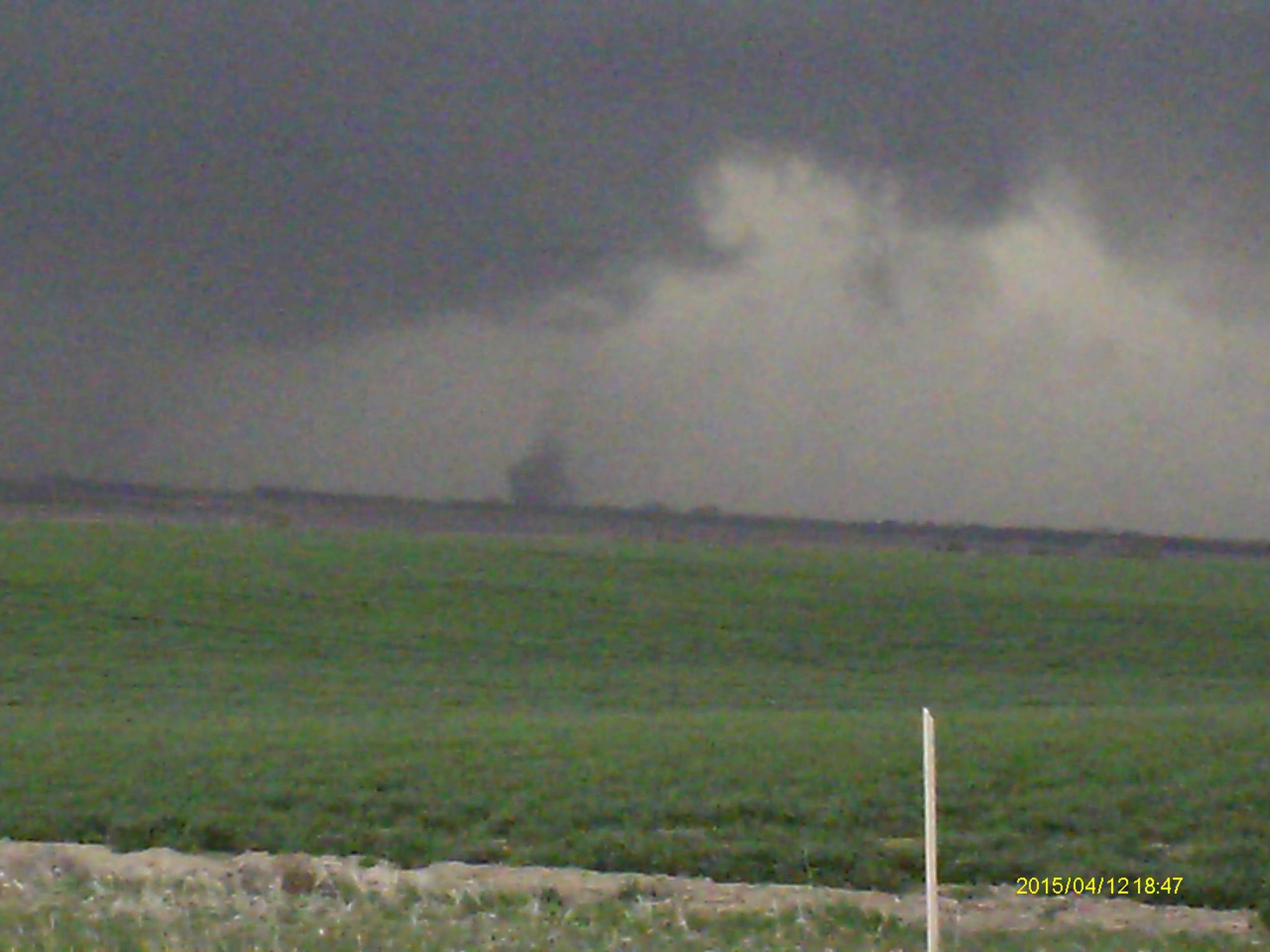
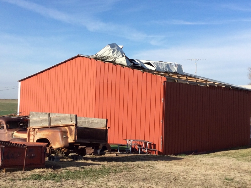
Event Summary: A surface cold front working southeast through the region heped to spark isolated to scattered thunderstorms during the late afternoon and evening hours of Sunday, April 12, 2015. A few of these storms became severe mainly within counties along/east of the Highway 281 corridor within the NWS Hastings coverage area, primarily between 5 PM-830 PM. The greatest concentration of severe weather reports were received from Polk County Nebraska and Smith/Jewell counties in Kansas. (click to get to more detail information)
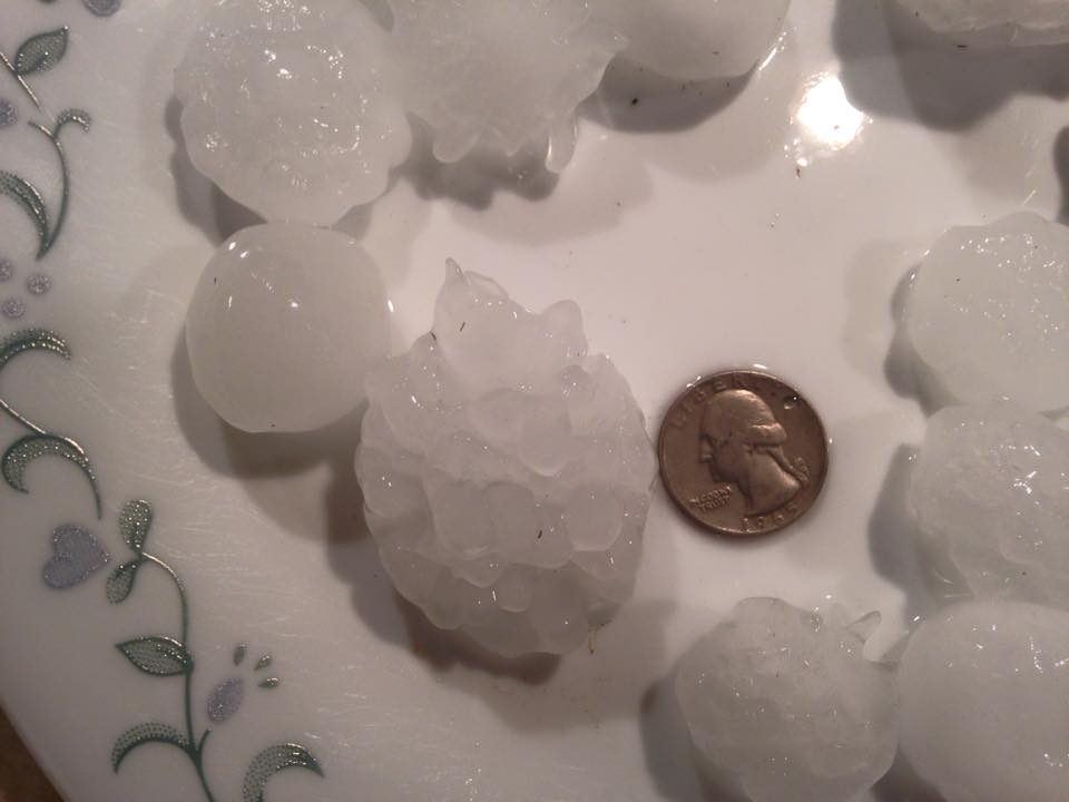
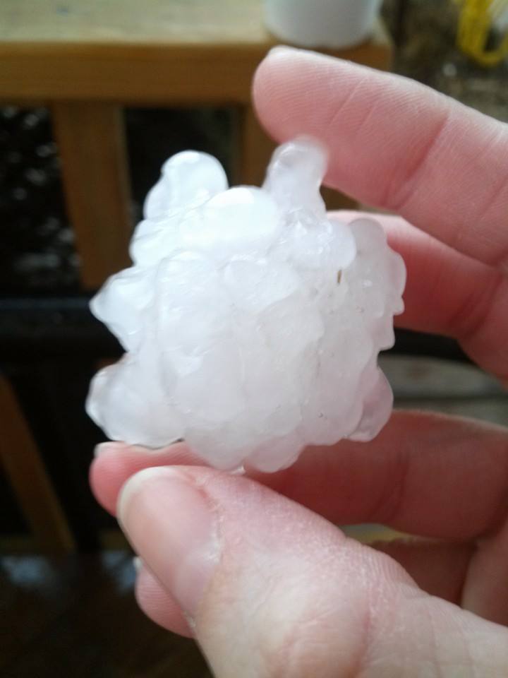
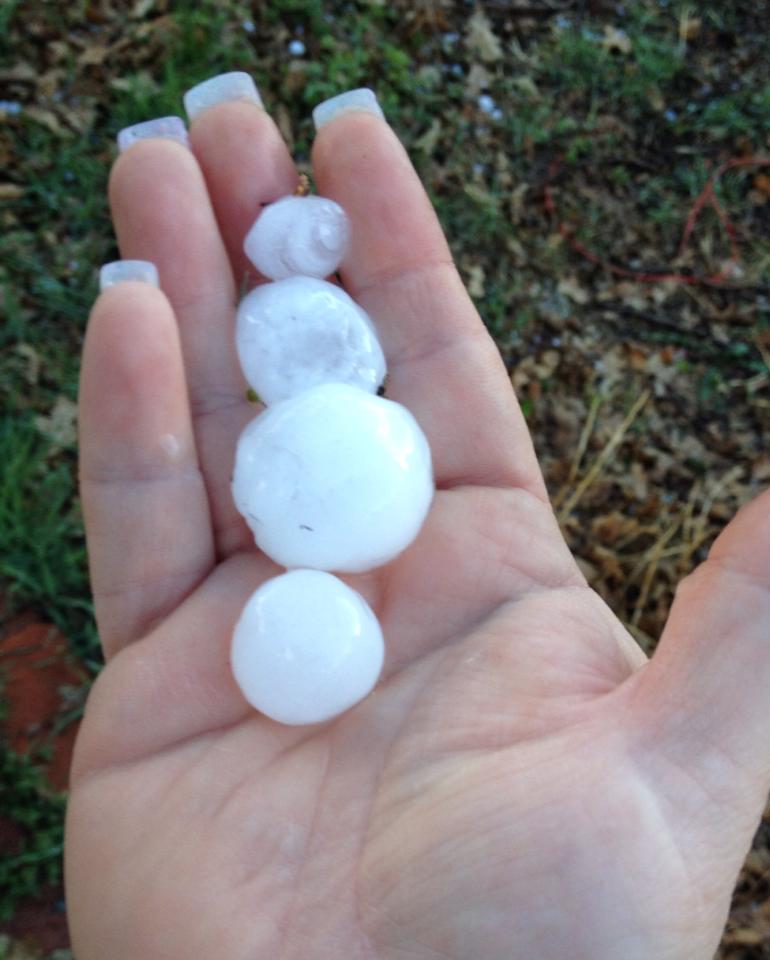
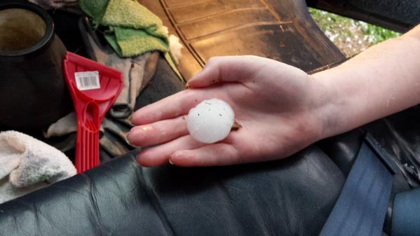
Here are a few of the most significant storm reports from this event:
|
||||||||||||||||
 |
This page was composed by the staff at the National Weather Service in Hastings, Nebraska. |
 |