Numerous severe thunderstorms are expected across a broad region from the Ohio Valley to the Mid-Atlantic and Northeast States today into tonight. Swaths of damaging wind gusts are expected and some tornadoes are possible. Bertha is expected to bring tropical storm conditions to portions of the Gulf Coast from the Florida Panhandle westward to southeastern Louisiana later today and Wednesday. Read More >
|
|
This tornado touched down approximately 4 miles southwest of Bradshaw, moving to the north-northeast and dissipating approximately 4 miles southeast of Polk, near the York and Polk County line. As the tornado approached Highway 34 west of Bradshaw, a metal outbuilding and grain bins were destroyed, and it also crossed a railroad line, derailing several train cars. North of Bradshaw, a home suffered significant roof damage and the loss of one wall, and as the tornado continued north, power poles were snapped, irrigation pivots were overturned, and several trees were damaged. Between Bradshaw to the area west of Benedict, a total of 40 power poles were downed. The maximum wind speed of this tornado was estimated to be 130 miles per hour. |
 |
 |
 |
|
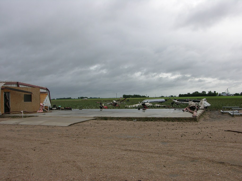
Destroyed outbuilding west of Bradshaw on Highway 34. |
Destroyed outbuilding west of Bradshaw on Highway 34. Photo by NWS Staff. |
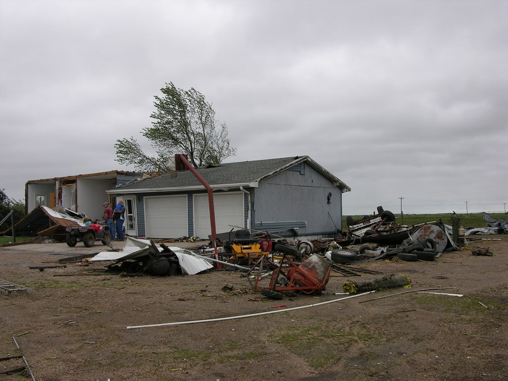
Home destroyed 4 miles north of Bradshaw. Photo by NWS Staff. |
 |
 |
 |
| Damage at home 4 miles north of Bradshaw. Photo by NWS Staff. |
Home destroyed 4 miles north of Bradshaw. Photo by NWS Staff. |
Irrigation pipes thrown into field next to destroyed home 4 miles north of Bradshaw. Photo by NWS Staff. |
 |
 |
 |
| Uprooted tree at destroyed home 4 miles north of Bradshaw. Photo by NWS Staff. |
Destroyed outbuilding in northern York County. Photo by NWS Staff. |
Damaged outbuilding in northern York County. Photo by NWS Staff. |
|
|
This page was composed by the staff at the National Weather Service in Hastings, Nebraska. |  |