
Thunderstorms with severe wind gusts and hail will be possible today across parts of the central Plains, and from the Missouri Valley into the upper Mississippi Valley. Heavy rain associated with the thunderstorms may also produce flash/urban flooding. Critical fire weather conditions expected in the Great Basin and interior Northwest. Dangerous heat continues across the Southwest and Southeast. Read More >
Overview
|
A dynamic low pressure system/winter storm crossed the Central Plains from Thursday, Feb. 23rd through Friday, Feb. 24th, 2017. As is common of many storm systems especially later in the winter, a variety of weather was observed across the NWS Hastings coverage area: |
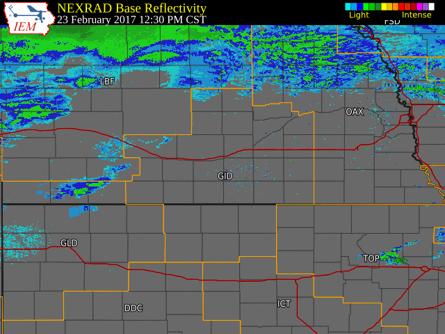 NWS Hastings radar loop from 12:30 PM on Feb. 23rd - 3:30 PM on Feb.24th. The NWS Hastings coverage area is outlined in orange and interstates are in red. |
Snowfall Amounts
Below is a table of selected snowfall totals from area NWS Hastings Cooperative Observers. These are storm total (48 hour) snowfall totals, ending Saturday morning, February 25th.
| Location | Snowfall (in) |
| Greeley | 7.5 |
| Ord | 7.0 |
| Loup City | 5.0 |
| 3 NE Shelby | 4.8 |
| St. Paul | 4.3 |
| Miller | 3.7 |
| Kearney Airport | 3.6 |
| Osceola | 3.2 |
| 3 N York | 3.2 |
| NWS Hastings (4 N Hastings) | 3.2 |
| Clay Center | 3.0 |
| Ravenna | 3.0 |
| Minden | 3.0 |
| Grand Island Airport | 2.9 |
| 8 S Elwood | 2.0 |
| Bradshaw | 1.9 |
| Smith Center, KS | 1.8 |
| Hebron | 1.7 |
| Wilsonville | 1.5 |
| Burr Oak, KS | 1.4 |
| 6 ESE Clay Center | 1.4 |
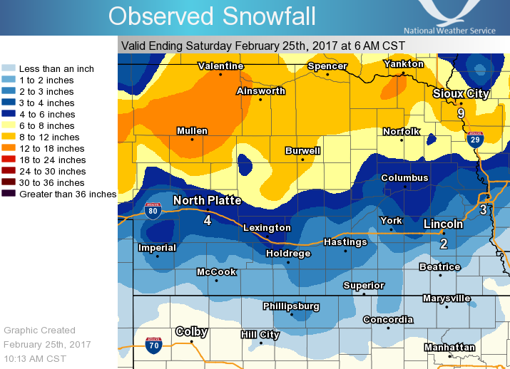
Precipitation Maps
 |
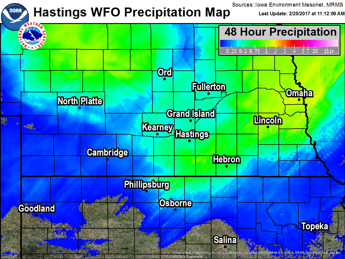 |
| Storm Total (48 Hr) Snowfall Ending The Morning of Feb. 25th. | Storm Total (48 Hr) Liquid Equivalent Ending The Morning of Feb. 25th. |
 |
Media use of NWS Web News Stories is encouraged! Please acknowledge the NWS as the source of any news information accessed from this site. |
|

