
Dangerous and extreme heat will remain across portions of the central U.S. this week, persisting across the mid to lower Mississippi Valley, Gulf Coast, southern Plains and portions of Texas. A heat wave over the Southwest U.S. will peak this weekend. Heavy to excessive rainfall may produce flash flooding from the Delmarva Peninsula north into the Hudson Valley today and tonight. Read More >
Ice Storm Evolution & Impacts
|
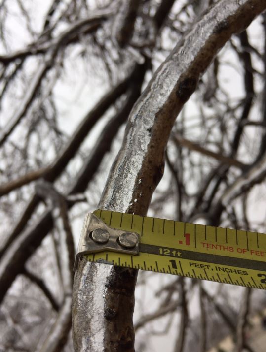
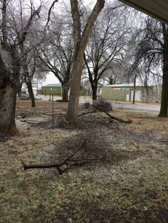
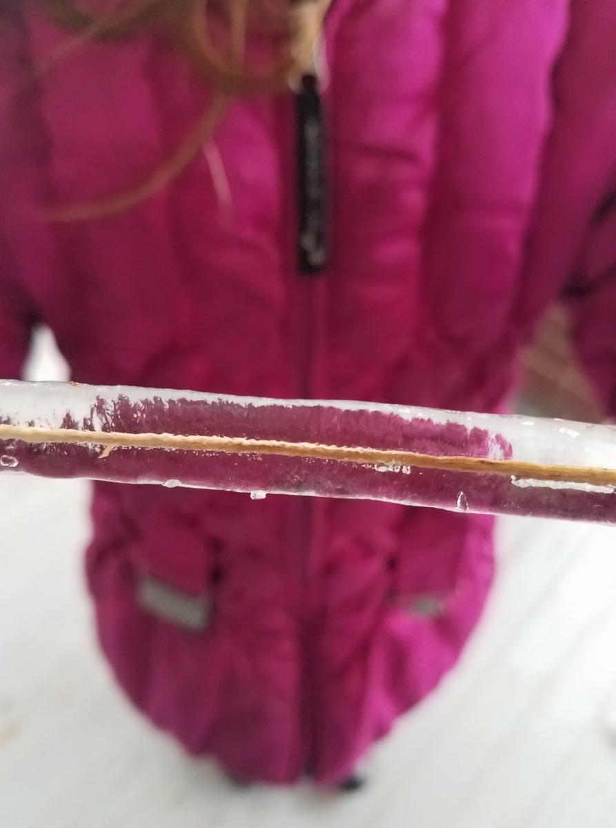
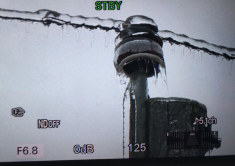
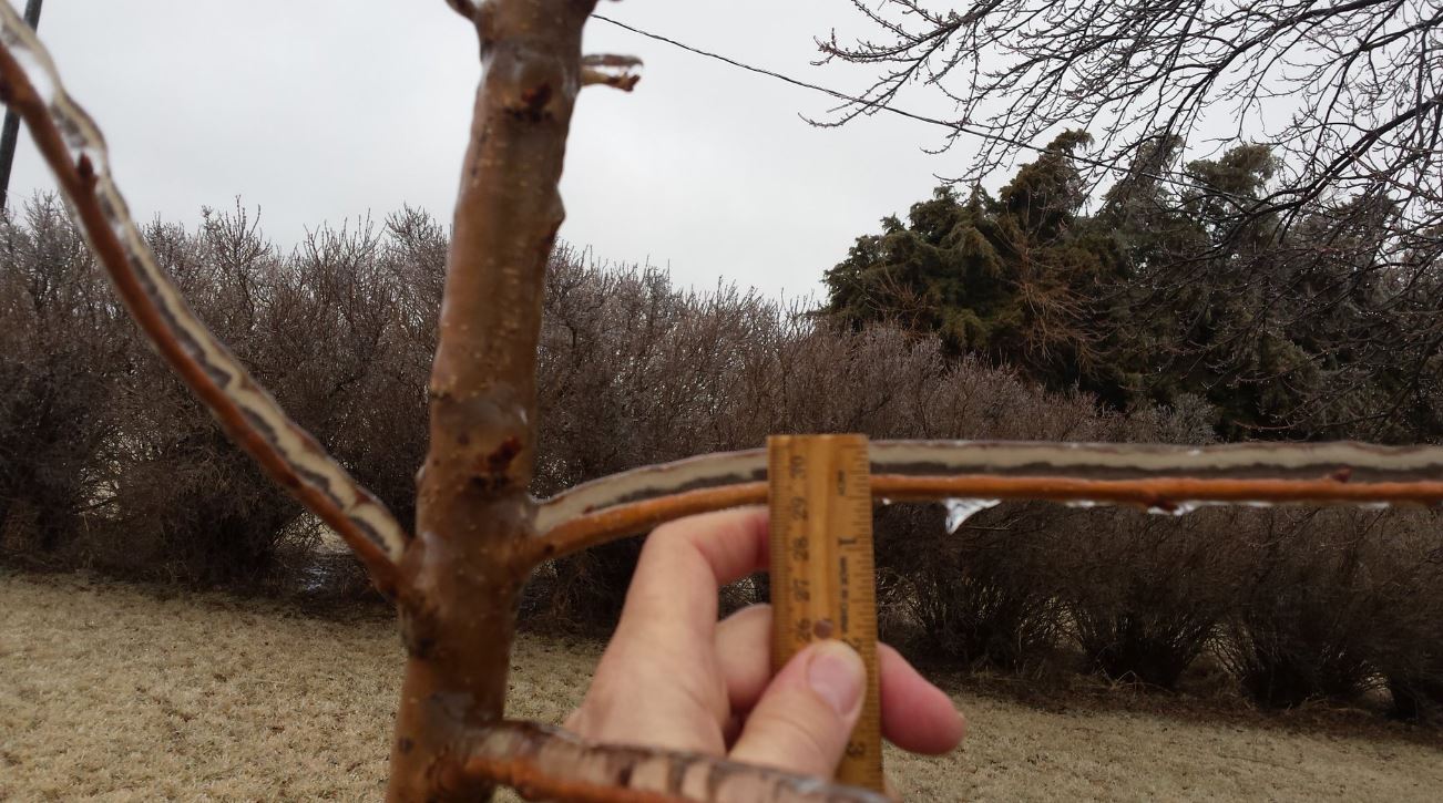
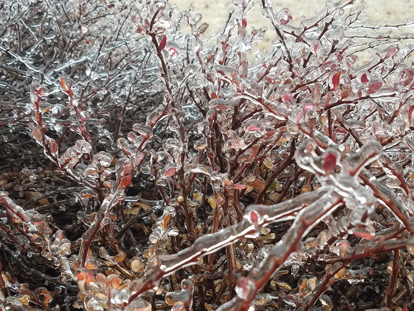
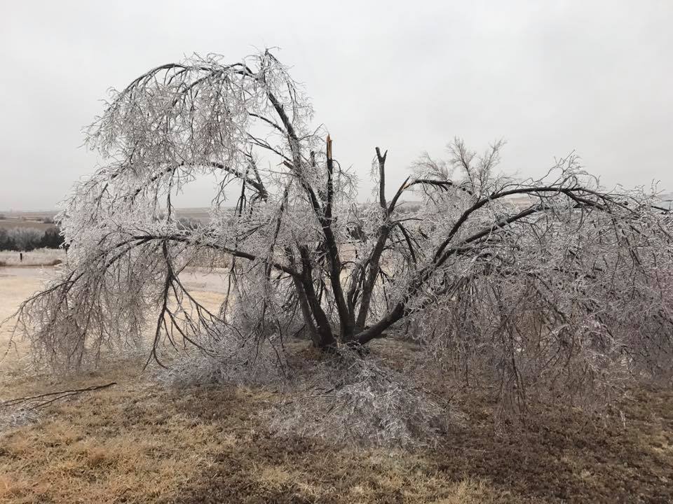
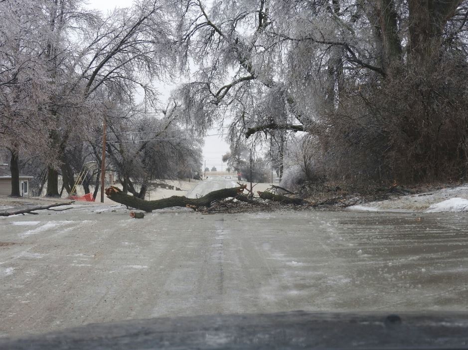
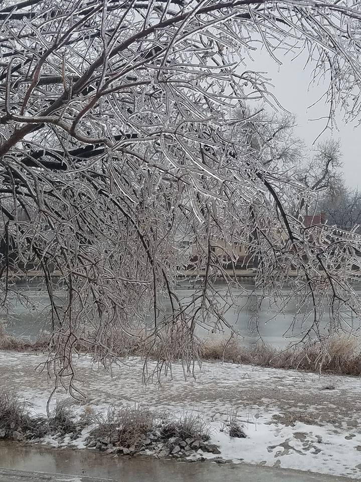
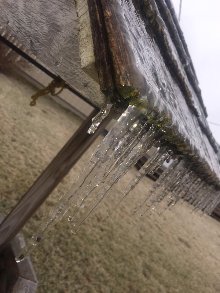
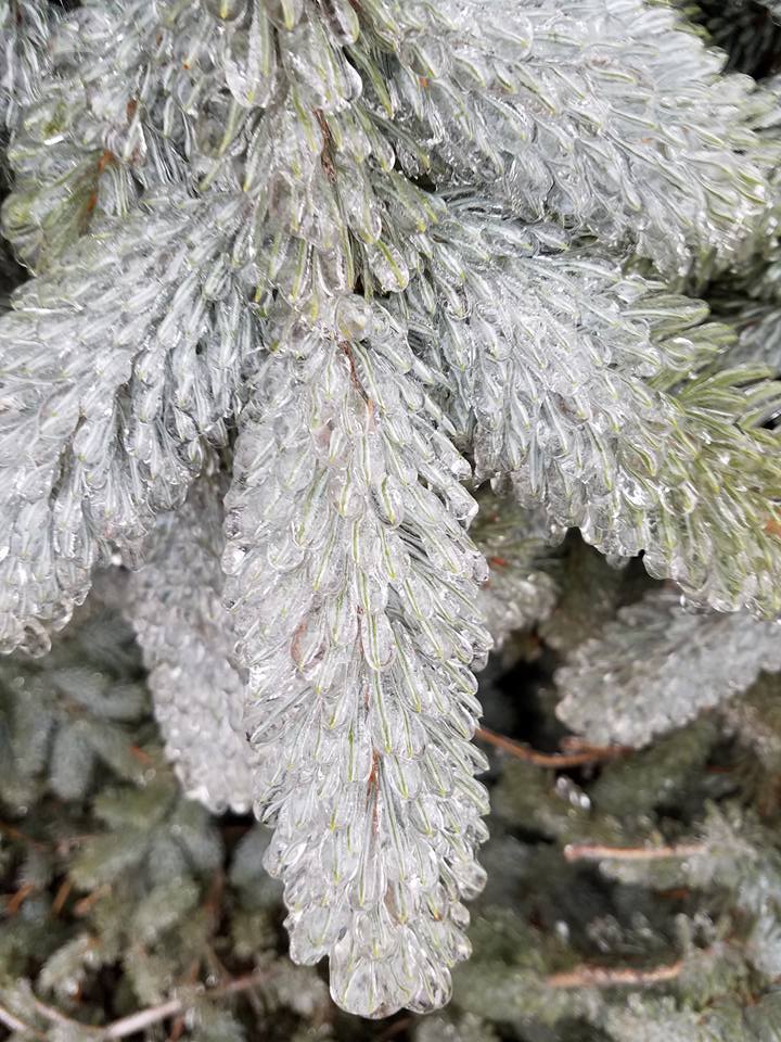
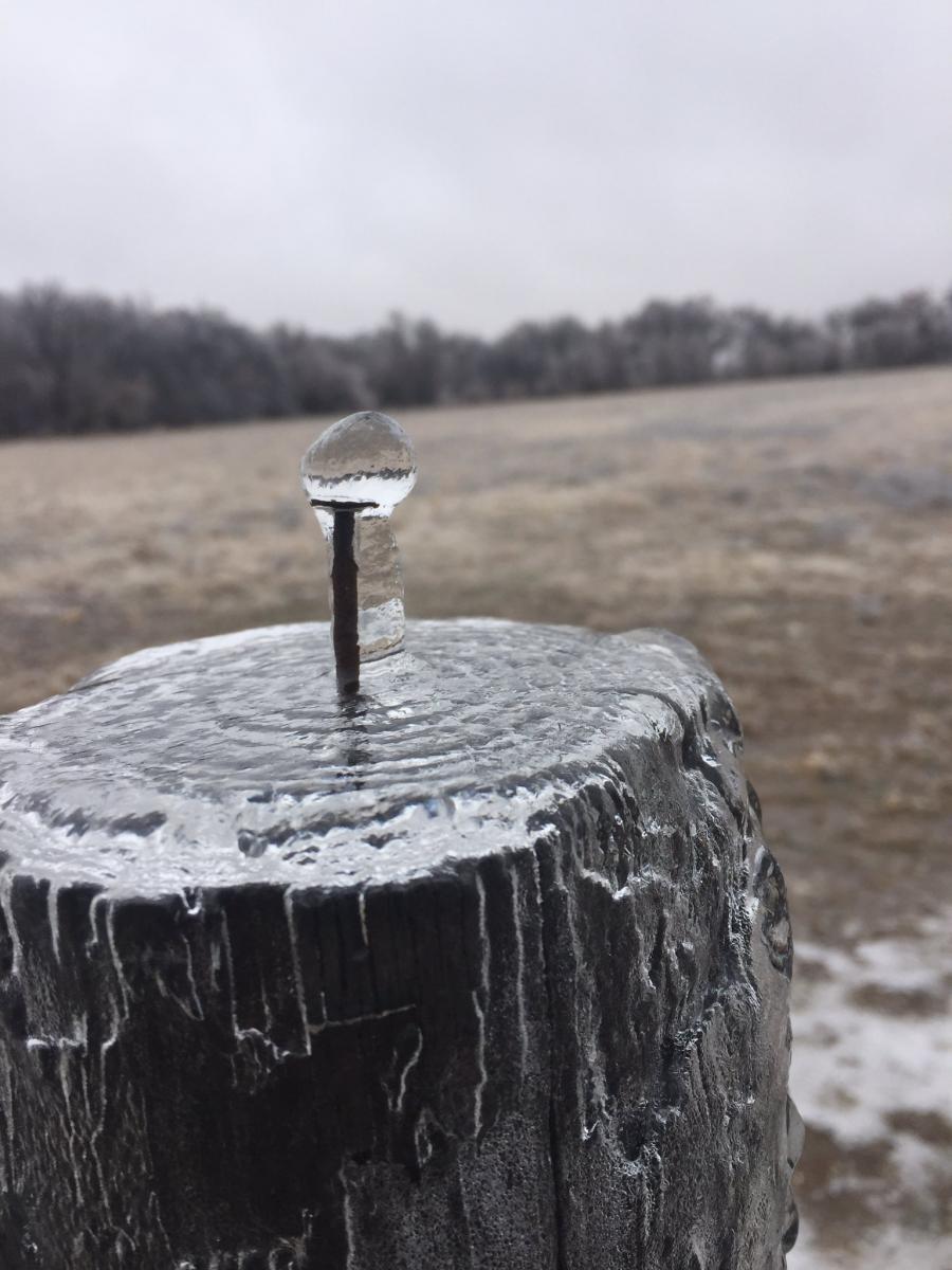
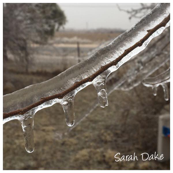
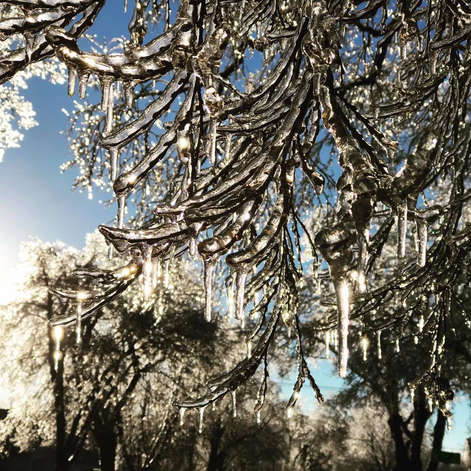
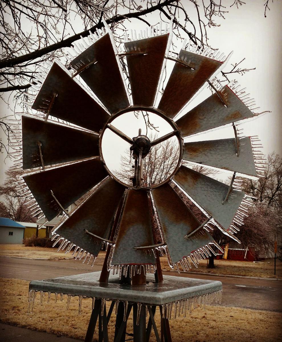
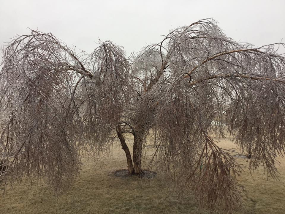
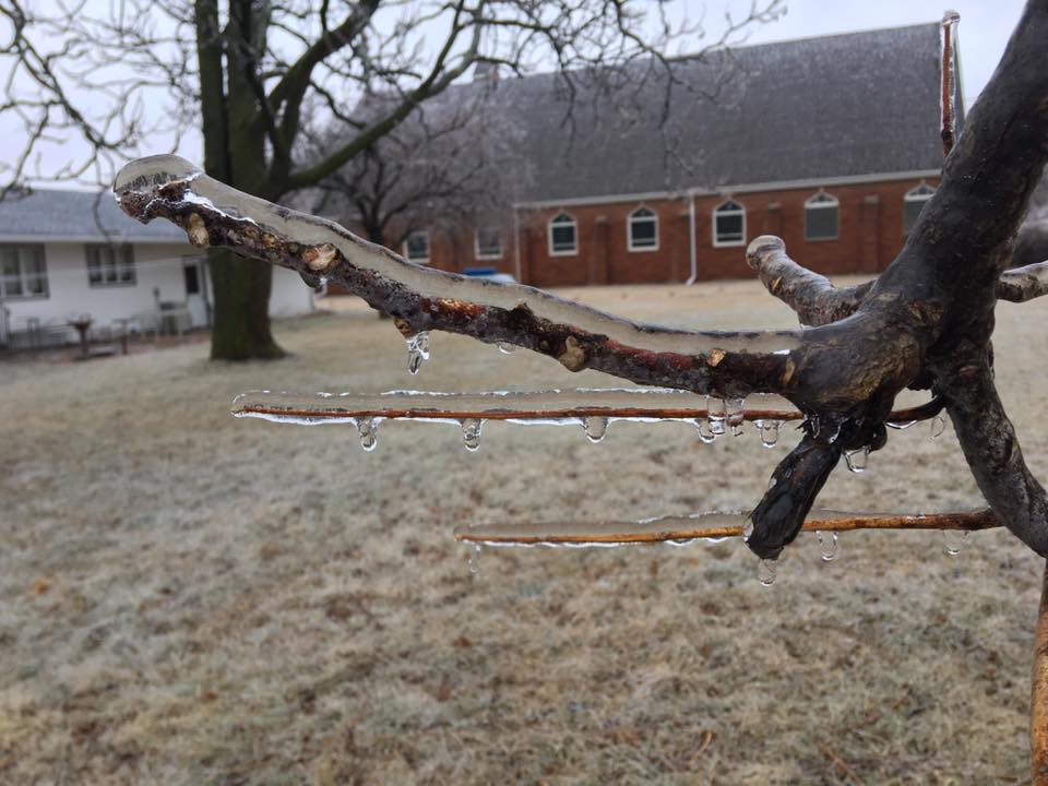
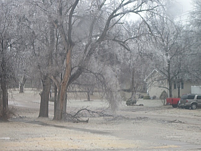
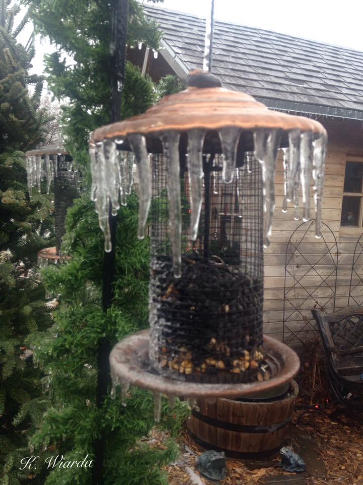
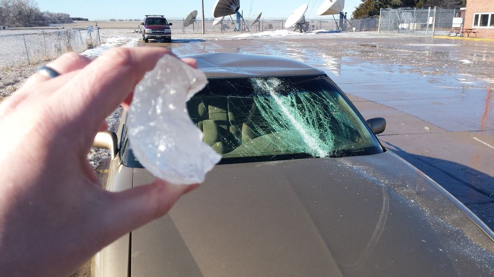
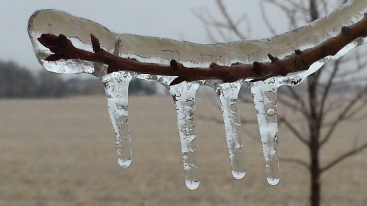
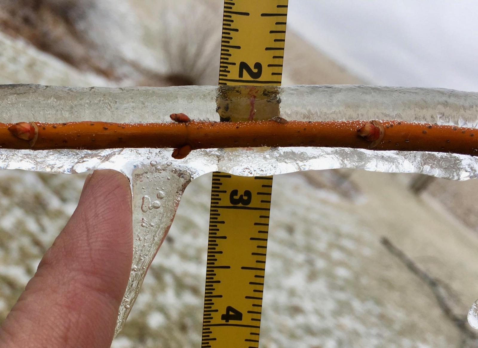
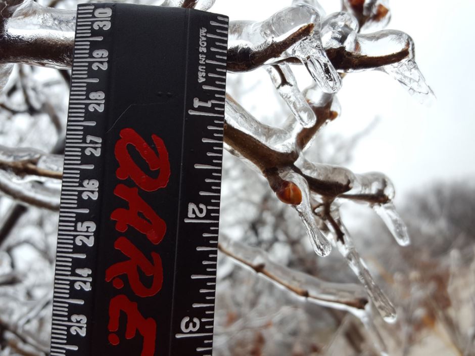
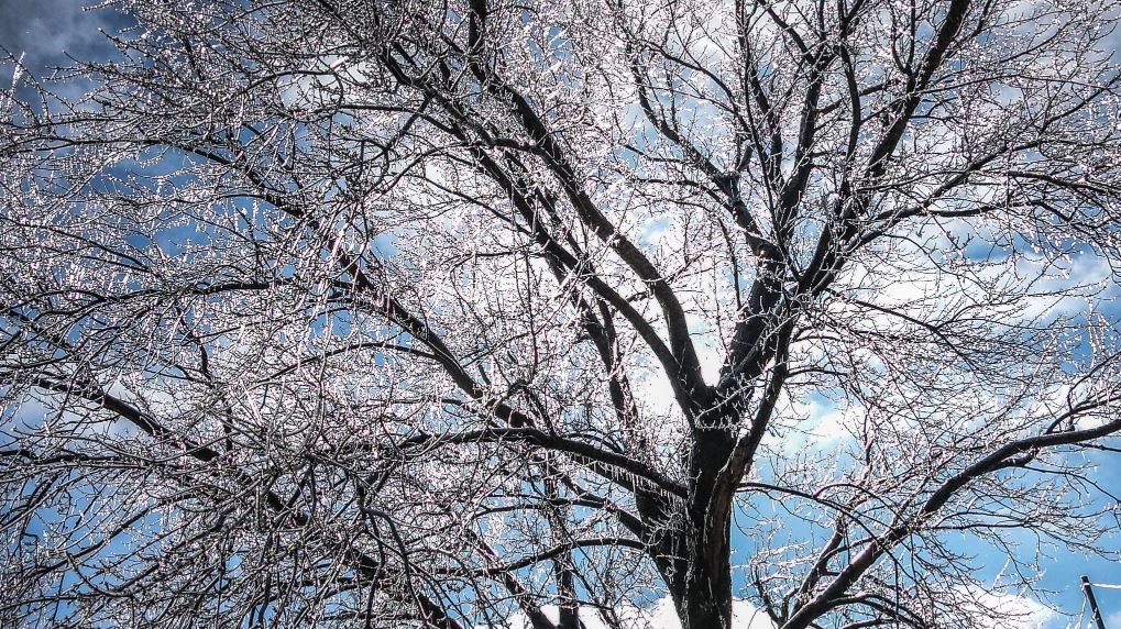
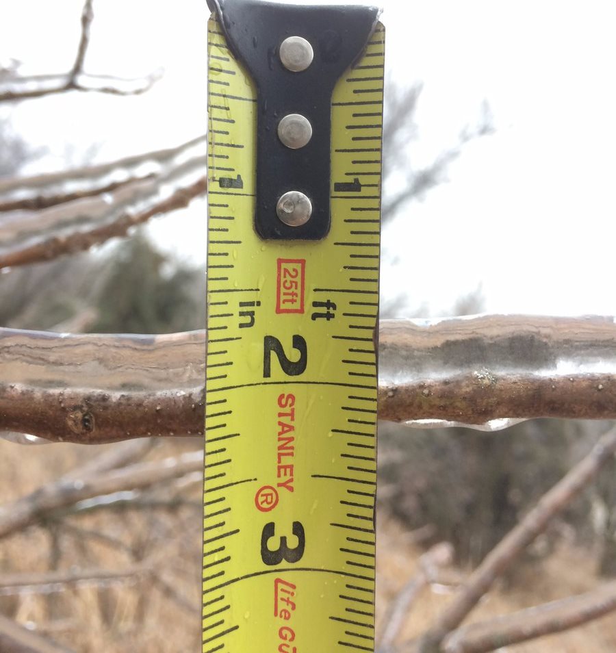
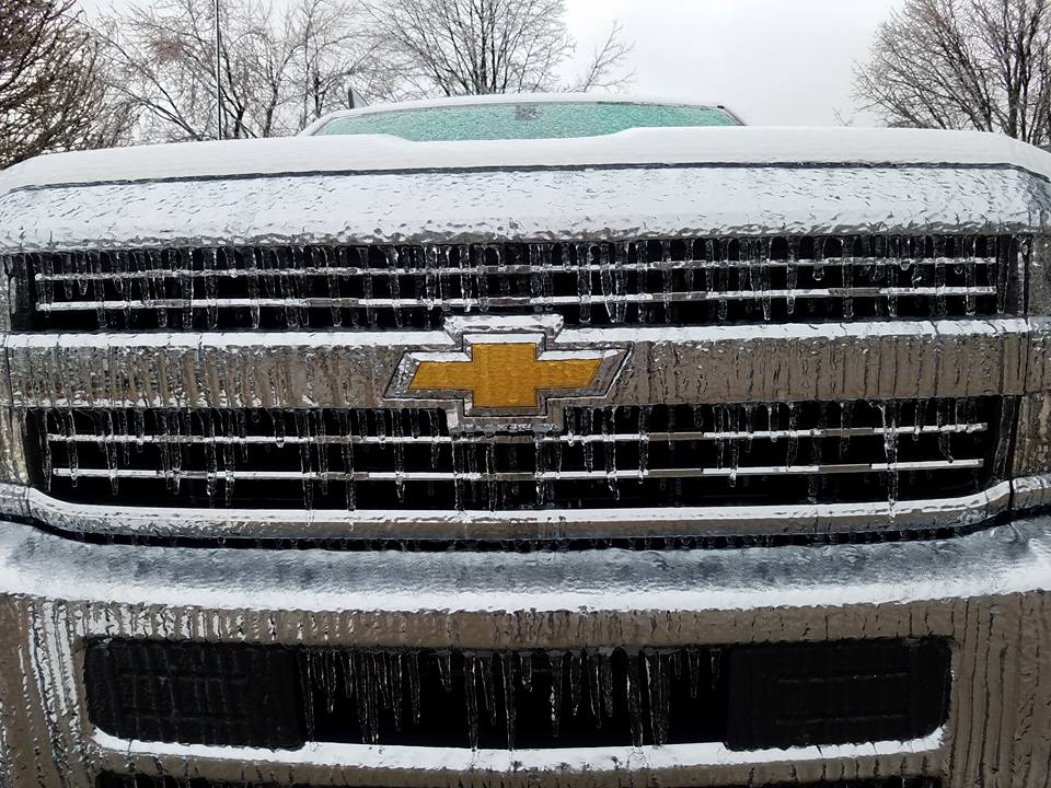
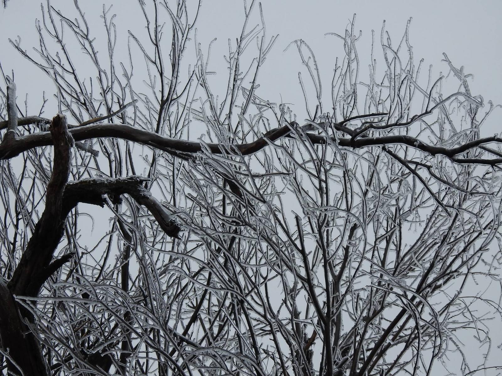
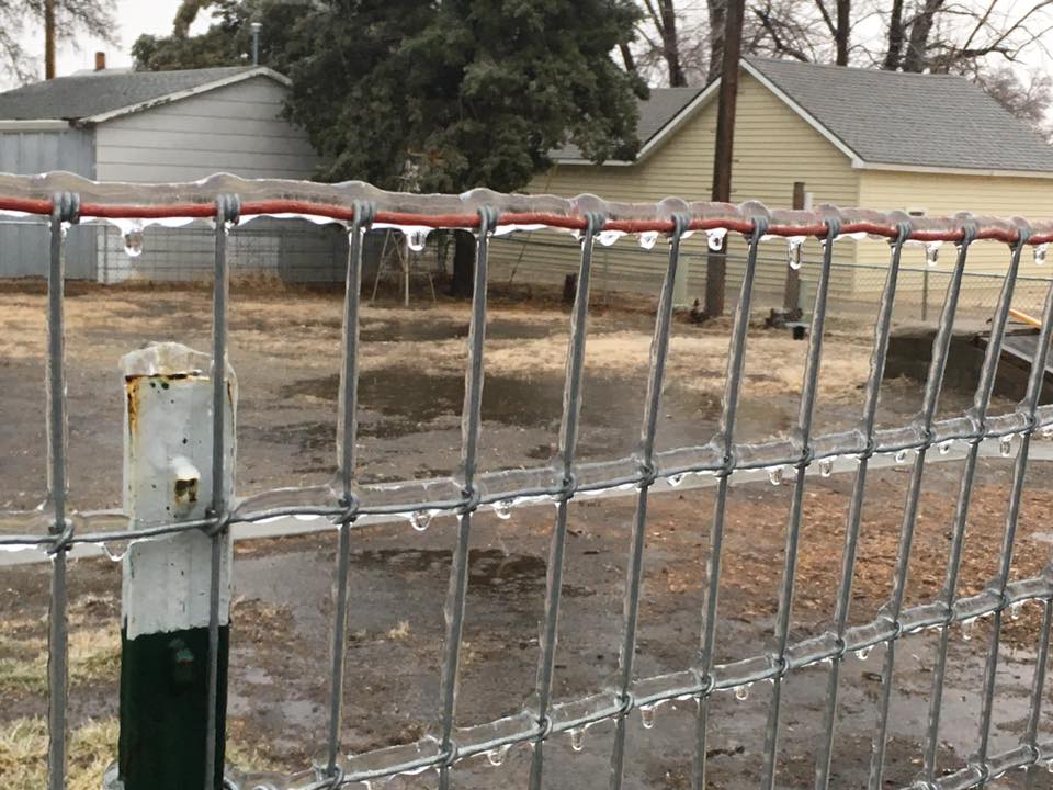
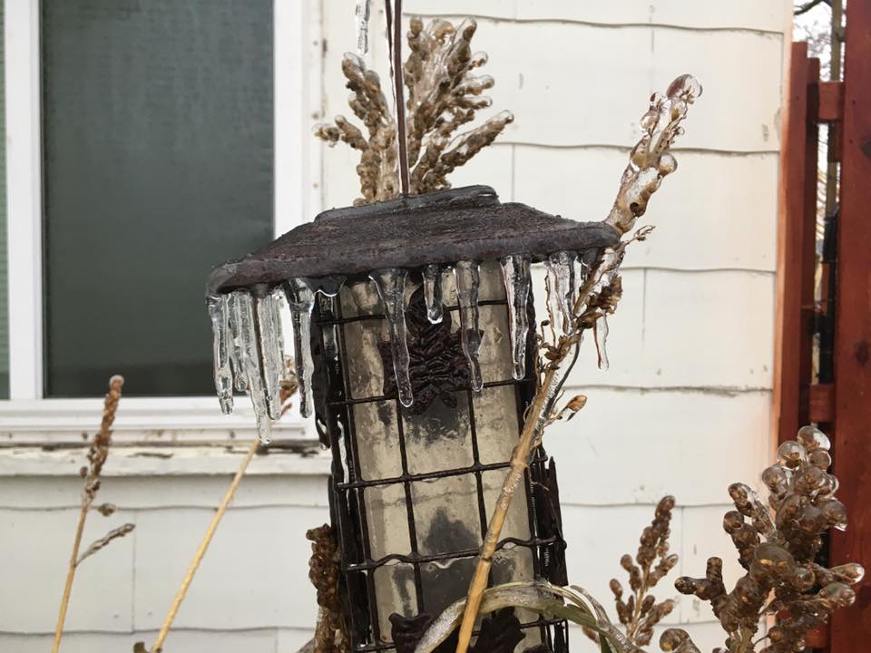
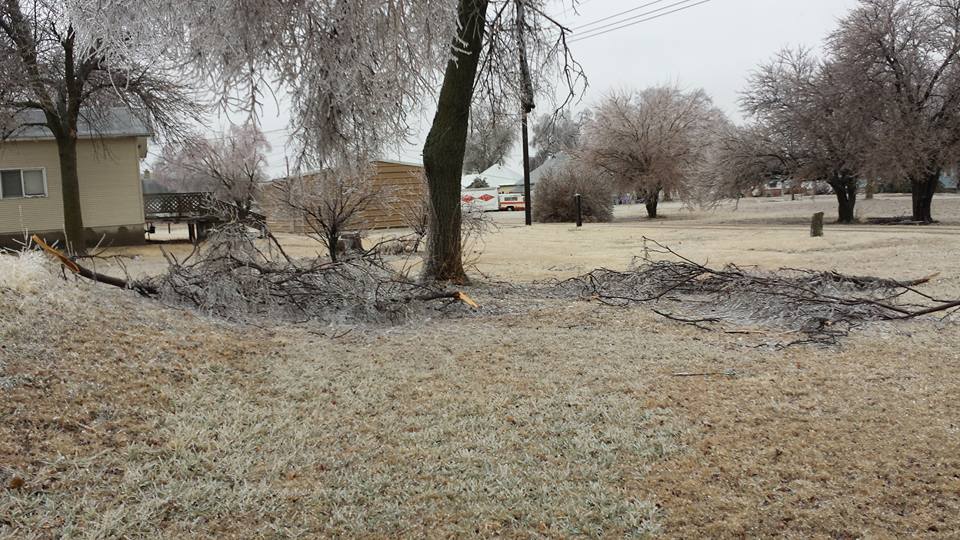
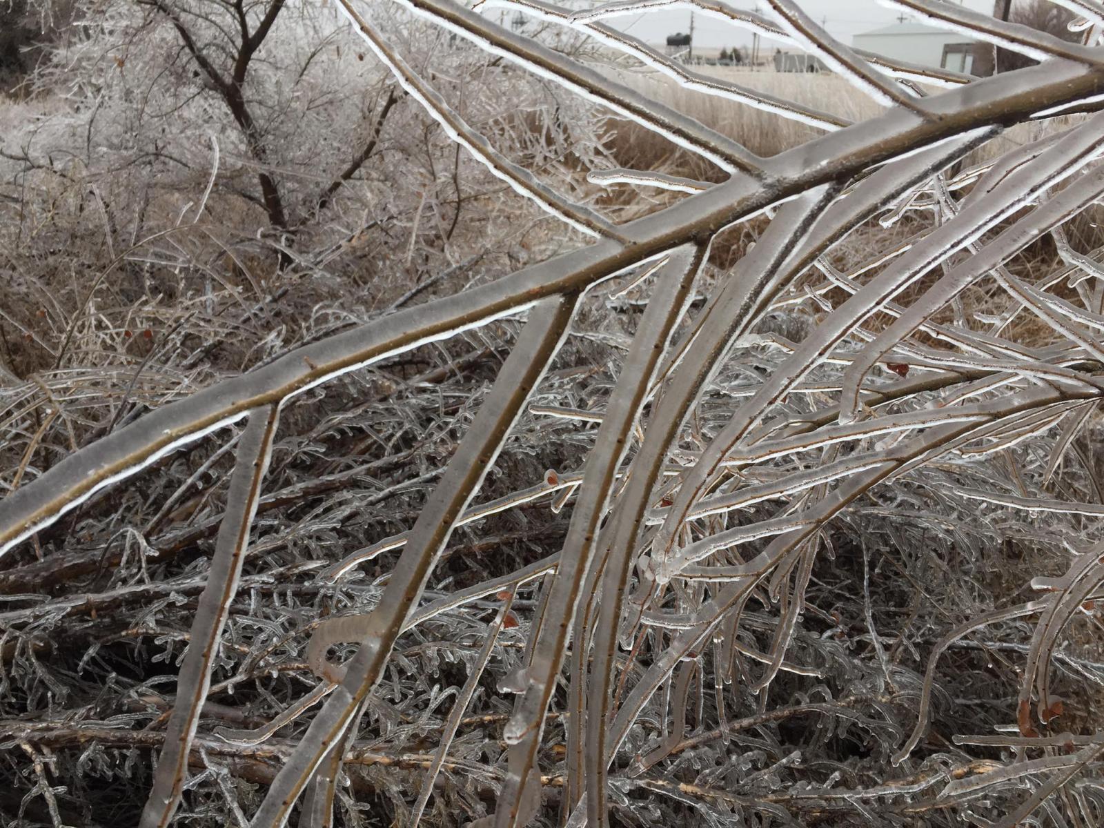
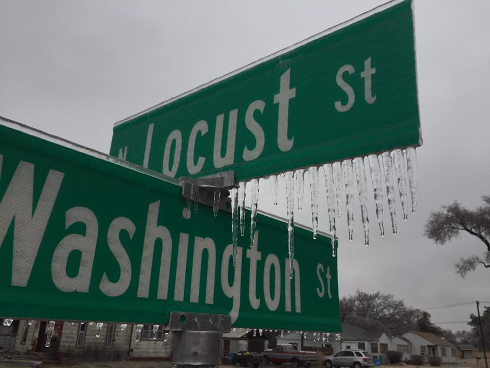
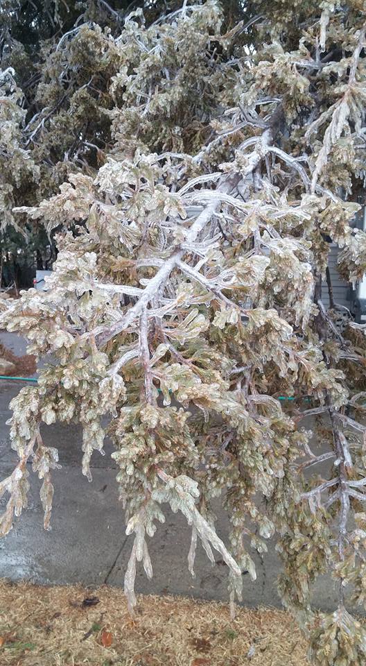
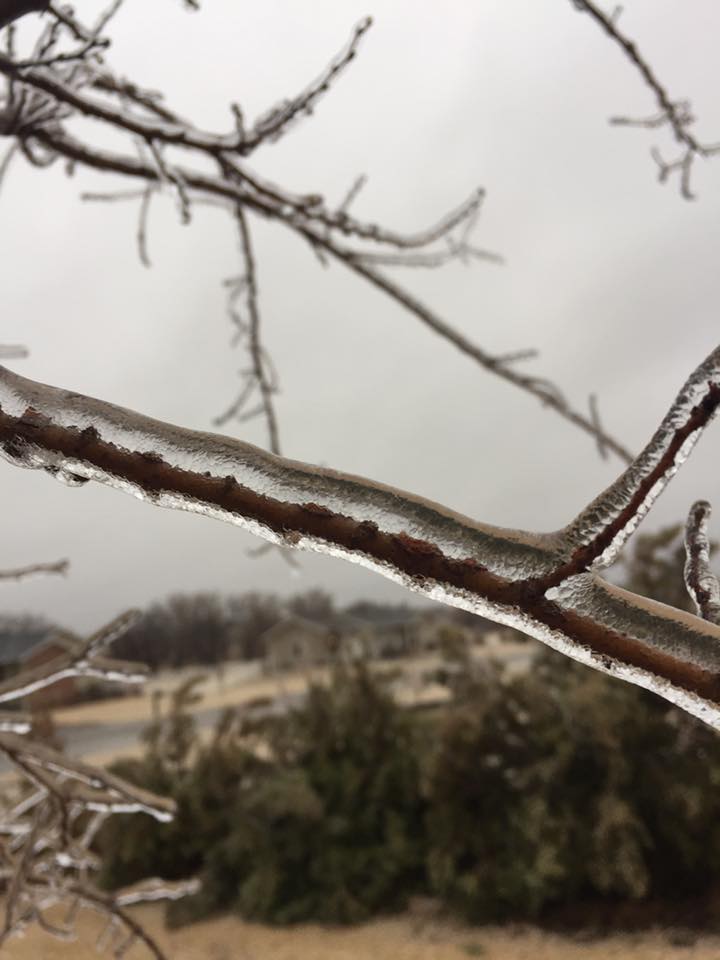
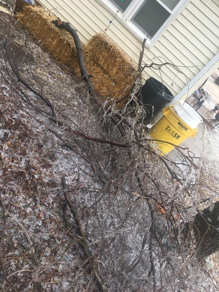
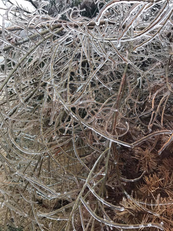
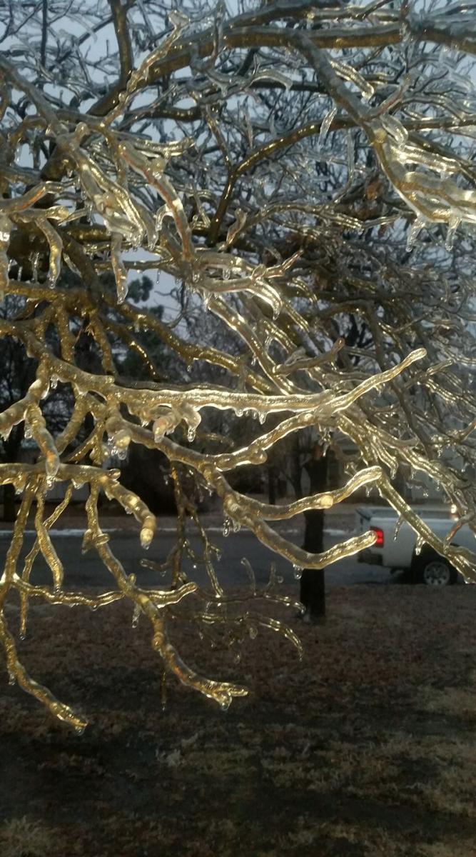
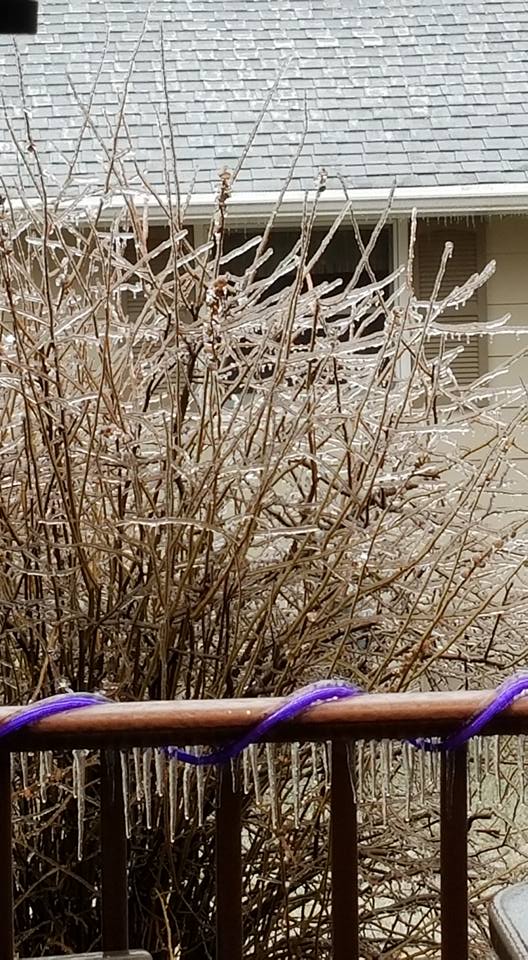
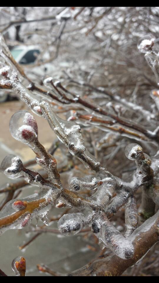
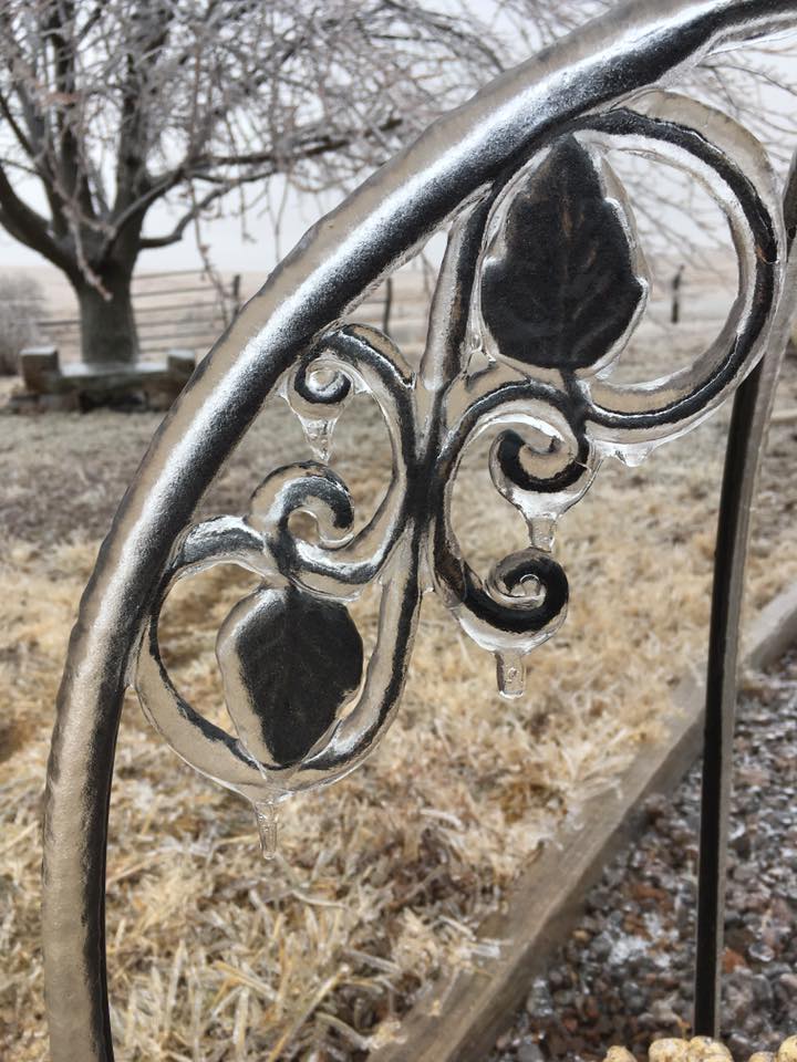
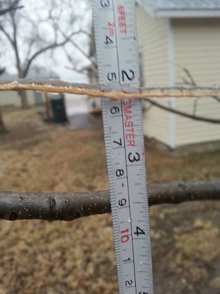
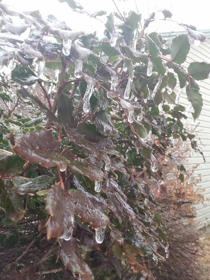
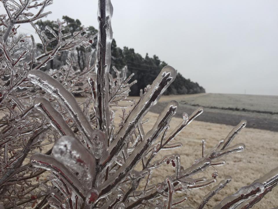
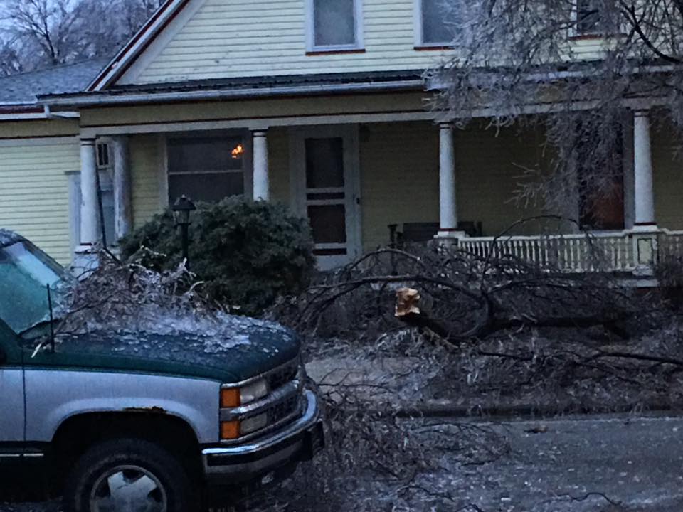
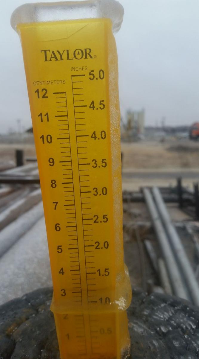
A strong, slow moving upper level low pressure slid northeast from the New Mexico-Texas-Mexico border region on Sunday, January 15th and Monday, January 16th, bringing the most significant icing event in 10 years to south central Nebraska and north central Kansas. Thanks to a nose of warmer air just off the surface and freezing temperatures at the surface, the predominant precipitation type during this event was freezing rain. During the latter portions of the event Monday afternoon, enough cold air started pushing east into the area that the precipitation type briefly switched over to sleet/snow before moving out. Any sleet or snow accumulation was minimal. Much of the NWS Hastings coverage area (click HERE for a map) saw at least 0.10" of ice accumulation, with locations roughly east of a line from Greeley to Beaver City (including north central Kansas) reporting 0.25" or more of ice accumulation. Far southeastern portions of the coverage area saw 0.5" or more. Surface temperatures hovering right around the freezing mark and an overall lack of winds kept this event from having a signficantly worse impact than it did. Roads were very slick, though main roads were pre-treated. There were no widespread, long lasting power outages, and and overall tree/power line damage was relatively minimal. Temperatures rebounded into the 35 to 45 degree range on January 17th and melted the ice. Ice melting and falling from trees, power lines and towers created dangerous conditions at times. Ice which fell from a tower at the KSNB television station north of Hastings broke a windshield on a vehicle in the parking lot. |
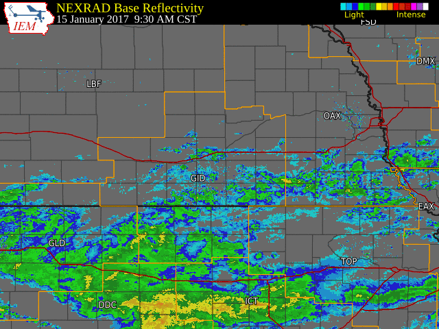 NWS Hastings radar loop from 9:30 a.m. on Jan. 15th - 5:30 p.m.on Jan.16th. The NWS Hastings coverage area is outlined in orange and interstates are in red. |
Ice & Precipitation Reports:
In general, ice accumulations across south central Nebraska ranged from 0.10-0.50", with the highest totals across southern and eastern portions. Across north central Kansas, ice accumulations ranged from 0.25-0.75".
Single day precipitation records were broken at both Grand Island and Hastings for January 16th. Grand Island's new record is 0.68", which broke the previous record of 0.30", set in 1932. The new record at Hastings is 0.53", which broke the previous record of 0.35", set in 1980.
Climatologically, January is the driest month of the year across the area, with most locations averaging 0.40-0.60" of precipitation for the month. Moisture was plentiful with this system, with totals of 0.25-1.0" across much of south central Nebraska, and a few higher than that across the south. Across north central Kansas, totals ranged from 1-2".
In this 2-day event, many locations exceeded (some significantly) what they typically see for the ENTIRE month of January!
2-Day (Jan. 15-16) Liquid Precipitation Reports - Please keep in mind these are NOT ice accumulations! The amounts in this table are from NWS Cooperative Observers & automated airport equipment.
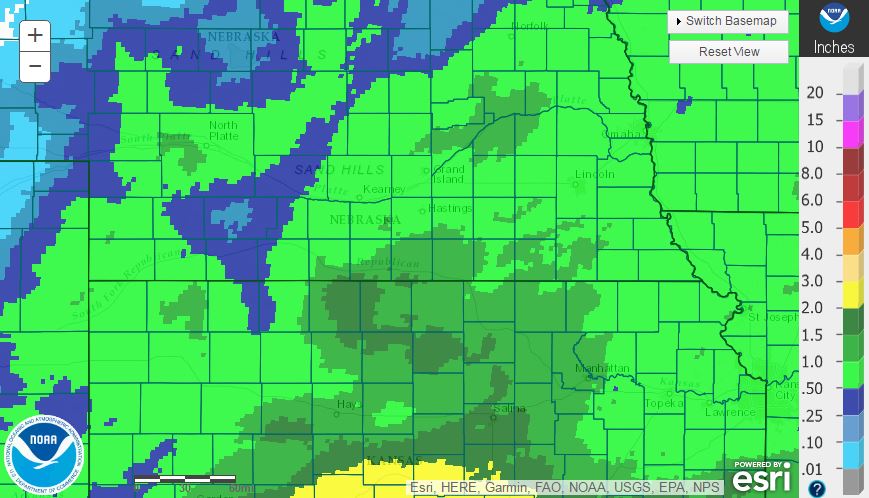 |
| Liquid precipitation from across the area. Click image to enlarge. |
| Location | Liquid Total (in) |
| Cawker City, KS | 1.84 |
| Beloit, KS | 1.55 |
| Ionia, KS | 1.51 |
| Lebanon, KS | 1.41 |
| Natoma, KS | 1.40 |
| Smith Center, KS | 1.35 |
| Jewell, KS | 1.30 |
| Clay Center | 1.30 |
| Logan, KS | 1.25 |
| Hubbell | 1.23 |
| Naponee | 1.22 |
| Geneva | 1.20 |
| Red Cloud | 1.08 |
| 4 SW Blue Hill | 1.05 |
| 3 NE Shelby | 0.97 |
| Osceola | 0.97 |
| 4 WNW Plainville, KS | 0.97 |
| 3 N York | 0.95 |
| Edison | 0.93 |
| 6 ESE Clay Center | 0.88 |
| Grand Island Airport | 0.86 |
| Bradshaw | 0.86 |
| NWS Hastings (4 N Hastings) | 0.81 |
| Holdrege | 0.80 |
| Wilsonville | 0.78 |
| St. Paul | 0.77 |
| Cambridge | 0.73 |
| Hastings Airport | 0.68 |
| Minden | 0.67 |
| 6 NNW Oxford | 0.67 |
| Kearney Airport | 0.63 |
| 8 S Elwood | 0.59 |
| Loup City | 0.49 |
| 6 SSE Lexington | 0.48 |
| Ravenna | 0.48 |
| Ord | 0.47 |
| Greeley | 0.38 |
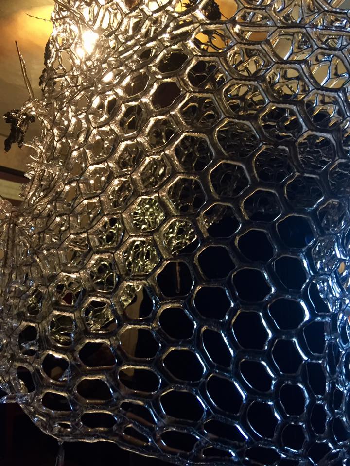
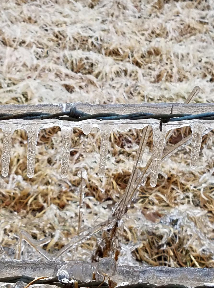
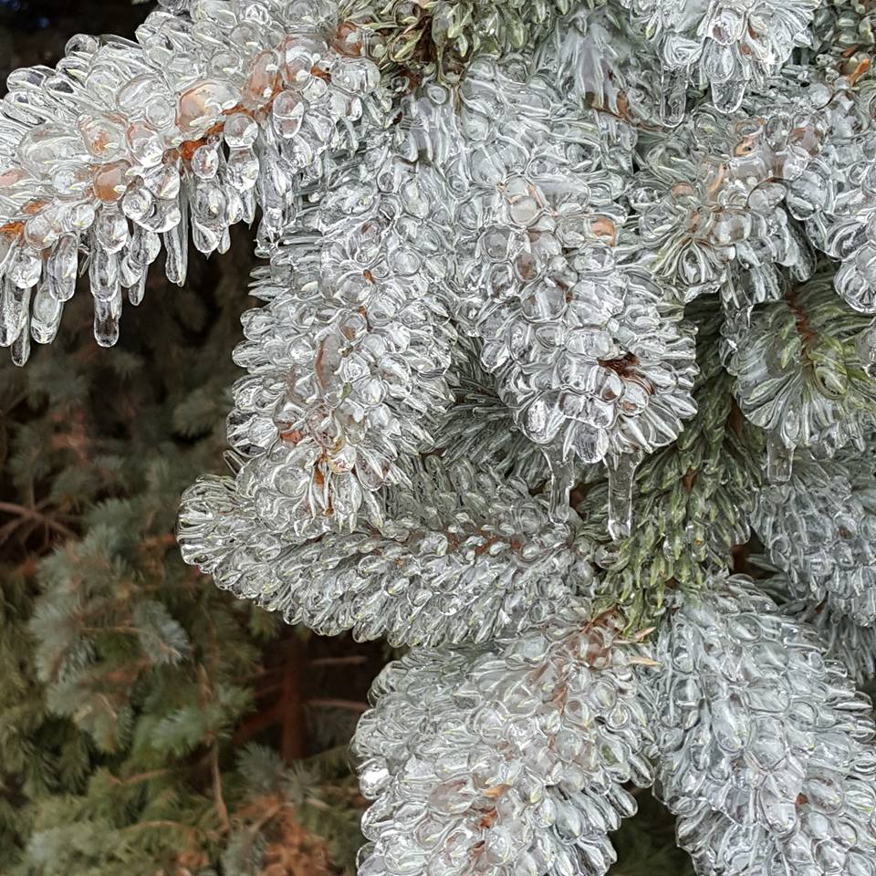
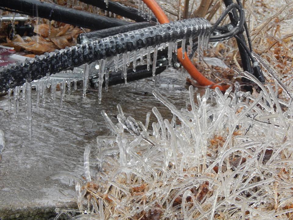
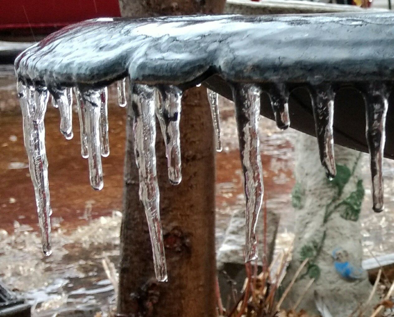
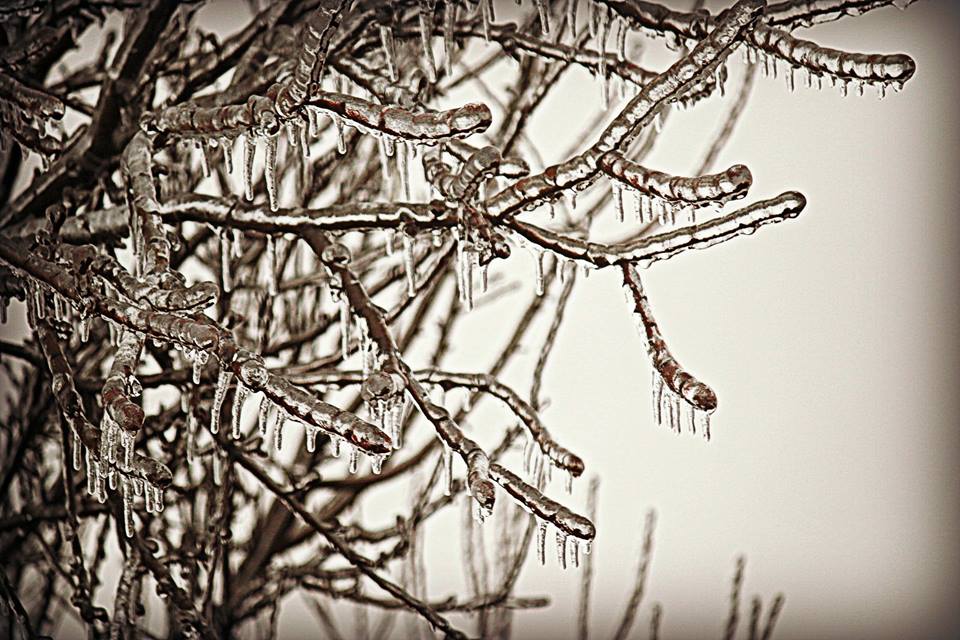
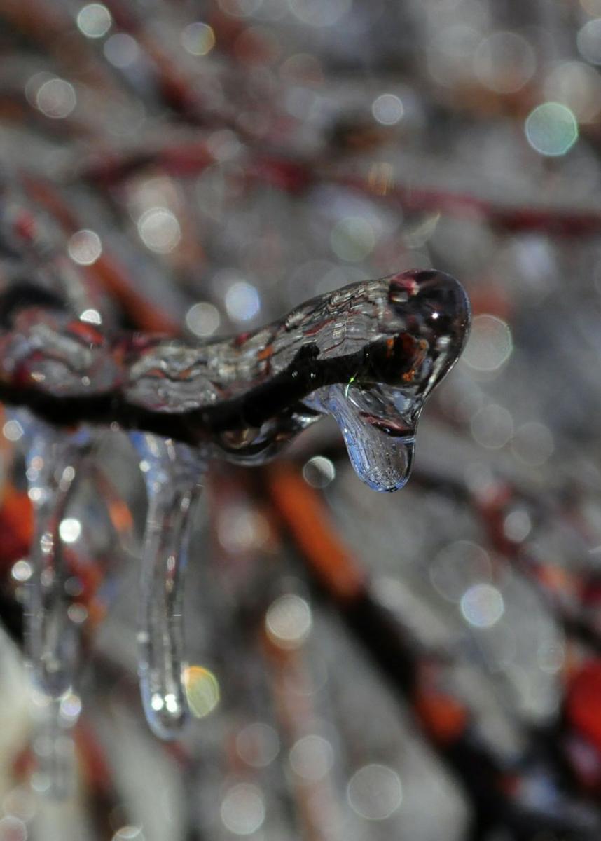
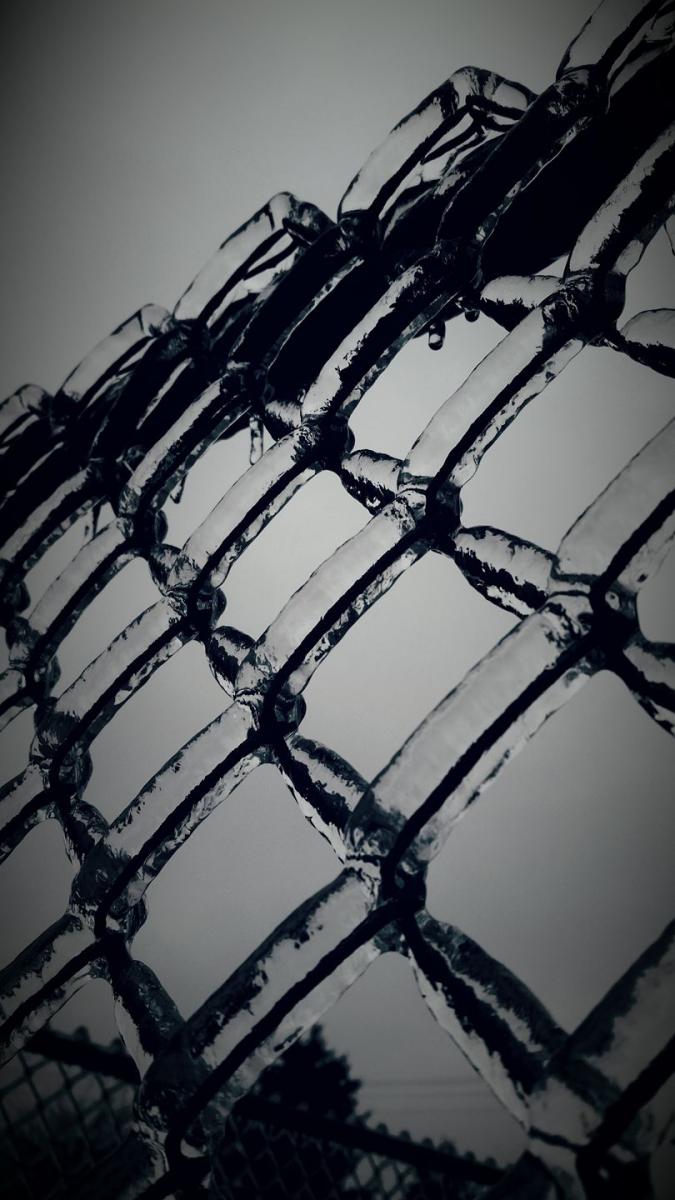
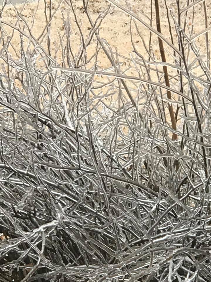
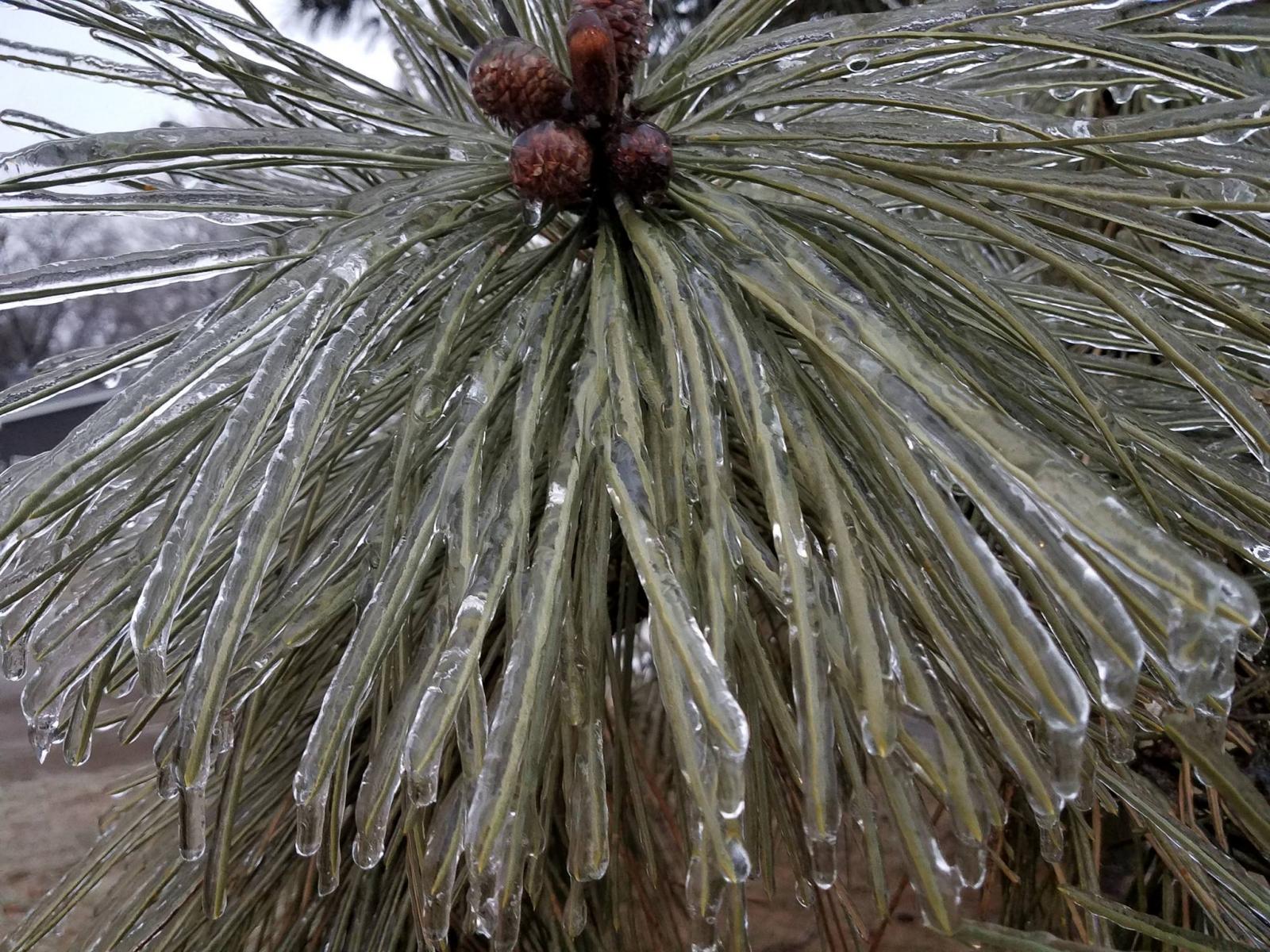
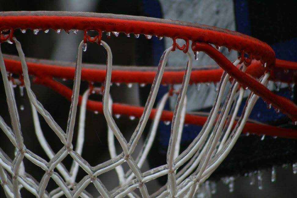
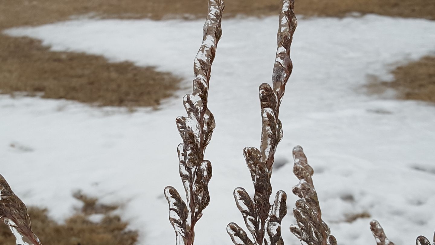
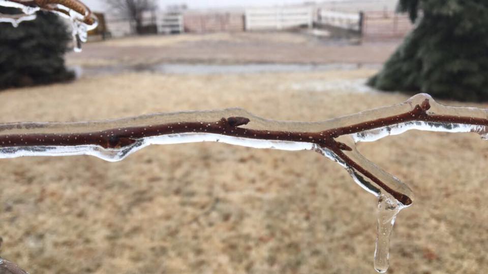
Nebraska Photos:
 |
 |
 |
 |
 |
| Bloomington photo by Rose Salinas |
Blue Hill photo by Jessica Cox |
Carleton photo by Thayer County EM |
Carleton photo by Thayer County EM |
Clay Center photo by Kandi Whiteley |
 |
 |
 |
 |
 |
| Shelby photo by Freddy McKinney |
Shelby photo by John McKinney |
Minden photo by Tammie Binderup |
Lawrence photo by Nick Kliewer |
Osceola photo by John McKinney |
 |
 |
 |
 |
 |
| Grand Island photo by Caitlin Derr |
Grand Island photo by Evita Franco |
Grand Island photo by Jessica Cook |
Guide Rock photo by Monica Montgomery |
Hamilton County photo by Pen Sheets |
 |
 |
 |
 |
 |
| Chester photo by Sarah Dake |
Grand Island (1/17) photo by Lina Sutton |
Hildreth photo by Emily Wagner |
Holdrege photo by Janet Bailey |
Ruskin photo by Janyssa Taylor |
 |
 |
 |
 |
 |
| Heartwell photo by Lacy Fredrickson |
Ayr photo by Angi Lovett Schneideler |
South of Clay Center photo by Scot Von Spreckelsen |
Bruning photo by Justin McGinley |
Fairfield photo by Rally Vee |
 |
 |
.jpg) |
 |
 |
| Hampton photo by Kathy Wiarda |
Hastings photo by Todd Addleman |
Kearney photo by Andrea Scheuffele |
Phillips photo by Kyla Trumble |
Superior photo by Kimberly Parker |
 |
.jpg) |
 |
 |
 |
| Hastings photo by Kendra Bargen |
Hastings photo by Renee DeVaney |
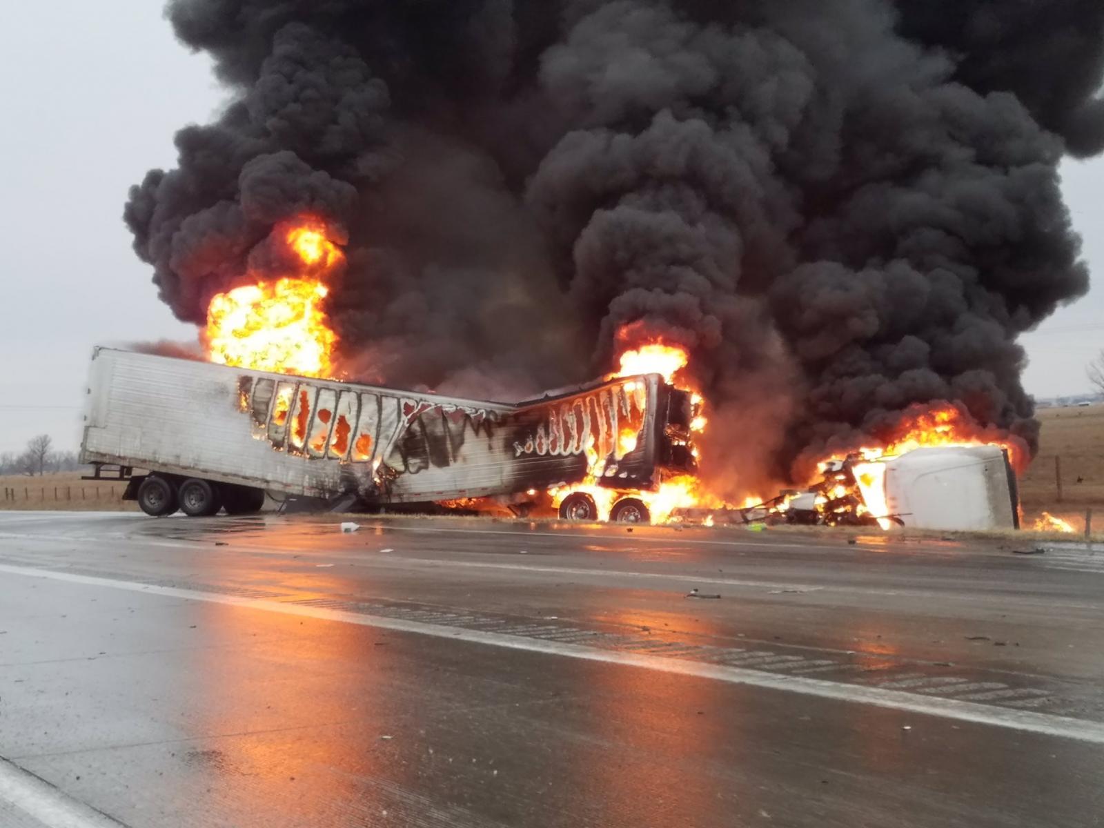
I-80 Near Odessa (No fatalities) photo by Scott Tustin |
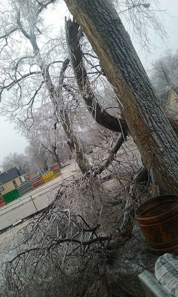
KSNB Hastings Ice Falling From Tower photo by Travis Klanecky |
Hastings photo by Mike Moritz |
 |
 |
 |
 |
 |
| Henderson photo by Brad Best |
Holdrege photo by John Thorburn |
Red Cloud photo by Katie Ord |
Shelton photo by Clifford Thibodeau |
York photo by Bryce Danielson |
 |
 |
 |
 |
 |
| Shelby (1/17) photo by Freddy McKinney |
Inavale photo by Wade Gibson. |
Aurora photo by Brooke Johnson |
Hastings photo by Jamie Williams |
Hendley photo by Darla McGahan |
Kansas Photos:
Header
 |
 |
 |
 |
 |
| Agra photo by Lance Dougherty |
Agra photo by Lance Dougherty |
Lebanon photo by Emily Roush |
Osborne photo by Kaelan Cameron |
Osborne photo by Kaelan Cameron |
 |
 |
 |
 |
 |
| Beloit photo by Jana Fairchild |
Beloit photo by Peter Sevilla |
Beloit photo by Rachel Grace Miller |
Burr Oak photo by Jessica Barnes |
Stockton photo by Kevin States |
 |
 |
 |
 |
 |
| Mankato photo by Jennifer Urbaniak |
Long Island area photo by Jhe Ny |
Northwest Jewell County photo by Betsy Jennings Reinert |
Phillipsburg photo by Kerri Footh |
Phillipsburg photo by Kerri Footh |
|
 |
 |
 |
 |
| Osborne photo by Kaelan Cameron |
Scottsville photo by Michelle Snyder Baxa |
Jewell photo by Sadie Hayden |
Stockton photo by Kevin States |
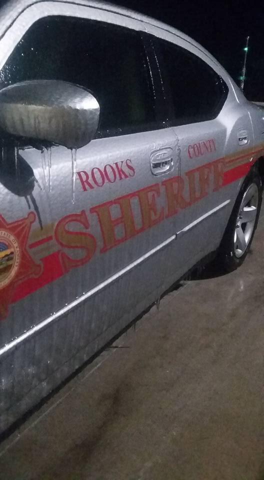
Rooks County photo by Sheriff's Office |
 |
Media use of NWS Web News Stories is encouraged! Please acknowledge the NWS as the source of any news information accessed from this site. |
|

