
A significant heat wave continues for the Rockies, Northern Plains, and Great Lakes into the Mid-Atlantic, peaking in intensity through midweek and lingering across parts of the Northern Plains and Midwest until this weekend. Excessive rainfall my bring life-threatening and locally catastrophic flash and urban flooding across portions of southwestern Texas through early Friday. Read More >
If you have any photos you would like to share, please feel free to post them to our Facebook or Twitter pages, or send them to our webmaster e-mail account at: w-gid.webmaster@noaa.gov. Please let us know where the photo was taken, and at least an approximate time. Thanks!
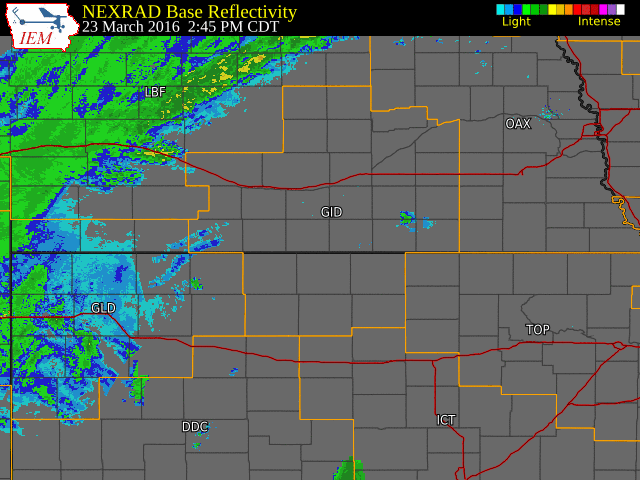
Radar Overview |
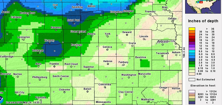
Snowfall Totals and Map/Wind Gust Information |
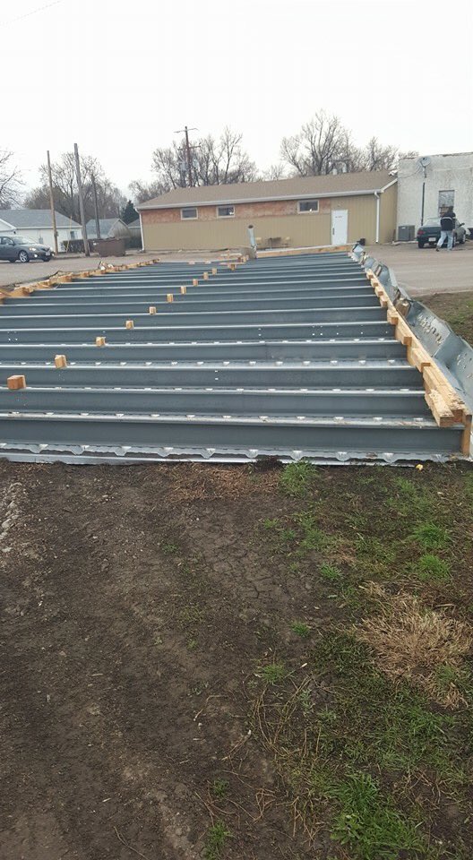
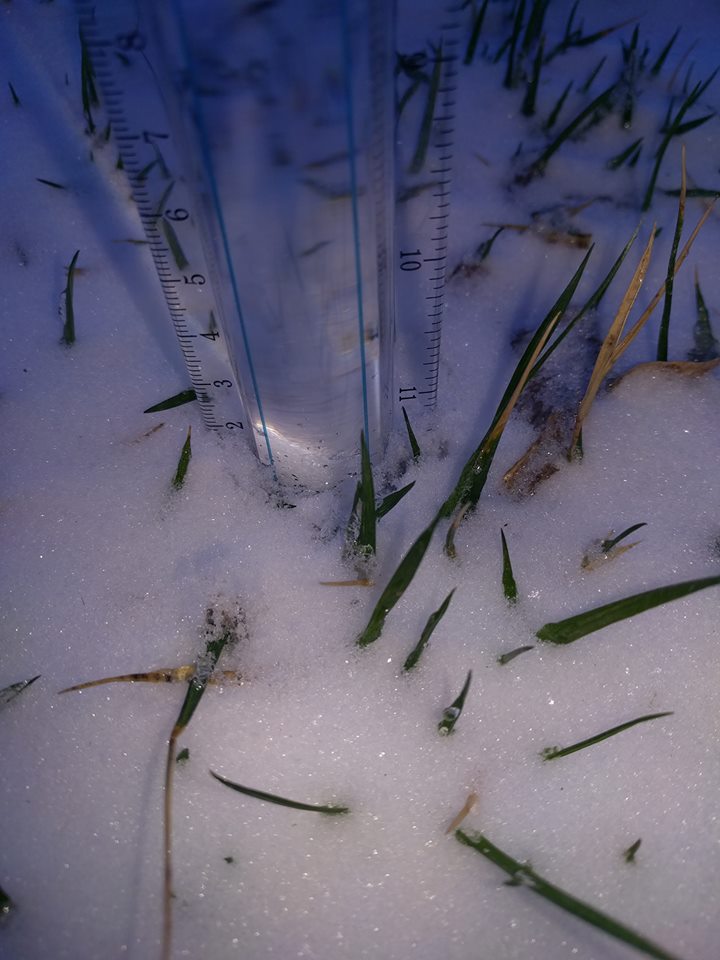
Photos |
 |
| Location | Storm Total Snowfall |
|---|---|
| Ord | 8.0 |
| 8 miles NNE Scotia | 7.5 |
| 2 ENE Axtell (NTV studios) | 5.0* |
| 9NW Ord | 5.0 |
| Minden | 4.0 |
| Greeley | 4.0 |
| 4E Scotia | 4.0 |
| 6S Wilcox | 4.0 |
| St. Paul | 3.2 |
| 2ENE Franklin | 3.5 |
| Kearney (airport) | 3.0 |
| 6W Elyria | 3.0 |
| Dannebrog | 3.0 |
| Grand Island (airport) | 2.6 |
| Arcadia | 2.5 |
| Holdrege | 2.5 |
| Ravenna | 2.0 |
| Hastings (NWS Office) | 1.9 |
| Location | Highest Known Gust (MPH) |
|---|---|
| Ord (airport) | 61 |
| 2E Axtell | 58 |
| 5NNW Oxford | 56 |
| Grand Island (airport) | 54 |
| York (airport) | 54 |
| Aurora (airport) | 53 |
| 1ENE Shelby | 53 |
| 3W Sumner | 52 |
| Logan KS | 52 |
| 7NE Phillips | 52 |
| 4WNW Bradshaw | 51 |
| Holdrege (airport) | 51 |
| 5SW Harvard | 51 |
| Hastings (airport) | 50 |
| Farwell | 50 |
 |
 |
 |
| Roof blown off of the Sit N Bull Saloon in Giltner, NE (photo via social media) | Snow in Clay Center, NE (photo by Tirin Vance ) |
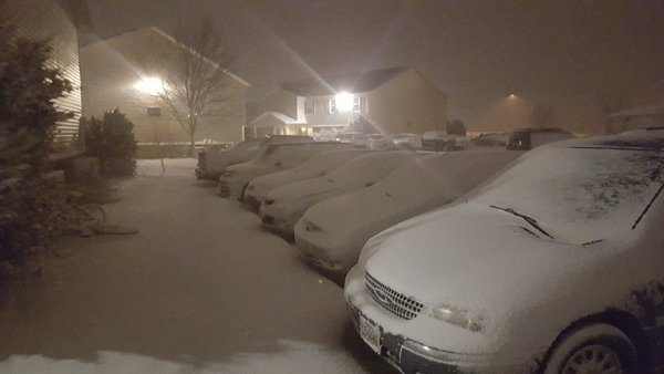
Snow in Loomis, NE (photo by Charles Rowell) |
 |
 |
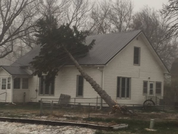
| Tree blown over in Arcadia, NE. (photo by emergency manager Scott Philbrick) |
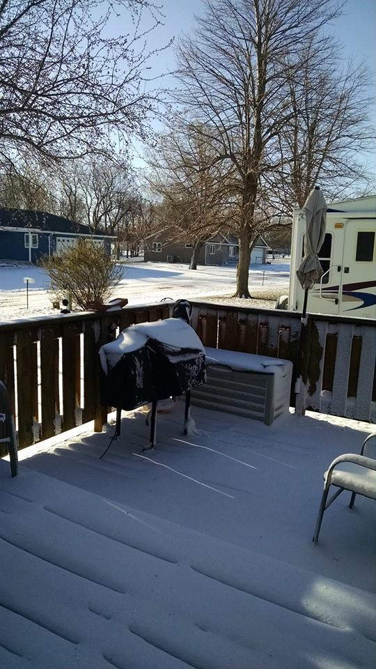
Snow in Kearney. (photo by Lauren Sharf) |
 |
This page was composed by the staff at the National Weather Service in Hastings, Nebraska. |
 |

