Flash flooding threatens areas from the Tennessee Valley to the Carolinas as storms repeat along a stalled front. Monsoonal storms may trigger flooding in the Southwest. Dangerous heat expands across the Desert Southwest, Plains, mid-Mississippi Valley and Southern Tier. Critical fire weather for interior Pacific Northwest. Cooler, drier air brings brief relief to the Great Lakes and Northeast. Read More >
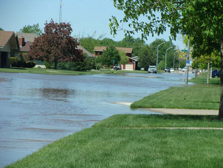
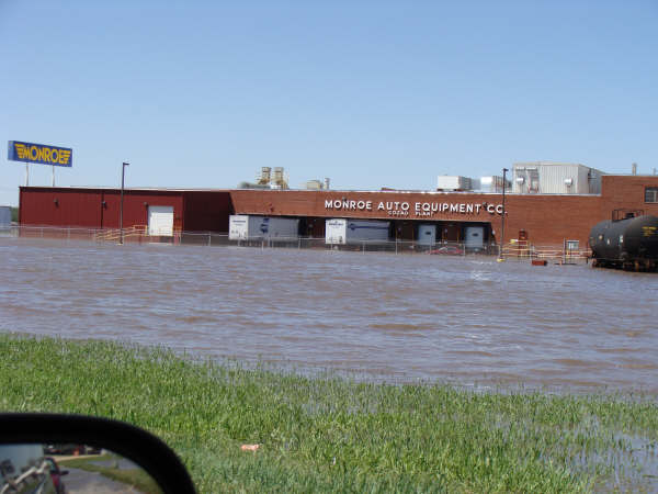
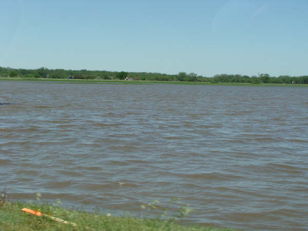
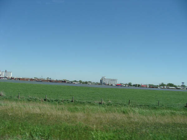
Thunderstorms produced heavy rainfall across south central Nebraska and north central Kansas beginning last Wednesday night and continuing through Friday night. Three day rainfall totals ranged from over one inch to over seven inches. The heavy rainfall resulted in widespread lowland flooding and river flooding.
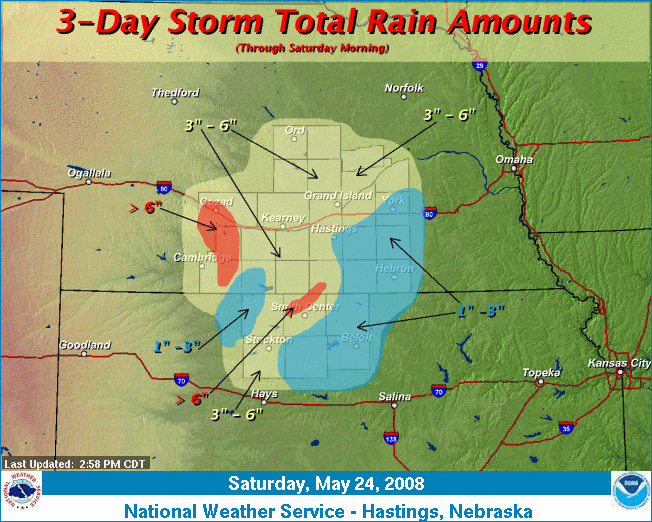
The following rainfall totals are from National Weather Service cooperative observers, automated rain gauges and weather spotters.
|
Rainfall Totals
May 22 - 24 |
|
| Location | Amount |
| Cozad | 7.25 |
| Red Cloud | 6.75 |
| Edison | 6.19 |
| Phillipsburg | 5.83 |
| Riverton | 5.63 |
| Lexington | 5.51 |
| Damar | 5.36 |
| Wilsonville | 5.29 |
| Smith Center | 5.23 |
| Cambridge | 5.08 |
| Arcadia | 4.96 |
| Loup City | 4.64 |
| Wolbach | 4.35 |
| Franklin | 4.30 |
| Saint Paul 4n | 4.26 |
| Ashton | 4.23 |
| Wood River | 4.21 |
| Lebanon | 4.17 |
| Kearney 4NE | 4.12 |
| Naponee | 4.12 |
| Ord | 4.10 |
| North Loup | 4.06 |
| Grand Island | 4.03 |
| Plainville 4WNW | 4.02 |
| Palco | 3.90 |
| Ord | 3.86 |
| Greeley | 3.84 |
| Fullerton | 3.74 |
| Phillips 4SE | 3.53 |
| Holdrege | 3.48 |
| Belgrade | 3.48 |
| Hastings 4N | 3.47 |
| Blue Hill 4SW | 3.18 |
| Aurora | 3.08 |
| Osceola | 3.05 |
| Guide Rock | 3.04 |
| Minden | 3.01 |
| Logan | 2.89 |
| Orleans | 2.66 |
| Clay Center | 2.46 |
| Hastings | 2.45 |
| York | 2.44 |
| Hebron | 2.42 |
| Bruning | 2.24 |
| Superior | 2.13 |
| Fairmont | 1.92 |
| Beloit | 1.88 |
| Clay Center 6ESE | 1.87 |
| Burr Oak | 1.81 |
| Cawker City | 1.20 |
| Ionia | 1.12 |
The heavy rainfall caused flooding throughout towns, rural areas, and rivers. The following pictures were taken in Cozad, NE. The photographs are courtesy of Michele Starman.