Dangerous and extreme heat will remain across portions of the central U.S. this week, persisting across the mid to lower Mississippi Valley, Gulf Coast, southern Plains and portions of Texas. A heat wave over the Southwest U.S. will peak this weekend. Heavy to excessive rainfall may produce flash flooding from the Delmarva Peninsula north into the Hudson Valley today and tonight. Read More >
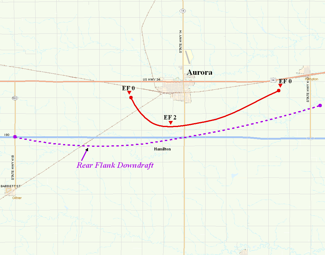
Hamilton County EF2 Tornado
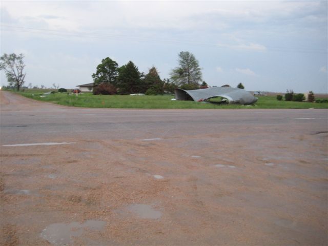
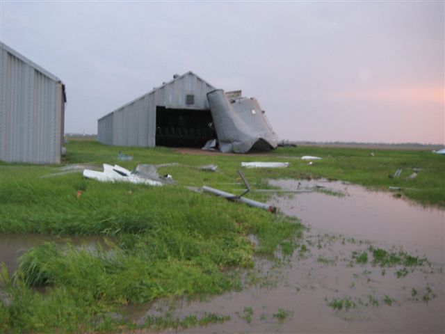
From the damage survey conducted on May 30, it appears that a tornado set down 3 miles west of Aurora around 7:05 pm and traveled to the southeast. When the tornado was about 2 miles south of town it rapidly intensified and increased to a half mile wide. At this point the winds were estimated to be around 130 mph and this would rate at an EF2. This wide tornado moved east and crossed Nebraska Highway 14 about a mile north of Interstate 80. The tornado then turned more to the northeast and started to decrease in strength. The tornado lifted about a mile southwest of Hampton around 7:28 pm. The tornado was on the ground for 9 miles.
To the south of the tornado track, strong winds associated with a rear flank downdraft (RFD) caused a damage path that started at the Giltner interchange on Interstate 80 which is about 3 miles north of the town of Giltner. The damage path continued just south of the interstate to the Aurora interchange. These winds caused the damage to the gas stations located at the interchange. The damage path then turned northeast and continued to about 2 miles southeast of Hampton. From the damage along the path of the RFD, winds would be estimated to be around 80 to 90 mph. The RFD began to interact with the tornado when it was south of Aurora and it is thought to have helped increase the intensity of the tornado by enhancing the inflow to the tornado. This inflow was responsible for blowing over several semi-trailer trucks on the Interstate. There were 5 reported injuries at this location, all minor. They were transported to the local hospital, where they were treated and released.
 ----------------------------------------------------------------------------------------------
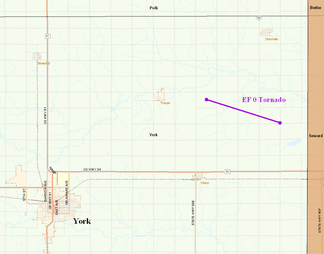
York County EF0 Tornado
A brief tornado set down in northeast York county around 7:30 pm. The tornado started about 2 miles east of the village of Thayer and traveled in an east-southeast direction. It crossed highway 69 about 5 miles south of the village of Gresham and dissipated shortly after that. This tornado damaged a few grain bins and power poles along its 3 mile path. It was about 100 yards wide and would have had winds estimated around 80 mph making it an EF0 tornado.
-------------------------------------------------------------------------------------
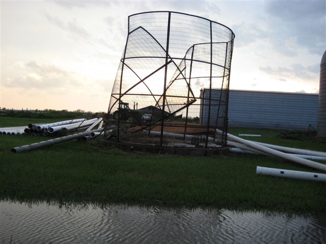
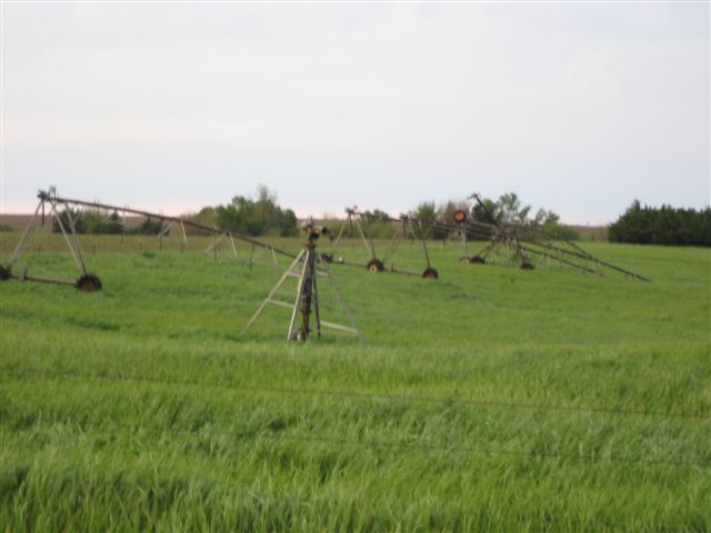
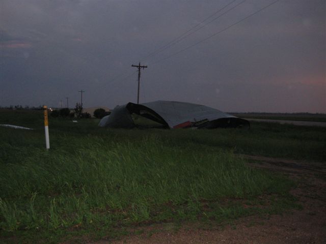
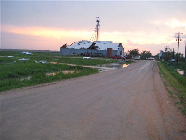
The following storm damage photographs were taken by a Hastings National Weather Service employee in Hamilton County. The photos were taken the evening of May 29, 2008.