A heat wave over the Southwest will intensify this week, peaking and expanding into the Intermountain West and northern High Plains this weekend. Critical to extremely critical fire weather conditions are forecast from the Northwest and the northern Great Basin this weekend. Particularly Dangerous Situation Red Flag Warnings have been issued. Read More >
Hastings, NE
Weather Forecast Office
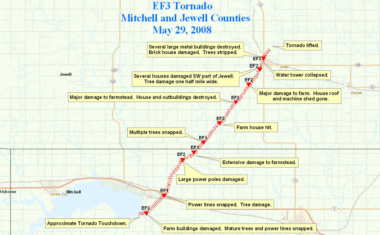
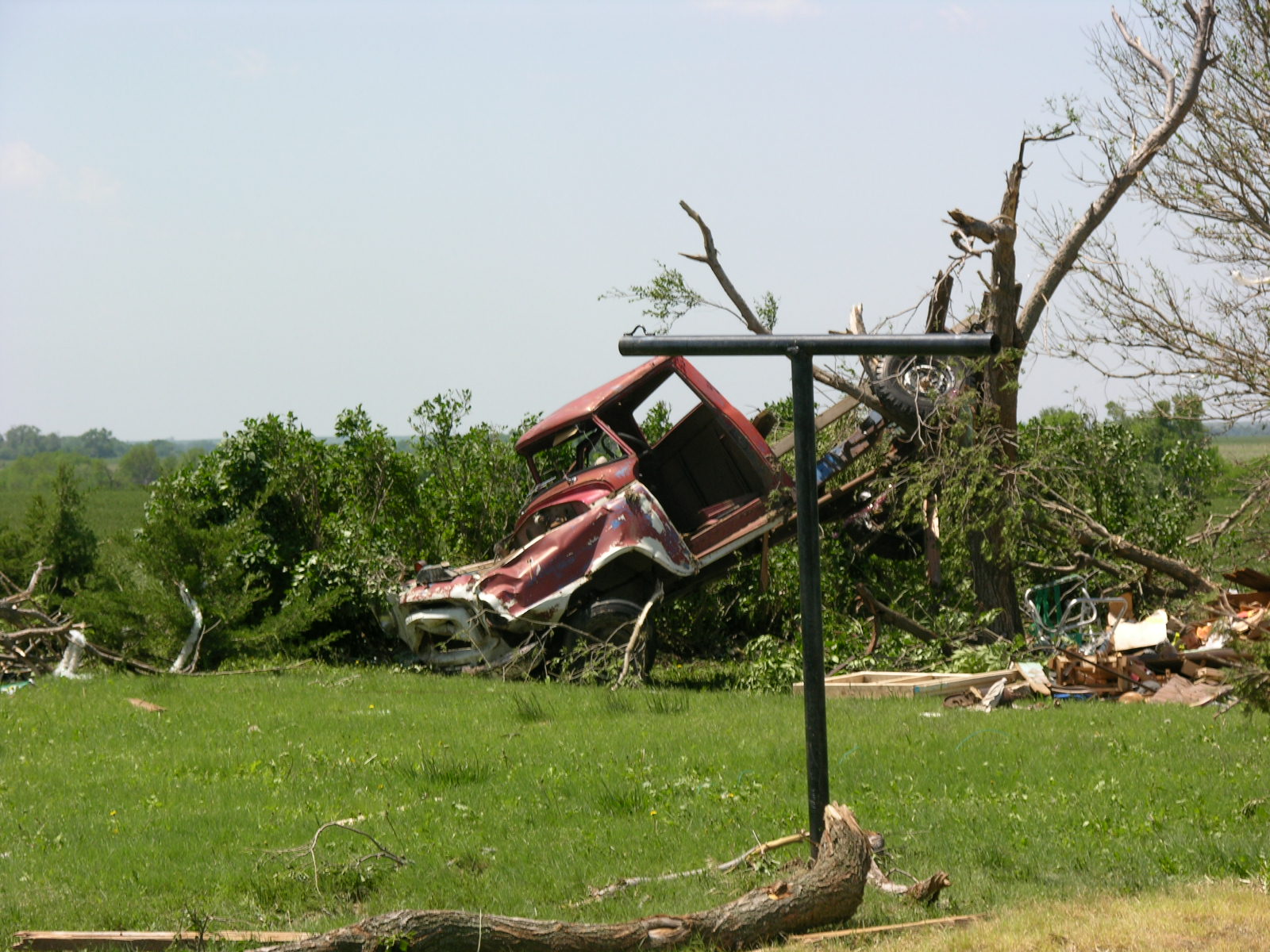
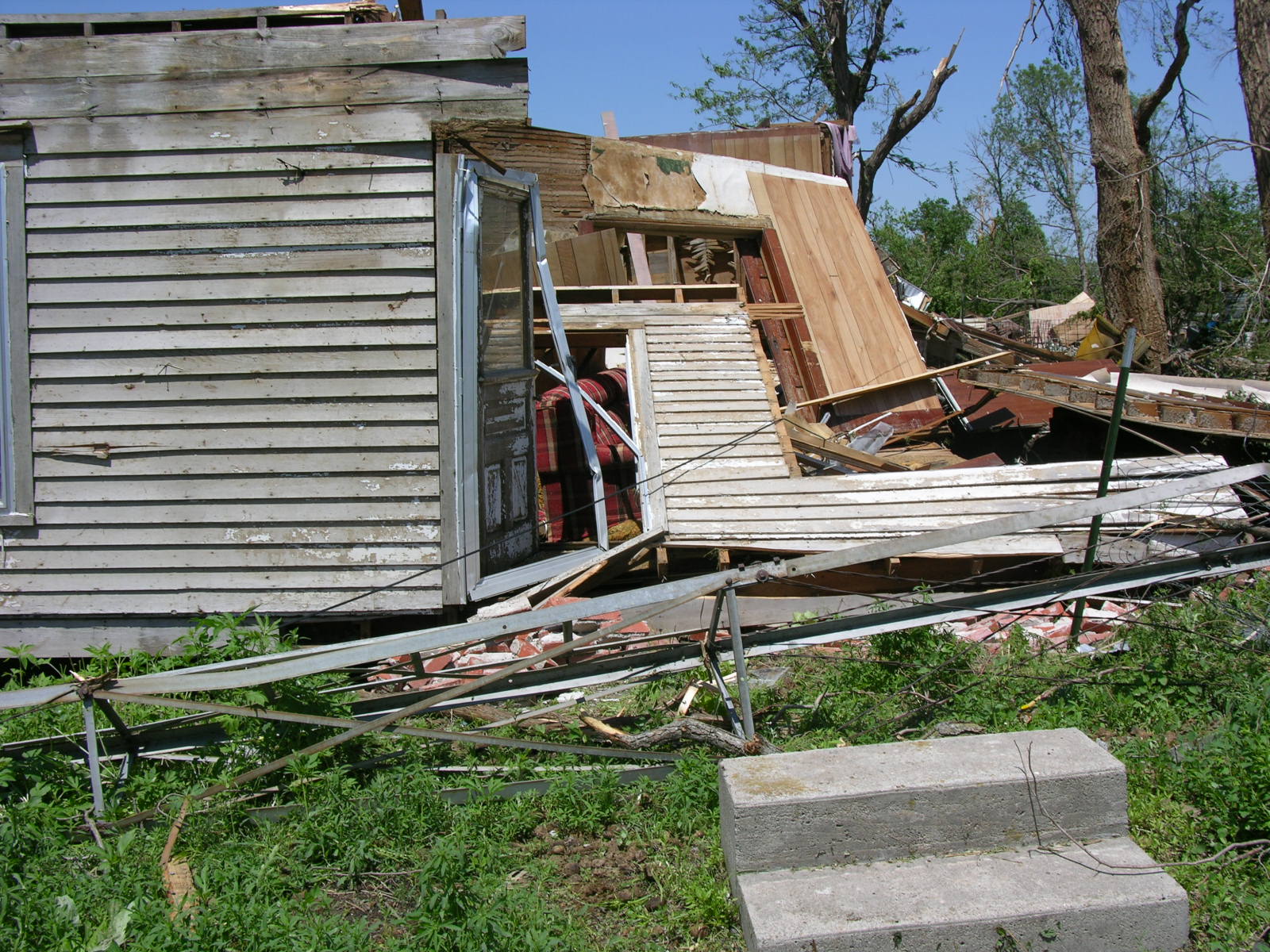
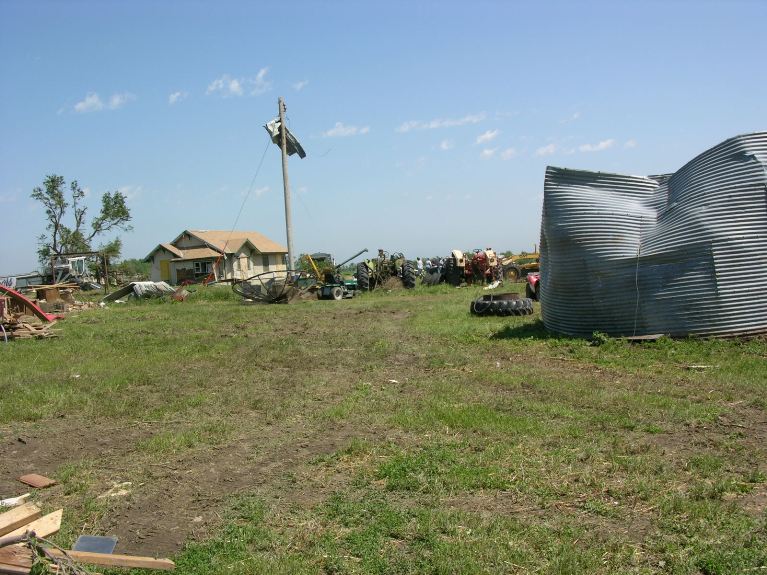
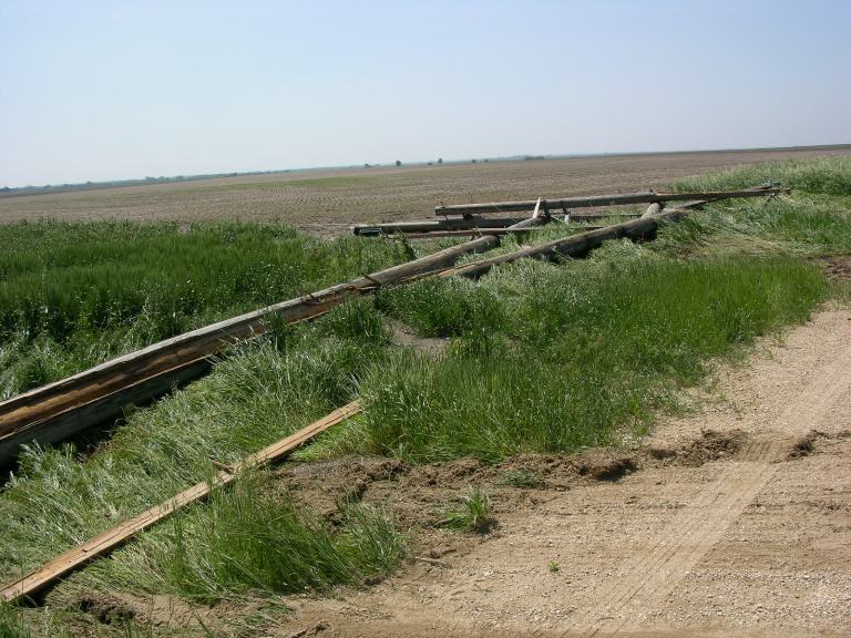
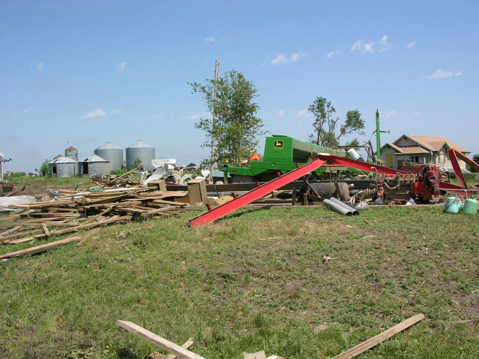
NWS damage survey crews have investigated the tornadic storm damage across Jewell and Mitchell Counties and have rated the tornado an EF3 at its strongest point. The tornado set down near Glen Elder Dam the night of May 29, 2008 and tracked to the northeast. The tornado had a path length of nearly 18 miles and a width up to one half mile.
The city of Jewell and areas around the city were hit especially hard with major structural damage in the city of Jewell. The water tower was destroyed/collapsed and multiple businesses including the Jewell CAFE and Bourbon Trucking were completely destroyed. Several houses in and south of Jewell sustained major damage.
Additional tornadoes may have occurred in Jewell and Mitchell Counties and this will be investigated over the next few days.
A map of the tornado path and photos of the damage are included below.
|
|
 |
 |
 |
 |
 |
 |
Hazardous Weather
Submit A Storm Report
Storm Prediction Center
Local Storm Reports
Experimental Graphical Hazardous Weather Outlook
Forecasts
Area Forecast Discussion
Fire Weather
Aviation Weather Center
Experimental Probabilistic Precip Amount Forecast
Winter Weather
Winter Storm Severity Index
Experimental Winter Storm Outlook
Wet Bulb Globe Temp
Activity Planner
Current Conditions
Current Area Observations
Text Products
Satellite
Rivers and Lakes
Local 24 Hour Precip Maps
Local Archived Precip Maps
NWPS Precipitation Analysis
Local Snowfall Maps
Snowfall Analysis
Snow Cover
Climate
Local Database (NOWData)
Local Climate Webpage
Hastings/G. Island Records
Local Historical Tornado Info
U.S. Drought Monitor
Grand Island - Daily
Grand Island - Monthly
Hastings - Daily
Hastings - Monthly
Kearney - Daily
Kearney - Monthly
Ord - Daily
Ord - Monthly
US Dept of Commerce
National Oceanic and Atmospheric Administration
National Weather Service
Hastings, NE
6365 North Osborne Drive West
Hastings, NE 68901-9163
402-462-4287
Comments? Questions? Please Contact Us.