
Lake-effect snow will continue downwind of Lakes Erie and Ontario through Friday. In the Western U.S., rain and higher elevation snow will continue over the Great Basin through Friday. A front will move over the Pacific Northwest Thursday afternoon and produce light rain and higher elevation snow over the Cascades through Saturday. Read More >
If you have any photos you would like to share, please feel free to post them to our Facebook or Twitter pages, or send them to our webmaster e-mail account at: w-gid.webmaster@noaa.gov. Please let us know where the photo was taken, and at least an approximate time. Thanks!
September 18, 2015: Morning Severe Thunderstorms Drop
Large Hail Across Portions Of South Central Nebraska
Event Summary |
Storm Reports |
Photos |
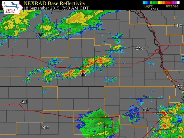
Radar
This is a NWS radar loop running from 7:50 a.m. to 11:00 a.m. CDT September 18th. The NWS Hastings coverage area is located within the orange outlined area labeled "GID".
 |
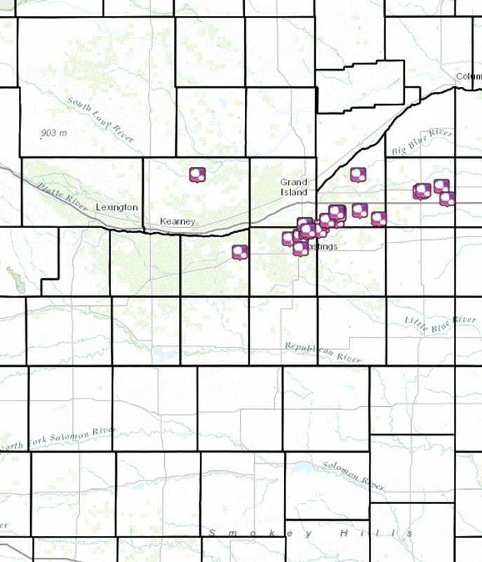
Between 8-11 AM on the morning of Friday, Sep. 18, 2015, a few severe hail storms tracked across east-central portions of the NWS Hastings coverage area (Click HERE for a map), producing localized swaths of large hail ranging from quarter size all the way up to tennis ball and even baseball size (see below for some of the most “notable” hail reports). Although not the only hail-producing storms in the area, the majority of severe weather reports resulted from a pair of elevated supercell storms that nearly “followed” each other along a similar path, primarily impacting the following counties: northeastern Kearney, northern Adams, far southeastern Hall, far northwestern Clay, southern Hamilton and central York. Some areas were actually pounded by hail from both of these storms, roughly 30 to 40 minutes apart!
Despite rather cool air at the surface that had poured into the region behind a cold front, these high-based storms were able to tap into strong “elevated” instability (meaning unstable air centered thousands of feet above the ground), aided by a strong upper level disturbance tracking into the Central Plains. The fact that hail storms developed over the area was actually not a complete surprise given that the local Hazardous Weather Outlook issued by NWS Hastings early Friday morning mentioned that “a few storms could become strong enough to produce hail up to around nickel size”. However, the potential size of the largest hail stones was obviously under-estimated.
This story will be updated with any additional information that becomes available.
 |
 |
 |
 |
|
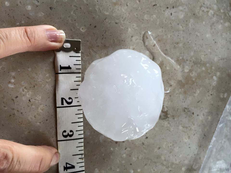
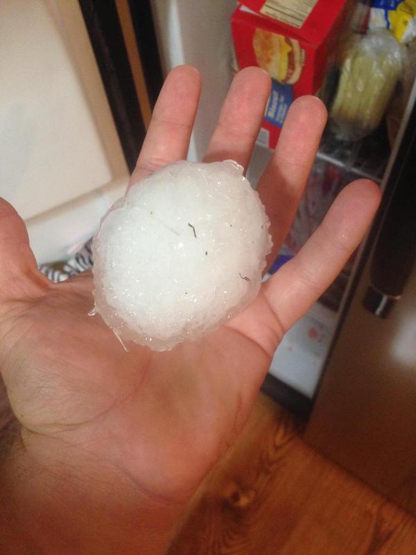
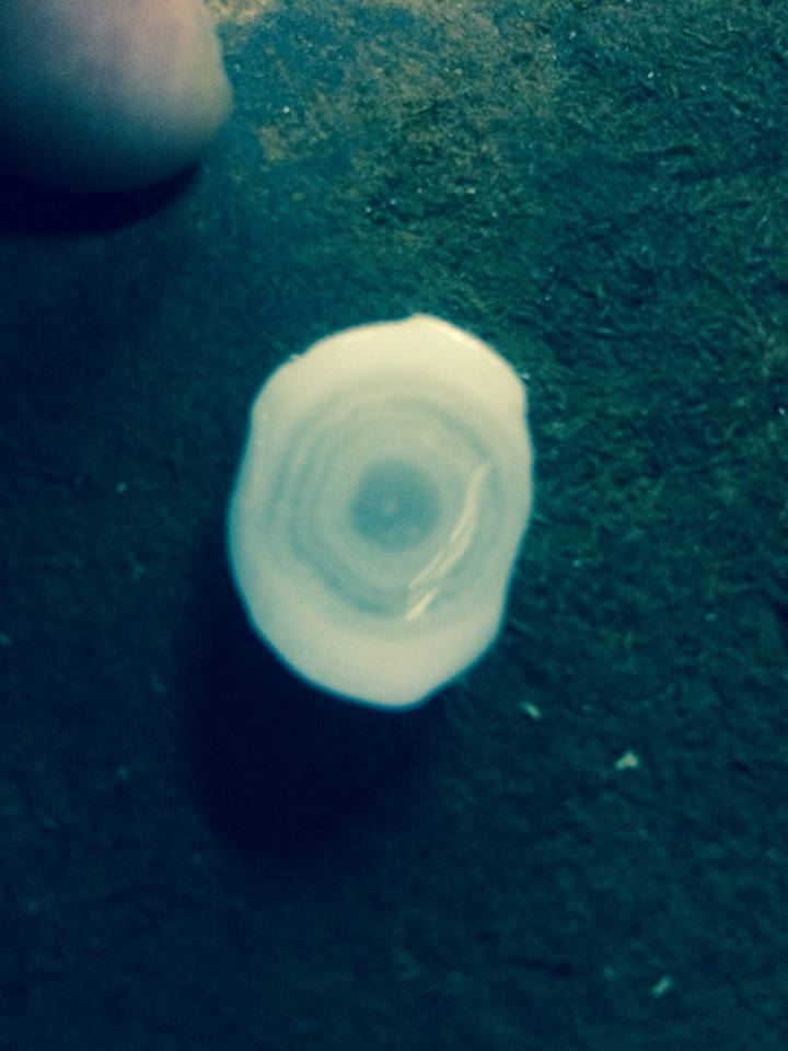
| Large hail near Trumbull, NE. Photos courtesy of Shari McDowell. | Large hail near Trumbull, NE. Photos courtesy of Scott Bieck. | ||
 |
 |
 |
 |
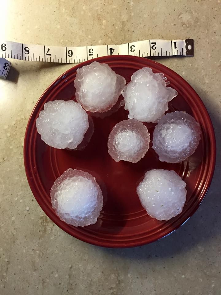
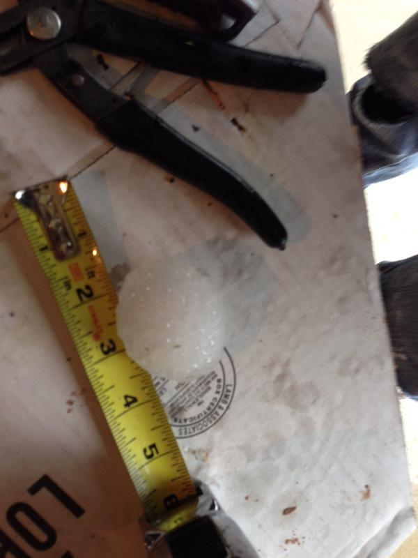
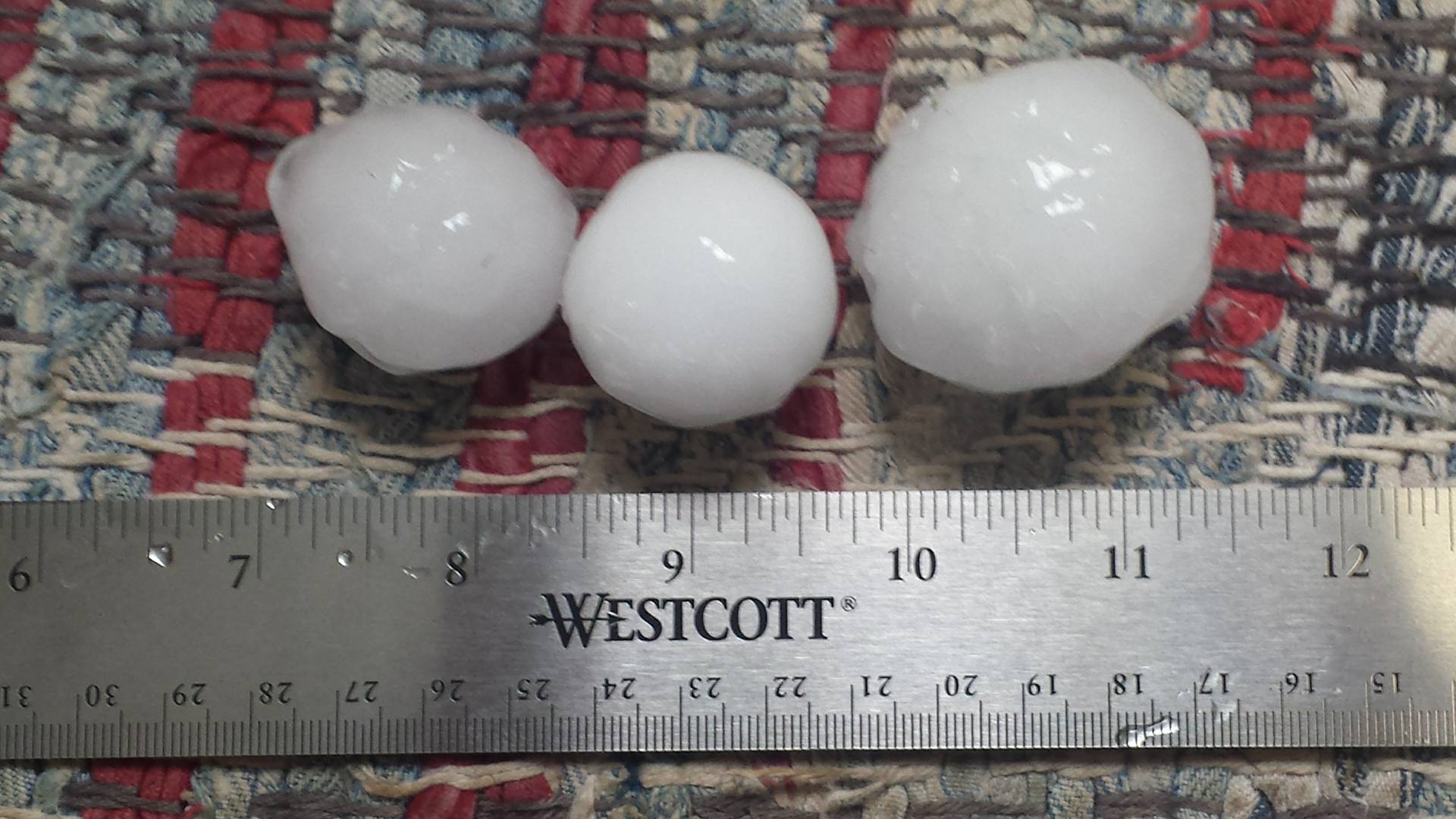
| Large hail south of Giltner. Photos courtesy of Bob Smith. |
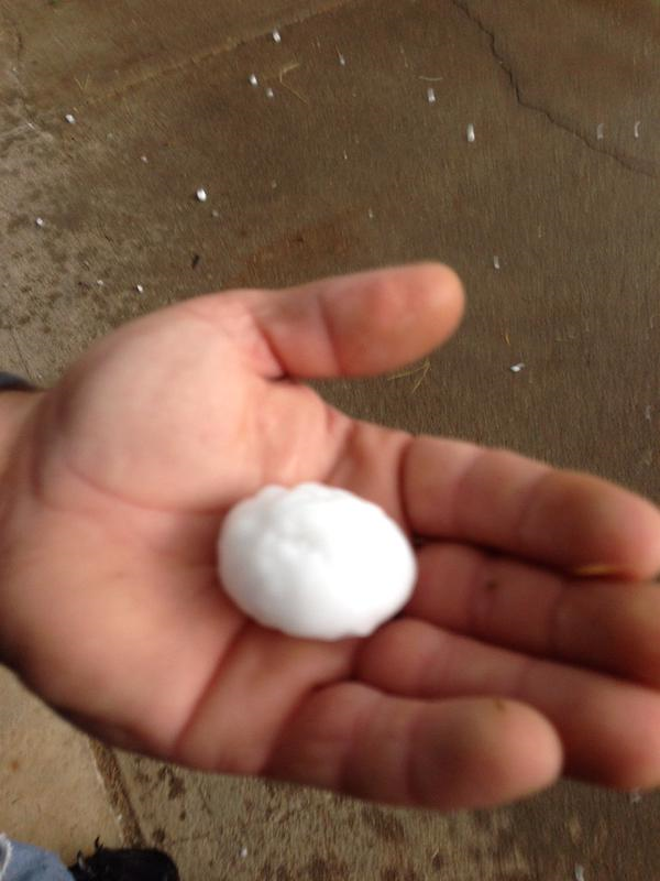
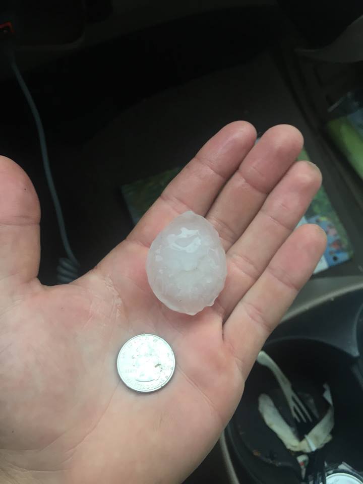
Large hail near Heartwell. Photo courtesy of Brynn Hopkins Gustafson. |
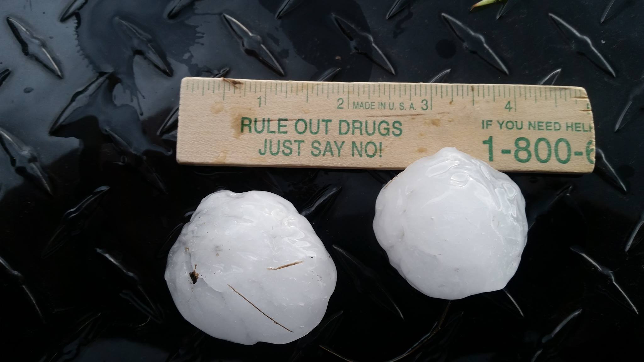
Large hail in York. Photo courtesy of Jeremiah Fisher. |
|
 |
 |
 |
|
| Hail near Waco. Photo courtesy of Matthew Mau. |
Hail 4 NW of Hastings. Photo courtesy of Micah Schutte. |
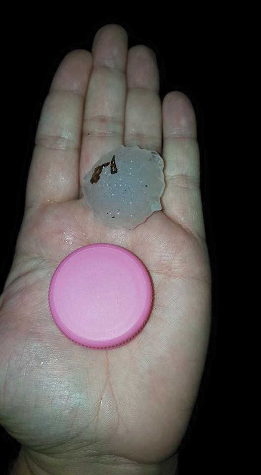
Hail 2 SE of Hansen. Photo courtesy of Ryan Pfannkuch. |
|
 |
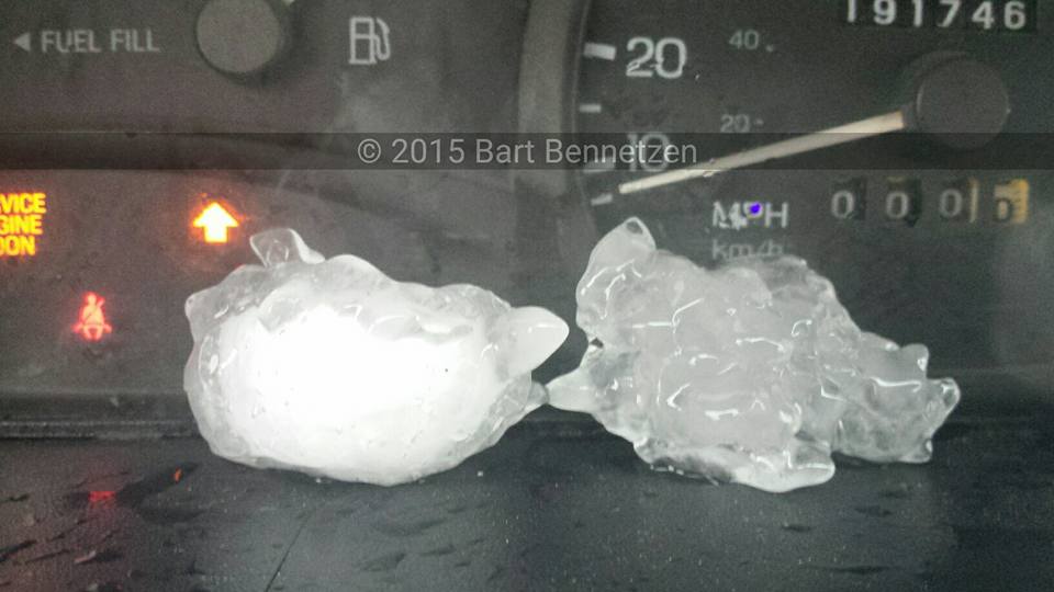 |
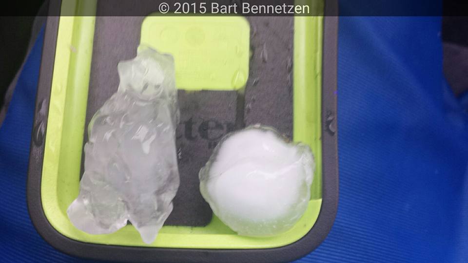
| Hail near Giltner. Photo courtesy of Bart Bennetzen. |
|
 |
This page was composed by the staff at the National Weather Service in Hastings, Nebraska. |
 |

