National Weather Service United States Department of Commerce

If you have any photos you would like to share, please feel free to post them to our Facebook or Twitter pages, or send them to our webmaster e-mail account at: w-gid.webmaster@noaa.gov. Please let us know where the photo was taken, and at least an approximate time. Thanks!


Sep. 9, 2015

Several Severe Storms Produce Mainly Large Hail, Some Wind Damage In Nebraska Counties


To the right is a NWS radar loop from 11:30 a.m.  on Wednesday, Sep. 9th to 1:30 a.m. on Thursday, Sep. 10th.

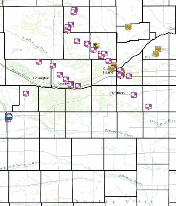
The NWS Hastings coverage area is located within the orange outlined area labeled "GID".
(Click Radar Loop To Enlarge)
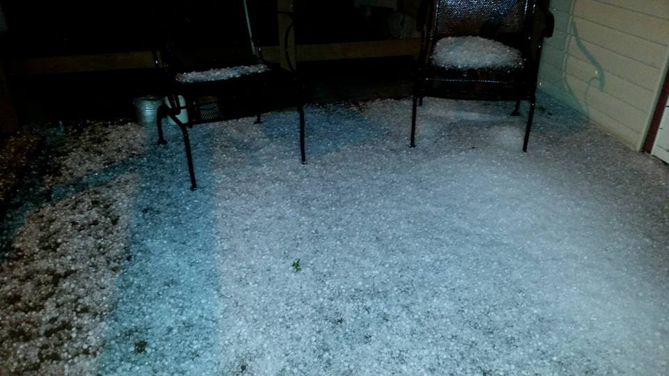
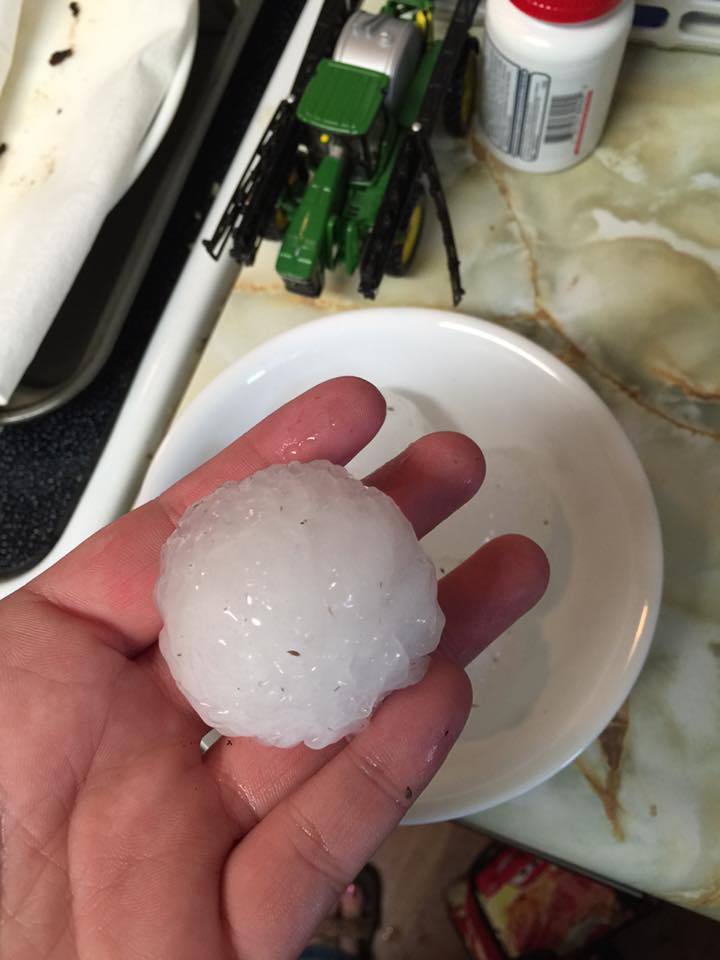
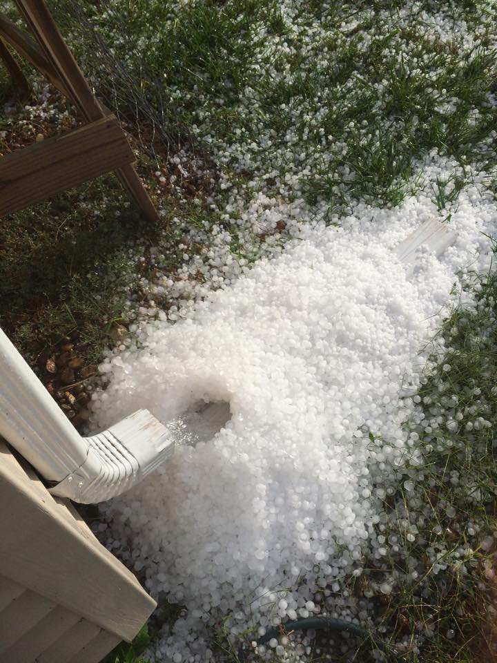
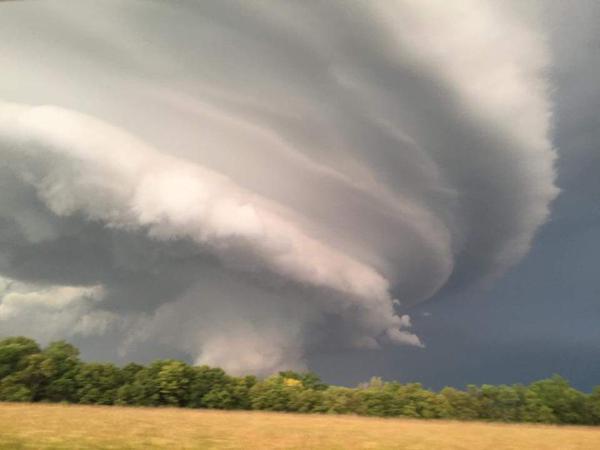
Event Summary(Note: This story focuses only on the NWS Hastings Coverage Area):

Primarily during the afternoon and evening hours of Wednesday, Sep. 9, 2015, several severe supercell thunderstorms tracked from northwest-to-southeast across portions of central/south central Nebraska. These storms promoted numerous reports of large hail up to around golf ball size, along with a few reports of straight-line wind damage (see below for some of the most "notable" severe weather reports). Along with numerous smaller towns, severe weather also affected mainly the northern and eastern portions of Kearney and Grand Island. Fortunately, no tornadoes were reported, despite the fact that some storms also exhibited some modest rotation aloft, as detected by radar. The "main show" of severe storms centered between the hours of 4 PM-Midnight. However, a few marginally severe storms also flared up earlier in the day in northern Dawson/Buffalo counties, while on the later side of things, the last severe storm of the night within the local area didn't depart Thayer County until after 1 AM on the 10th.

Forecast-wise, although the potential for at least " a few strong to severe storms" was noted in advance, this activity ended up being somewhat more intense and longer-lasting than anticipated. Unlike many severe weather events, this one did not feature a strong "upper level disturbance". However, the combination of modest atmospheric instability and wind shear, along with colder air aloft, clearly proved sufficient to promote robust severe storms.


Heavy Rainfall/Flooding: As with most thunderstorm events, rainfall was highly variable across the local area, with many counties receiving little to nothing, while others were soaked with at least 1-2" of rain. In general, there were two "zones" of enhanced rain totals:

  • On a more widespread scale, many locations received generally 1.00-2.50" within a roughly 10-20 mile wide corridor, extending along a northwest-to-southeast line roughly centered from Ord-St. Paul-Aurora-York. Radar data suggests that a few small pockets of 3+" inch amounts might have fallen within this corridor as well, but there are no official "ground-truth" reports of this. Although there were likely some short-term, minor flooding issues with this heavy rain, the fact that most of the area had been rather dry for several days/weeks leading up to this event likely kept more impactful problems at bay.
     
  • On a very localized scale, parts of northwestern Furnas County, including the town of Cambridge, received at least 2-3" of rain in a short time primarily during the 4:00-5:30 PM time frame. This heavy rain caused short-term flooding issues, including several inches of water flowing over Highway 6/34 in town.


(click to get to more detailed information)
Storm reports from September 9th.


Summary of the most "notable" storm reports (NOT a complete list):

  • Golf ball size hail (1.75") - Cambridge, Arcadia, Riverdale, Kearney, Loup City, Dannebrog and 1 N Elyria
     
  • Ping pong ball size hail (1.5") - Farwell
     
  • Half dollar size hail (1.25") - Elwood, 10 SW Ord, 7 NNW Grand Island
     
  • Quarter size hail (1") - Shickley, 1 W Eddyville, 2 N Miller, 1 SE Ashton, 3 SW Saronville
     
  • Strong winds downed numerous tree limbs and power lines in the Farwell area. One home's windows were broken.
 

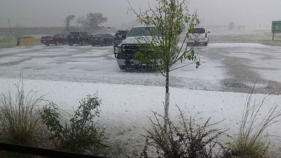
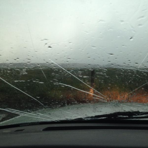
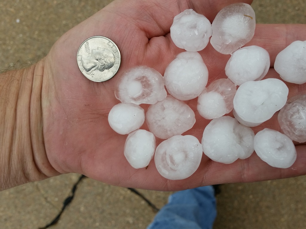
Photos from the area:
 
Hail covers the ground in Cambridge.
Photo courtesy of Cassie Jo.
Windshield damage from
hail near Elyria.
Photo courtesy of
Scott Philbrick.

Hail in the Kearney area.
Photo courtesy of
Richard Thomas.

Hail covers the ground
near Phillips.
Photo courtesy of
Kyla Trumble.
 
Large hail near Arcadia.
Photo courtesy of Angie Hain Rohan.
Pile of hail on the north side of Kearney.
Photo courtesy of
Amanda Anderson.
Large hail near Dannebrog.
Photo courtesy of Heather Christensen.
 
Impressive storm structure near Grand Island.
Photo courtesy of Jeff Bulin.


This page was composed by the staff at the National Weather Service in Hastings, Nebraska.