Extreme heat continues today from the central Plains to the lower Mississippi River Valley, over southeast Montana, and from southern California into the Southwest Deserts. Extreme Heat Warnings remain in effect. Severe thunderstorms capable of strong to severe wind gusts and large hail are possible across the Great Lakes into the Ohio Valley today into tonight. Read More >
Overview
|
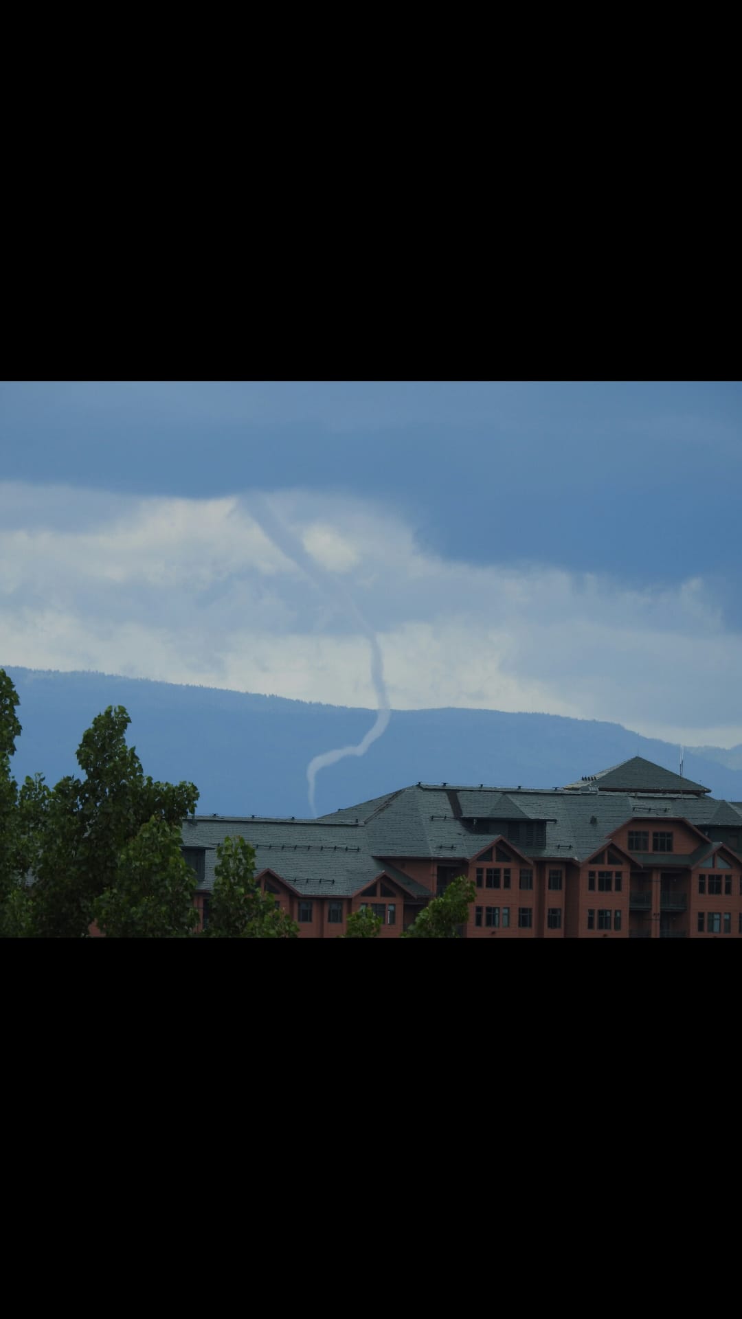
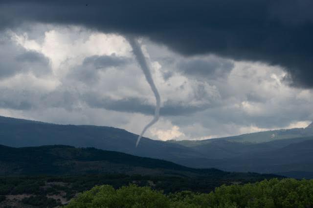
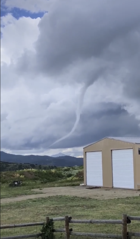
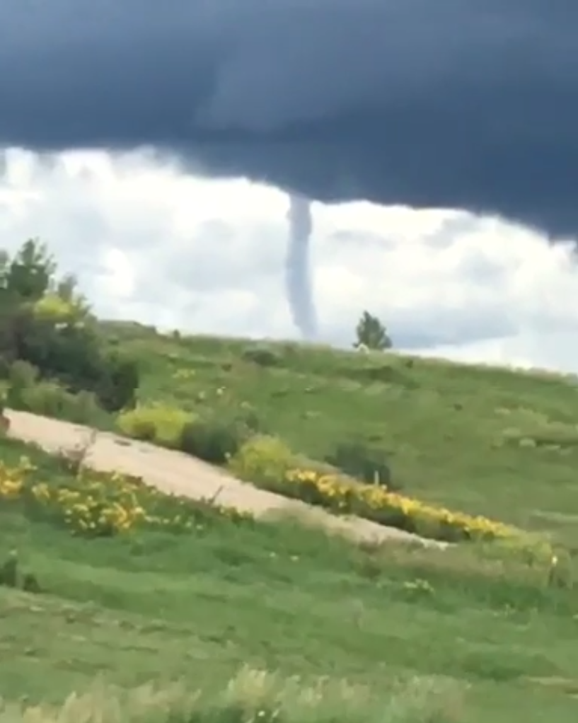
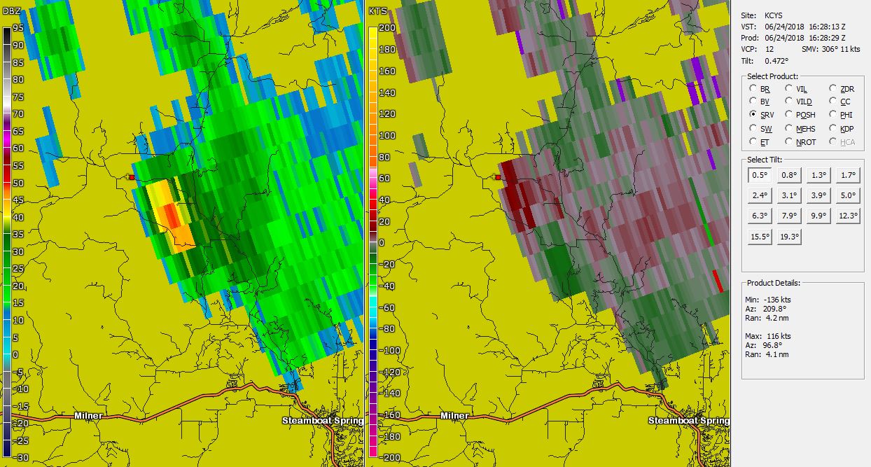
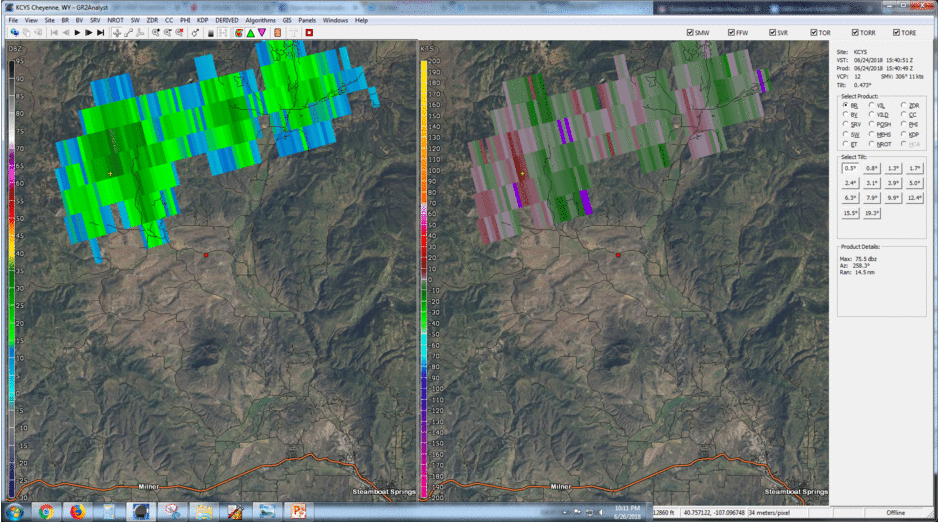
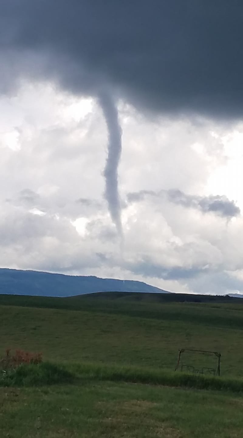
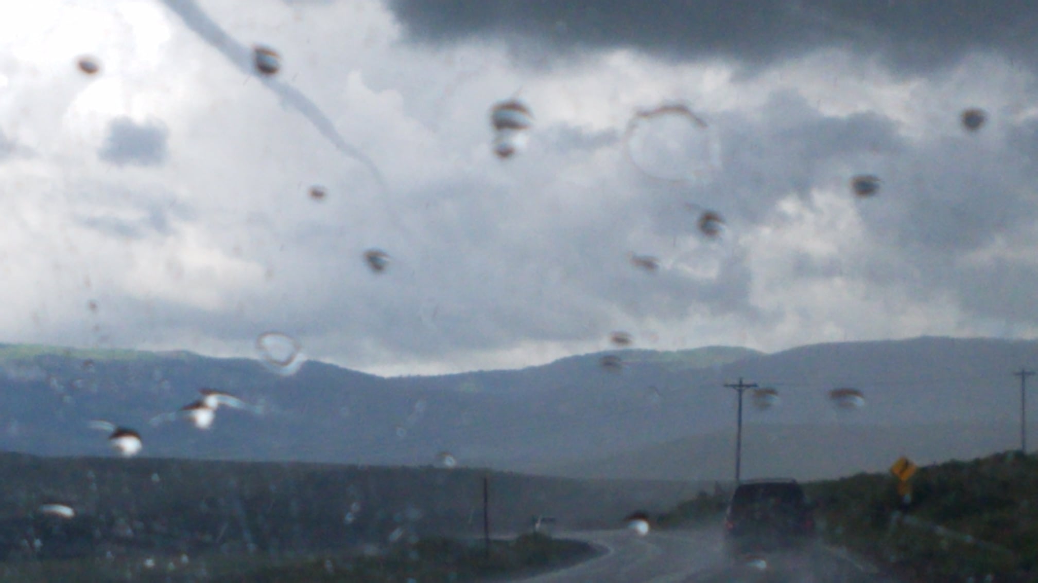
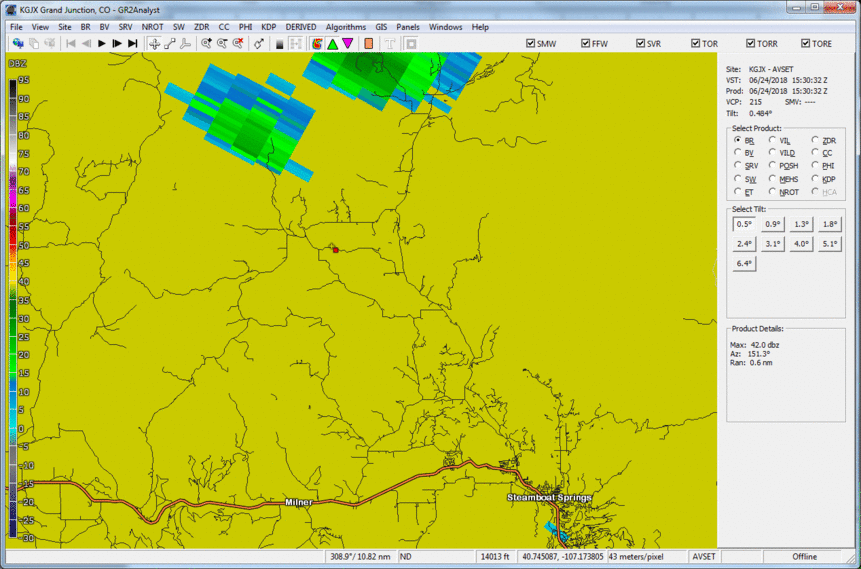
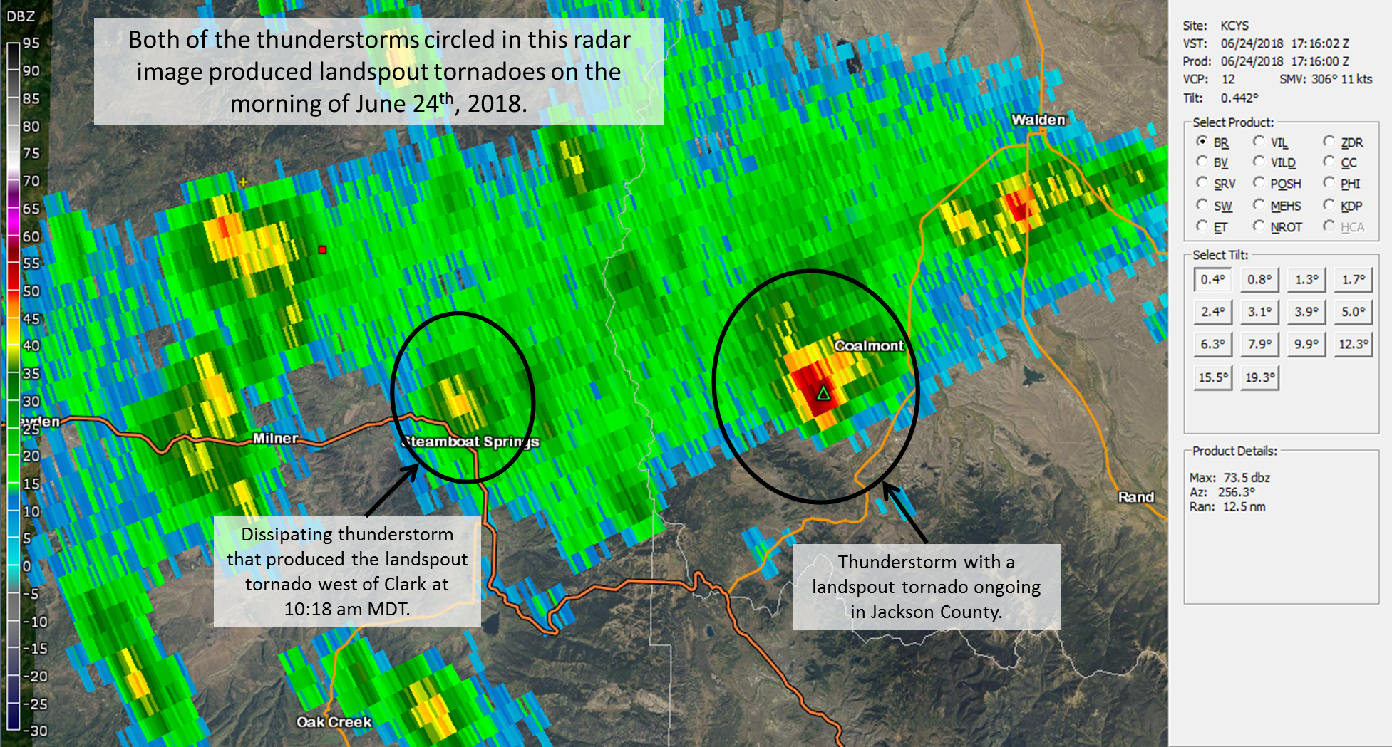
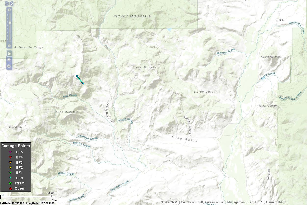
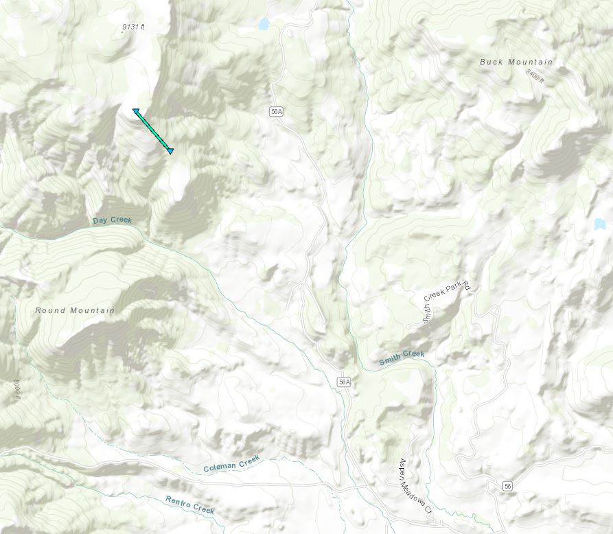
A landspout tornado briefly touched down approximately 17 miles NNW of Steamboat Springs, Colorado, or 7 miles WSW of Clark, Colorado, around 10:18am on June 24, 2018. This is the first confirmed tornado in western Colorado west of the continental divide in 2018. Two National Weather Service meteorologists met with the Routt County Emergency Management Director on June 25, 2018 and surveyed the area to try and confirm whether the reported funnel cloud produced a tornado. Though no concrete evidence was found during the survey, the group spoke with many people around the region and pinpointed the likely track of the center of circulation. Late on the 25th, a couple of eyewitnesses contacted the National Weather Service in Grand Junction and confirmed a small dust cloud at the bottom of the funnel which indicated contact with the ground. The tornado was estimated to last for about a minute, while the associated condensation funnel existed for about 10 minutes. |
.jpg) Credit: Soren Jespersen |
|
Tornado - 17 miles NNW Steamboat Springs/8 miles WSW of Clark, Colorado
|
||||||||||||||||||||||||
|
||||||||||||||||||||||||
The Enhanced Fujita (EF) Scale classifies tornadoes into the following categories:
| EF0 Weak 65-85 mph |
EF1 Moderate 86-110 mph |
EF2 Significant 111-135 mph |
EF3 Severe 136-165 mph |
EF4 Extreme 166-200 mph |
EF5 Catastrophic 200+ mph |
 |
|||||
 |
Media use of NWS Web News Stories is encouraged! Please acknowledge the NWS as the source of any news information accessed from this site. |
|