
Tropical Storm Bertha could bring tropical storm conditions to portions of the Florida Panhandle and Alabama coast through Wednesday, where a Tropical Storm Watch and Storm Surge Watch is in effect. Numerous severe thunderstorms with heavy rainfall are expected from the Ohio Valley into the Mid-Atlantic and Northeast Tuesday. Read More >
Overview
|
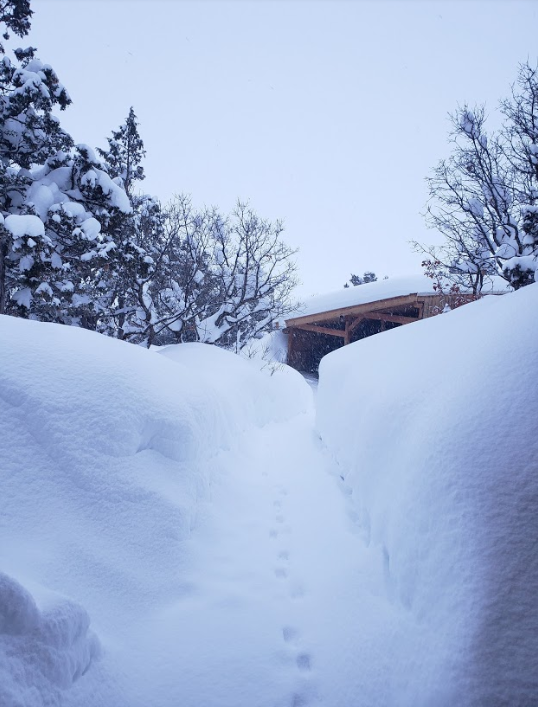
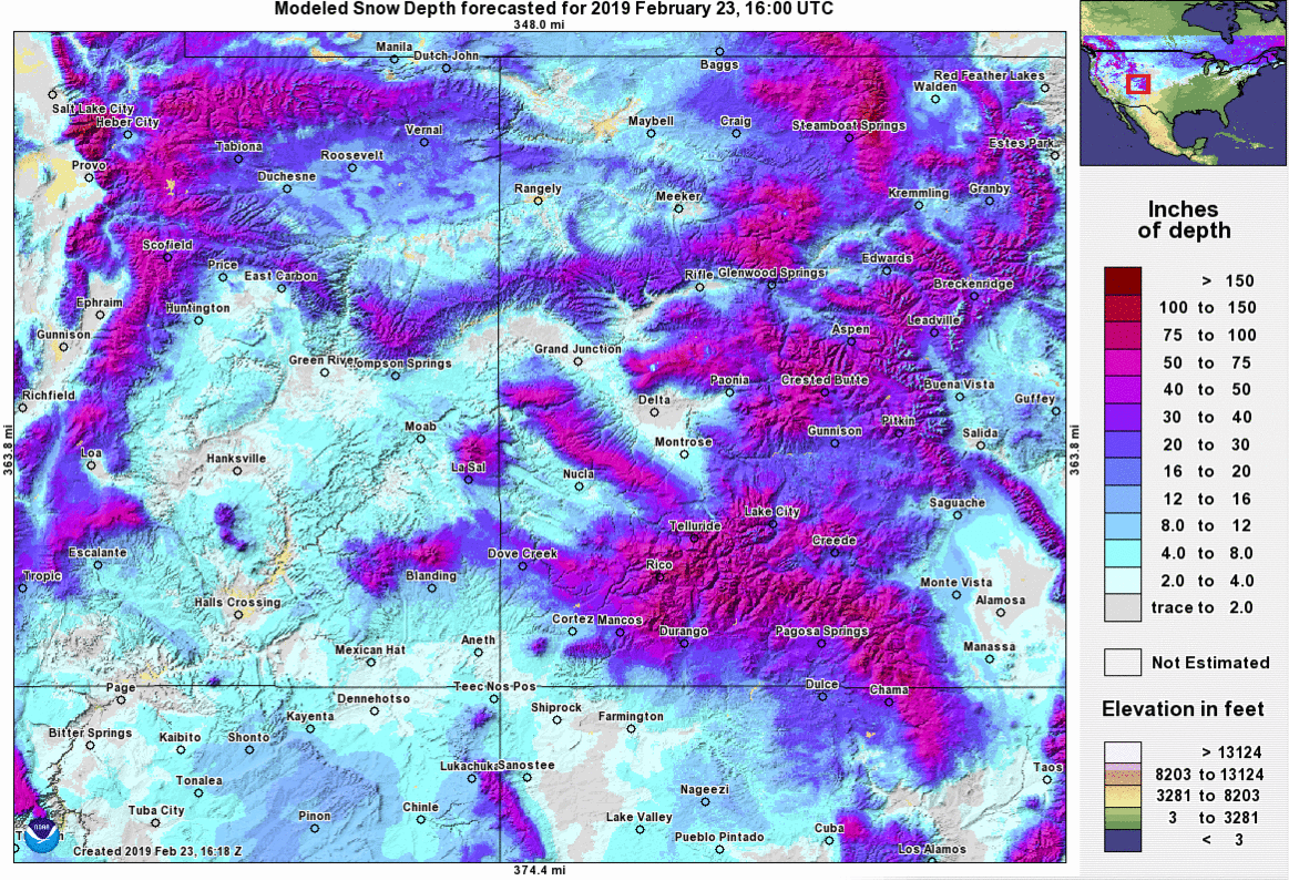
A powerful low pressure system affected much of the southwestern United States from February 20th through the 23rd. This storm was characterized by cold temperatures and very high snowfall totals across the Four Corners region. Over three feet of snow fell in the San Juan Mountains, with well over a foot along portions of the US 160 corridor. This storm was the largest in a series of heavy snow events across the central and southern Rockies throughout the month of February. Mountain snowpack values averaged well above seasonal averages, and were close to 150% of normal by the time the storm ended. Many highways in southeast Utah and southwest Colorado were closed for a period of time on February 22nd when snow rates were at their highest. Mountain passes in the San Juans were closed due to avalanche concerns. Avalanche warnings were issued in the La Sal, Abajo and San Juan mountains. |
 A large area of low pressure dives southward through the western United States on February 22nd. This system was accompanied by very cold air stretching all the way south of the USA/Mexico Border and into the eastern Pacific Ocean. |
 |
 |
 |
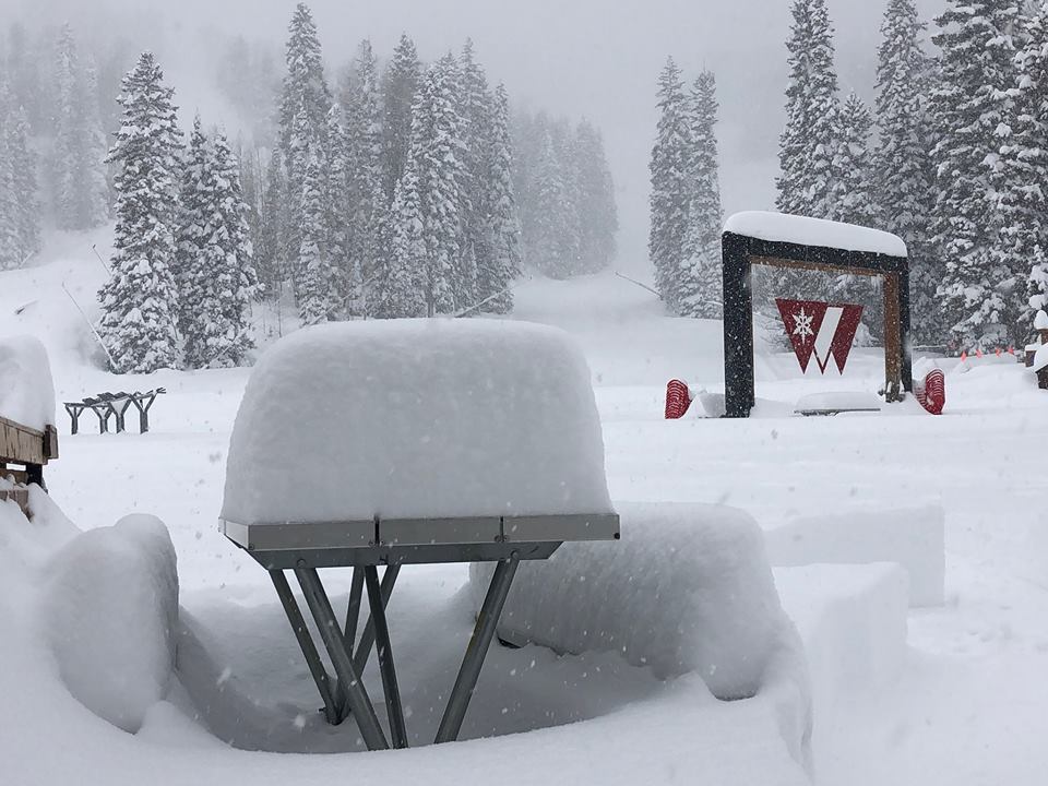
| Snowfall at Purgatory Ski Resort on 2/22. Photo credit: Purgatory Ski Resort |
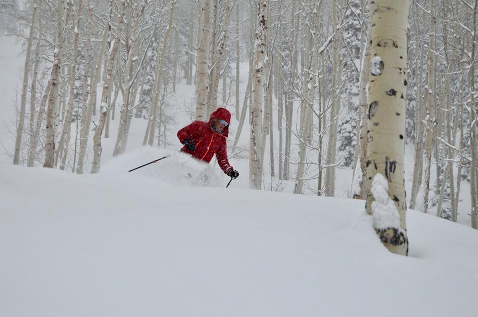
Snowfall at Powderhorn Ski Resort. Photo credit: Powderhorn Ski Resort |
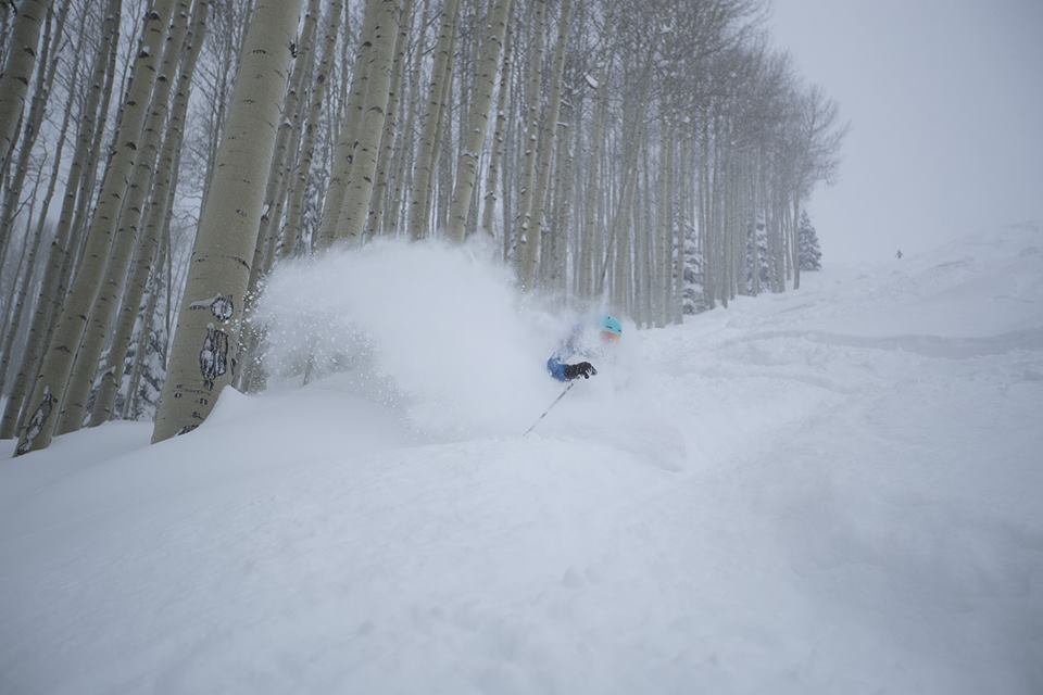
Snowfall in the San Juan Mountains. Photo credit: Purgatory Ski Resort |

Photos & Video
 |
 |
 |
 |
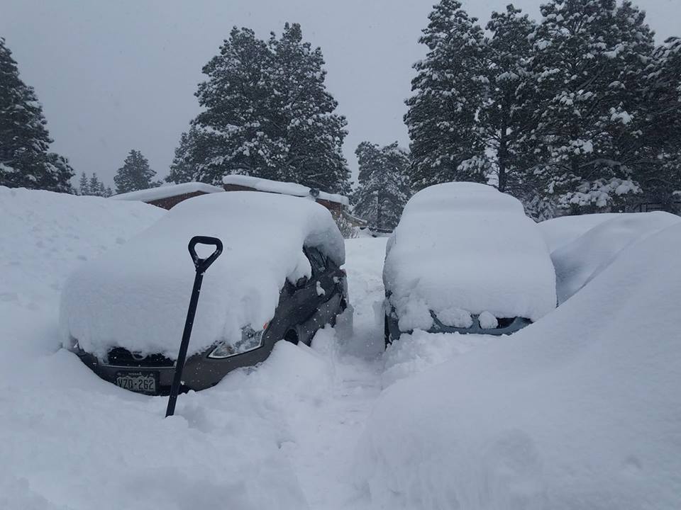
| Snow in Pagosa Springs on February 22nd. Photo courtesy of Michele Ó Raifeartaigh | Snow in Pagosa Springs on February 22nd. Photo courtesy of Jay Godson | Snow in the Durango West Subdivision. Photo from Jerry McBride/Durango Herald | Snow on top of the Kennebec Cafe in Hesperus. Photo from Jerry McBride/Durango Herald |
Radar and Satellite Imagery
 |
.gif) |
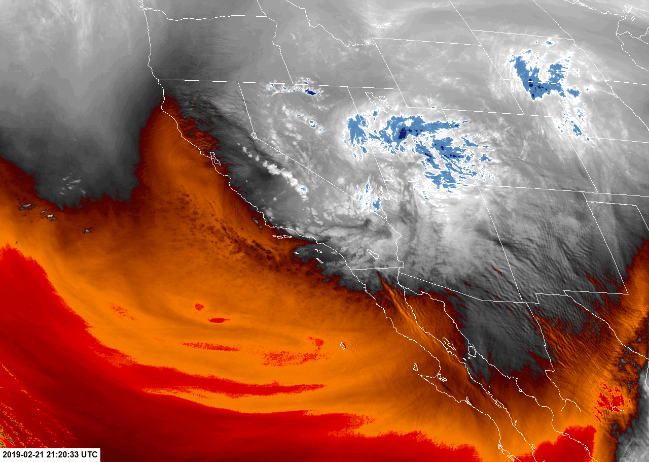 |
 |
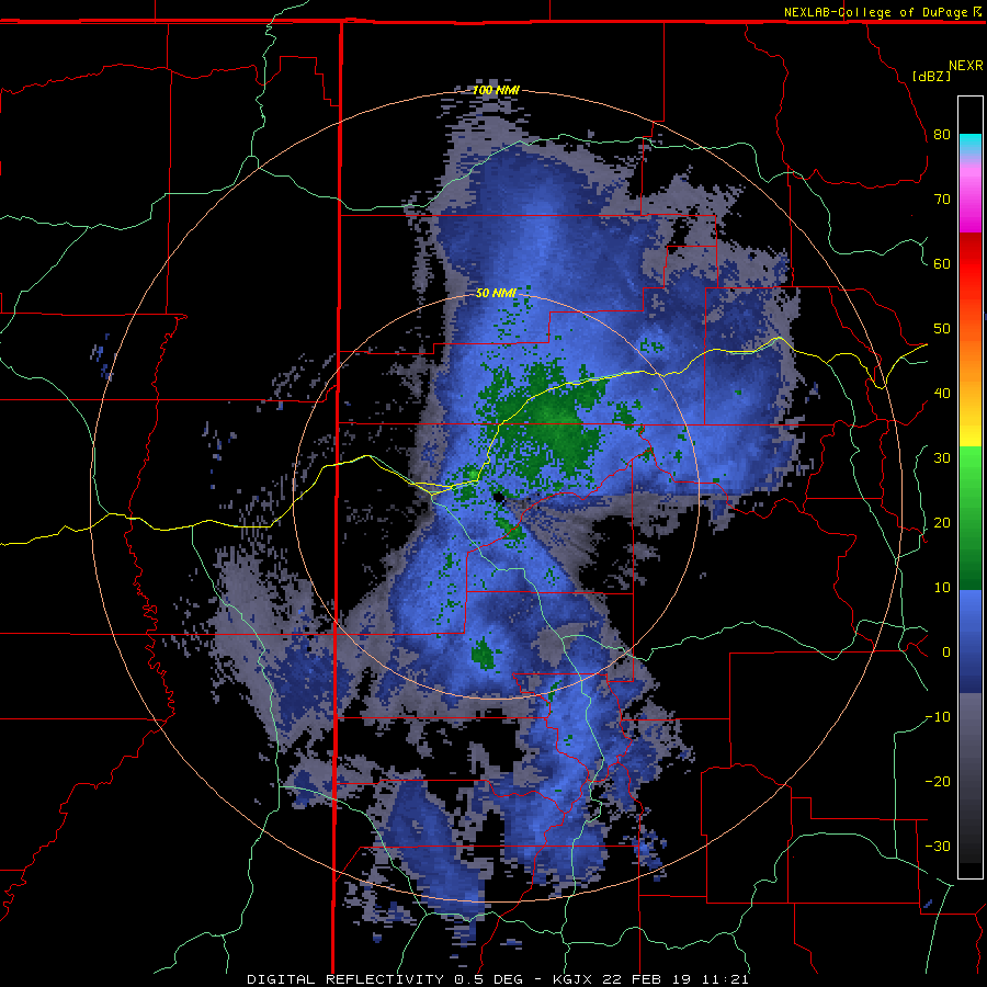
| KGJX radar data throughout the heaviest portion of snowfall on February 22nd. Data visualization courtesy of College of DuPage. | GOES West Infrared data showing the evolution of the low pressure and moisture stream over the southwest USA. Data visualization courtesy of CIRA. | GOES West Water Vapor imagery showing the deep low pressure system moving across the southwest. Data visualization courtesy of CIRA. | Satellite derived snowfall data before and after the event. Data visualization courtesy of NOHRSC. |
 |
Media use of NWS Web News Stories is encouraged! Please acknowledge the NWS as the source of any news information accessed from this site. |
|

