
Canadian wildfire smoke will push into the Midwest, worsening air quality. A frontal system brings severe storms from the Northern Plains to the Mid‑Atlantic the next few days. Heavy Gulf Coast rain is possible as we closely monitor tropical development, while monsoonal storms persist in the Southwest with heavy rainfall. Hazardous heat expands from the Plains into the Lower Mississippi Valley. Read More >
Grand Junction, CO
Weather Forecast Office
| NRCS Snow Water Equivalent | CBRFC Peak Flow Forecasts |
| CBRFC Water Supply Forecast | River Conditions & Forecasts |
| River Basin Tea-Cup Diagrams (USBR) | Reservoir Data (USBR) |
Regional Snow Analysis: Central Rockies
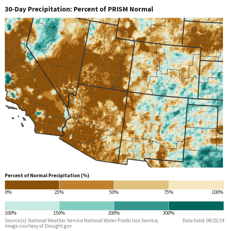
Estimated 30-Day Precipitation Acummulations:
-intermountain.png)
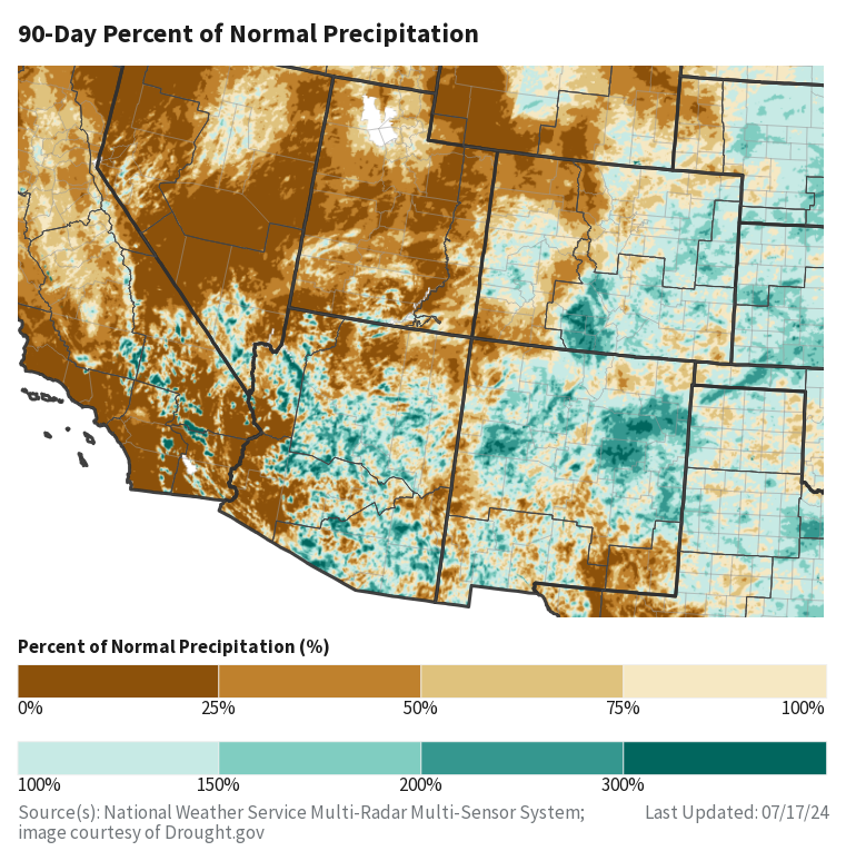
Estimated 90-Day Precipitation Acummulations:

Temperature Anomaly (7-Day and 30-Day):


Climate Prediction Center Outlooks:


US Drought Monitor:
Hazards
Detailed Hazards Viewer
National Briefing
Outlooks
Transportation Decision Support
Winter Storm Severity Index
Forecasts
Aviation Weather
Fire Weather
Forecast Discussion
Forecast Points
Local Area
Severe Weather
Soaring Forecast
Winter Weather
Hydrology
Recreational River Report
River Forecast
Weather Safety
Preparedness
NOAA Weather Radio
StormReady
SkyWarn
US Dept of Commerce
National Oceanic and Atmospheric Administration
National Weather Service
Grand Junction, CO
2844 Aviators Way
Grand Junction, CO 81506-8644
970-243-7007
Comments? Questions? Please Contact Us.

