
Severe thunderstorms capable of damaging winds will be possible from the Ozark Plateau east into portions of the Southeast today. Rounds of heavy thunderstorms ahead of a slow moving front will continue locally heavy rainfall and scattered flash flooding potential from the Ozarks to the Ohio and Tennessee Valleys today. Read More >
Grand Junction, CO
Weather Forecast Office
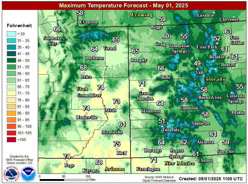
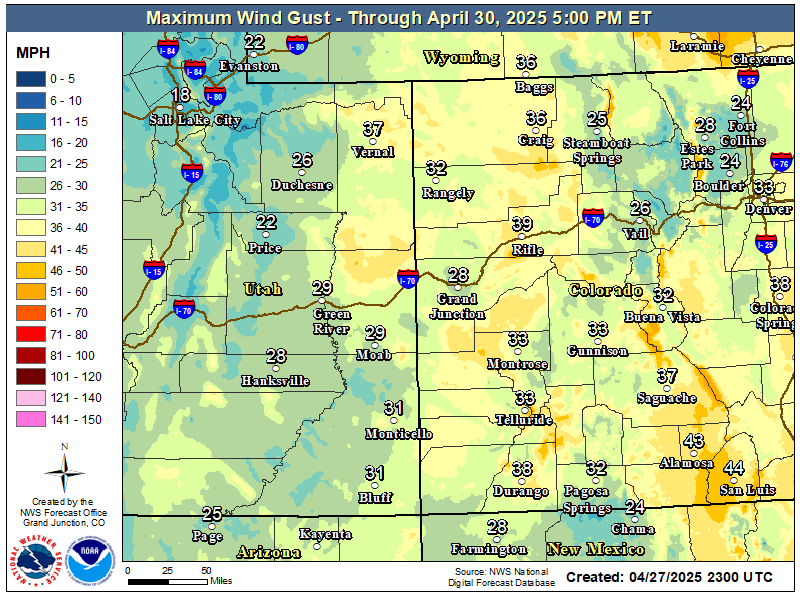
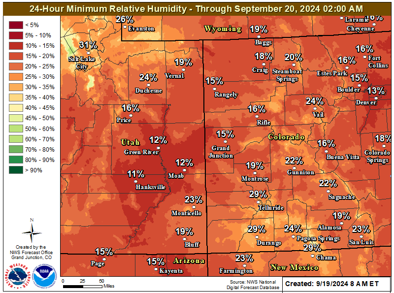
Dry, warm and windy conditions will occur again by late this morning and continue into the evening ahead of a storm system moving into the Great Basin. This will lead to critical fire weather conditions across portions of western Colorado in areas where fuels are deemed critical. See Red Flag Warning highlights below for the specific areas where the combination of low relative humidity, gusty winds and dry fuels will lead to critical fire weather conditions. Windy conditions will also occur across much of eastern Utah and western Colorado requiring Wind Advisories for those areas where winds are expected to gust to 50 mph in the valleys and up to 60 mph over Douglas Pass.
Winds should subside by Sunday with cooler temperatures, yet still remaining above normal. Precipitation potential is becoming less and less likely through the weekend as the western slope gets caught in the dry slot with not much progression of this storm system. Any shower activity looks to be confined to areas north of I-70 with more wind than rain as low levels remain very dry. Temperatures this weekend will cool by 10 degrees compared to the readings over the last few days, but still be fairly mild with values still 5 degrees above normal.
Latest Red Flag Warnings

Latest Wind Advisories
Non-Precipitation Warnings / Watches / Advisories Issued: 07/12/2026 10:50:00 AM UTC

Expected High Temperatures Saturday
Highest Wind Gusts Expected Through Monday
(Highest Winds Expected Saturday)
Minimum Relative Humidity Saturday
Climate Prediction Center 6 to 10 Day Outlooks


Climate Prediction Center 8 to 14 Day Outlooks


Hazards
Detailed Hazards Viewer
National Briefing
Outlooks
Transportation Decision Support
Winter Storm Severity Index
Forecasts
Aviation Weather
Fire Weather
Forecast Discussion
Forecast Points
Local Area
Severe Weather
Soaring Forecast
Winter Weather
Hydrology
Recreational River Report
River Forecast
Weather Safety
Preparedness
NOAA Weather Radio
StormReady
SkyWarn

US Dept of Commerce
National Oceanic and Atmospheric Administration
National Weather Service
Grand Junction, CO
2844 Aviators Way
Grand Junction, CO 81506-8644
970-243-7007
Comments? Questions? Please Contact Us.


 Follow us on X
 Follow us on Facebook
 Follow us on YouTube
 GJT RSS Feed