
Heat expands across the Desert Southwest, Plains, Mississippi Valley and Midwest into Monday. Fire weather concerns continue for portions of the Intermountain West. Active monsoonal moisture fuels thunderstorms over the Southwest with possible flash flooding. Tropical cyclone Fausto in the Pacific, should weaken as it approaches Hawaii; Dangerous surf, swells and rip currents are expected. Read More >
Grand Junction, CO
Weather Forecast Office
Using the weather.gov/gjt website, you can obtain forecast lightning information year-round. The Lightning Potential Index (LPI) provides graphical guidance for the potential of lightning over a 60 hour period. This looping product will update continuously on a 3 hourly basis as new computer model information becomes available. This information should be used for general planning purposes only and is provided for the National Weather Service Grand Junction area of responsibility (eastern Utah and western Colorado). You are urged to seek out the latest forecast information by visiting WFO Grand Junction. Please see our Lightning Safety Page for more information.
To access the LPI:
First, click on the ‘Forecasts’ section of our website (red arrow below). A drop-down menu will then appear. Click on the 7th entry from the top (or 2nd one from the bottom) called ‘Lightning Potential Index (red oval).
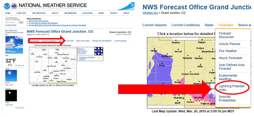
From there, you will see the following webpage:
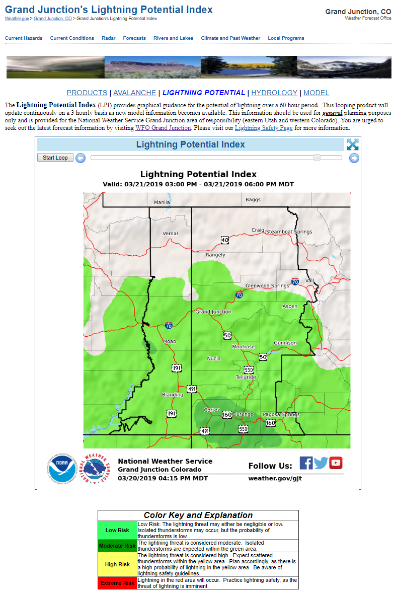
From this page, you can loop the current forecast, stop the loop, and step through each image in the loop.
And at the bottom of the page (or right above this text) you will find the Color Key and Explanation section of the page (or the legend). Think of the LPI as a stop light; Green means go, Yellow exercise caution and Red means stop (or take the day off from climbing that 14er).
If you have any questions on how to use the Lightning Potential Index, don’t hesitate calling us at 970-243-7007 or email us at wxgjt@noaa.gov.
Hazards
Detailed Hazards Viewer
National Briefing
Outlooks
Transportation Decision Support
Winter Storm Severity Index
Forecasts
Aviation Weather
Fire Weather
Forecast Discussion
Forecast Points
Local Area
Severe Weather
Soaring Forecast
Winter Weather
Hydrology
Recreational River Report
River Forecast
Weather Safety
Preparedness
NOAA Weather Radio
StormReady
SkyWarn
US Dept of Commerce
National Oceanic and Atmospheric Administration
National Weather Service
Grand Junction, CO
2844 Aviators Way
Grand Junction, CO 81506-8644
970-243-7007
Comments? Questions? Please Contact Us.

