
Flash flooding threatens areas from the Tennessee Valley to the Carolinas as storms repeat along a stalled front. Monsoonal storms may trigger flooding in the Southwest. Dangerous heat expands across the Desert Southwest, Plains, mid-Mississippi Valley and Southern Tier. Critical fire weather for interior Pacific Northwest. Cooler, drier air brings brief relief to the Great Lakes and Northeast. Read More >
Grand Junction, CO
Weather Forecast Office
Red Flag Warning in Effect Today, June 29, from 12 PM until 8 PM MDT for all of eastern Utah and western Colorado
Dry and hot conditions will prevail through the end of this week as high pressure remains in control. Southwest winds will increase this afternoon ahead of an approaching trough of low pressure and its cold front. Temperatures in many lower valleys will be approaching, if not exceeding triple digit heat! Follow heat safety tips to Beat the Heat at www.weather.gov/safety/heat.
RED FLAG WARNINGS IN EFFECT
(click image for detailed view of latest hazards: some elevation specific)

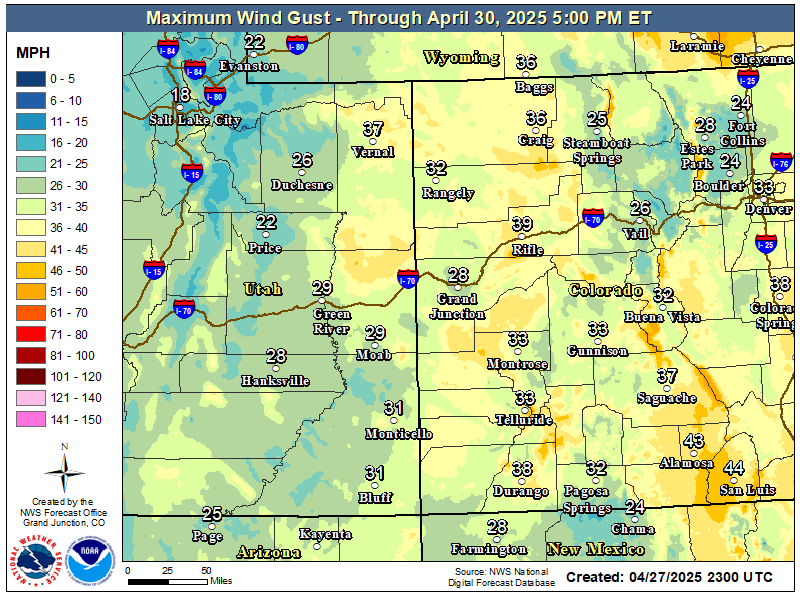
Maximum Wind Gusts Expected Through Sunday
High Temperatures Expected Friday

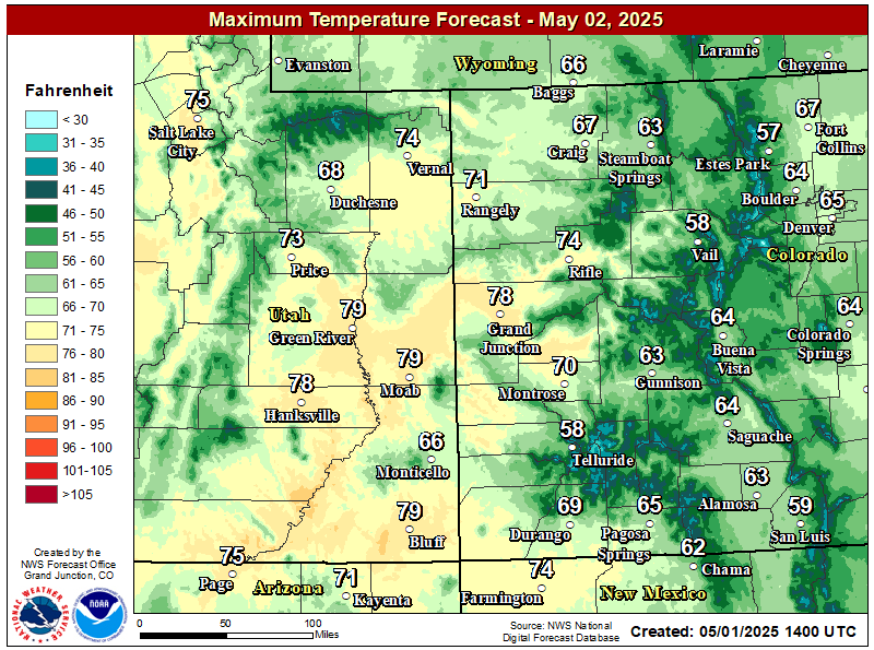
High Temperatures Expected Saturday
Hazards
Detailed Hazards Viewer
National Briefing
Outlooks
Transportation Decision Support
Winter Storm Severity Index
Forecasts
Aviation Weather
Fire Weather
Forecast Discussion
Forecast Points
Local Area
Severe Weather
Soaring Forecast
Winter Weather
Hydrology
Recreational River Report
River Forecast
Weather Safety
Preparedness
NOAA Weather Radio
StormReady
SkyWarn
US Dept of Commerce
National Oceanic and Atmospheric Administration
National Weather Service
Grand Junction, CO
2844 Aviators Way
Grand Junction, CO 81506-8644
970-243-7007
Comments? Questions? Please Contact Us.

