
Numerous severe thunderstorms with a potential for 60-80 mph winds, along with tornadoes (some strong), and large to very large hail are expected across the northern and central Plains through tonight. Heavy to excessive rainfall may bring a flooding threat to parts of North Dakota and Minnesota, and from the Ohio Valley to the Southeast through tonight. Read More >
Grand Junction, CO
Weather Forecast Office
...Active weather in store for the area today...
Another round of active weather is in store for the forecast area today as a low pressure system pushes northeast toward the Four Corners. This low pressure system will provide lift and moisture to fuel showers and thunderstorms which will strengthen towards afternoon. Expect strong winds, hail, frequent lightning and locally heavy rainfall with these storms. A marginal risk of severe thunderstorms is present over southern portions of the forecast area today as the low pressure system makes its way north.
Storm Prediction Center Day 1 Outlook
.gif)
Storm Prediction Center Severe Hail Outlook

Storm Prediction Center Severe Wind Outlook

High Temperature This Afternoon

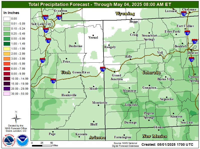
Total Precipitation Amounts Through Monday
Hazards
Detailed Hazards Viewer
National Briefing
Outlooks
Transportation Decision Support
Winter Storm Severity Index
Forecasts
Aviation Weather
Fire Weather
Forecast Discussion
Forecast Points
Local Area
Severe Weather
Soaring Forecast
Winter Weather
Hydrology
Recreational River Report
River Forecast
Weather Safety
Preparedness
NOAA Weather Radio
StormReady
SkyWarn
US Dept of Commerce
National Oceanic and Atmospheric Administration
National Weather Service
Grand Junction, CO
2844 Aviators Way
Grand Junction, CO 81506-8644
970-243-7007
Comments? Questions? Please Contact Us.

