
Scattered severe thunderstorms are expected this afternoon and evening from eastern Texas into the lower Mississippi and Tennessee Valleys/southern Appalachians. Heavy to excessive rainfall may produce flash flooding from the lower Mississippi River Valley into the southern Appalachians today. A late-season snowstorm will continue heavy snow over parts of the central Rockies through today. Read More >
Grand Junction, CO
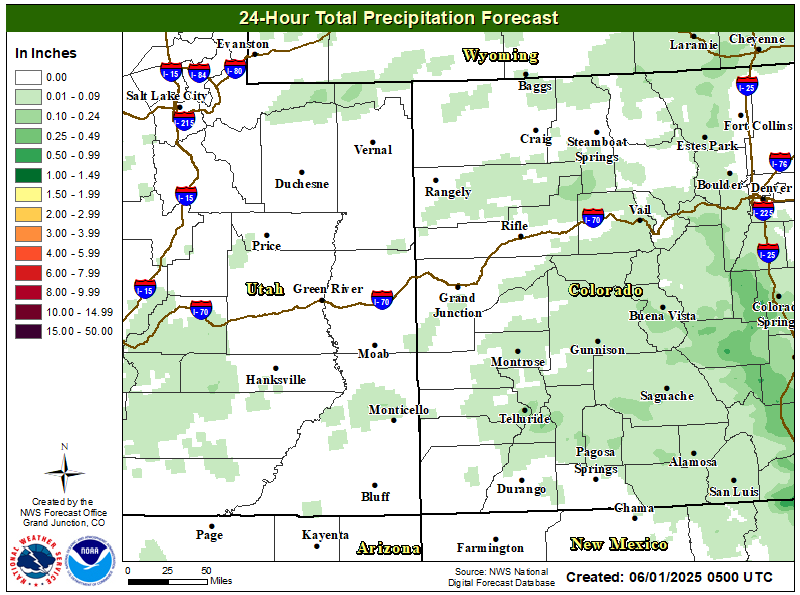
Weather Forecast Office
24 Hour Precipitation Outlook
5 Day Precipitation Outlook

Most Probable 48hr Snow Forecast

Forecast High Temperatures

Hazards
Detailed Hazards Viewer
National Briefing
Outlooks
Transportation Decision Support
Winter Storm Severity Index
Forecasts
Aviation Weather
Fire Weather
Forecast Discussion
Forecast Points
Local Area
Severe Weather
Soaring Forecast
Winter Weather
Hydrology
Recreational River Report
River Forecast
Weather Safety
Preparedness
NOAA Weather Radio
StormReady
SkyWarn
US Dept of Commerce
National Oceanic and Atmospheric Administration
National Weather Service
Grand Junction, CO
2844 Aviators Way
Grand Junction, CO 81506-8644
970-243-7007
Comments? Questions? Please Contact Us.

