
A heat wave over the Southwest will intensify this week, peaking and expanding into the Intermountain West and northern High Plains this weekend. Critical to extremely critical fire weather conditions are forecast from the Northwest and the northern Great Basin this weekend. Particularly Dangerous Situation Red Flag Warnings have been issued. Read More >
Grand Junction, CO
Weather Forecast Office
Wind...Snow...and Sub-Freezing Temperatures on the way!
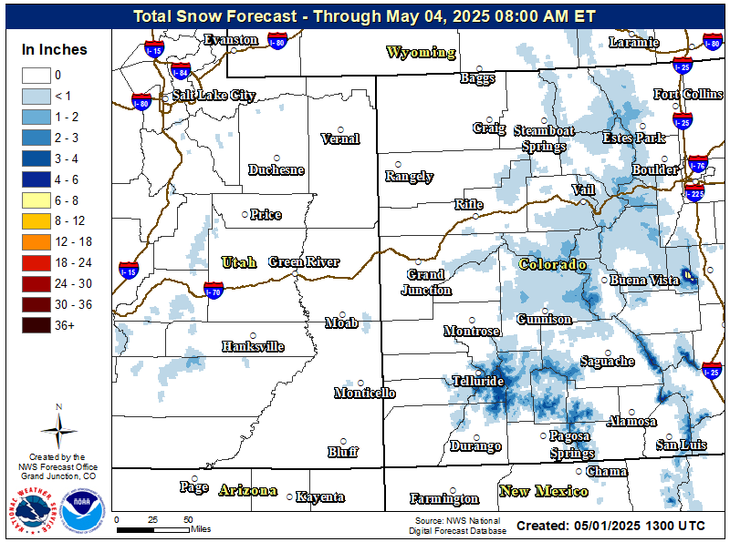
Just when you thought Spring temperatures were here to stay...remember it is Spring in Colorado! Temperatures nearly 15 degrees above normal will trick you into thinking it's time to put plants in your garden on Wednesday. However - a STRONG cold front on Thursday will allow temperatures to plummet late Thursday night and through Saturday. All areas across eastern Utah and western Colorado are anticipated to be below freezing by Friday morning and again on Saturday morning. Significant amounts of snow are possible late Thursday into Friday not only in the mountains, but some valley locations may also see snowfall mainly across Northwest Colorado. In the meantime, critical fire weather conditions are expected across Southwest Colorado Wednesday as conditions remain dry and become very windy. Red Flag Warnings are in effect.
Latest Snowfall Forecast
Latest Weather Map

Forecast Low Temperatures Saturday Morning (coldest day after cold front passes through)

Hazards
Detailed Hazards Viewer
National Briefing
Outlooks
Transportation Decision Support
Winter Storm Severity Index
Forecasts
Aviation Weather
Fire Weather
Forecast Discussion
Forecast Points
Local Area
Severe Weather
Soaring Forecast
Winter Weather
Hydrology
Recreational River Report
River Forecast
Weather Safety
Preparedness
NOAA Weather Radio
StormReady
SkyWarn
US Dept of Commerce
National Oceanic and Atmospheric Administration
National Weather Service
Grand Junction, CO
2844 Aviators Way
Grand Junction, CO 81506-8644
970-243-7007
Comments? Questions? Please Contact Us.

