
Widely scattered severe thunderstorms may produce damaging winds, hail, and flash flooding from the southern Plains into the lower Great Lakes. Elevated to locally critical fire weather conditions will persist across portions of the Southwest and Southern High Plains due to gusty winds and dry conditions. An early-season heatwave will challenge temperature records across the eastern U.S.. Read More >
Grand Junction, CO
Weather Forecast Office
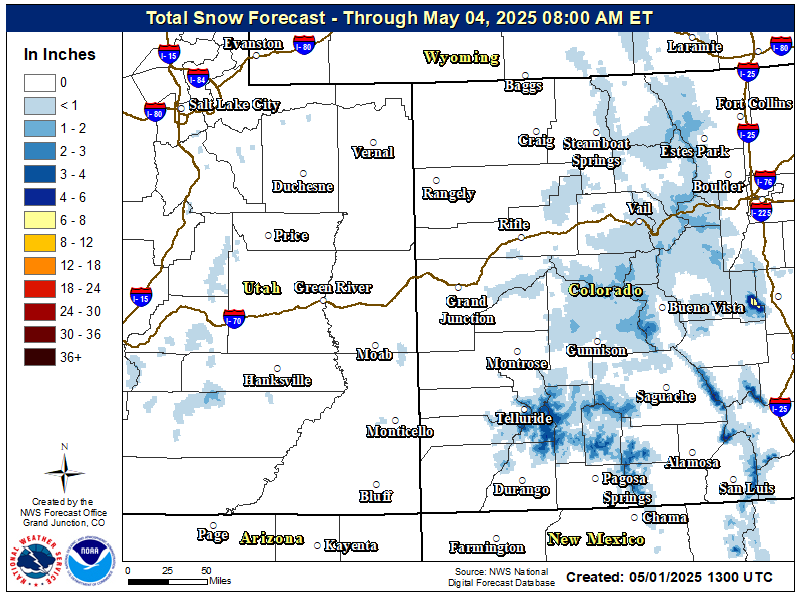
Unsettled weather will continue over the region through today as a series of weather disturbances pass through the area. Cool daytime temperatures are expected with areas of valley rain showers and mountain snow showers. Locally heavy snow will shift to the northern and central mountains in Western Colorado for the remainder of the night and during the day. Total snowfall by late this afternoon could exceed 10 inches over the higher passes.
                                        Winter Weather Warnings / Watches / Advisories

                Issued: 05/19/2026 06:11:00 AM UTC

Snowfall Totals through Saturday evening
High Temperatures for May 3, 2018

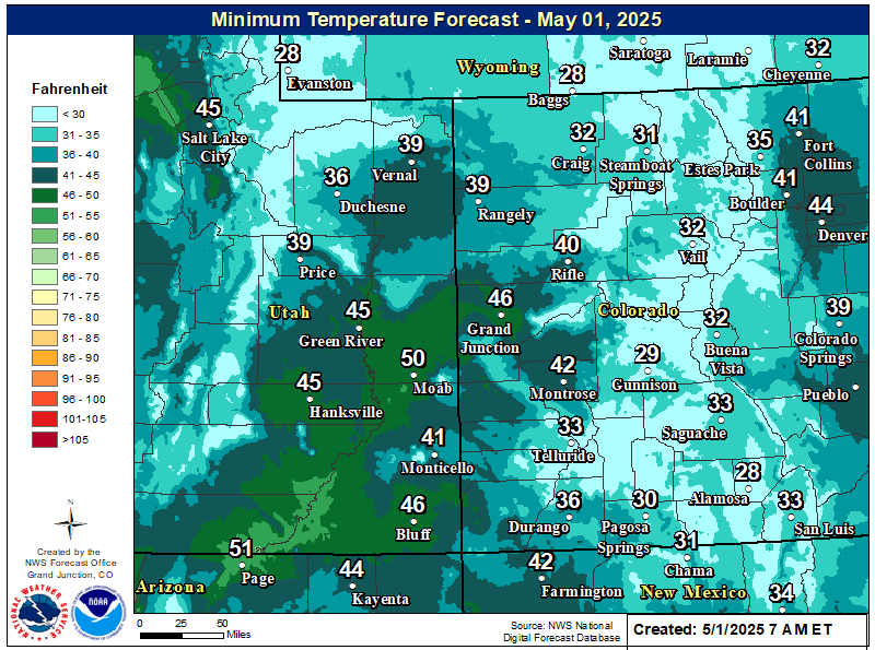
Low Temperatures for May 3, 2018
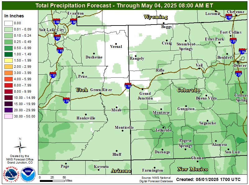
Predicted Precipitation through Saturday
Hazards
Detailed Hazards Viewer
National Briefing
Outlooks
Transportation Decision Support
Winter Storm Severity Index
Forecasts
Aviation Weather
Fire Weather
Forecast Discussion
Forecast Points
Local Area
Severe Weather
Soaring Forecast
Winter Weather
Hydrology
Recreational River Report
River Forecast
Weather Safety
Preparedness
NOAA Weather Radio
StormReady
SkyWarn
US Dept of Commerce
National Oceanic and Atmospheric Administration
National Weather Service
Grand Junction, CO
2844 Aviators Way
Grand Junction, CO 81506-8644
970-243-7007
Comments? Questions? Please Contact Us.

