
Flash flooding threatens areas from the Tennessee Valley to the Carolinas as storms repeat along a stalled front. Monsoonal storms may trigger flooding in the Southwest. Dangerous heat expands across the Desert Southwest, Plains, mid-Mississippi Valley and Southern Tier. Critical fire weather for interior Pacific Northwest. Cooler, drier air brings brief relief to the Great Lakes and Northeast. Read More >
Grand Junction, CO
Weather Forecast Office
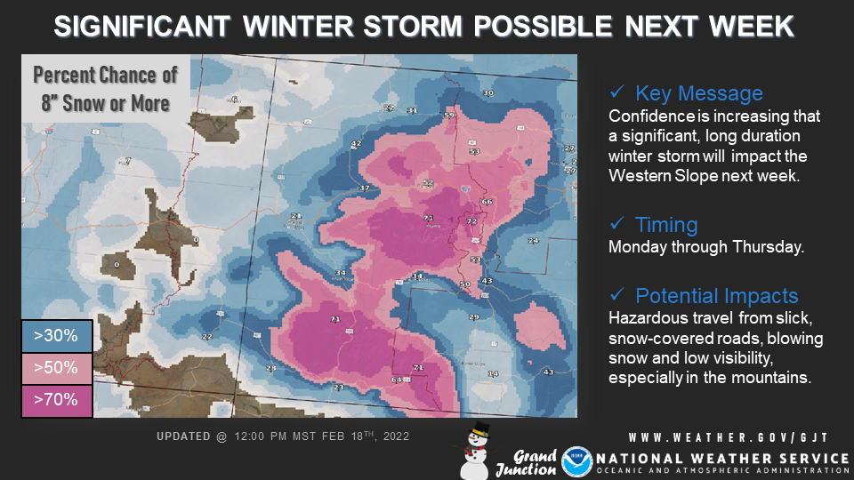
Winter Storm Threat Increasing Next Week
The potential for a significant winter storm next week is increasing across the Western Slope. A series of potent disturbances will result in a prolonged winter storm beginning on Monday and lasting through Wednesday night or Thursday. Potential impacts include hazardous travel from slick, snow-covered roads, blowing snow and low visibility. The mountains of western Colorado stand to face the greatest impacts, but adjacent valleys will also be at risk. Stay tuned to the forecast through the weekend and consider making alternate travel plans for next week.
Hazards
Detailed Hazards Viewer
National Briefing
Outlooks
Transportation Decision Support
Winter Storm Severity Index
Forecasts
Aviation Weather
Fire Weather
Forecast Discussion
Forecast Points
Local Area
Severe Weather
Soaring Forecast
Winter Weather
Hydrology
Recreational River Report
River Forecast
Weather Safety
Preparedness
NOAA Weather Radio
StormReady
SkyWarn
US Dept of Commerce
National Oceanic and Atmospheric Administration
National Weather Service
Grand Junction, CO
2844 Aviators Way
Grand Junction, CO 81506-8644
970-243-7007
Comments? Questions? Please Contact Us.

