
Dangerous and extreme heat will remain across portions of the central U.S. this week, persisting across the mid to lower Mississippi Valley, Gulf Coast, southern Plains and portions of Texas. A heat wave over the Southwest U.S. will peak this weekend. Heavy to excessive rainfall may produce flash flooding from the Delmarva Peninsula north into the Hudson Valley today and tonight. Read More >
Grand Junction, CO
Weather Forecast Office
Overview
|
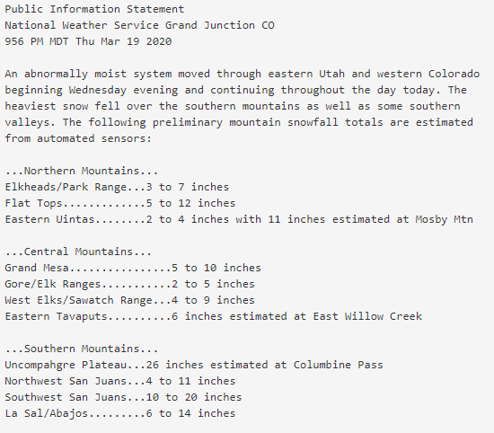
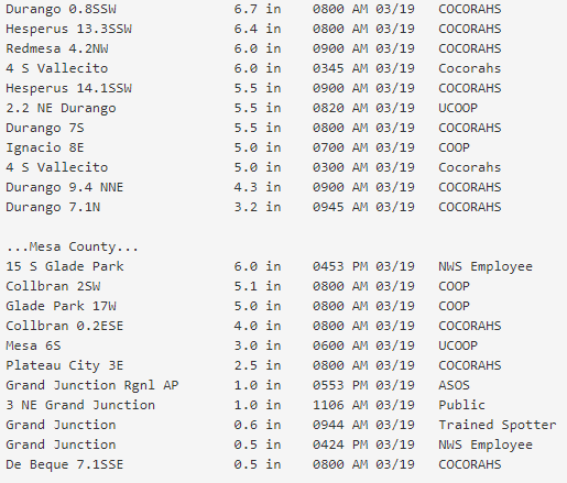
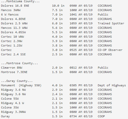
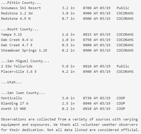
A large and unseasonably moist low pressure system lifted across the Four Corners region March 18-20. Favorable southerly flow during the onset of the event produced moderate to heavy snow over the southern mountains and some southwest Colorado valleys. Once cooler air moved into the region during the latter half of the storm, snowfall began to favor the northern and central Colorado mountains. By the end of the event, generally 12 to 20 inches of snow fell over the Southwest San Juan Mountains with 3 to 8 inches across the Northwest San Juans. The Animas River Basin saw an average of 7 to 11 inches of snow while the San Juan River Basin received 6 to 7 inches. The Uncompahgre Plateau saw locally high amounts of up to 27 inches while portions of the west-central Colorado mountains saw 8 to 11 inches. In eastern Utah, the La Sal and Abajo Mountains received an average of 12 to 19 inches of snow. In addition to heavy snow, wind gusts exceeded 45 MPH at times. |
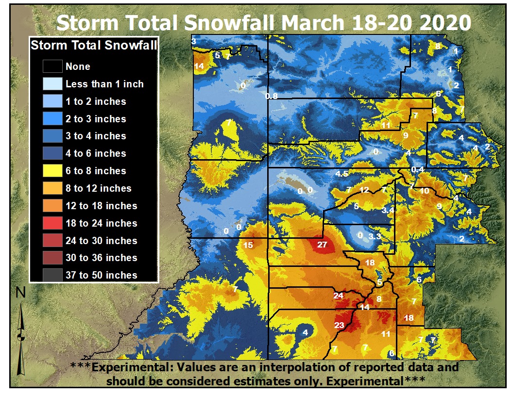 Storm Total Snowfall: March 18-20, 2020 |
 |
 |
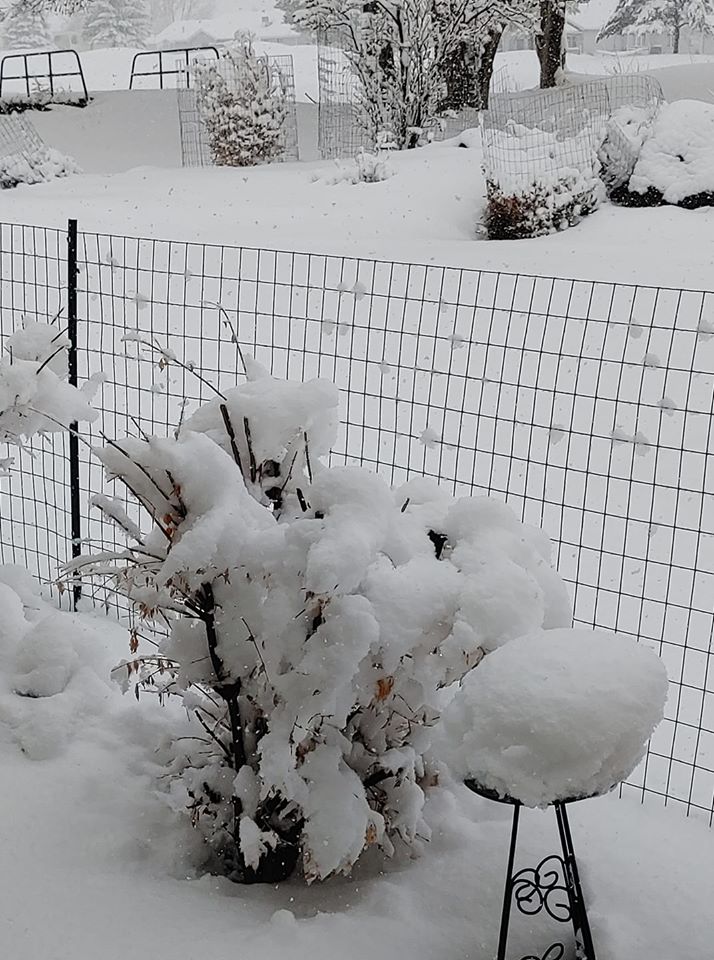 |
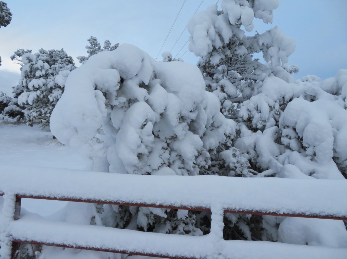
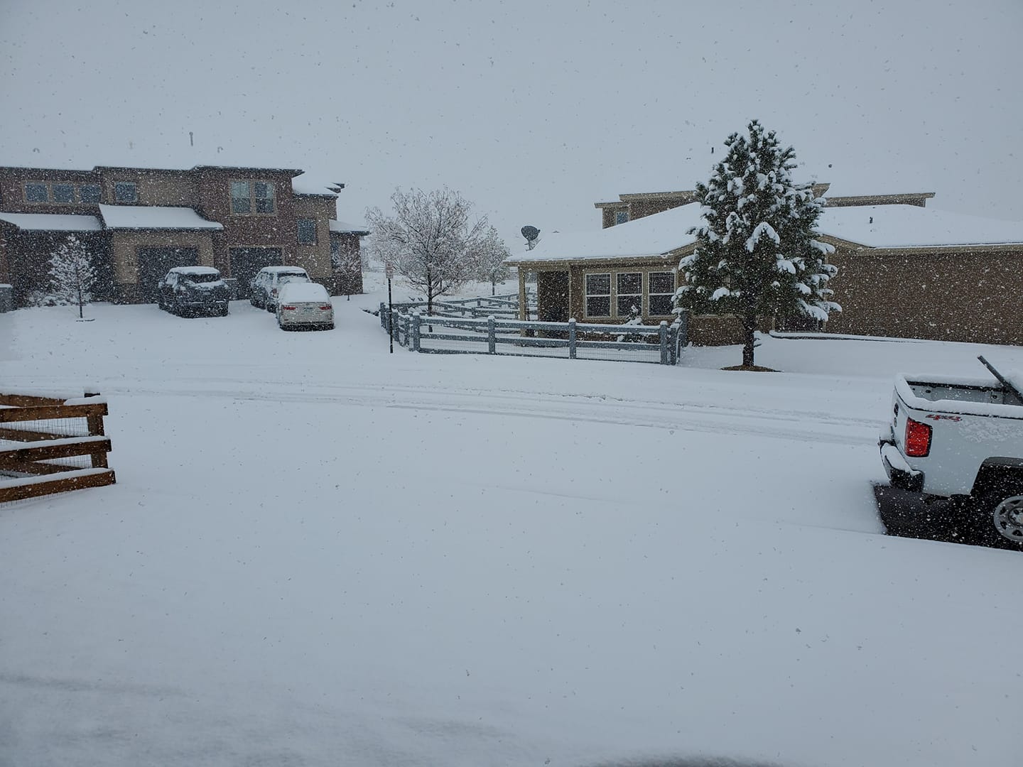
| Durango, Colorado (Credit: Stagger & Lurch Twitter) | New Castle, Colorado (Credit: Kim Krelovich) | Cedaredge, Colorado (Credit: Kathy Cronin) |
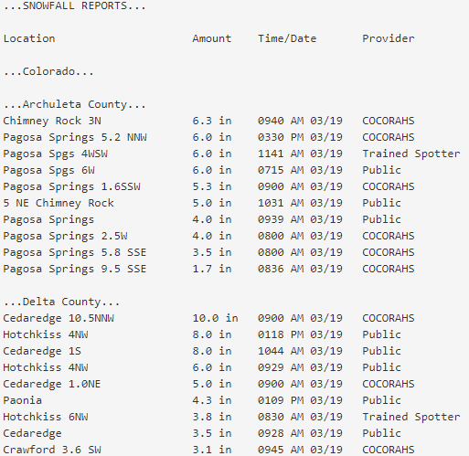
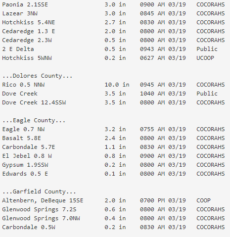
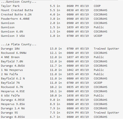
Storm Reports
 |
Media use of NWS Web News Stories is encouraged! Please acknowledge the NWS as the source of any news information accessed from this site. |
|
Hazards
Detailed Hazards Viewer
National Briefing
Outlooks
Transportation Decision Support
Winter Storm Severity Index
Forecasts
Aviation Weather
Fire Weather
Forecast Discussion
Forecast Points
Local Area
Severe Weather
Soaring Forecast
Winter Weather
Hydrology
Recreational River Report
River Forecast
Weather Safety
Preparedness
NOAA Weather Radio
StormReady
SkyWarn
US Dept of Commerce
National Oceanic and Atmospheric Administration
National Weather Service
Grand Junction, CO
2844 Aviators Way
Grand Junction, CO 81506-8644
970-243-7007
Comments? Questions? Please Contact Us.

