
Tropical Depression Two is expected to gradually strengthen and could bring tropical storm conditions to the Florida Panhandle beginning late Monday. Areas of flash flooding will be possible through Thursday along the eastern and central Gulf Coast. Severe thunderstorms will develop and move along a cold front crossing the Upper Midwest Monday, and through the Ohio Valley/Mid-Atlantic on Tuesday. Read More >
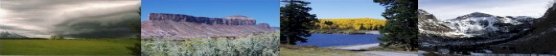
The Grand Junction Weather Office provides a user-oriented fire weather forecasting service tailored for use by federal, state, and county land and fire management agencies as well as state and county emergency management organizations within our forecast area. The types of forecasts prepared by the Grand Junction Weather Office include general fire weather forecasts, general smoke management forecasts, fire-specific forecasts (called spot weather forecasts), fire weather watches, and red flag warnings.
The general fire weather and smoke management forecasts are issued routinely by the Grand Junction Office from April 1 through October 31 of each year. This time period is commonly considered to be western Colorado’s and eastern Utah’s "fire weather season". Fire weather watches and red flag warnings can be issued any time of the year but occur predominantly during the fire weather season. Spot weather forecasts for wildfires and prescribed burns are issued only upon request. Requests for spot weather forecasts for prescribed burns are accepted from federal and non-federal agencies.
Clearing Index - An index that relates atmospheric stability and wind to the air pollution potential of an area. Lower values indicate a greater potential for air stagnation and air pollution problems.
Diurnal - Daily actions which are completed within 24 hours and which recur every 24 hours (usually in a cyclical pattern).
Dry Thunderstorm - A thunderstorm that produces less than 0.10 inch of precipitation.
Haines Index - An index from 2 (lowest) to 6 (greatest) that relates atmospheric stability and moisture content of the lower atmosphere to the potential for large plume-dominated fires.
LAL (Lightning Activity Level) - A rating from 1 (lowest) to 6 (greatest) related to the frequency of cloud-to-ground lightning strikes in a 2500 sq. mile area (50 mi. x 50 mi).
Mixing Height - The maximum height above the ground surface to which smoke will rise. The air is considered thoroughly mixed up to the mixing height (which acts as a cap, causing the smoke to stop rising and "flatten out").
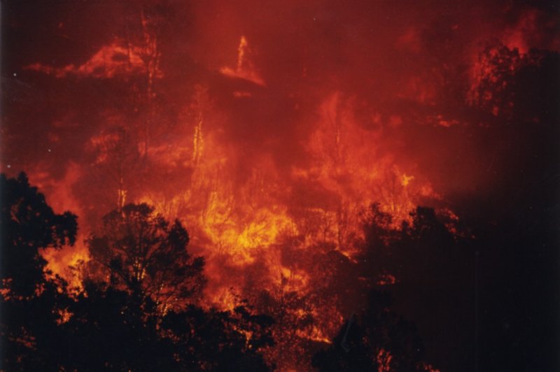
Red Flag Criteria - A combination of "High" or "Extreme" fire danger and critical weather conditions that could cause extensive wildfire occurrences or create a critical fire control situation.
Transport Wind - The average wind direction and wind speed between the surface and the mixing height (the mixed layer).
Upslope/Upvalley - Moving from a lower elevation to a higher elevation.
A Red Flag Warning normally requires the combination of "High" or "Extreme" fire danger (as determined by the land management agencies) and critical weather conditions (as determined by the meteorologist). These critical weather conditions include, but are not limited to, thunderstorms producing frequent lightning but little rain (called "dry" thunderstorms), the first occurrence of lightning after a hot and dry spell, a significant increase in wind speed and/or air temperature, a significant decrease in relative humidity.
In short, a Red Flag Warning covers any combination of weather and fire danger that, together, would create a critical fire control situation or extensive wildfire occurrences!

