
Widespread showers and thunderstorms may produce isolate instances of flash flooding across the Ozarks and Southeast through Friday. Scattered severe storms and heavy rain is expected across the Northwest U.S.. Gusty winds and low relative humidity will contribute to elevated fire weather over a portion of the northern Plains with a secondary threat in the Great Basin. Read More >
Grand Junction, CO
Weather Forecast Office
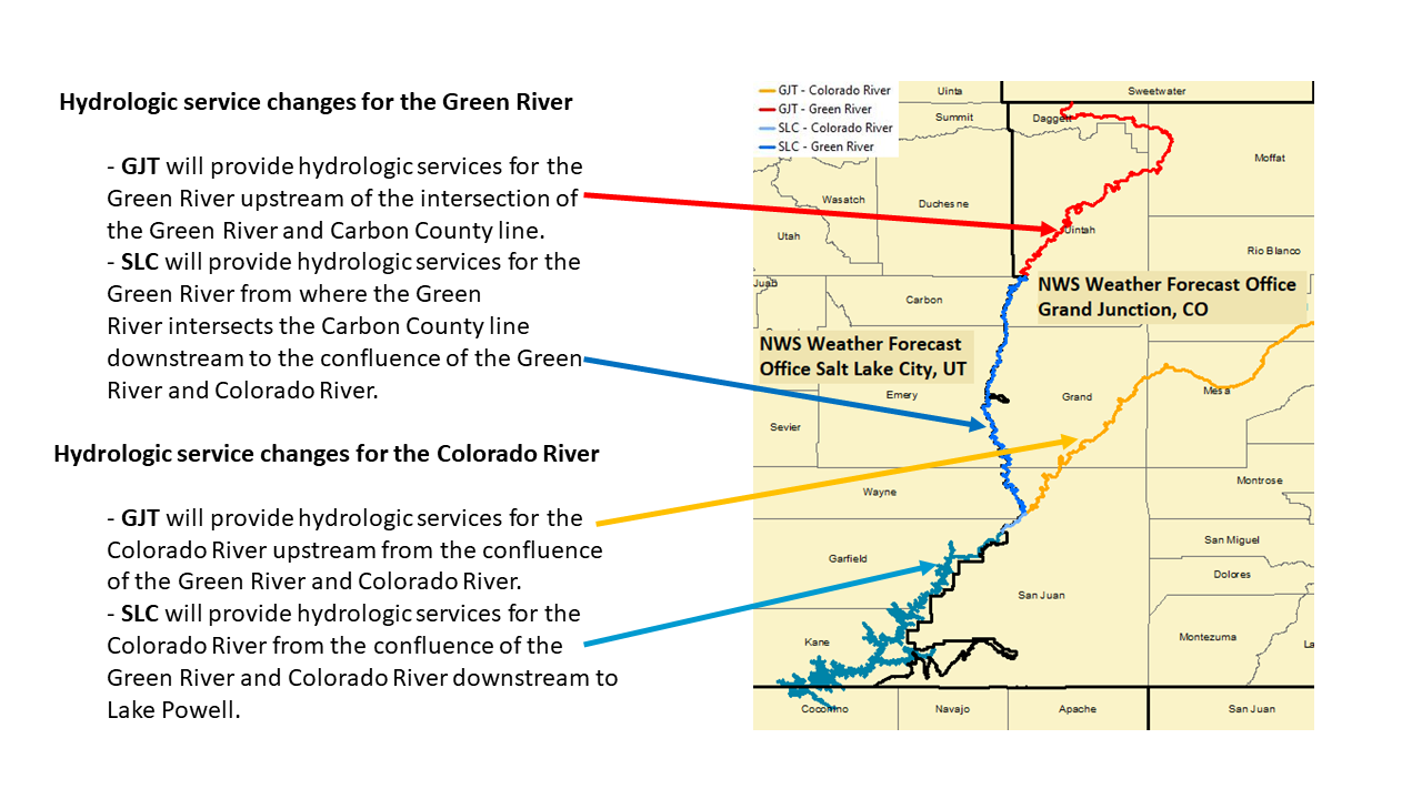
Hydrologic Service Changes for Green River and Colorado River in Utah
provided by
NWS Weather Forecast Offices Grand Junction, CO and Salt Lake City, UT
Weather Forecast Office (WFO) Grand Junction, CO, (GJT) and Weather Forecast Office (WFO) Salt Lake City, UT, (SLC) are in the process of modifying hydrologic services responsibility for the Green River and Colorado River in Utah. The changes will enable more efficient hydrologic services and facilitate more accurate and consistent provision of water information for core partners, as well as the general public.
Please reference the service change description below, and the attached maps highlighting the proposed hydrologic responsibilities.
Hydrologic service changes for the Green River
Hydrologic service changes for the Colorado River
This is not a Hydrologic Service Area (HSA) boundary change, but rather a change in responsibility for issuing river flood products along the border between WFO GJT and WFO SLC. The HSA shapefile will remain unchanged.
Hazards
Detailed Hazards Viewer
National Briefing
Outlooks
Transportation Decision Support
Winter Storm Severity Index
Forecasts
Aviation Weather
Fire Weather
Forecast Discussion
Forecast Points
Local Area
Severe Weather
Soaring Forecast
Winter Weather
Hydrology
Recreational River Report
River Forecast
Weather Safety
Preparedness
NOAA Weather Radio
StormReady
SkyWarn
US Dept of Commerce
National Oceanic and Atmospheric Administration
National Weather Service
Grand Junction, CO
2844 Aviators Way
Grand Junction, CO 81506-8644
970-243-7007
Comments? Questions? Please Contact Us.

