Goodland, KS
Weather Forecast Office
|
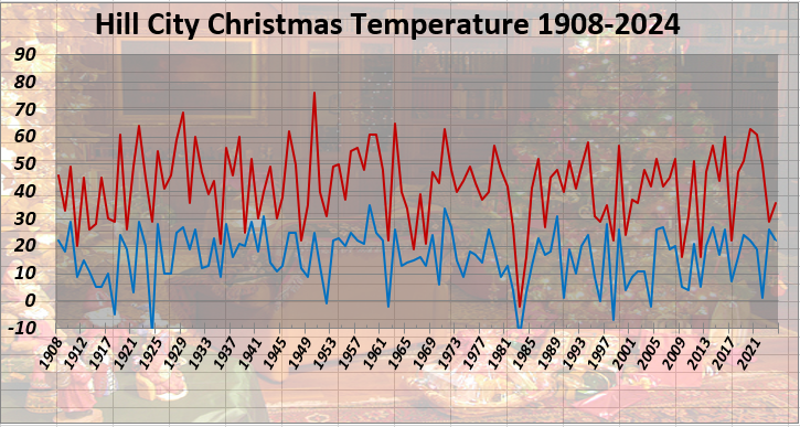
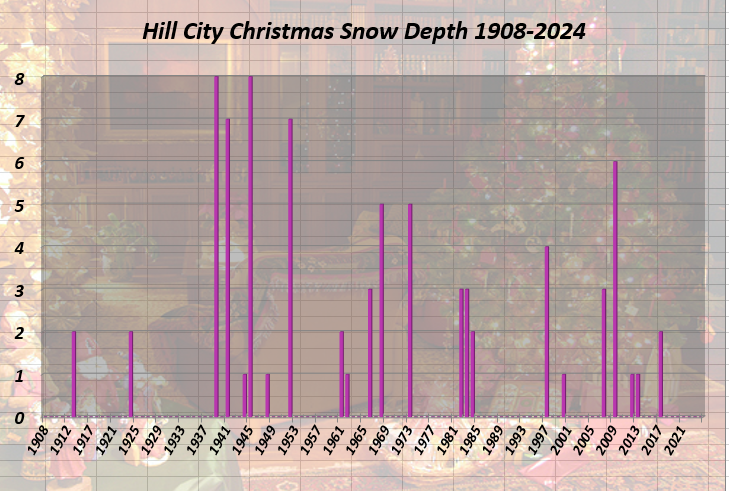
Period of Record 115 Years: 1908-2024 Missing: 1916 Temperature Information
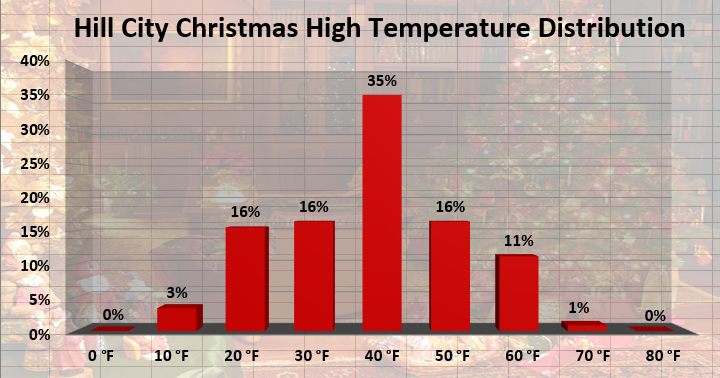
(Click image for a larger version) Distribution of High Temperatures in 10 Degree Fahrenheit Ranges
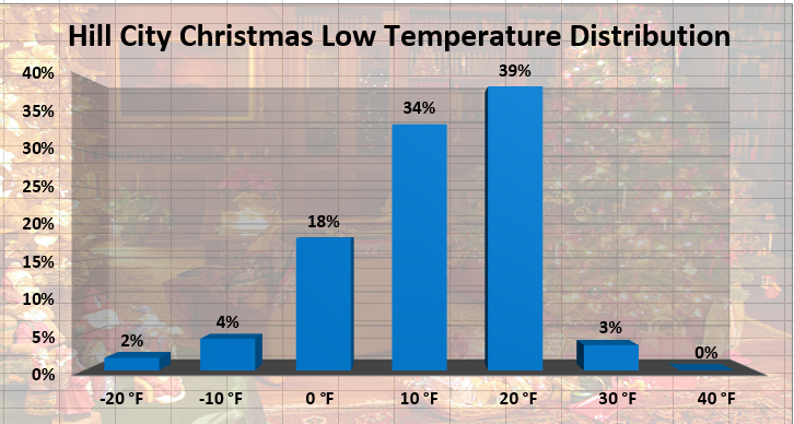
(Click image for a larger version) Distribution of Low Temperatures in 10 Degree Fahrenheit Ranges
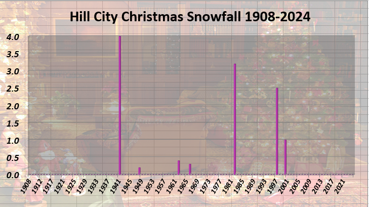
(Click image for a larger version) Precipitation Information
(Click image for a larger version)
(Click image for a larger version) GOODLAND CHRISTMAS DAY CLIMATOLOGY BURLINGTON CHRISTMAS DAY CLIMATOLOGY MCCOOK CHRISTMAS DAY CLIMATOLOGY For additional holiday climate studies, return to the main menu Updated Jan 1, 2025 |
Current Hazards
Storm and Precipitation Reports
Experimental Graphical Hazardous Weather Outlook
Submit a Storm Report
Outlooks
Current Conditions
Observed Precipitation
Local Snowfall Reports
Observations
Snowfall Analysis
Satellite
Local Storm Reports
Forecasts
Fire Weather
Forecast Discussion
User Defined Area Forecasts
Activity Planner
Hourly Forecasts
Local Information
Aviation Weather
Blog
Coop Observer
Decision Support Serivces Page
Local Observations
Local RSS Feeds
Our Office
Precip Analysis
Republican River Flood of 1935
Snowfall Analysis
Social Dashboard
Text Weather Index
Today in Weather History
Weather Radio
Weather Safety Images
Winter Storm Severity Index
Local WRN Ambassadors
US Dept of Commerce
National Oceanic and Atmospheric Administration
National Weather Service
Goodland, KS
920 Armory Road
Goodland, KS 67735-9273
785-899-7119
Comments? Questions? Please Contact Us.