|
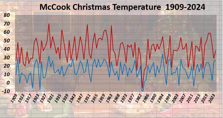
Period of Record 109 Years: 1909-2024 Missing: 1920, 1921, 1967, 1971, 1978 and 1998 Temperature Information
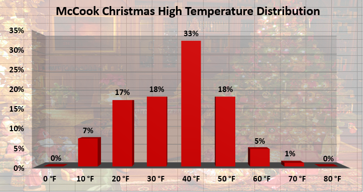
(Click image for a larger version) Distribution of High Temperatures in 10 Degree Fahrenheit Ranges
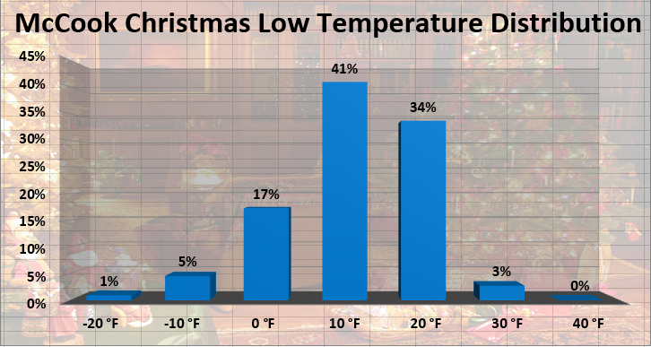
(Click image for a larger version) Distribution of Low Temperatures in 10 Degree Fahrenheit Ranges
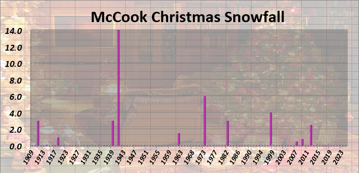
(Click image for a larger version) Precipitation Information
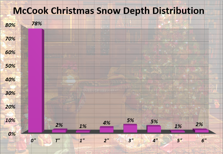
(Click image for a larger version)
(Click image for a larger version) GOODLAND CHRISTMAS DAY CLIMATOLOGY BURLINGTON CHRISTMAS DAY CLIMATOLOGY HILL CITY CHRISTMAS DAY CLIMATOLOGY For additional holiday climate studies, return to the main menu Updated Jan 1, 2025 |