Routine forecasts are issued for the Marianas and Micronesian Coastal Waters. The Marianas Coastal Waters are within 40 nautical miles of Guam, Rota, Tinian and Saipan. The Micronesian Coastal Waters are within 40 nautical miles of Koror Palau, Yap, Weno Chuuk, Pohnpei, Kosrae and Delap Majuro.
Coastal Waters Forecast for Marianas Waters of Guam, Saipan, Rota and Tinian
Coastal Waters Forecast for Eastern Micronesian Waters of Majuro, Kosrae and Pohnpei
Coastal Waters Forecast for Western Micronesian Waters of Chuuk, Yap and Koror - Palau
Surf Forecast for the Marianas Beaches and Reefs
Tide and Climate Report for Guam (Includes Sunrise/Sunset Information and Moon Phase)
| Experimental Graphics for Marianas Waters | |
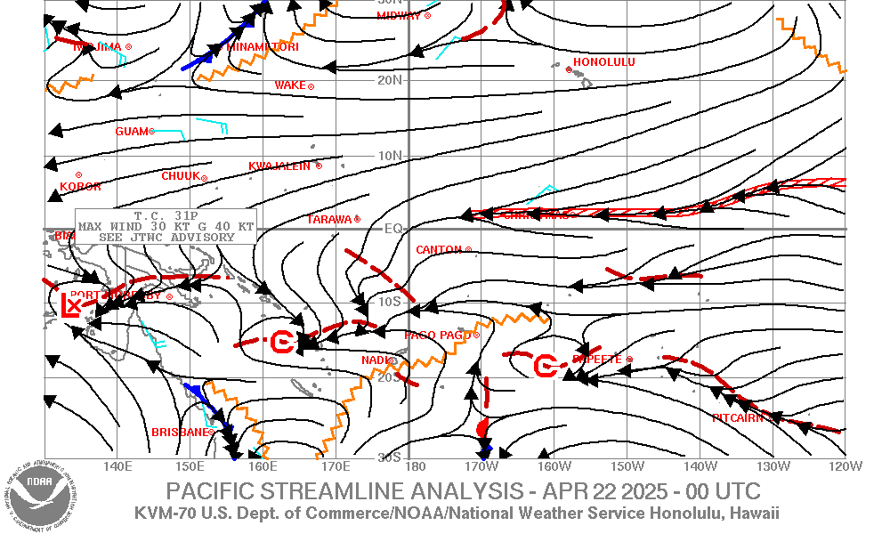
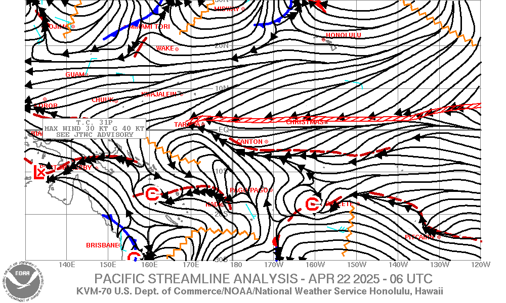
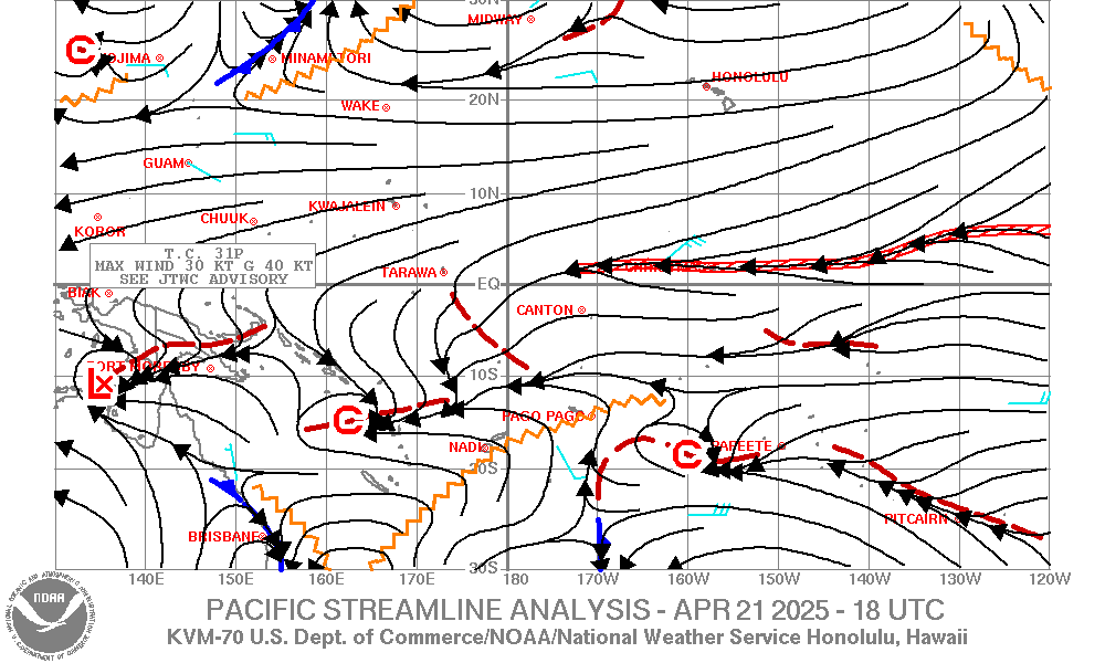
| Pacific Streamline Analysis (What's this?) (130E-110W,30S-30N) |
|
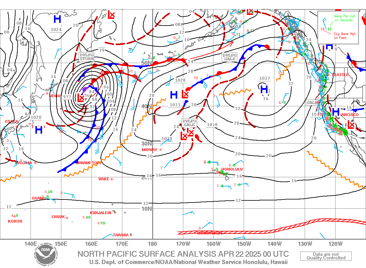
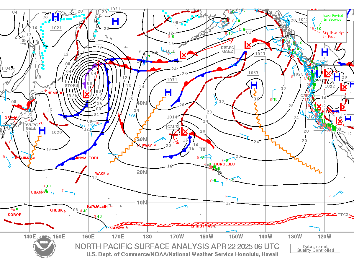
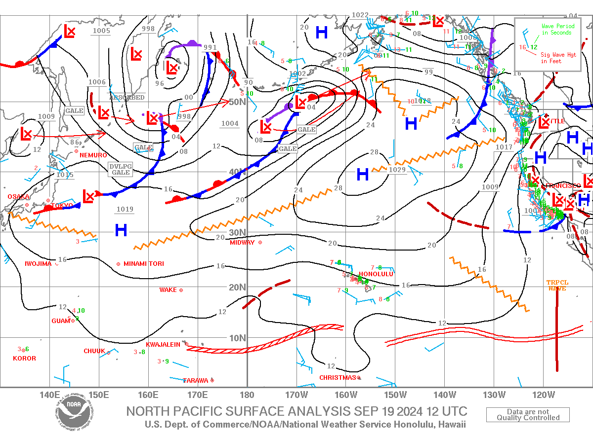
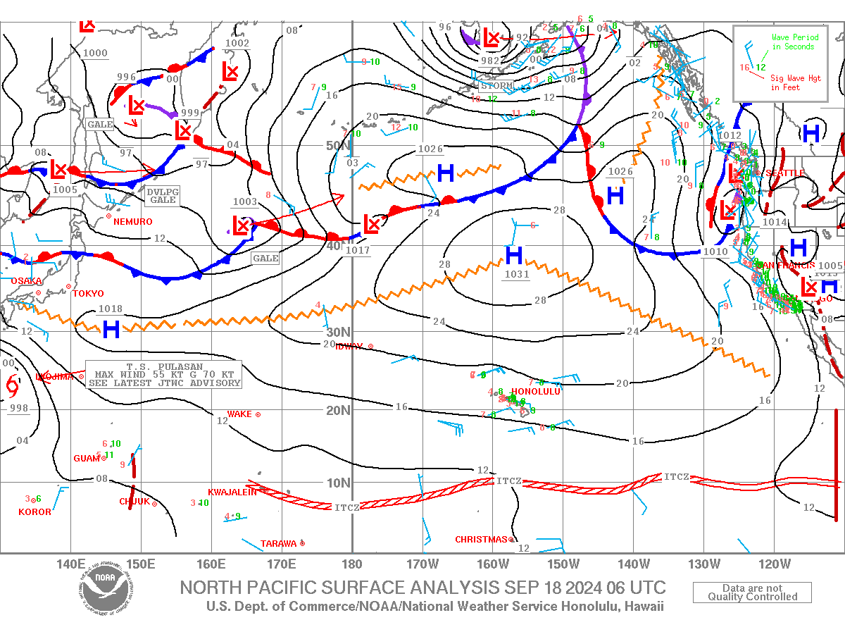
| North Pacific Surface Analysis (What's this?) (130E-110W,EQ-60N) From the Unified Surface Analysis |
|
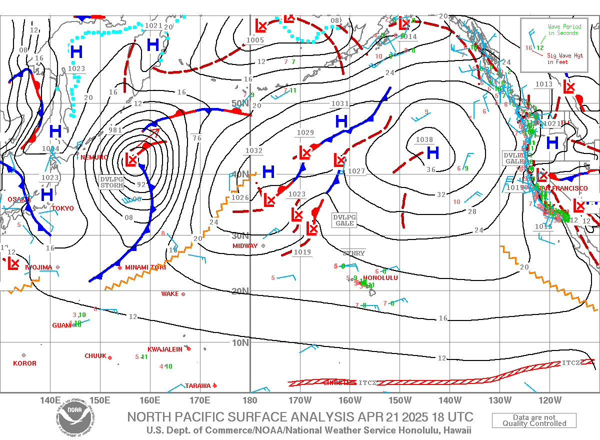
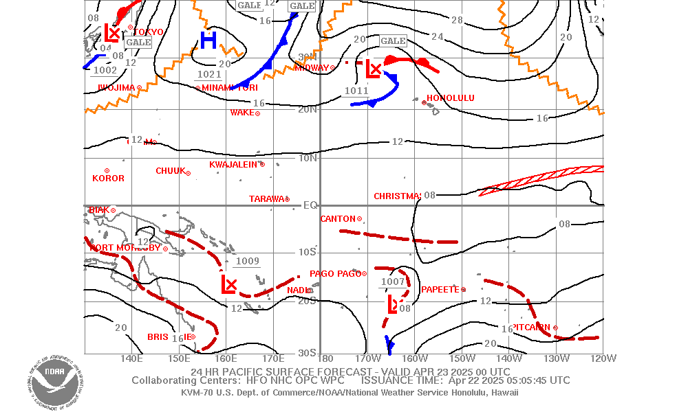
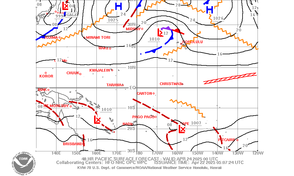
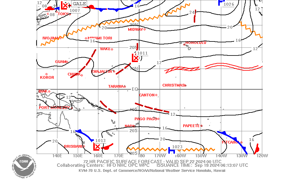
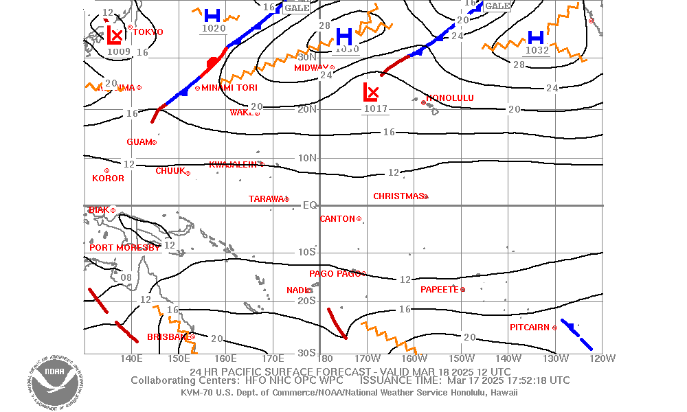
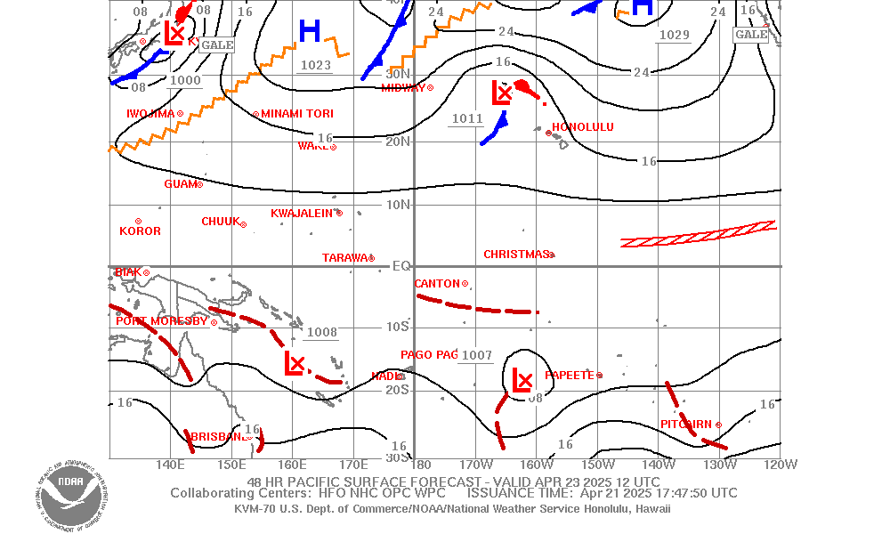
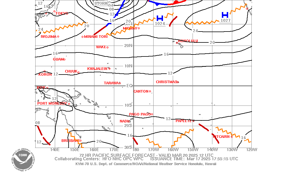
| Pacific Surface Forecast (What's this?) (130E-110W,30S-50N) |
|
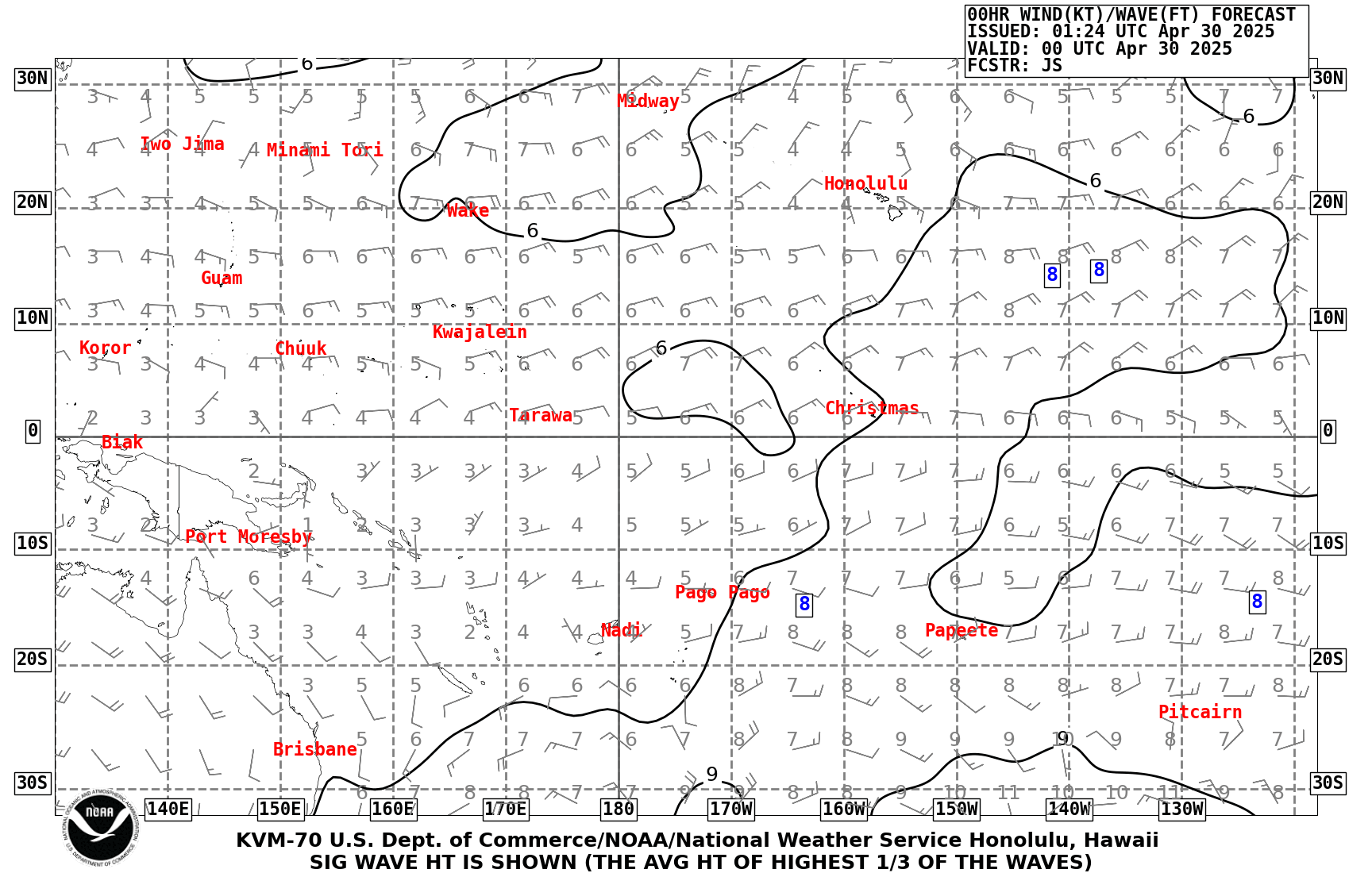
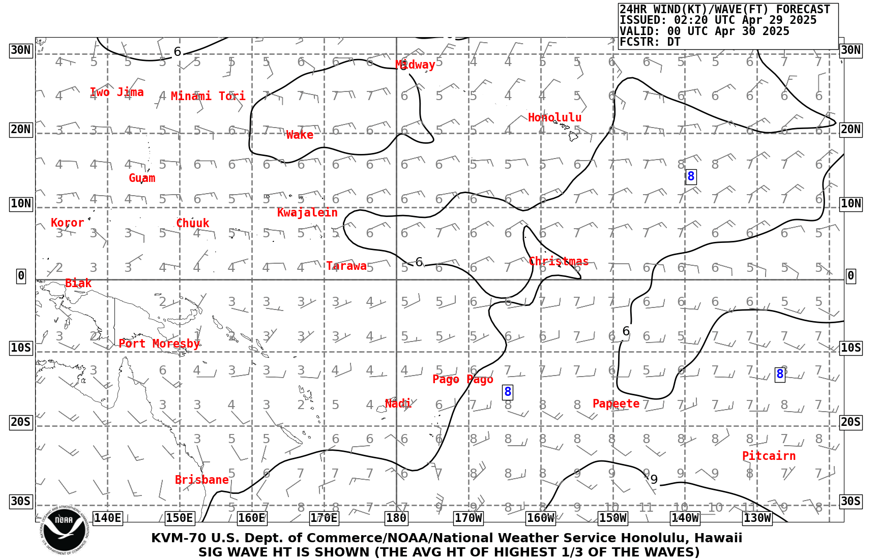
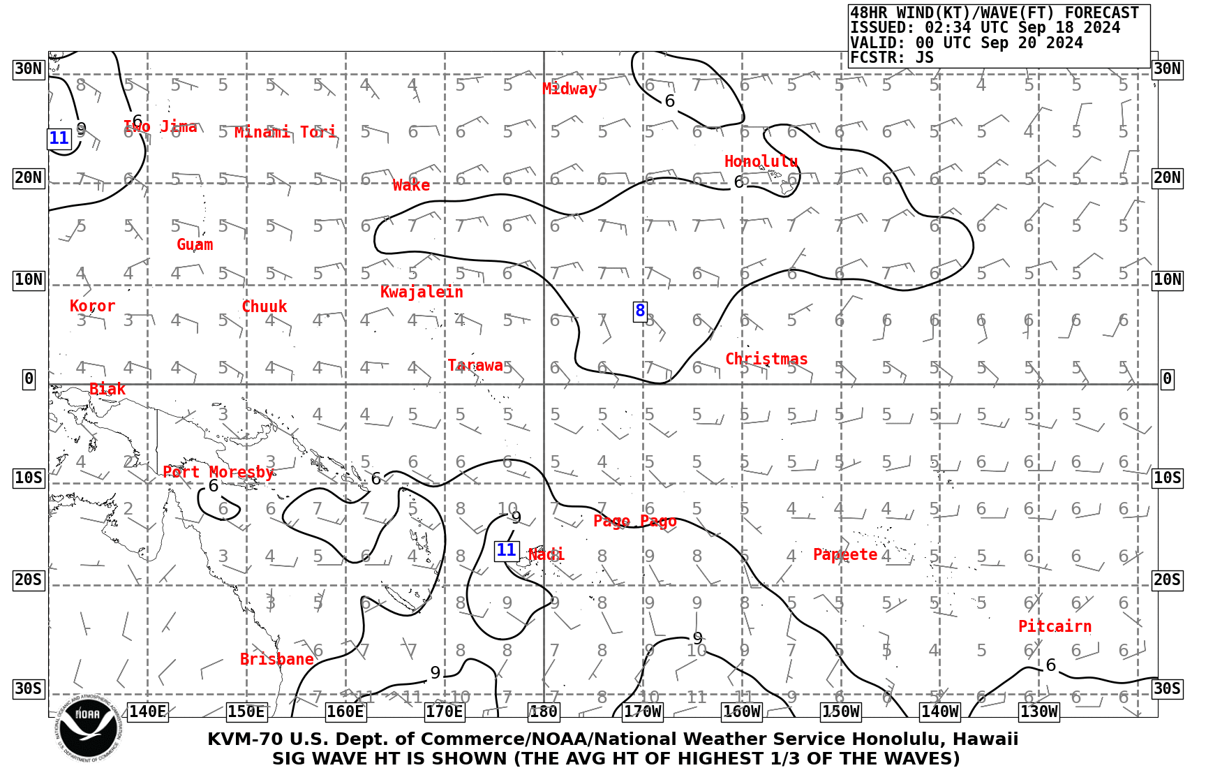
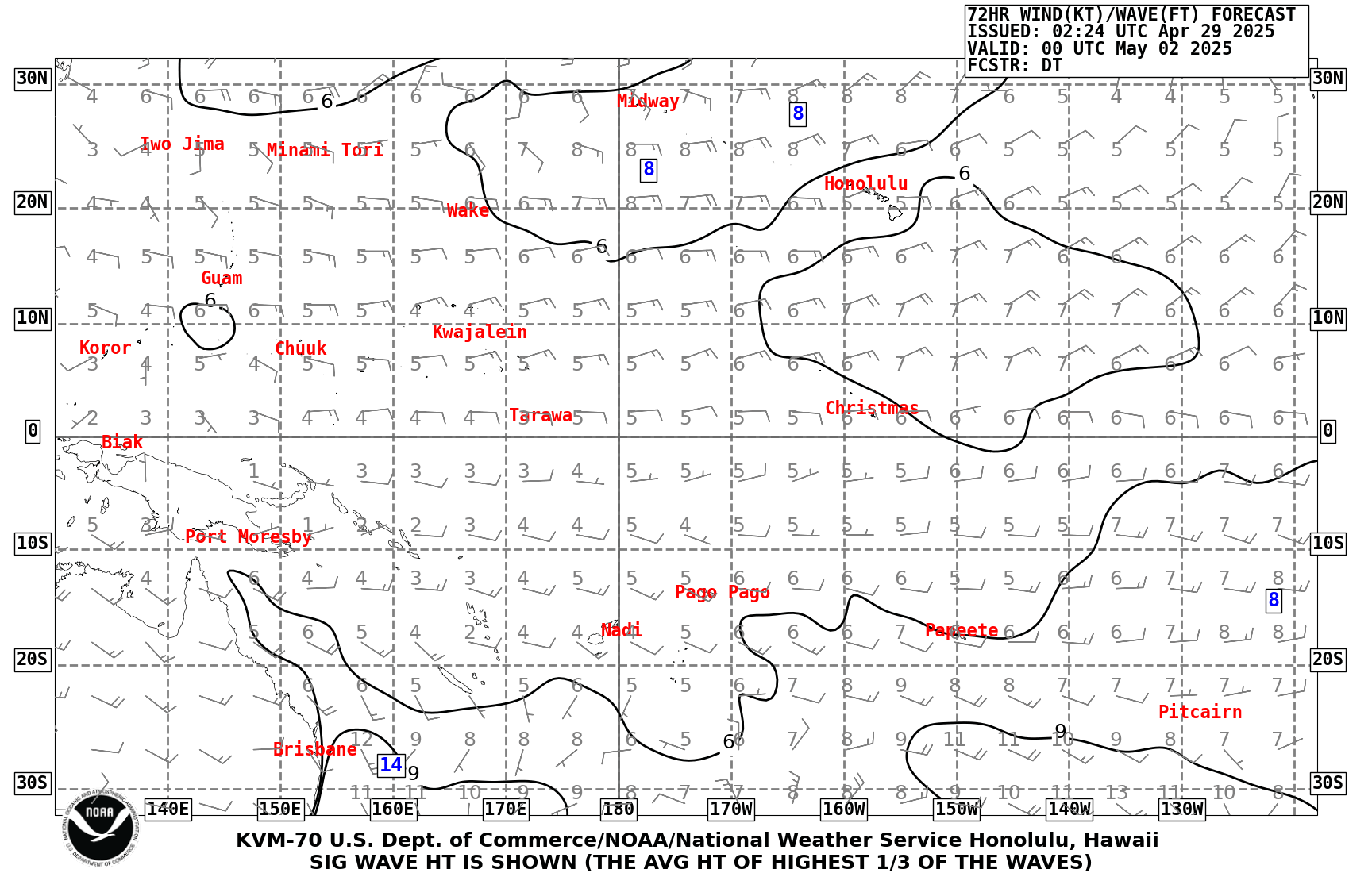
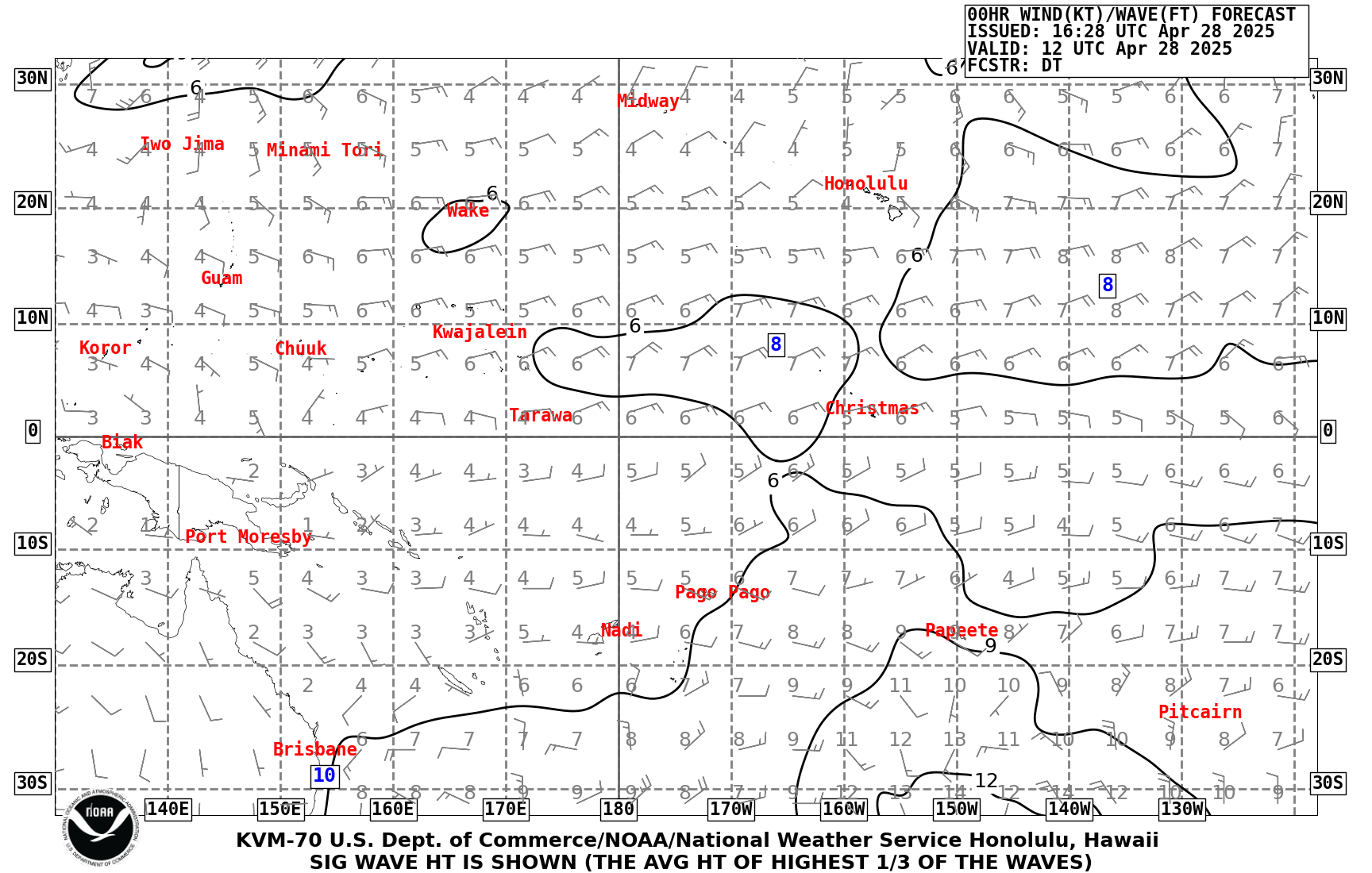
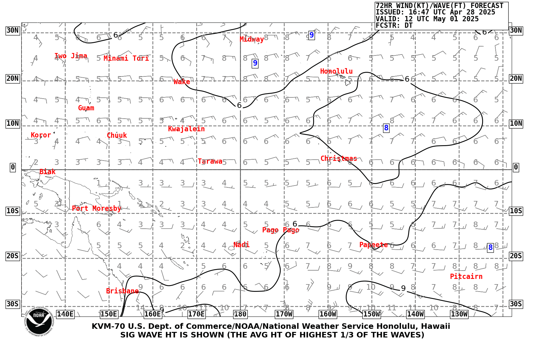
| Pacific Wind Wave Analysis and Forecasts |
00Z Charts tif Analysis 24 hr 48 hr 72 hr gif Analysis 24 hr 48 hr 72 hr 12Z Charts |
|
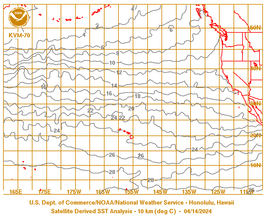
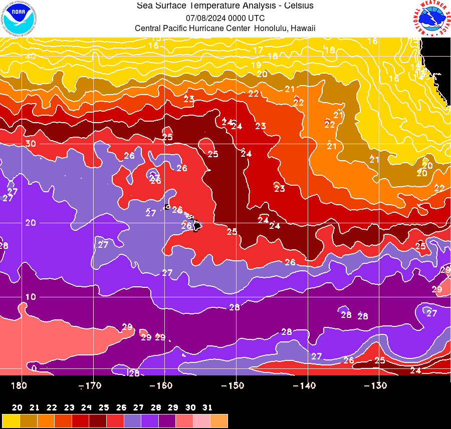
Pacific Sea Surface Temperature Analysis CPHC centric Sea Surface Temperature Analysis Loop |
Northern Marianas Islands:
Federated States of Micronesia:
Chuuk
Weno (Moen) Island, Chuuk Lagoon
Tonowas (Dublon) Island, Chuuk Lagoon
Pohnpei
Pohnpei (From University of Hawaii Seas Level Center)
Yap
Yap (From University of Hawaii Seas Level Center)
Marshall Islands:
Republic of Palau:
Malakal, Palau (From University of Hawaii Seas Level Center)


 Public Forecast
 Marine Forecast
 Radar
Radar Satellite
 Area Forecast Discussion
.png) Active Tropical Cyclones
Active Tropical Cyclones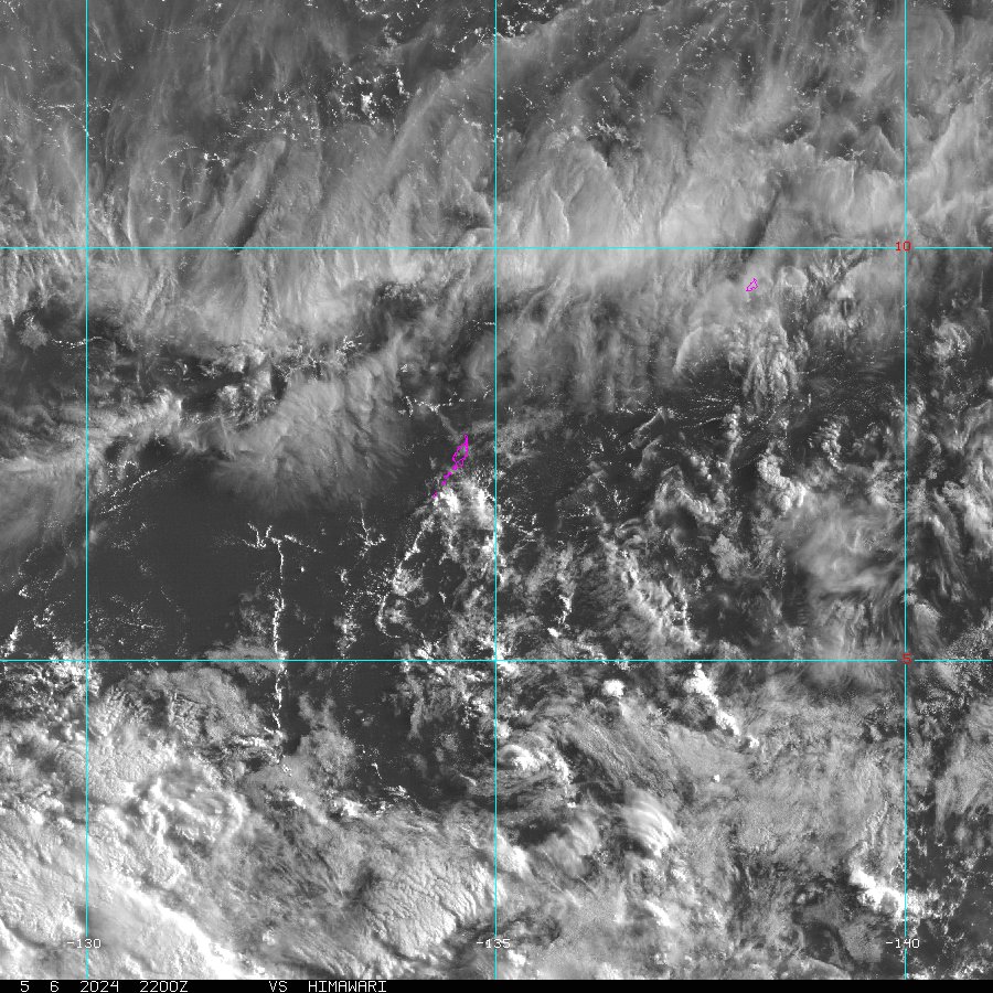 Palau Sector
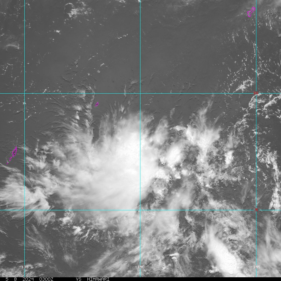 Yap Sector
 Marianas Sector
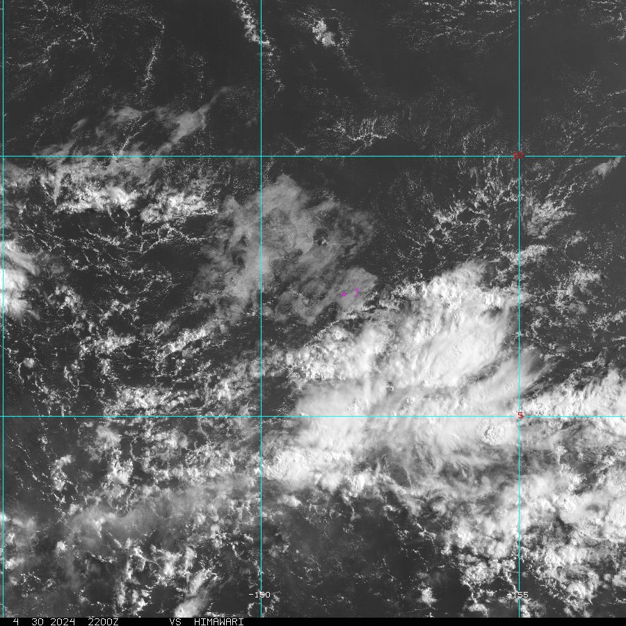 Chuuk Sector
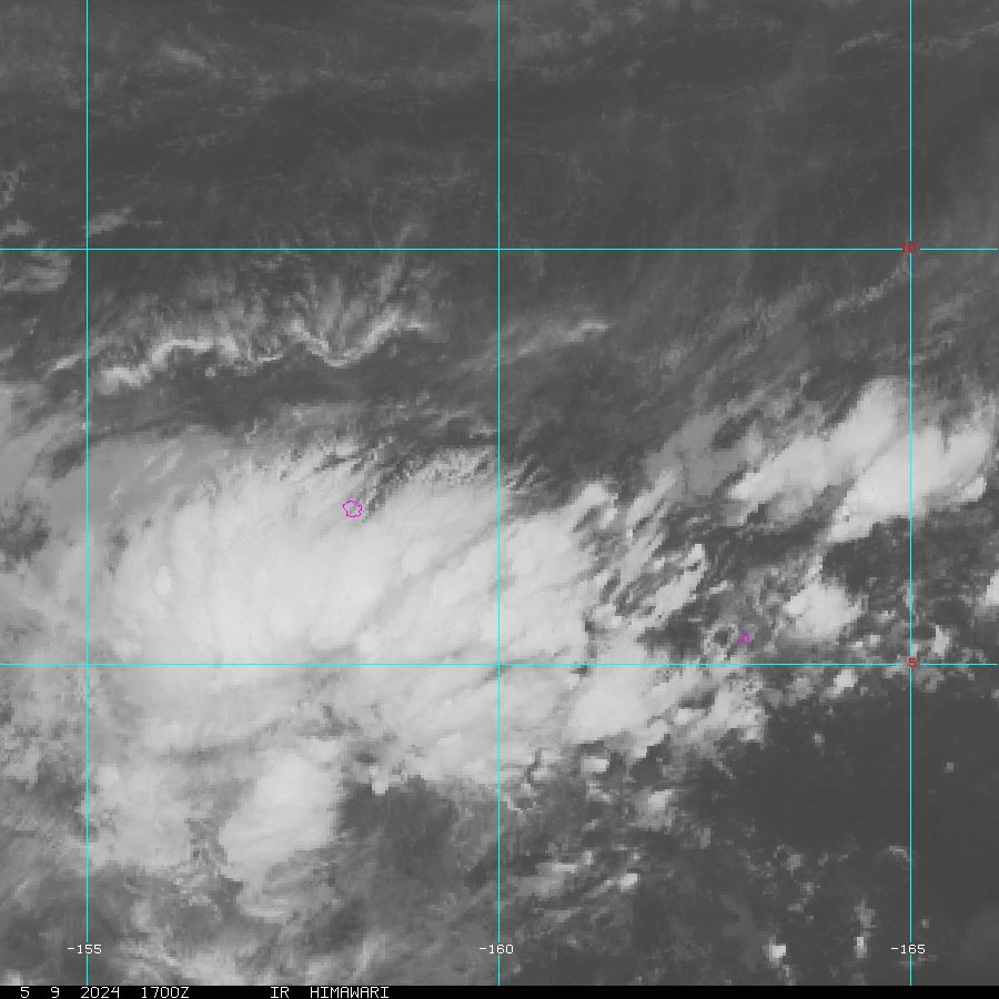 Pohnpei/Kosrae Sector
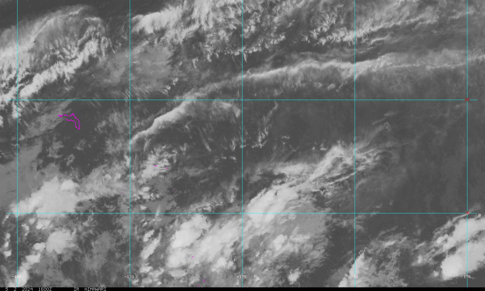 Marshall Islands Sector
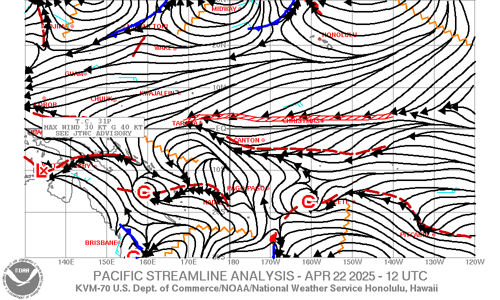