
Heat expands across the Desert Southwest, Plains, Mississippi Valley and Midwest into Monday. Fire weather concerns continue for portions of the Intermountain West. Active monsoonal moisture fuels thunderstorms over the Southwest with possible flash flooding. Tropical cyclone Fausto in the Pacific, should weaken as it approaches Hawaii; Dangerous surf, swells and rip currents are expected. Read More >
|
||||||||||||||||
|
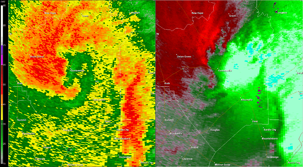
The tornado initially touched down between Buck Island and Pine Island on Guntersville Lake in northeast Marshall County. Numerous hardwood and softwood trees were snapped along Highway 79 as the tornado skipped northeast. The tornado touched down again on Pine Island and remained on the ground for several miles approaching the Jackson County line. Numerous homes sustained damage from trees falling on them in a convergent pattern as the tornado moved along the shore of the lake on Preston Island. At this point in the tornado path, width was estimated at 50 yards, but additional surveys are needed to determine both the entire path length and width of this tornado. |
||||||||||||||||
Radar Data |
||||||||||||||||
|
||||||||||||||||


 Local Radar
 Weather Map