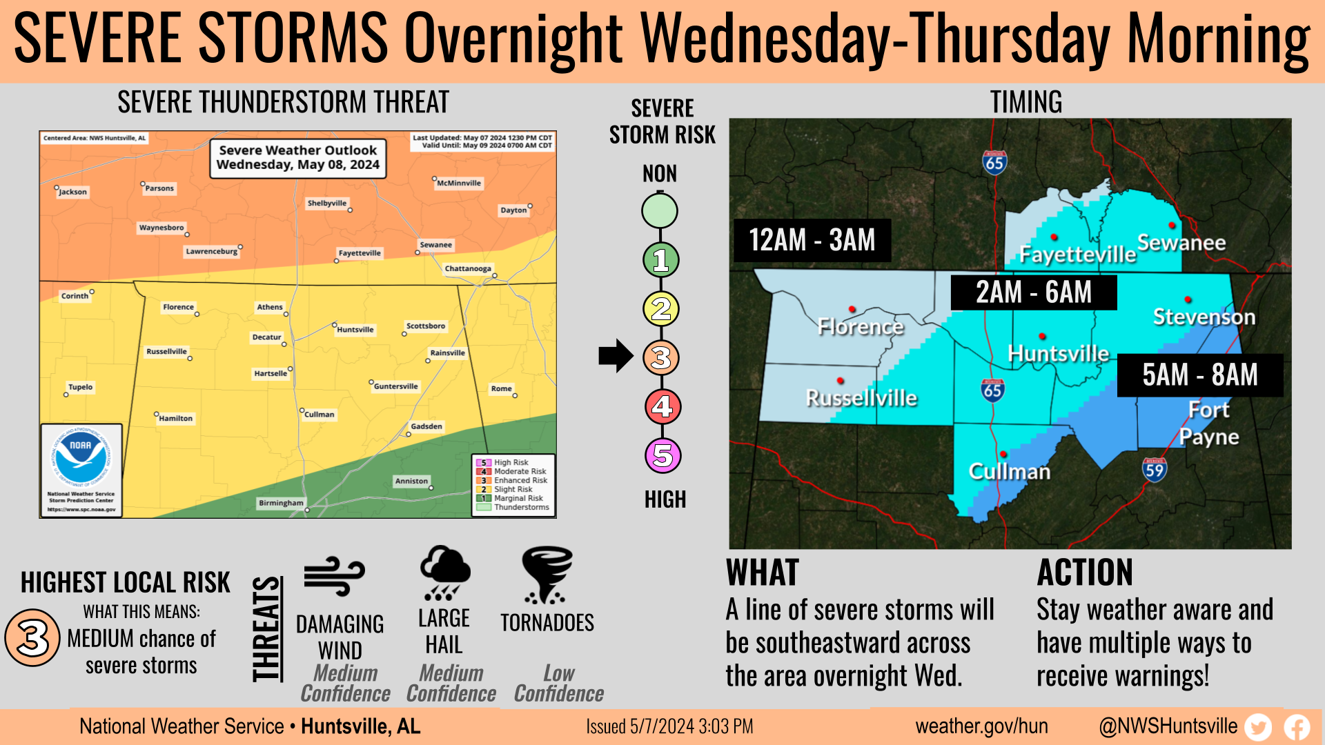
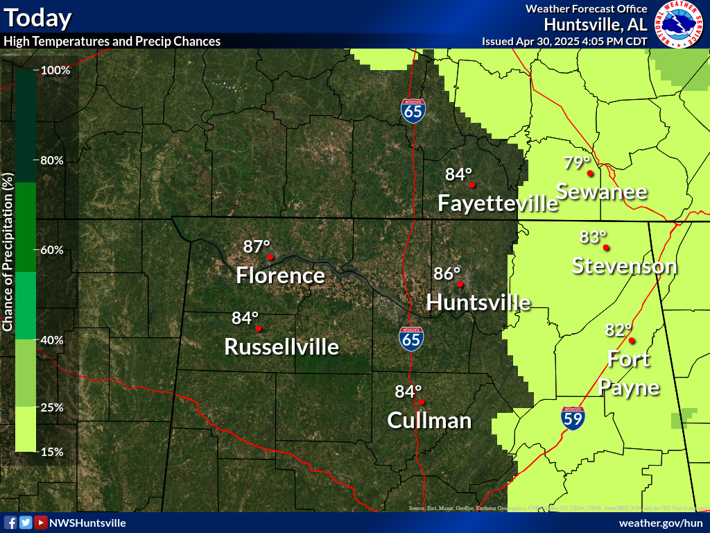
Dry and cool conditions will persist through the weekend with temps warming back into the upper 70s/lower 80s on Monday. We are monitoring a low risk for strong to severe storms late Wednesday so be sure to check back for forecast updates!
This graphic contains daily climate data (climate normals and records) for today for the sites listed. The legend is in the upper left portion of the image. The current normals period is 1991-2020.
Note: "N/A" or "MISG" will be displayed if values are not available. In the LOCATION column, click on links for a list of recent observations at sites of interest. In the WIND column, VRB is "variable" and G is "gust". Wind speeds are in MPH. In the BARO (pressure) column, values are in inches. In the REMARKS column, HX is "heat index", WCI is "wind chill index", and VSB is "visibility" (if shown).
Text Product Selector (Selected product opens in a new window)


 Local Radar
 Weather Map