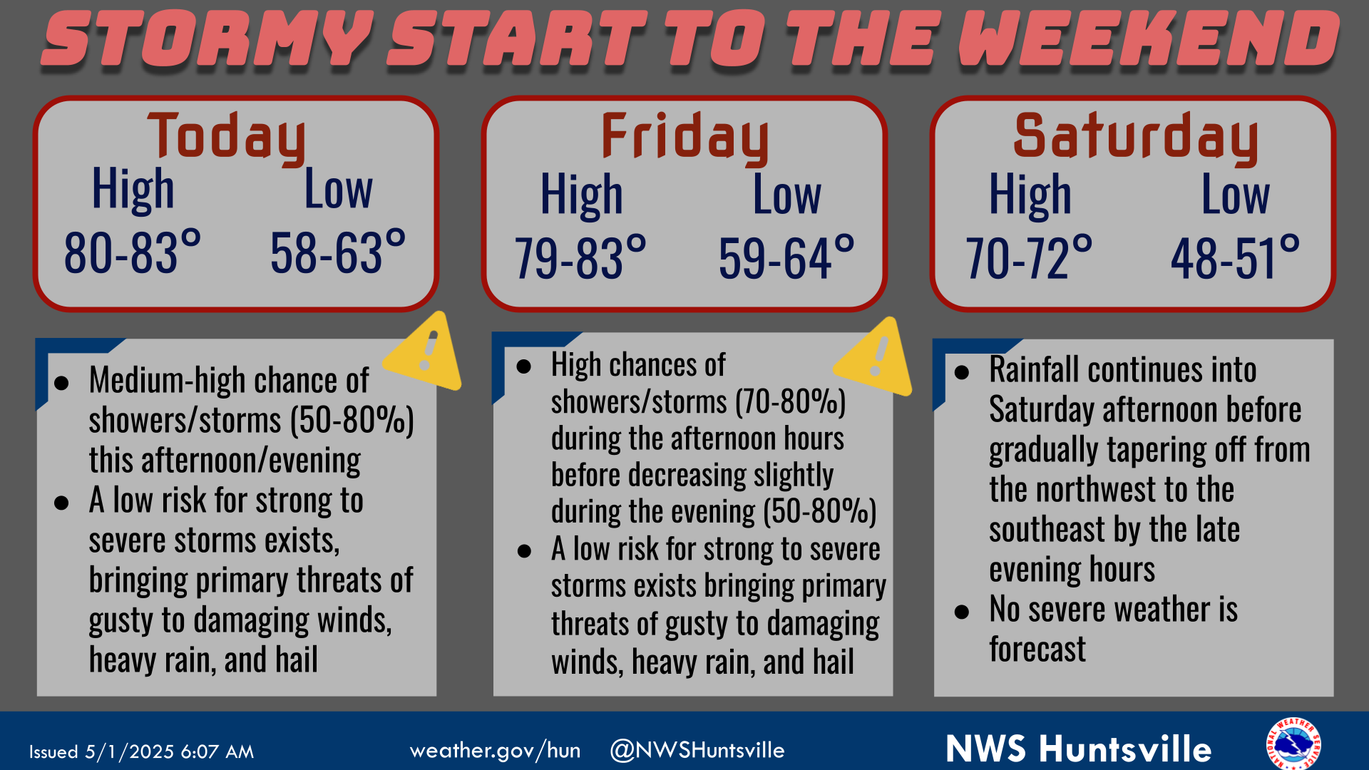
The forecast will remain warm and mostly dry through the end of the work week before a cold front brings a low risk for severe storms and locally heavy rainfall to the area late Saturday into Sunday.
A cold front will bring widespread rain and a low risk for severe storms and locally heavy rainfall to the area late Saturday into Sunday. Be sure to monitor the forecast for updates!
Note: "N/A" or "MISG" will be displayed if values are not available. In the LOCATION column, click on links for a list of recent observations at sites of interest. In the WIND column, VRB is "variable" and G is "gust". Wind speeds are in MPH. In the BARO (pressure) column, values are in inches. In the REMARKS column, HX is "heat index", WCI is "wind chill index", and VSB is "visibility" (if shown).
Text Product Selector (Selected product opens in a new window)


 Local Radar
 Weather Map