| You are at: HUN Home » April 7th, 2006 Severe Outbreak » Colbert County | |||||
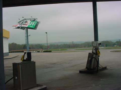
Tuscumbia/Muscle Shoals Tornado (F1) [ Back to Top | Back to April 7 Home ] A multicell cluster of thunderstorms developed across northeast Mississippi in the late afternoon hours and moved into northwest Alabama. These cells eventually split into two distinct cells that both had supercellular characteristics. The northern of the two supercells was responsible for this particular tornado. The F1 tornado with estimated maximum winds of 90 MPH occurred about 4 miles southwest of Tuscumbia. Initially, the tornado had a width of 100 yards and produced damage along a 200 yard path length before weakening to F0 intensity. A gas station suffered extensive damage (pictured). The tornado finally dissipated just southeast of Muscle Shoals. Approximate time of the tornado touchdown was 625 PM CDT. Also of note was a 66 MPH wind gusts reported at the Northwest Alabama Regional Airport (KMSL) at 633 PM CDT. A tornado warning was issued for Colbert County at 605 PM CDT.
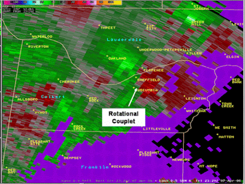
The Storm Relative Motion (SRM) image from KGWX radar showing the velocity couplet near the time of the tornado touchdown in Tuscumbia.
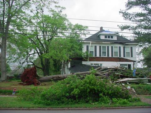
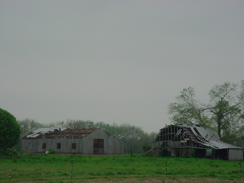
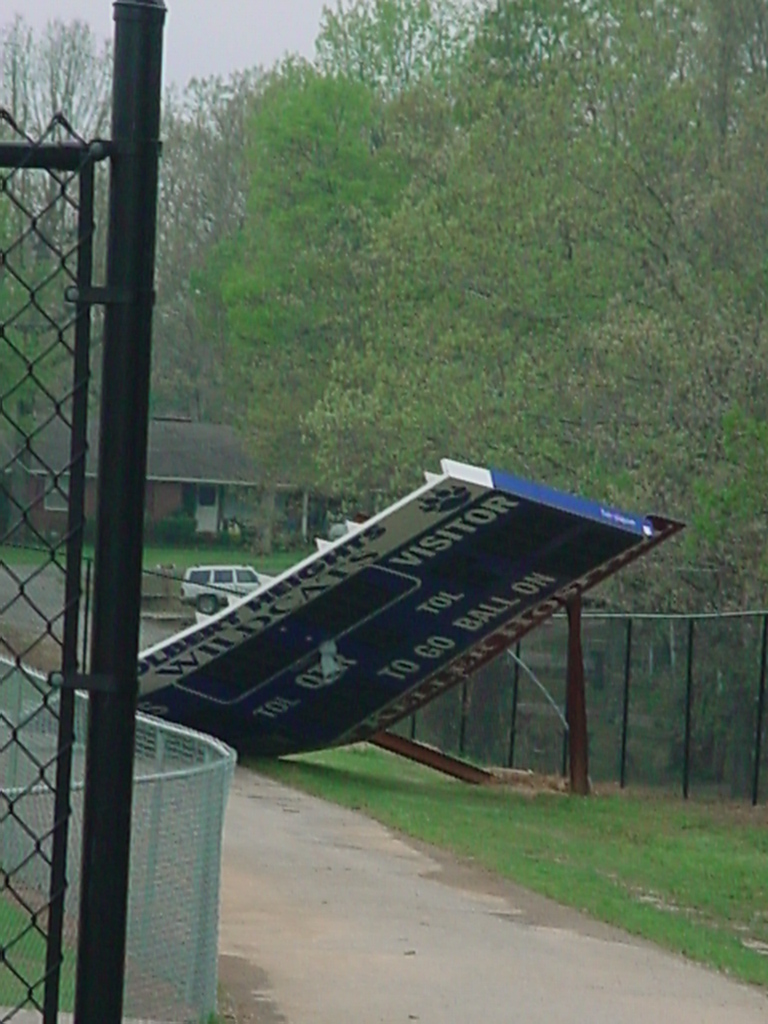
Damage at a Tuscumbia Gas Station Tornado damage in Tuscumbia Cherokee (F0) [ Back to Top | Back to April 7 Home ] A short lived F-0 tornado occurred initially about two miles east of Cherokee, Alabama. The path length of this tornado was around 50 yards with a path width also of 50 yards. Colbert Heights/Leighton (F1) [ Back to Top | Back to April 7 Home ] A third tornado reaching a maximum wind speed of 90 miles an hour began a nearly continuous 10 mile path in southeast Colbert County. The F1 tornado began its path from Colbert Heights Elementary School, continuing east and northeast to the Colbert Heights High School. The tornado first produced damage at a ball field near the elementary school, where the fence was extensively damaged. Across the street from the elementary school, a manufactured home suffered extensive roof and porch damage. Most of the roof was blown as much as 100 yards behind the home. At Colbert Heights High School, damage included a scoreboard, which was blown and twisted off of its base, and a nearby baseball dugout at the high school lost its roof. Also, a large antenna at the high school was twisted in two. The tornado weakened to F0 intensity about two miles east of Colbert Heights High School. There was continuous light tree damage along the path of the tornado until it moved through the Leighton, Alabama community. Near Leighton, the tornado reached F1 intensity again with wind speeds estimated at a maximum of 80 miles an hour. A large barn suffered extensive roof damage just west of Leighton. The roof of this barn was blown 200 yards from the structure. Corn stalks from a nearby field were found embedded between the remaining walls in the barn. The tornado uprooted five large oak trees in Leighton before abruptly dissipating on the east side of town.
|


 Local Radar
 Weather Map