
Heat expands across the Desert Southwest, Plains, Mississippi Valley and Midwest into Monday. Fire weather concerns continue for portions of the Intermountain West. Active monsoonal moisture fuels thunderstorms over the Southwest with possible flash flooding. Tropical cyclone Fausto in the Pacific, should weaken as it approaches Hawaii; Dangerous surf, swells and rip currents are expected. Read More >
| Summary | |
|
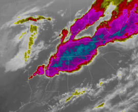
A series of supercell thunderstorms swept across the Tennessee Valley during the late afternoon and evening hours on Friday, April 7, 2006. The storms resulted in numerous tornado touchdowns, large hail up the size of softballs, and straight-line wind gusts in excess of 60 mph. Although additional storm surveys are still possible, it appears there were at least 21 brief tornado touchdowns across the Huntsville County Warning Area, occurring along 16 tornado tracks (many of the tornadoes touched down multiple times). The tornadoes were all in the F0 to F1 range on the Fujita Scale. |
|
|
|
|
|
Weather Summary/Overview
|
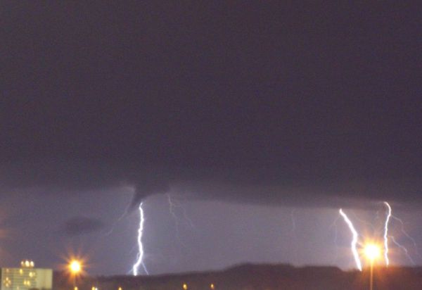
Storm Photos
|
 |
 |
|
|
|
|
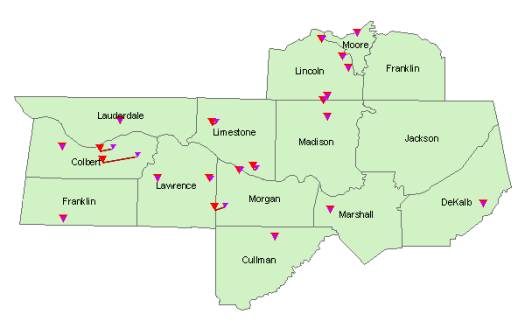
Tornado Tracks
|
|
|
Larger red triangles indicate the touchdown point, while the smaller purple triangles indicate where damage ended. Locations where the triangles overlap indicate a very brief, short-track tornado. |
|
 |
|
|
|
|
|
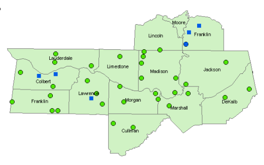
Severe Weather (Hail/Wind) Reports
Blue squares indicate wind damage or a severe wind gust. Green circles indicate large hail (3/4" or penny-size or larger). Click the image for a complete list (updated 4/12/06). |
|
 |
|
|
|
|
| Additional Coverage from Other NWS Offices | |
|
Nashville, TN (middle Tennessee) |
|


 Local Radar
 Weather Map