
Tropical Storm Bertha could bring tropical storm conditions to portions of the Florida Panhandle and Alabama coast through Wednesday, where a Tropical Storm Watch and Storm Surge Watch is in effect. Numerous severe thunderstorms with heavy rainfall are expected from the Ohio Valley into the Mid-Atlantic and Northeast Tuesday. Read More >
Event Summary |
||||
|
||||
|
||||
|
||||
|
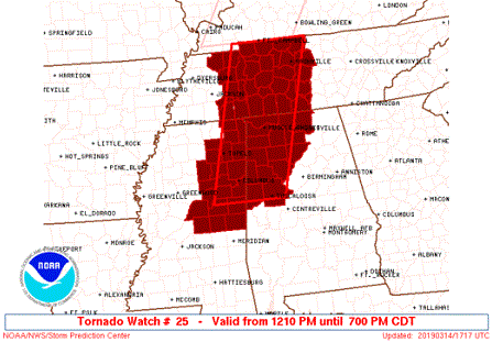
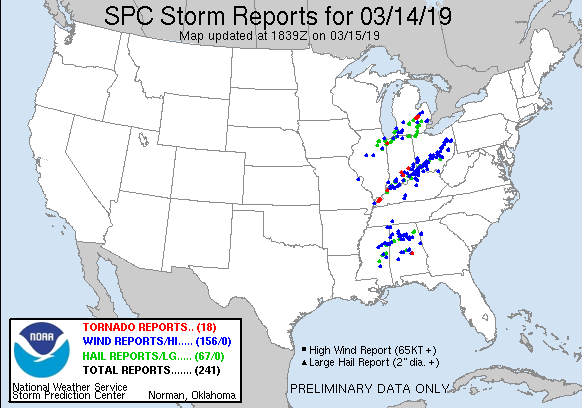
Tornadoes:
|
White City to Holly Pond
Track Map 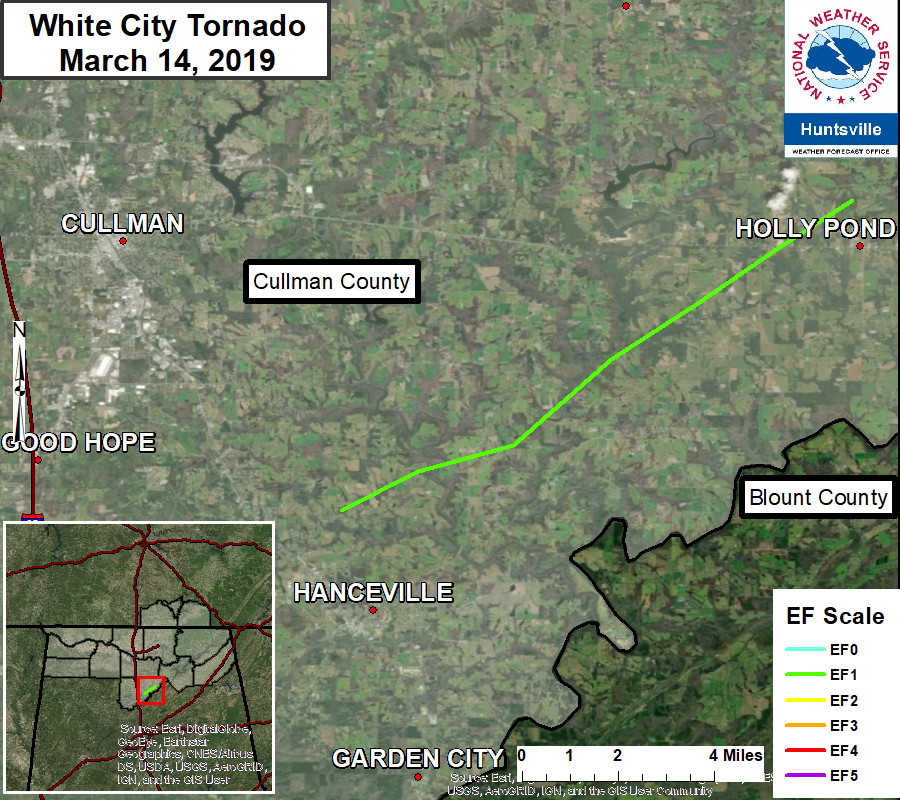
|
||||||||||||||||||||||||||
| EF0 Weak 65-85 mph |
EF1 Moderate 86-110 mph |
EF2 Significant 111-135 mph |
EF3 Severe 136-165 mph |
EF4 Extreme 166-200 mph |
EF5 Catastrophic 200+ mph |
 |
|||||
Upper Air Charts
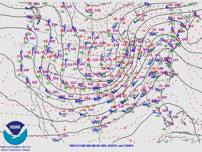
500mb Chart at 7 AM March 14th |
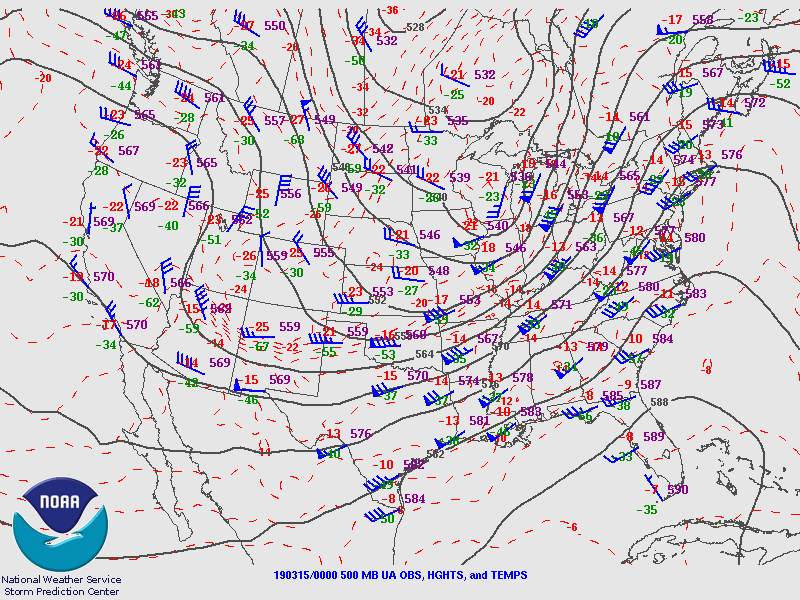
500mb Chart at 7 PM March 14th |
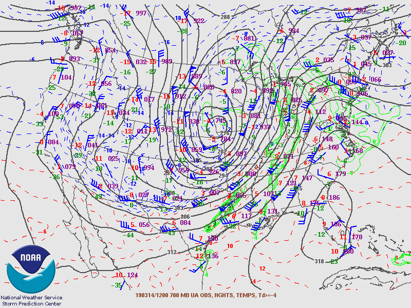
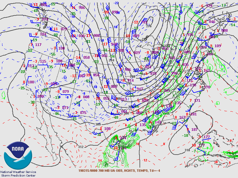
700mb Chart at 7 AM March 14th |
700mb Chart at 7 PM March 14th |
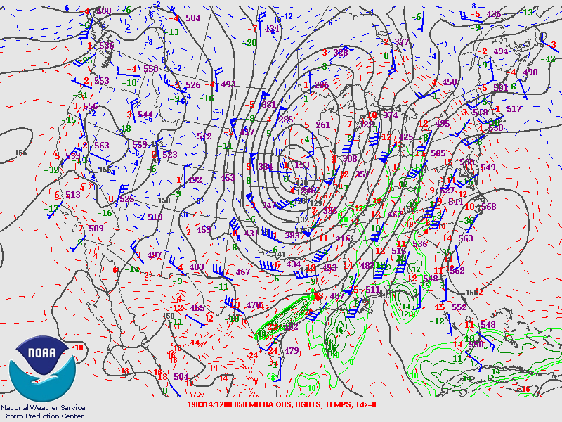
850mb Chart at 7 AM March 14th |
700mb Chart at 7 PM March 14th |
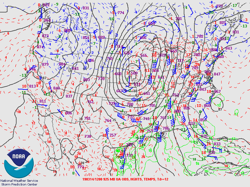
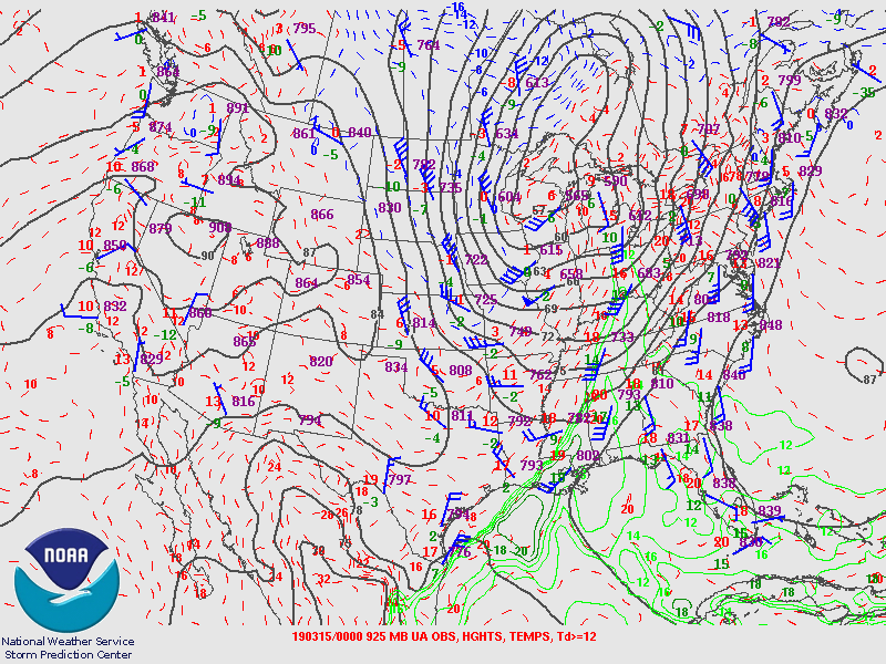
925mb Chart at 7 AM March 14th |
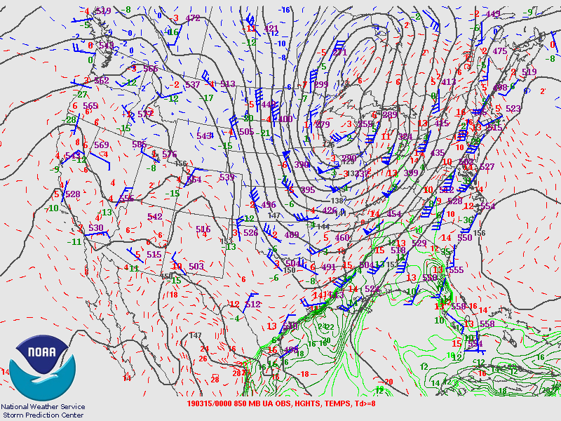
925mb Chart at 7 PM March 14th |
Soundings
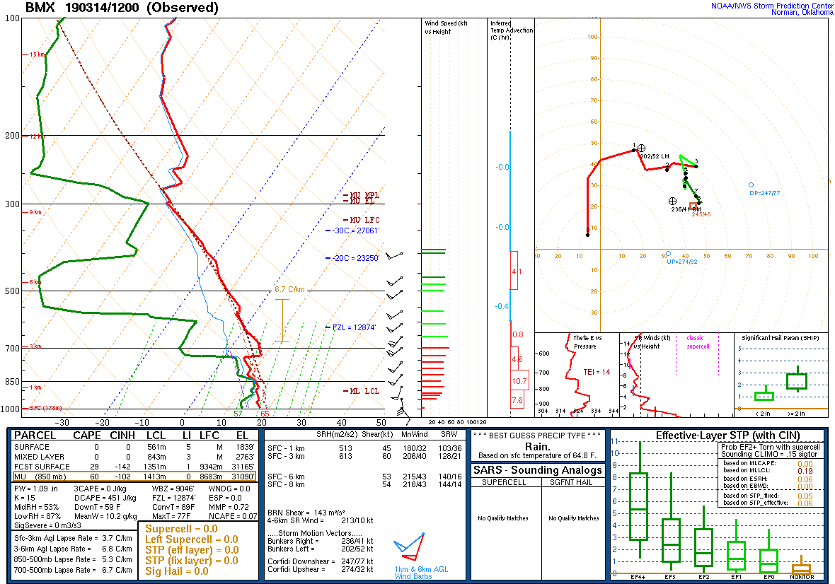
12Z Sounding March 14th, 2019/BMX |
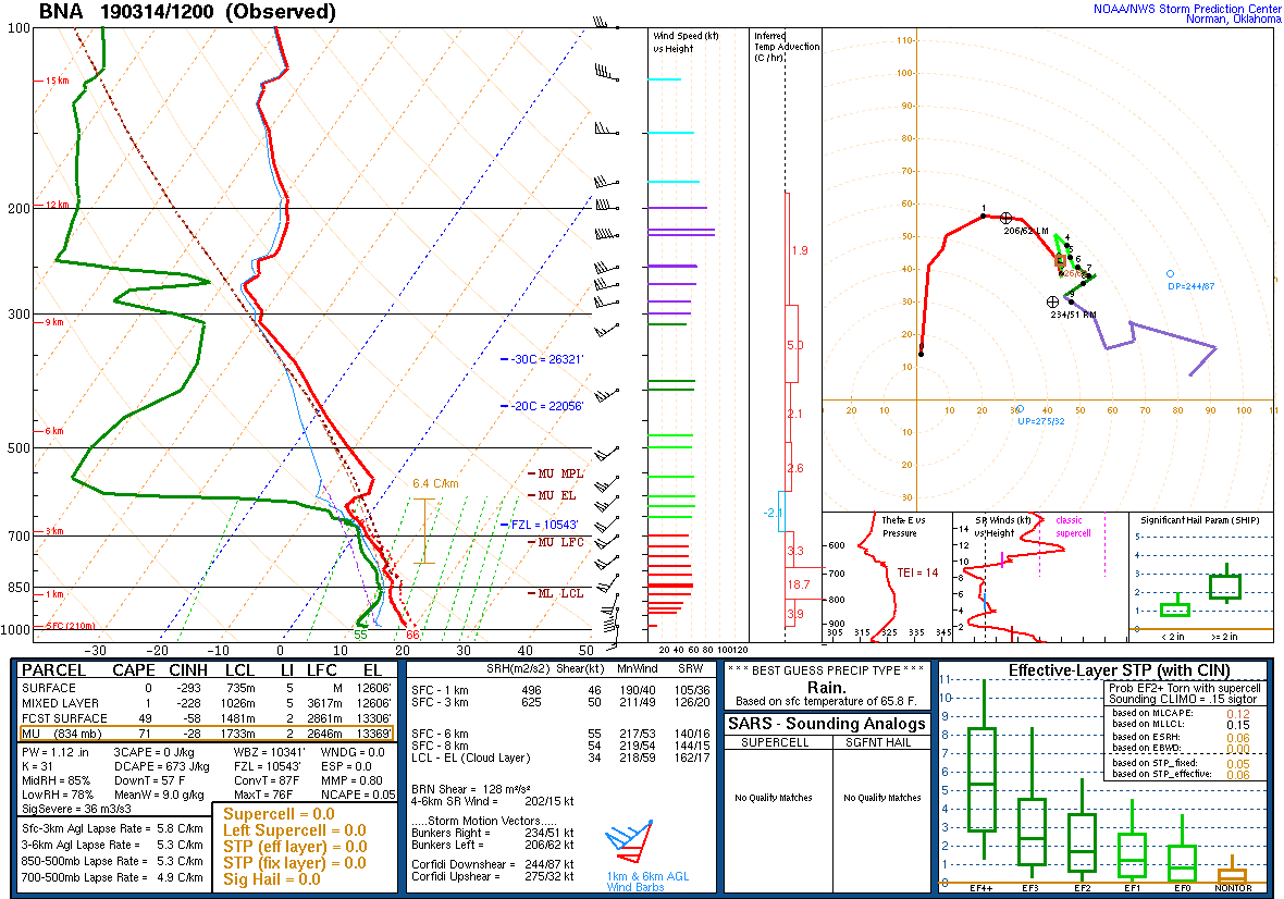
12Z Sounding March 14th, 2019/BNA |
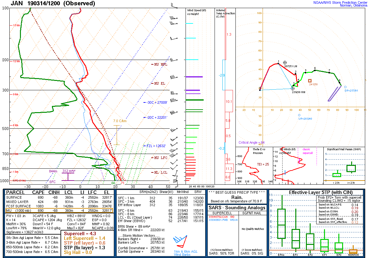
12Z Sounding March 15h, 2019/JAN |
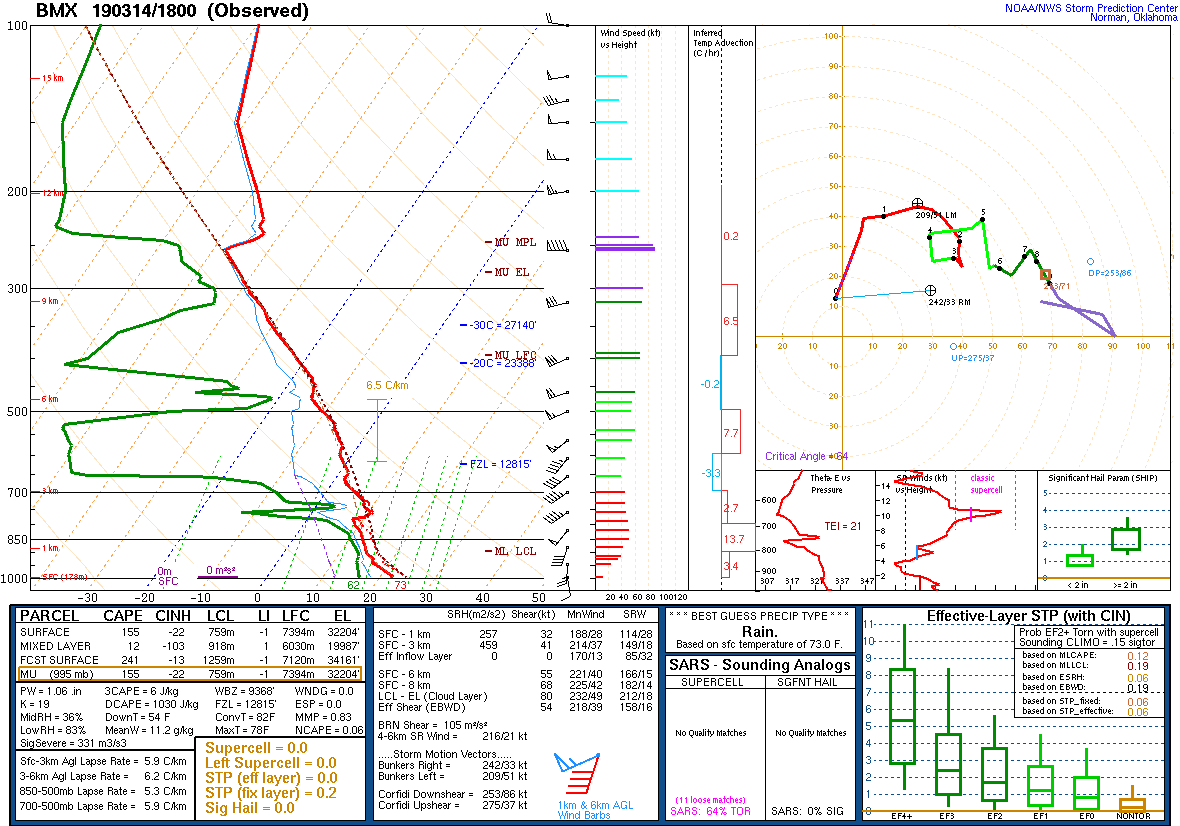
18Z Sounding March 14th, 2019/BMX |
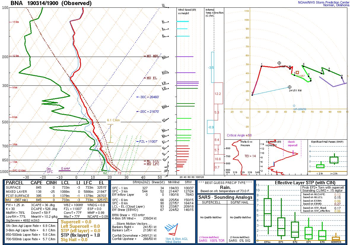
19Z Sounding March 14th, 2019/BNA |
|
SPC Outlooks
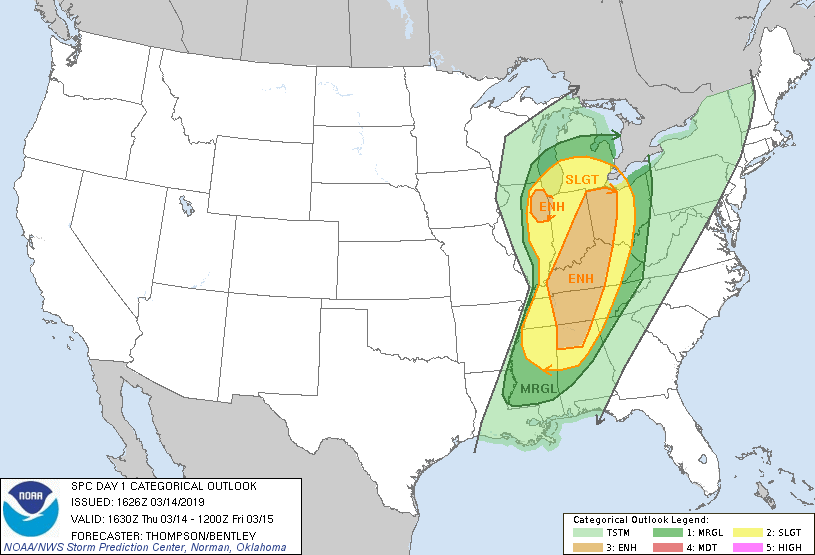
Day 1 Outlook |
||
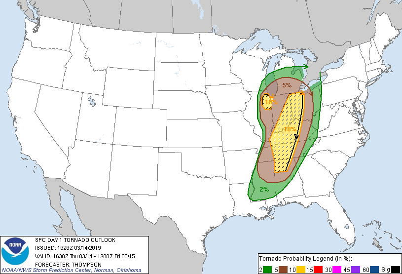
Day 1 Tornado Probability |
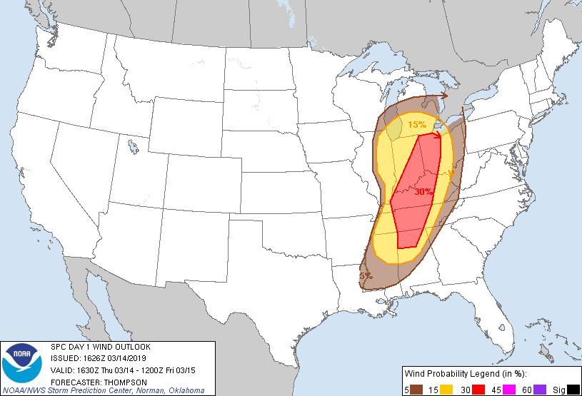
Day 1 Wind Probability |
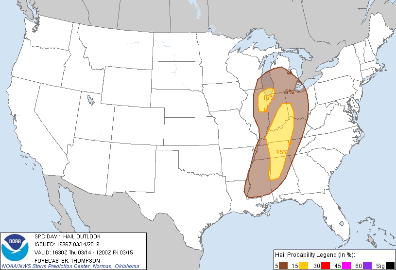
Day 1 Hail Probability |


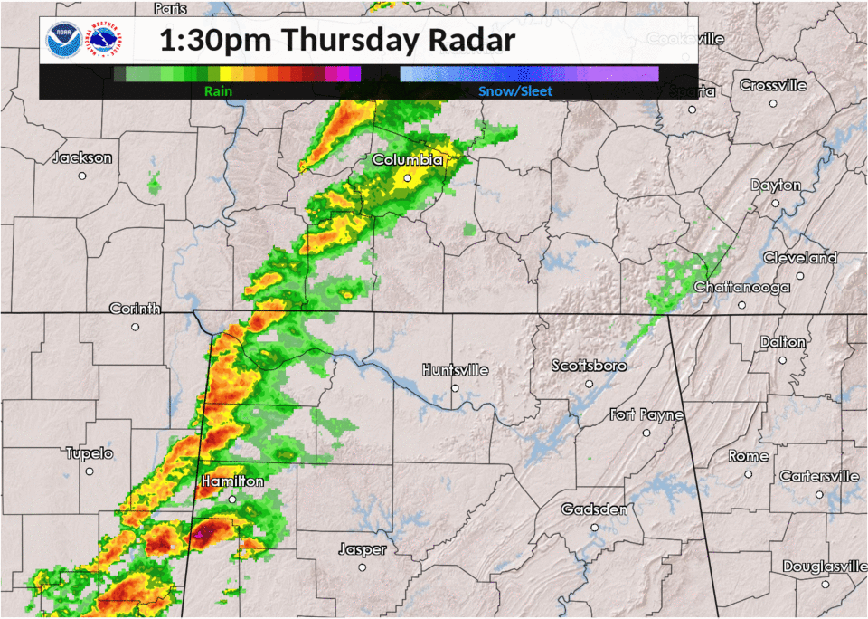
 Local Radar
 Weather Map
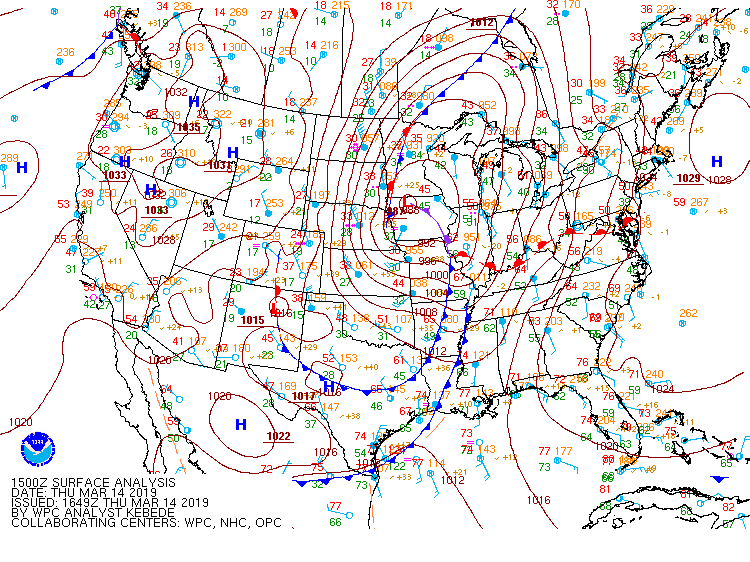