
Severe thunderstorms with damaging wind gusts will be possible from the mid-Mississippi Valley into parts of the Ohio Valley and central Appalachians. Heavy rain associated with these storms may lead to considerable flash and urban flooding impacts across portions of the Ohio Valley. Mid-summer heat persists from the Central Plains to the Southeast. Read More >
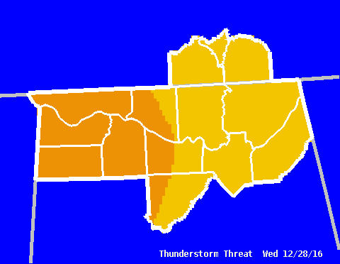
| Graphical HWO - Thunderstorm Threat | ||||||||||||
|
This graphic reflects both the severity of any thunderstorm activity that may develop, as well as the potential coverage of severe thunderstorms. For example, an area under the "Strong to Severe" category, at worst, will see storms that have severe-criteria damaging winds or large hail. However, only a few of the storms that will develop are expected to meet these criteria. |
||||||||||||
|
|
||||||||||||
Categories
|
|
Related Links Related Text Products(Note: These are the latest products issued, so they may be old. Check the date and time. For more information on what these products are, see our Product Guide.) |



 Local Radar
 Weather Map
 NWS Huntsville SitRep
 Follow us on X
 Follow us on Facebook
 Follow us on YouTube
 HUN RSS Feed