Northern Madison/Southern Lincoln (F0) [ Back to April 7 Home ]
This tornado was the result of a supercell thunderstorm that tracked northeast out of Colbert County, across northern Limestone County, and into northern Madison and southern Lincoln Counties. Prior to moving into Madison County, this same storm spawned a brief F1 tornado (maximum winds estimated at 80 mph) in the Sugar Creek Estates Community falling numerous large trees.
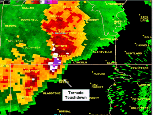
As the storm moved into Madison County, this same supercell produced two brief F0 tornadoes. One of those touched down just east of Hazel Green in the Sulphur Springs Community. A roof was peeled from a mobile home and insulation tossed into trees. The resident of the home was inside at the time but was fortunately unharmed. The tornado touched down at approximately 745 PM CDT. Maximum winds were estimated at 60 MPH. A Tornado Warning had been issued for Northern Madison County at 721 PM CDT.
The second tornado touched down about 4 miles east northeast of Hazel Green, Alabama near the Alabama-Tennessee state line. A few trees were twisted and uprooted by the short-lived tornado as it touched down, and moved to about three miles west of Vanntown, Tennessee. The path length of this tornado was 150 yards, and the width of the tornado was 30 yards, with a maximum wind speed reaching 60 miles an hour.
|


 Local Radar
 Weather Map