
Deep tropical moisture will lead to widespread showers and thunderstorms capable of producing flash flooding through early next week over the Southwest and Four Corners. A coastal storm is expected to develop off the southeast U.S. coast tonight and is expected to strengthen and bring flooding, dangerous rip currents, gusty winds and heavy rain up much of the East Coast through early next week. Read More >
 |
| Safety & Preparedness | Past Events | Additional Info |
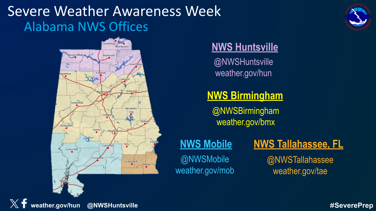
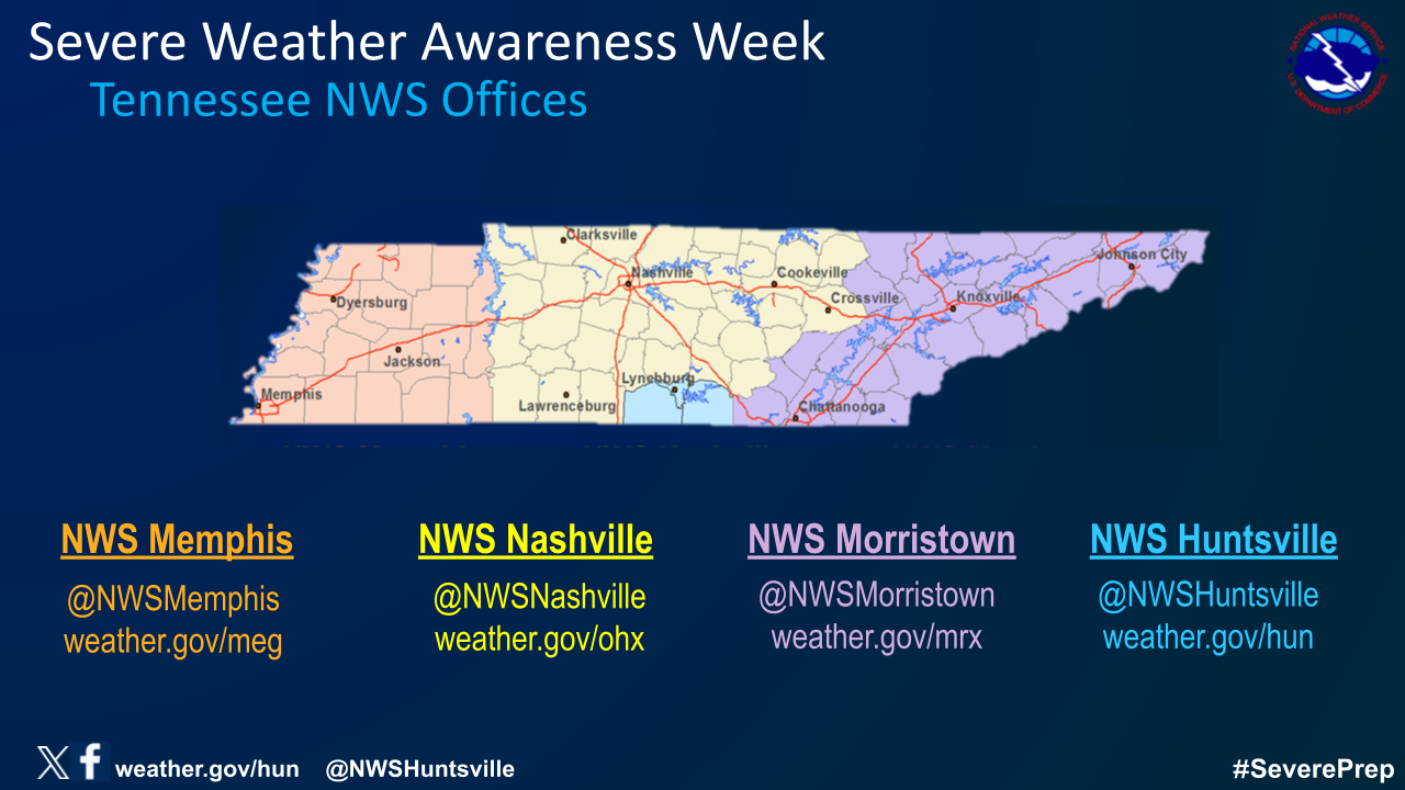
| Severe weather in the Tennessee Valley can happen during any time of year, but there are two distinct peaks: Spring and Fall. While March, April, and May contain the greatest number of severe weather instances, severe weather for our area peaks again in November. Take the time to prepare now! Click the images below to see which office covers your location, and have a plan ready for when severe weather happens in your area! |
 |
 |
|
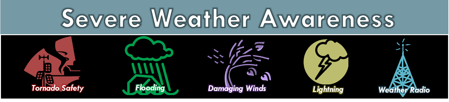
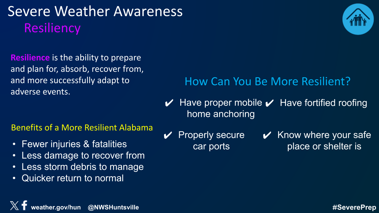
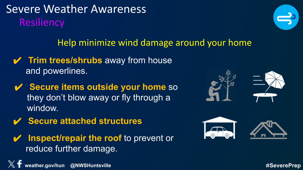
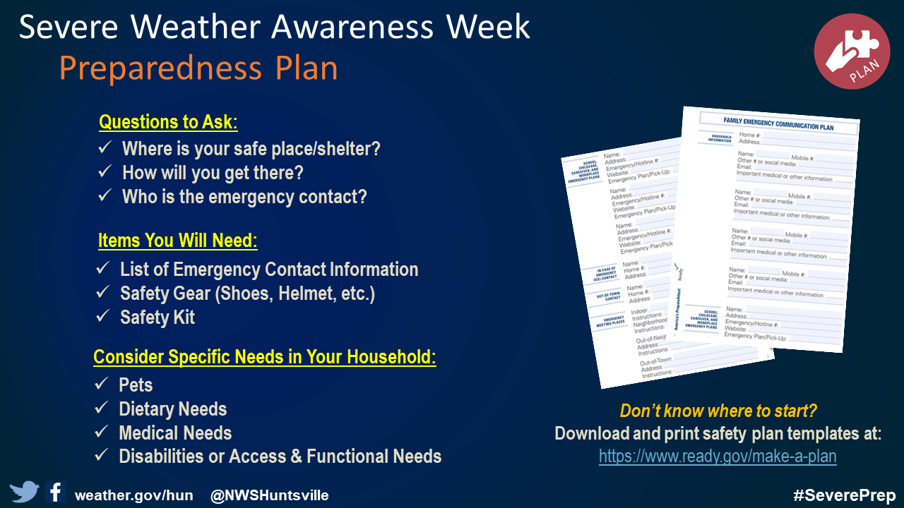
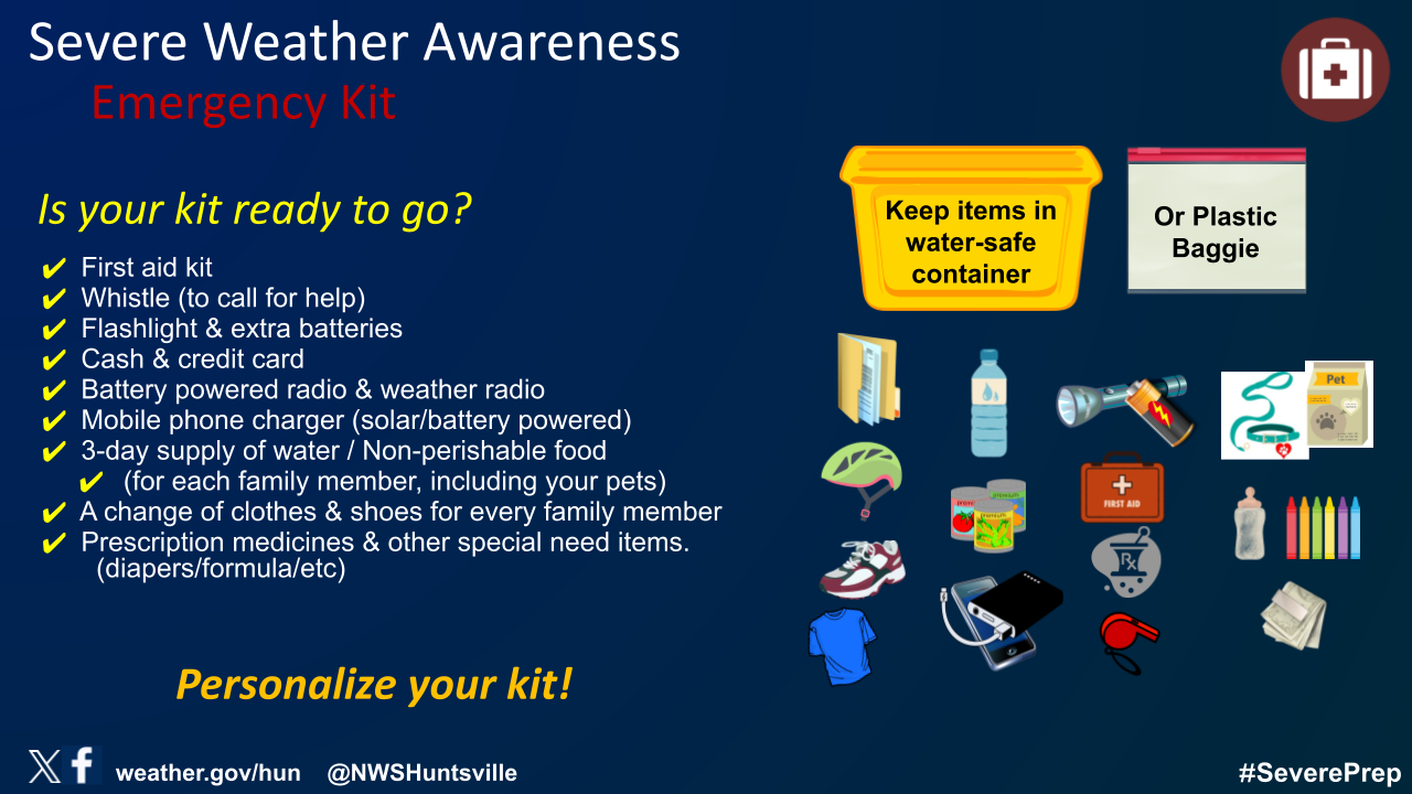
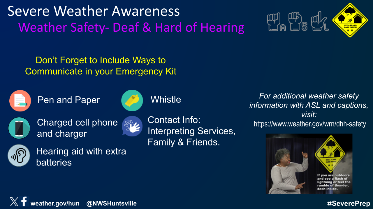
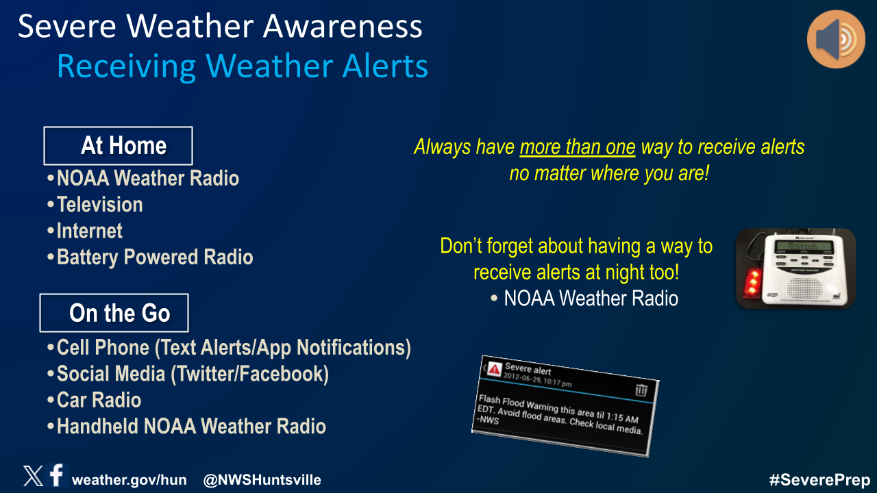
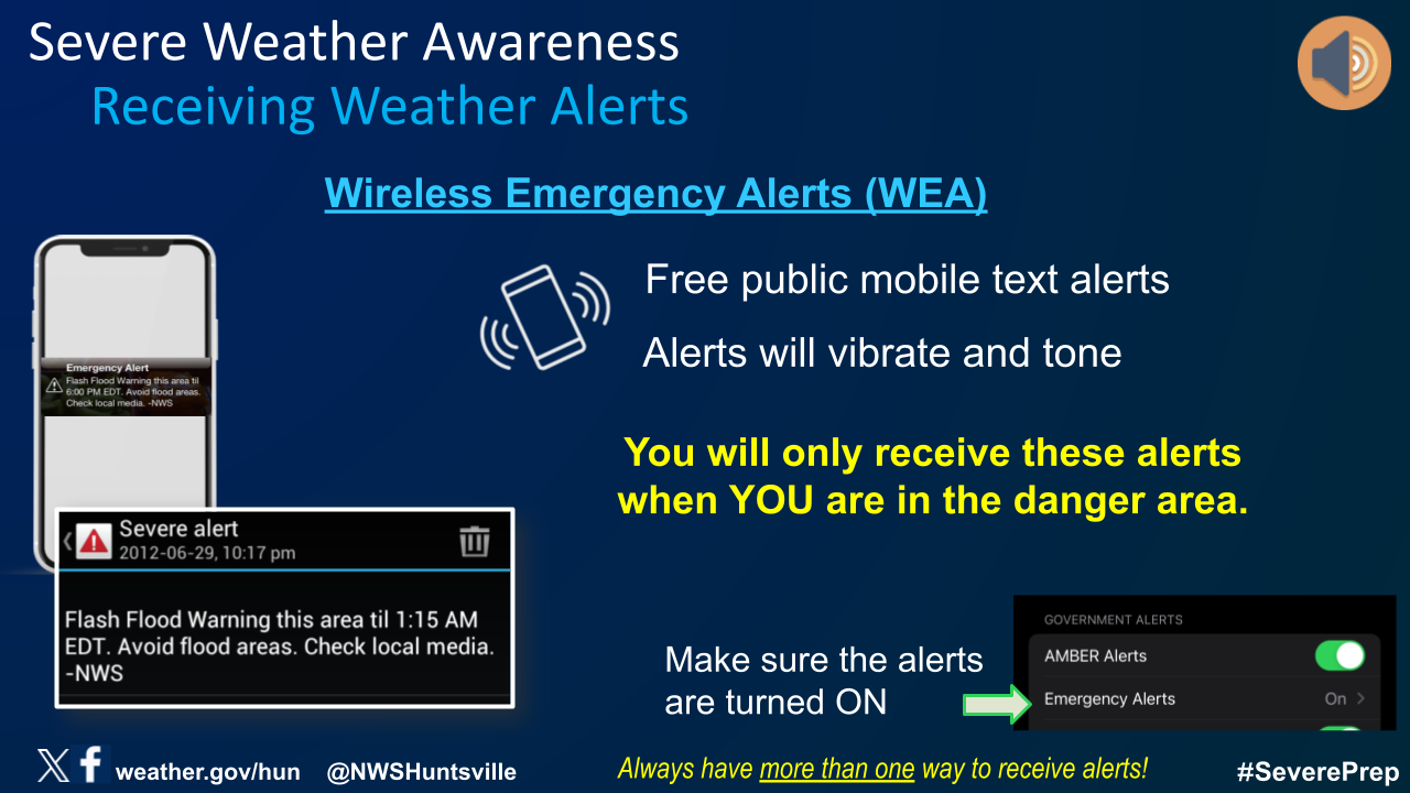
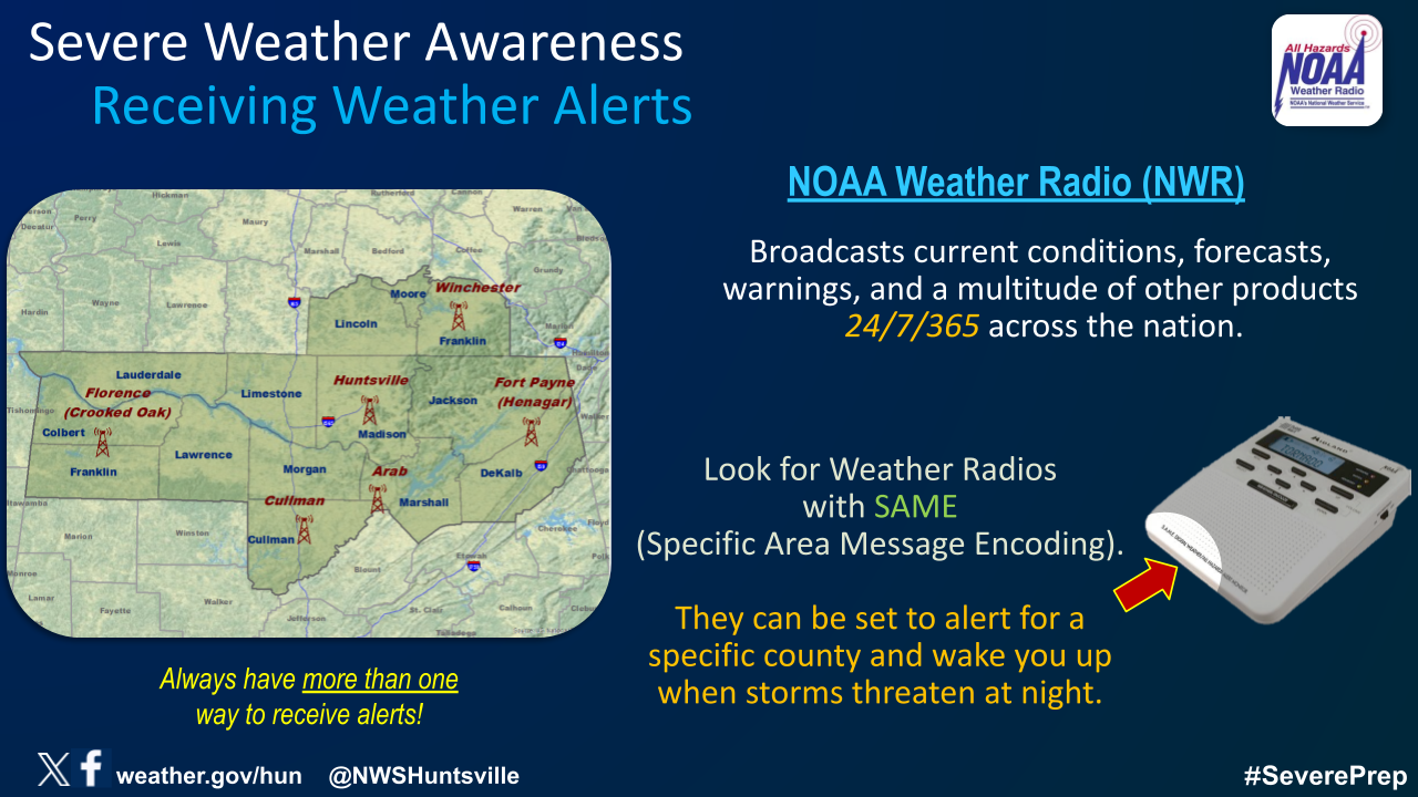
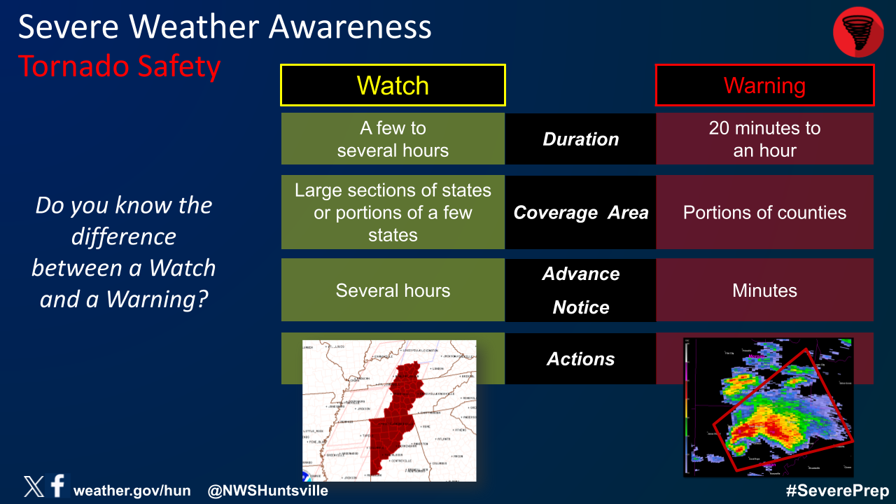
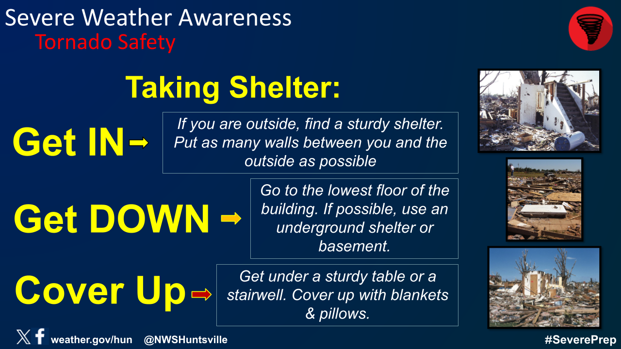
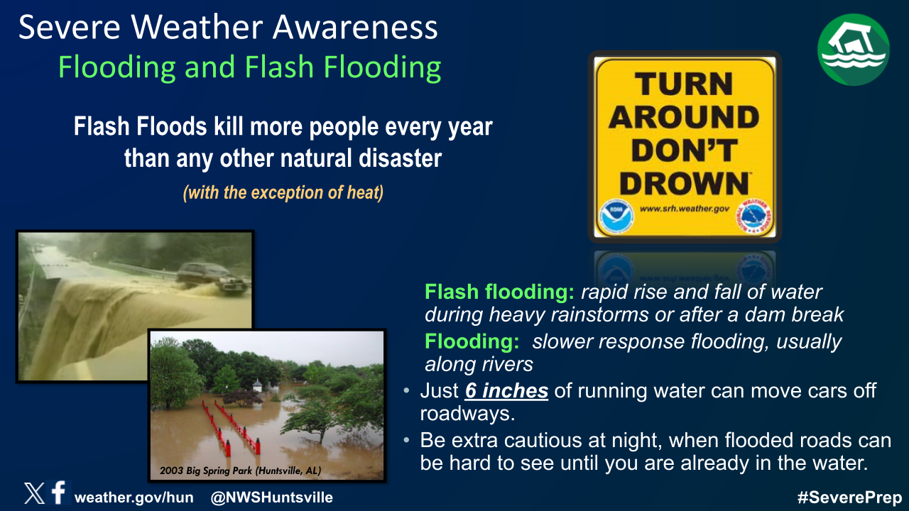
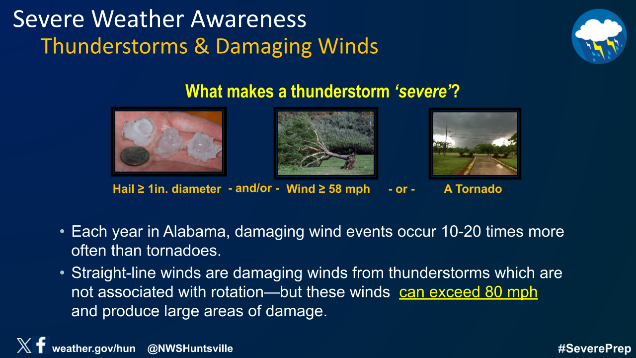
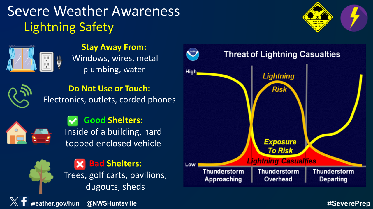
Don't wait until severe weather is happening to have a plan! Take the time to prepare NOW! Know the difference between a Watch and a Warning, and know what to when/if one is issued for your location! Always have more than one way to receive potentially life-saving weather information! Make sure you have fresh batteries in your NOAA Weather Radio, too! Have a plan in place, and know where to take shelter at home, work, church, or any other venue you frequent! Injuries and deaths due to severe weather can be prevented through proper safety and preparedness measures! The following graphics cover important safety and preparedness information for all of the hazards that may occur. |
 |
 |
 |
 |
 |
 |
 |
 |
 |
 |
 |
 |
 |
|
|


 Local Radar
 Weather Map