Wichita, Kansas
Weather Forecast Office
Overview
|
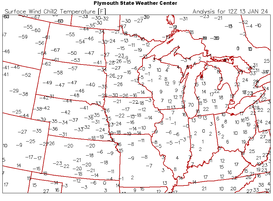
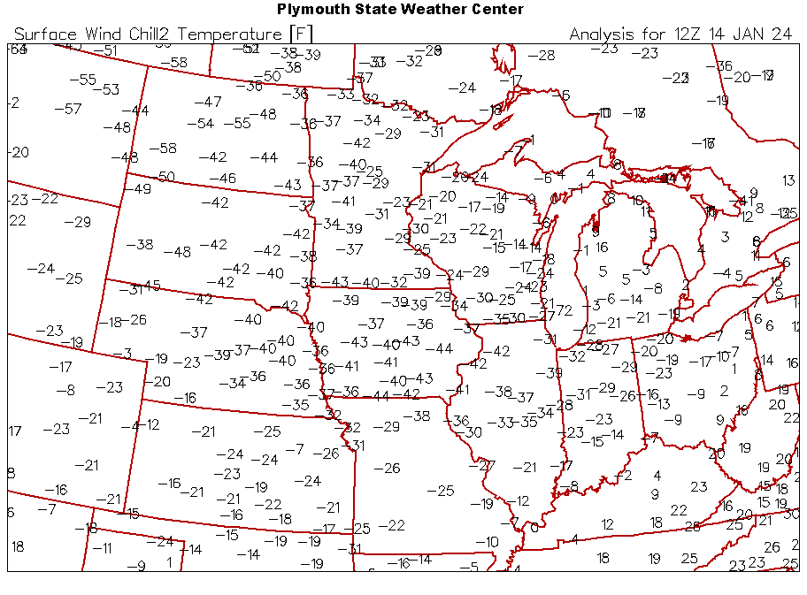
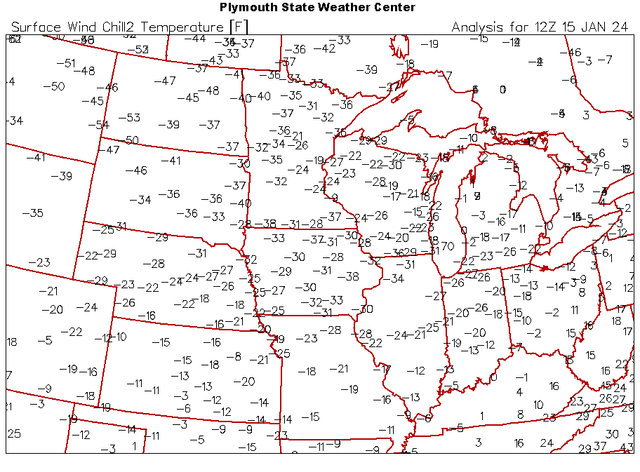
Arctic air spilled south across the Plains starting on Friday January 12th and lasting through January 16th. Windchills in the -20 to -30 range were common through this time period. In addition, 15 temperature records were broken across Central and Southeast Kansas. |
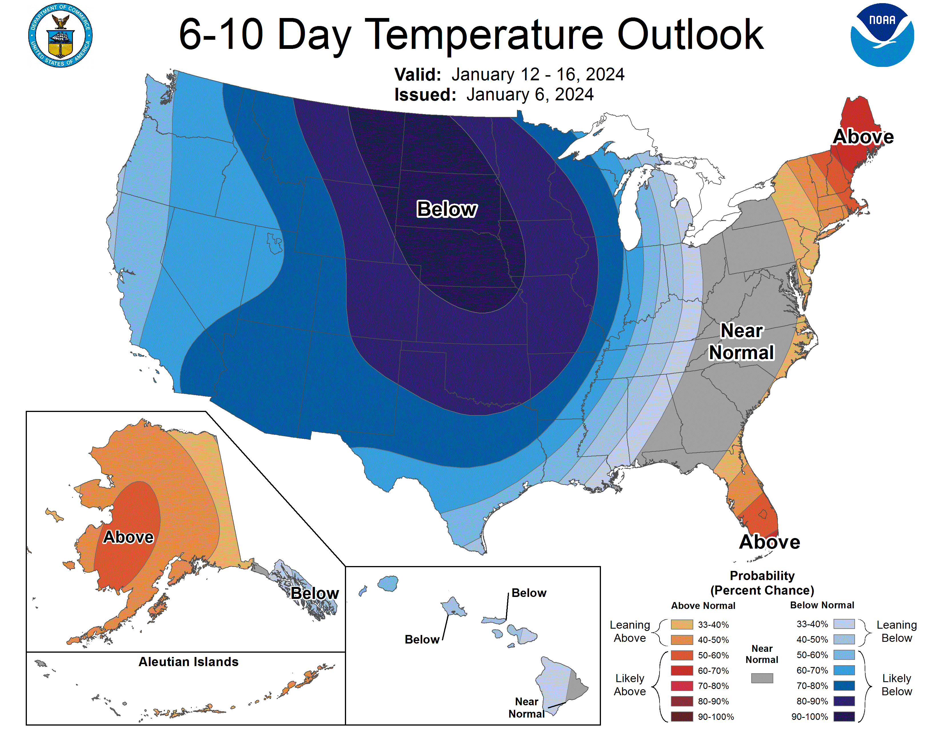 6-10 day temperature outlook ahead of the cold outbreak. |
Images and info
|
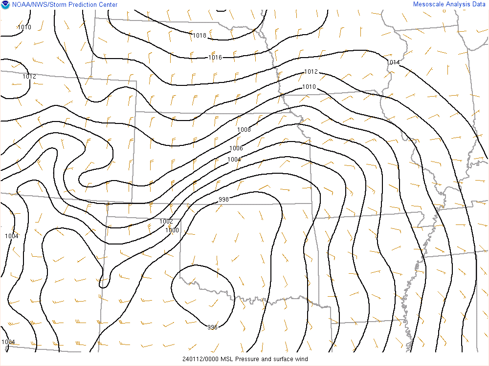
Loop of surface pressure through the cold outbreak. |
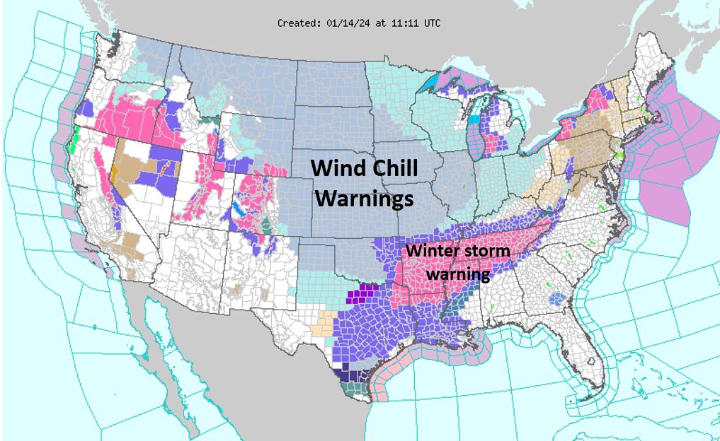
Watch/Warning Map from the morning of January 14th. Showing how expansive the wind chill warnings were. |
|
|
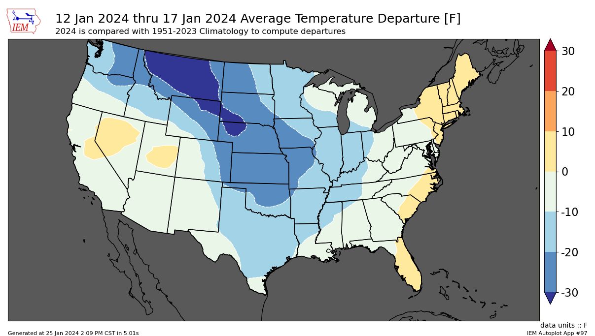
Average temperature departure for Jan 12th - 17th |
||
 |
 |
 |
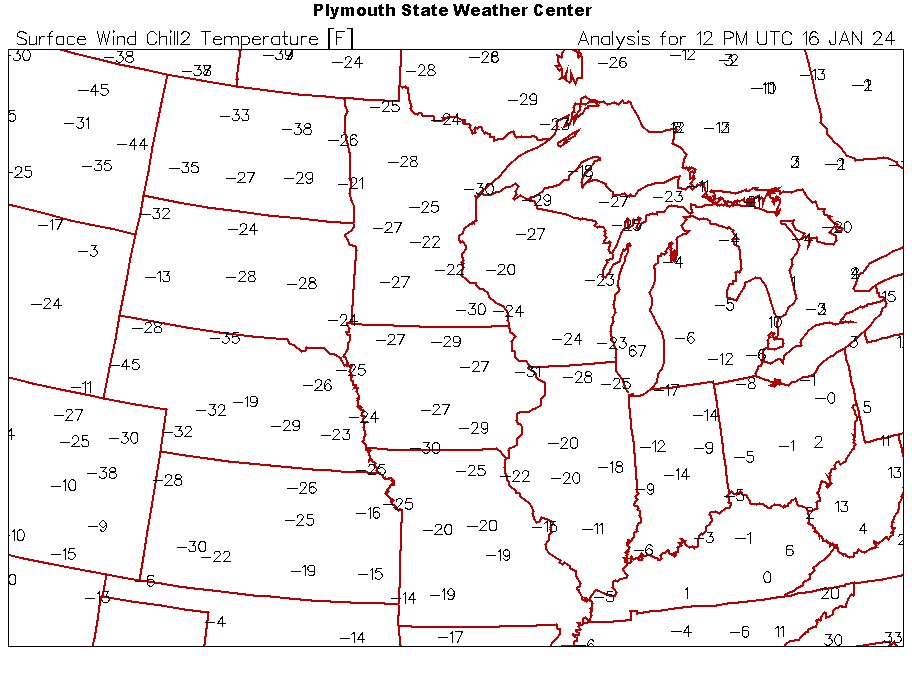 |
| Wind Chills on the morning of the 13th | Wind Chills on the morning of the 14th | Wind Chills on the morning of the 15th | Wind Chills on the morning of the 16th |
Additional facts
* The coldest wind chills recorded since the start of this cold snap: Wichita -24 Saturday evening, Salina -27 early this morning, Russell -34 early this morning, and Chanute -24 Saturday night. These were the coldest wind chills across the area since late Dec 2022.
*Wichita temperatures didn't get above 10 degrees Jan 13-15. This was only the 8th time since 1888 the city saw 3 or more consecutive days of temperatures 10 degrees or colder. The last time was Feb 2021.
* Salina temperatures didn't get above 10 degrees Jan 13-15. This was only the 8th time since 1900 the city saw 3 or more consecutive days of temperatures 10 degrees or colder. The last time was 1989!
* Russell temperatures didn't get above 10 degrees Jan 13-15. This was only the 6th time since 1949 the city saw 3 or more consecutive days of temperatures 10 degrees or colder. The last time was 1990!
* Frost depth in Wichita reached 12 inches, which matches the deepest since frost depth has been recorded(~2010)
 |
Media use of NWS Web News Stories is encouraged! Please acknowledge the NWS as the source of any news information accessed from this site. |
|
Hazards
Briefing pages
Local weather story
Submit a storm report
Storm Prediction Center
Enhanced Hazardous Weather Outlook
Hazardous Weather Outlook Text
Current Conditions
Local Radar
National Radar
Satellite
Hourly weather(text)
Precip Analysis
Snowfall analysis
This day in weather history
7 Day Lightning Archive
Forecasts
Forecast Discussion
Weather Story
Fire Weather
Activity Planner
Aviation Weather
Soaring Forecast
Hurricane Center
Graphical Forecasts
Regional Weather Summary
Probabilistic Snow
Probabilistic QPF
Wet Bulb Globe temp
Climate
Local Climate Page
Daily/Monthly data(F6)
Daily Records
Climate Normals
Local drought page
Latest Climate Report(ICT)
Latest Climate Report(SLN)
Latest Climate Report(CNU)
CoCoRaHS
7 Day Lightning Archive
US Dept of Commerce
National Oceanic and Atmospheric Administration
National Weather Service
Wichita, Kansas
2142 S. Tyler Road
Wichita, KS 67209-3016
316-942-3102
Comments? Questions? Please Contact Us.