Damaging Straight Line Winds, Hail, and Tornadoes
Across Central and Southeast Kansas
April 2-3th, 2015
Story will continue to be updated, check back:
last updated at 4am Sat April 4th
|
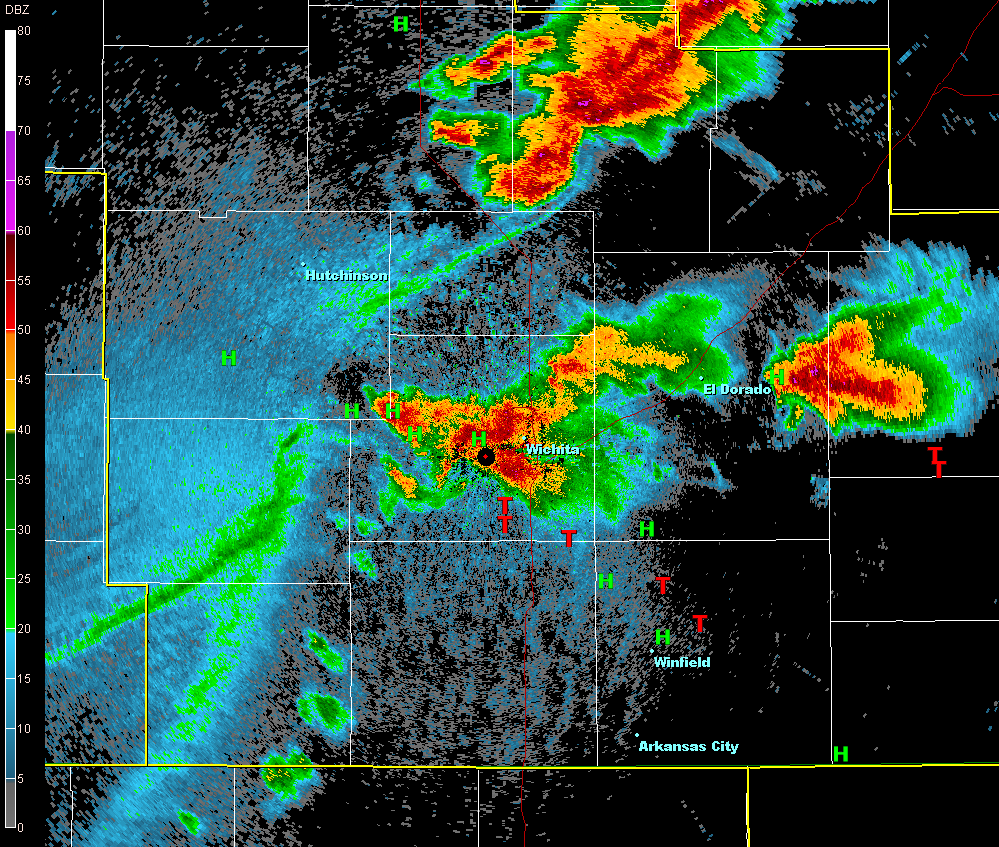
Overview: Severe thunderstorms developed rapidly and became supercellular on the evening of April 2nd across far southeast Kansas and produced two brief tornadoes in Labette County. As the initial storms continued to move southeast into Oklahoma and Missouri Thursday night, a severe thunderstorm developed near the border of Colorado and Kansas. This severe thunderstorm continued to develop and intensify across central Kansas and took on bow echo-like characteristics. This bow-echo later produced damaging straight-line winds and large hail across much of central and south central Kansas. As the bow-echo approached Sedgwick and Harvey counties, channeled microbursts developed and caused significant straight-line wind damage. This dangerous storm continued to move through south central Kansas during the early morning hours and took on supercellular characteristics as it moved into southeast Kansas producing hail up to the size of tennis balls! |
|
Overview loop of radar data, warnings, and local storm reports.
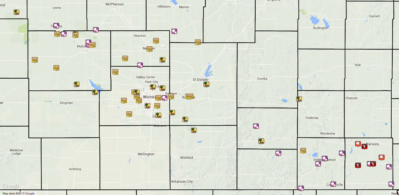
Above is a map of preliminary local storm reports. |
Channeled Microbursts Across Sedgwick and
Harvey Counties Damage
|
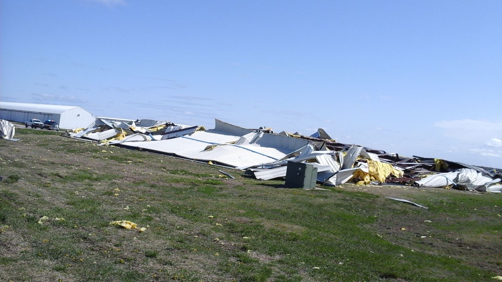
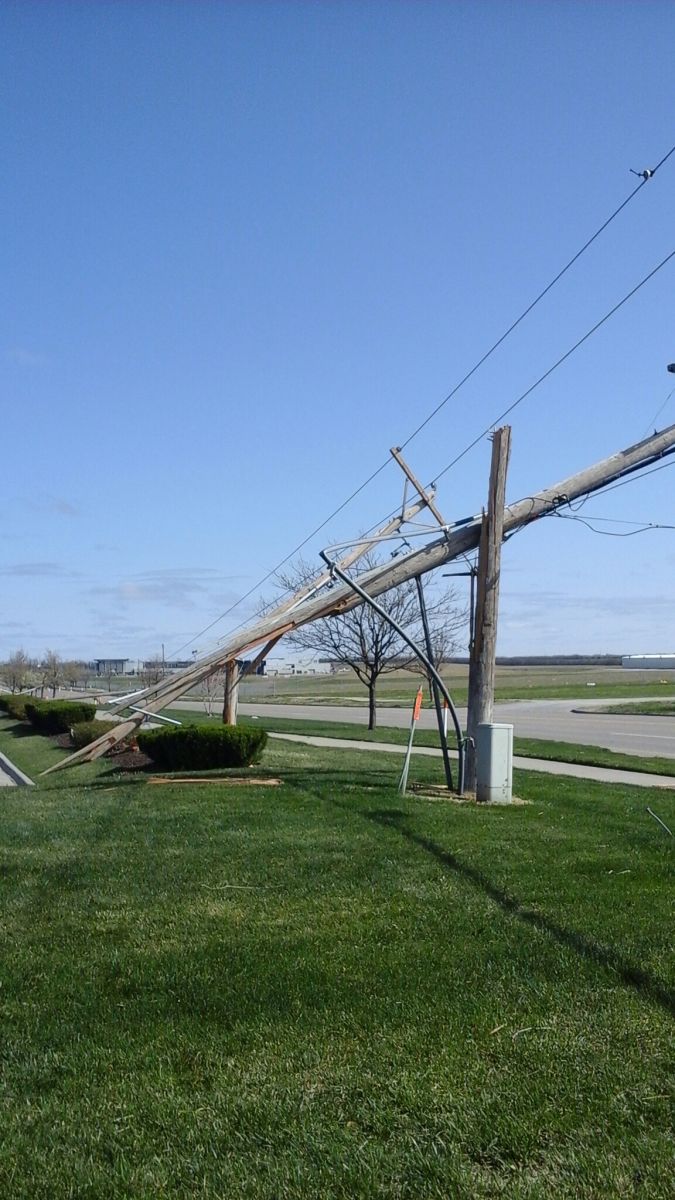
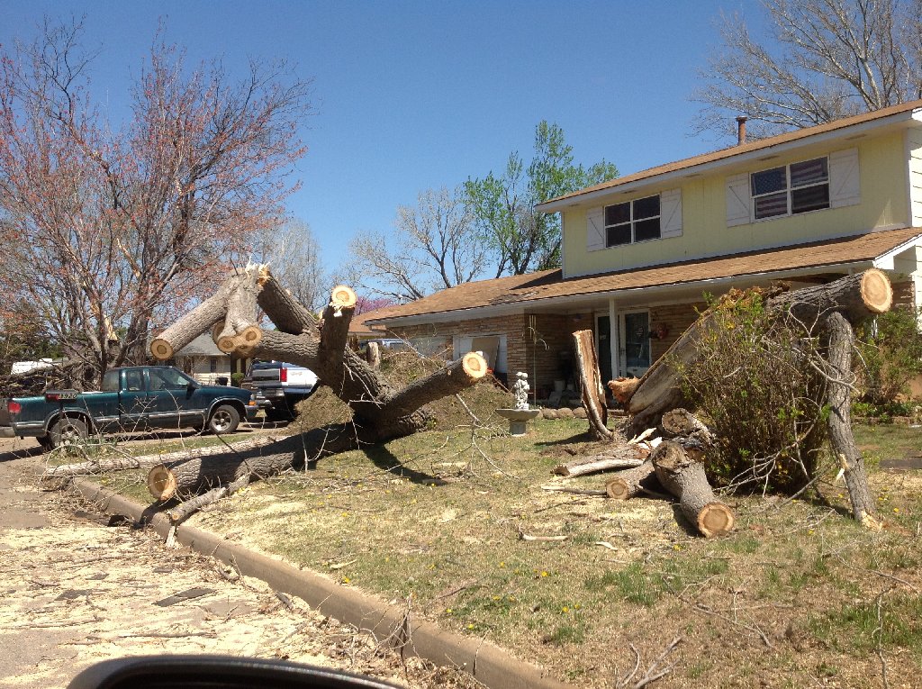
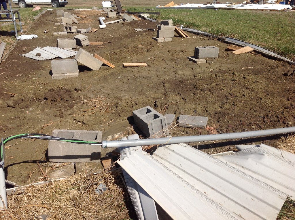
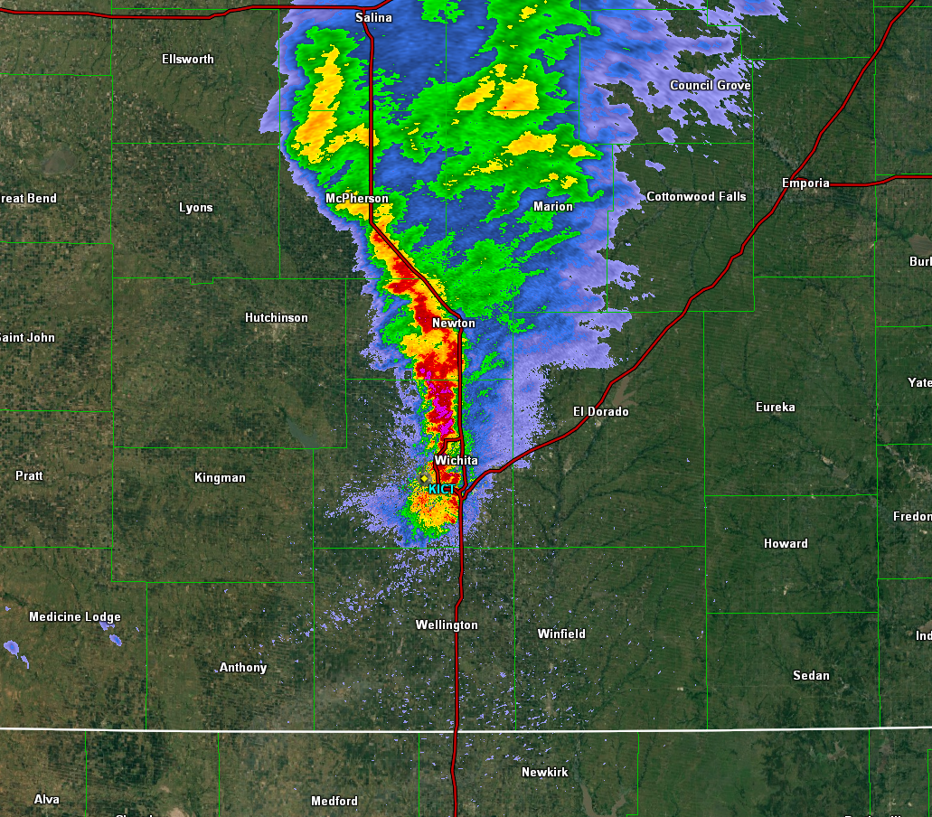
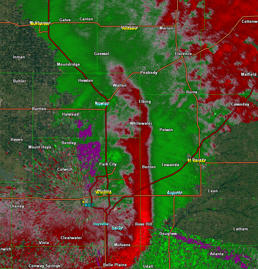
The storm that impacted much of central to southeast Kansas developed along the Colorado and Kansas border on the during late afternoon of April 2nd. It left behind a track of high wind and hail reports extending across the state of Kansas. As the storms moved into Barton, Rice, and Reno counties reports of wind damage, including snapped power lines and uprooted trees, with golf ball size hail. As the storm continued southeast into Harvey and Sedgwick counties, individual bowing segments within the main bow echo developed and producing channeled microbursts. These channeled microbursts resulted in significant straight line wind damage in Newton and northern Wichita, where surveying supported winds around 100 mph. Across northeast Wichita a hanger was destroyed at the Jabara Airport and a 1/10 of a mile of power poles were snapped off at the base. In Newton, portions of the city had damage including roof and tree damage. Near Whitewater a mobile home was destroyed by the straightline winds, yet the whole family survived. As of Friday morning, nearly 50,000 people woke up without power as many power lines came down across the area. After impacting south central Kansas, the storm continued to drop into southeast Kansas and took on supercellular characteristics as it encountered better low level moisture and instability producing 4 inch hail.
Highest measured wind speeds:
Largest Hail Reports:
|
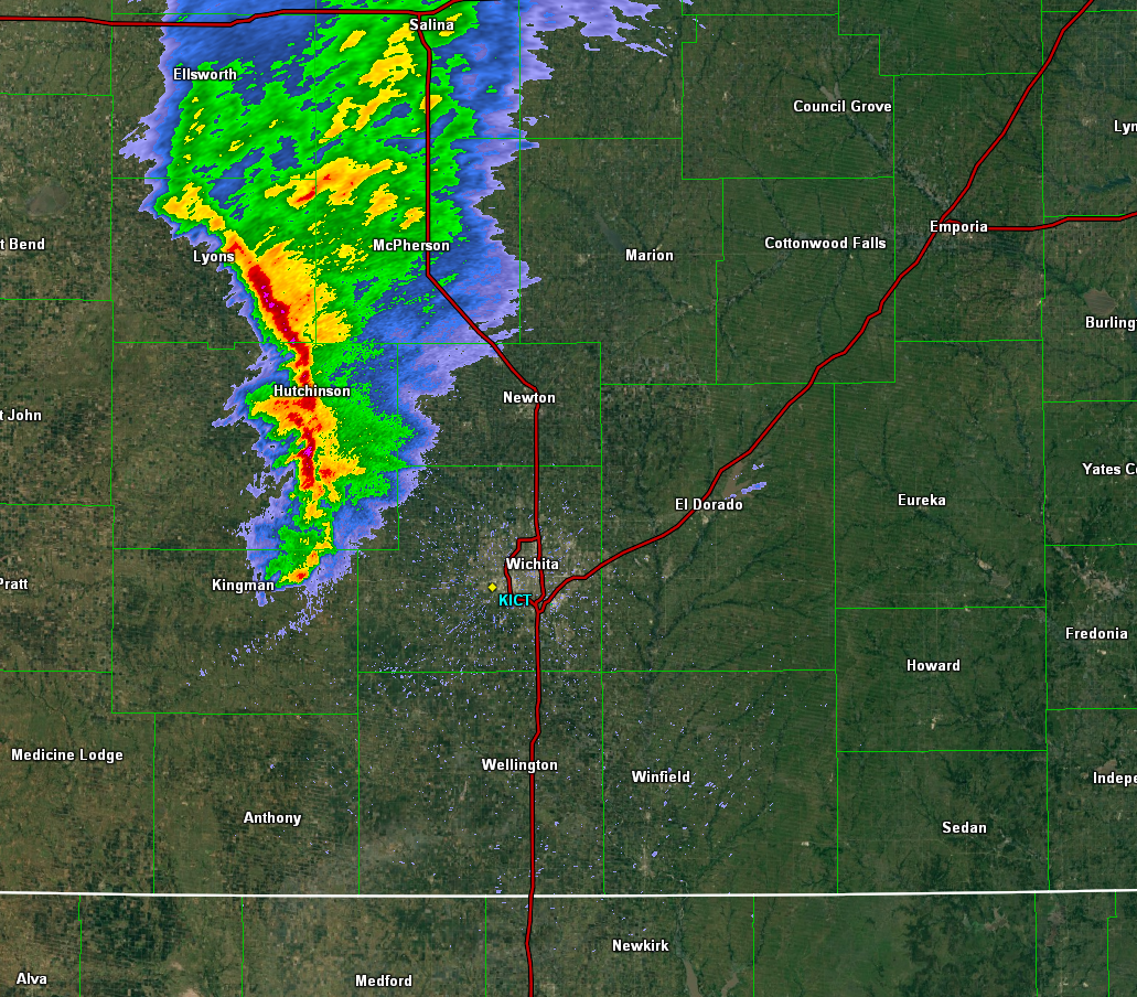 Reflectivity at 11:40pm showing a bowing feature moving into Sedgwick and Harvey counties Reflectivity at 11:40pm showing a bowing feature moving into Sedgwick and Harvey counties |
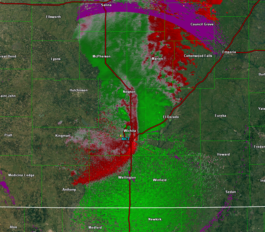
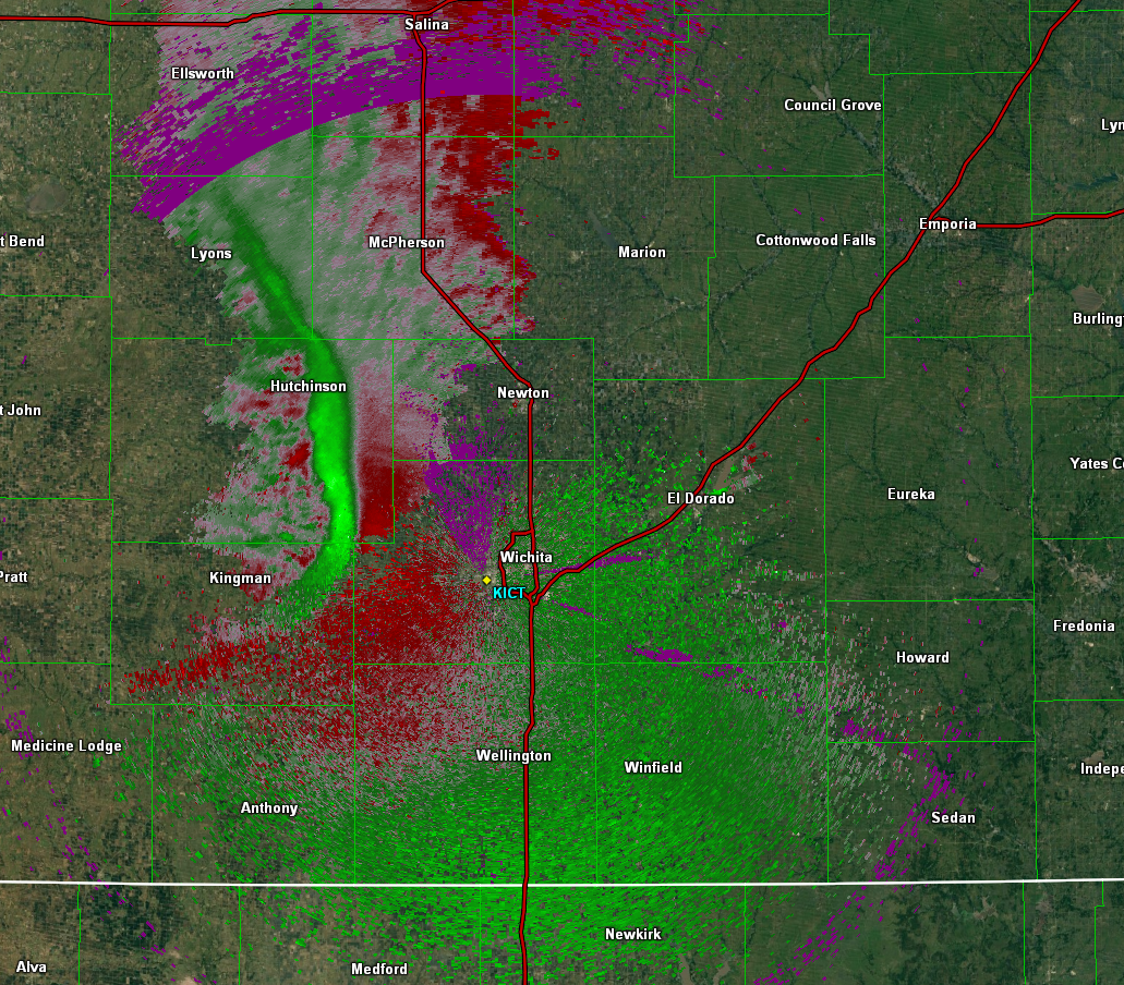 Base Velocity at 11:40pm showing the bright band of green, high velocities, moving towards the radar site in Wichita. |
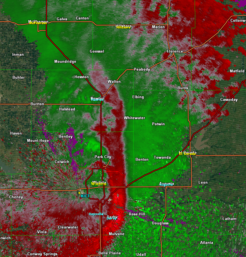
 Reflectivity at 12:19am showing smaller bowing features along the main bowing segment along I-135. Reflectivity at 12:19am showing smaller bowing features along the main bowing segment along I-135. |
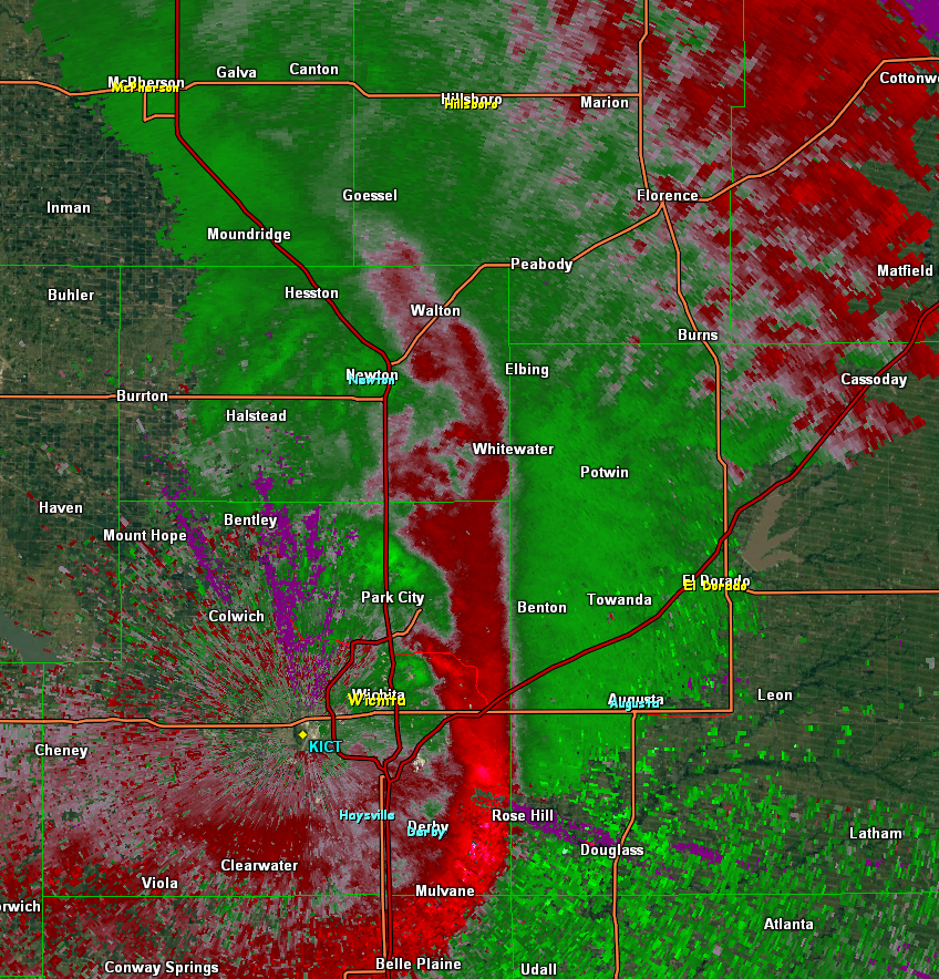
 Base Velocity at 12:19am showing a large area of 60-70 mph pushing south of Wichita and channeled microbursts developing across the northern Sedgwick and southern Harvey counties. |
 Base Velocity at 12:21am Base Velocity at 12:21am |
 Base Velocity at 12:24am |
 Base Velocity at 12:27am |
Straight Line Wind Damage Photos in Sedgwick County
|
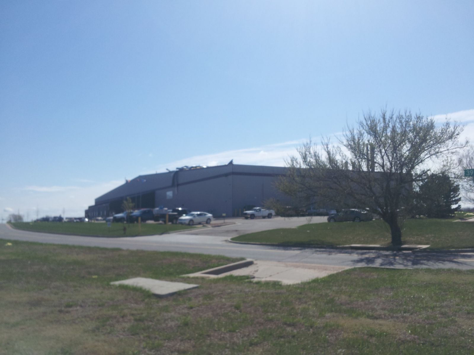
Damage at Jabara Airport to Hangar. Picture taken by NWS Wichita. |
Power lines down near Jabara Airport and Kansas Heart Hospital near Webb and K-96. Picture taken by NWS Wichita |
Roof Damage near 39th and Tobin. Picture taken by NWS Wichita |
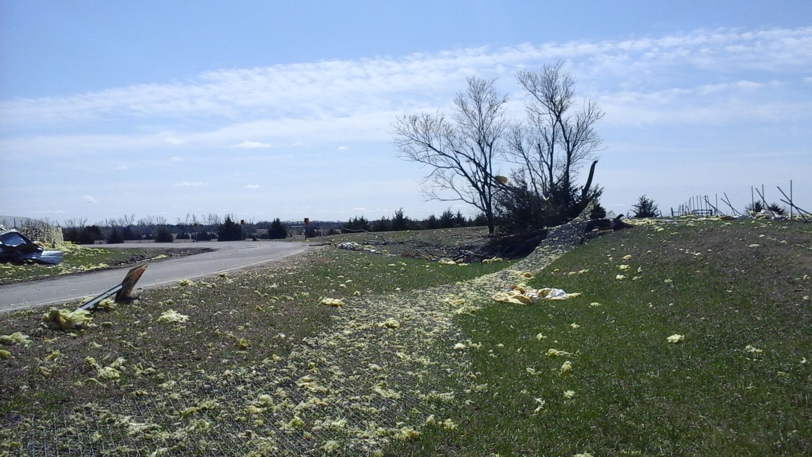
Unanchored Mobile Home rolled 25ft near 127th and 37th St. Picture taken by NWS Wichita |
|||
|
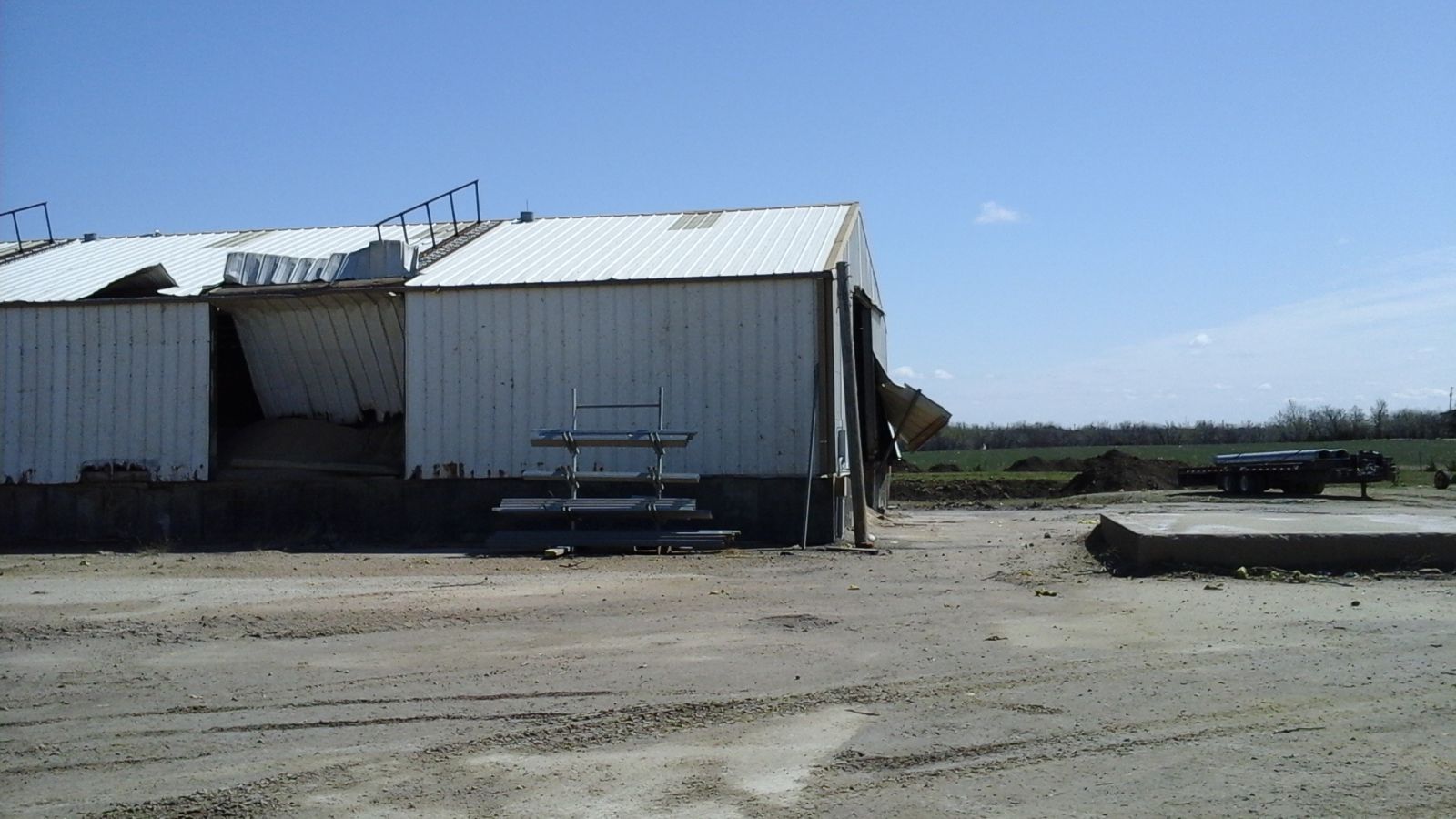
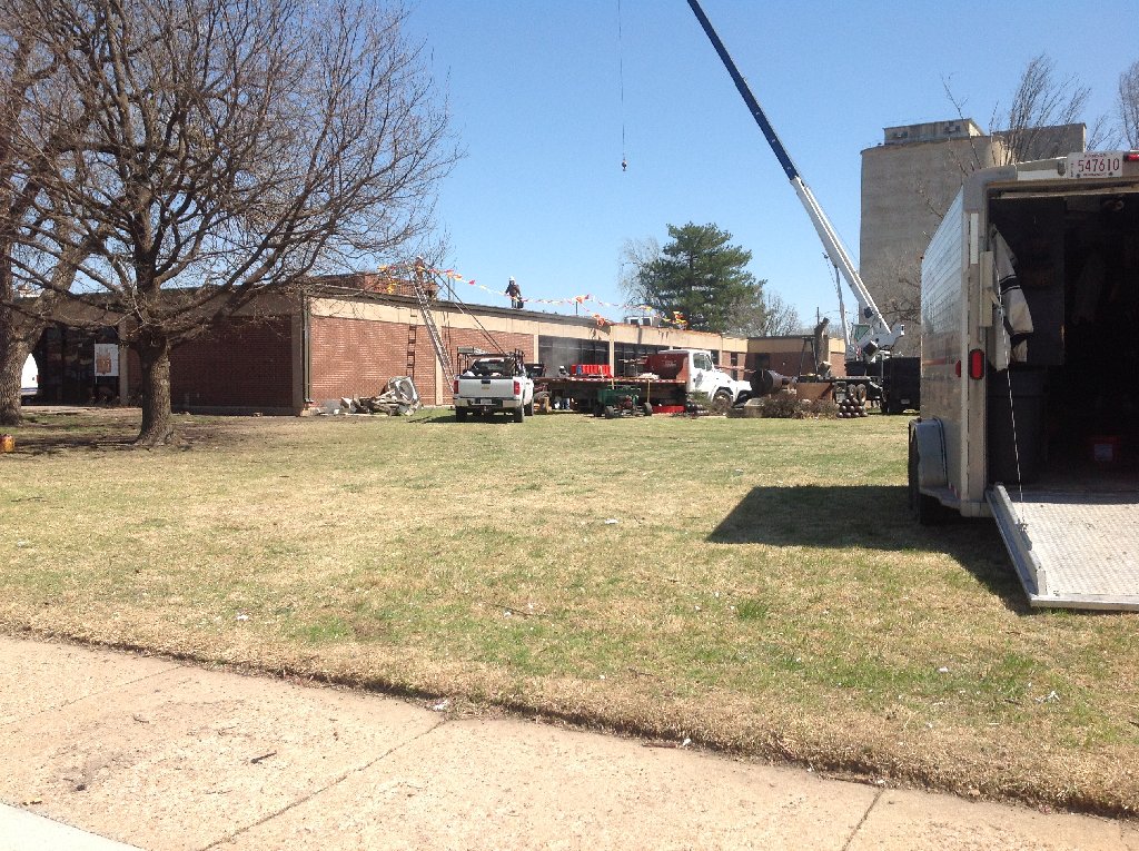
Damage to Building east of Jabara Airport. Picture taken by NWS Wichita. |
Empty Trailer rolled across the road. Picture taken by NWS Wichita |
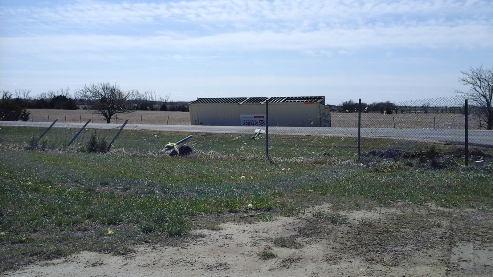
Debris from Jabara Airport. Picture taken by NWS Wichita |
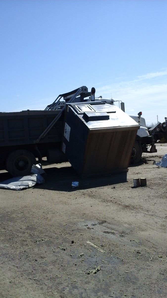
Dumpster blown into Truck at Maintenance facility east of Jabara Airport. Picture taken by NWS Wichita |
|||
|
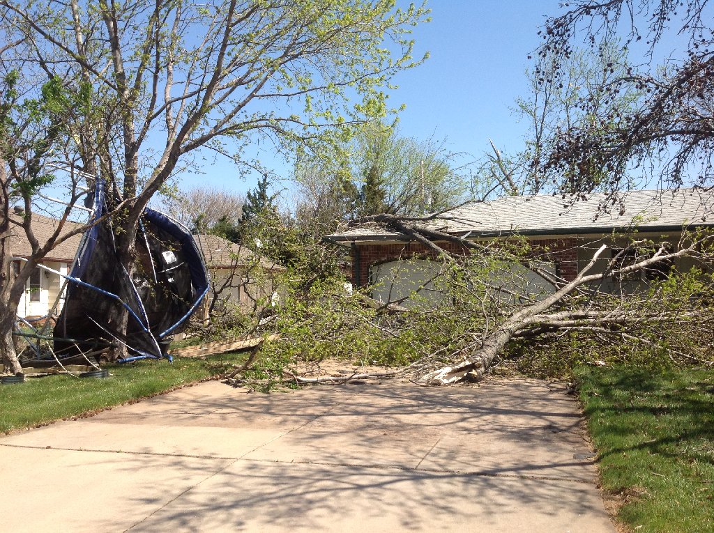
Tree damage in north Wichita. Picture taken by NWS Wichita. |
Tree damage in north Wichita. Picture taken by NWS Wichita |
Tree damage in north Wichita. Picture taken by NWS Wichita |
Map showing where some of the tree and shingle damage was in the previous pictures in north Wichita. |
|||
Straight Line Wind Damage Photos in Harvey County
|
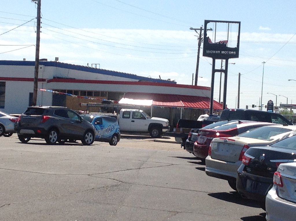
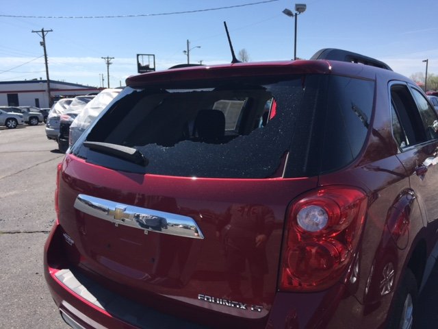
Damage to a car dealership in Newton. Picture taken by NWS Wichita. |
Vehichle damaged at car dealership. Picture taken by NWS Wichita |
Roof damage to the Newton Library. Picture taken by NWS Wichita |
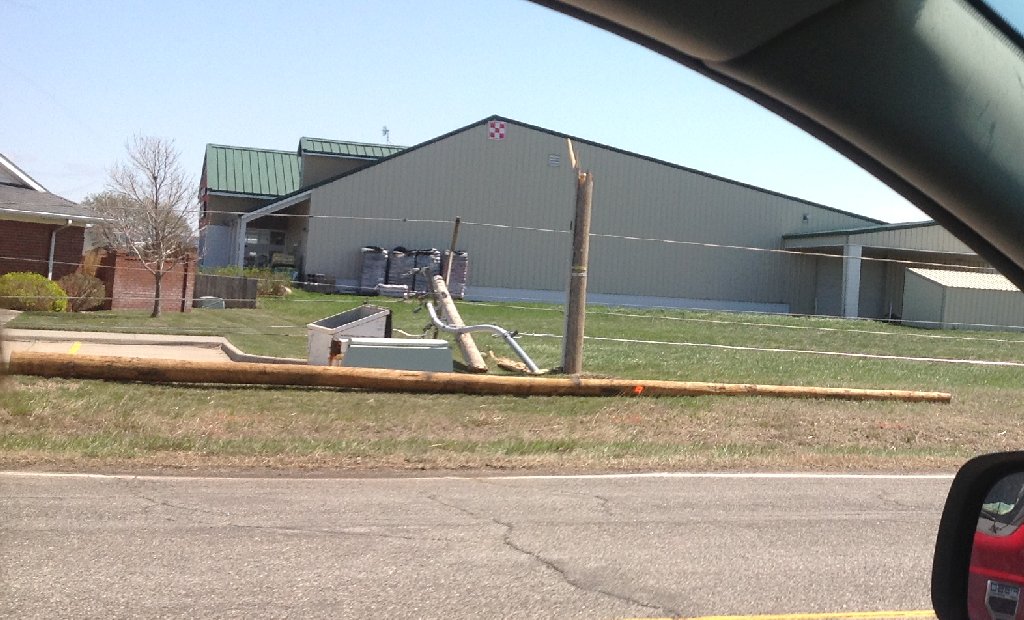
Power poles snapped in Newton. Picture taken by NWS Wichita |
|||
|
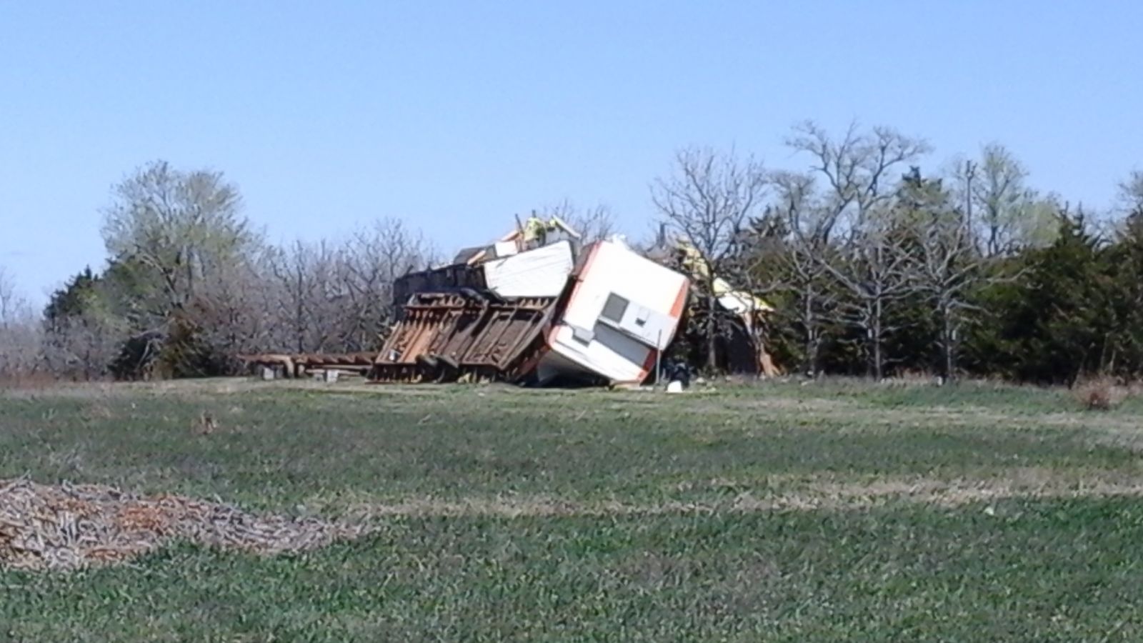
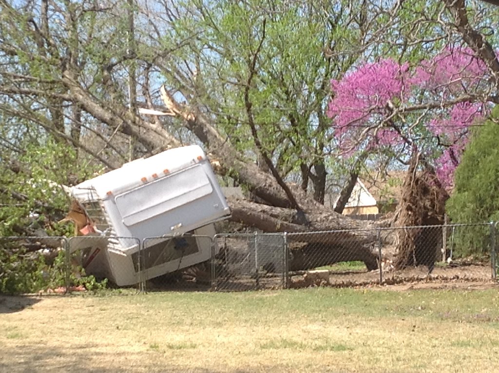
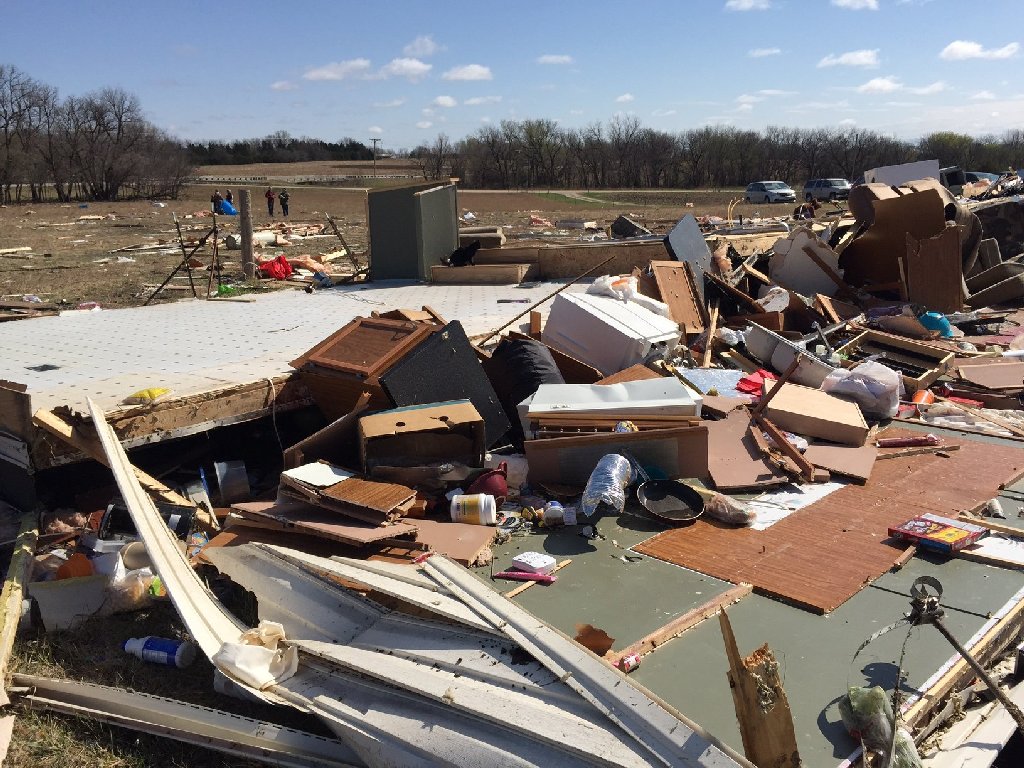
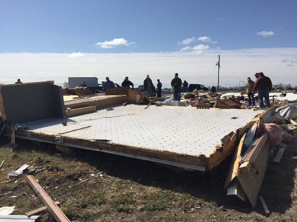
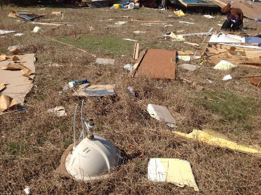
Trailer damage in Harvey county. Picture taken by NWS Wichita. |
Trailer damage in Harvey county. Picture taken by NWS Wichita. |
Trailer damage in Harvey county. Picture taken by NWS Wichita. |
Trailer damage in Harvey county. Picture taken by NWS Wichita. |
|||
|
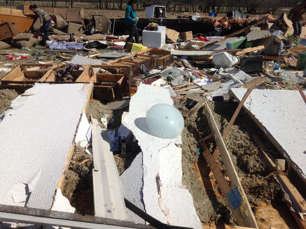
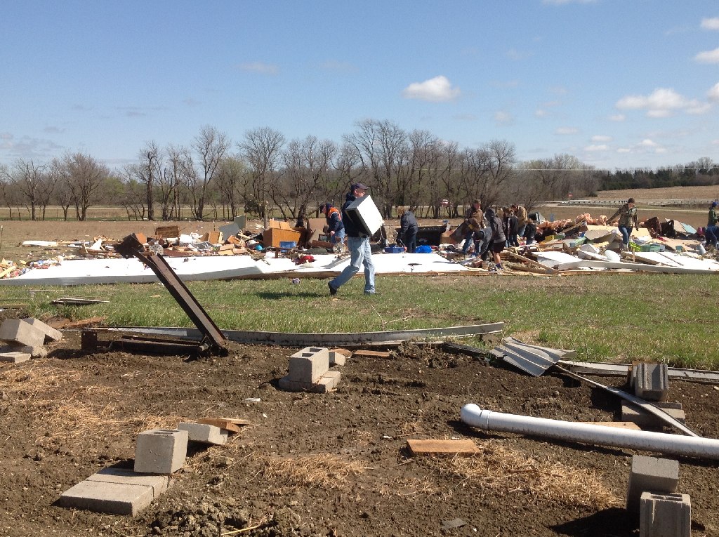
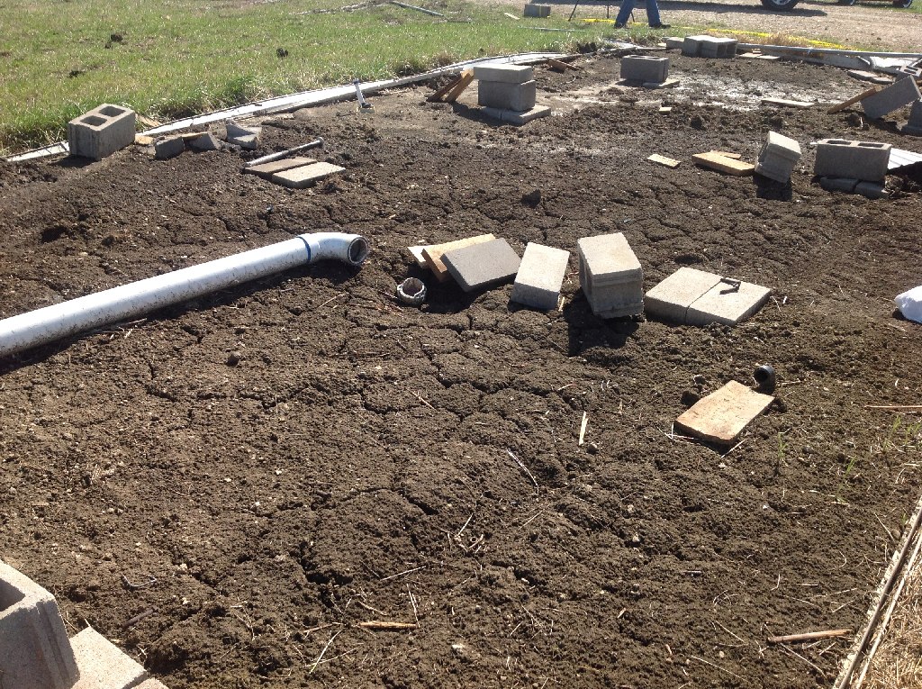
Trailer damage in Harvey county. Picture taken by NWS Wichita. |
Trailer damage in Harvey county. Picture taken by NWS Wichita. |
Trailer damage in Harvey county. Picture taken by NWS Wichita. |
Trailer damage in Harvey county. Picture taken by NWS Wichita. |
|||
Butler County
|
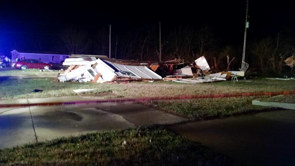
Mobile home destroyed in Douglass Kansas. Picture courtesy of Butler County Emergency Management. |