Wichita, Kansas
Weather Forecast Office
Overview
|
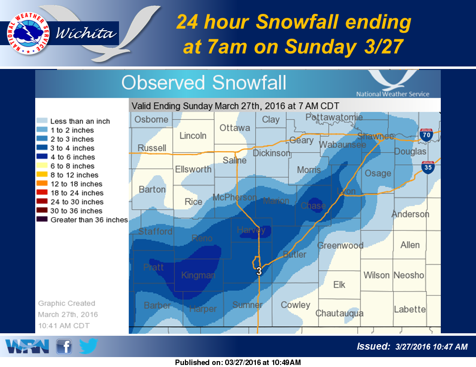
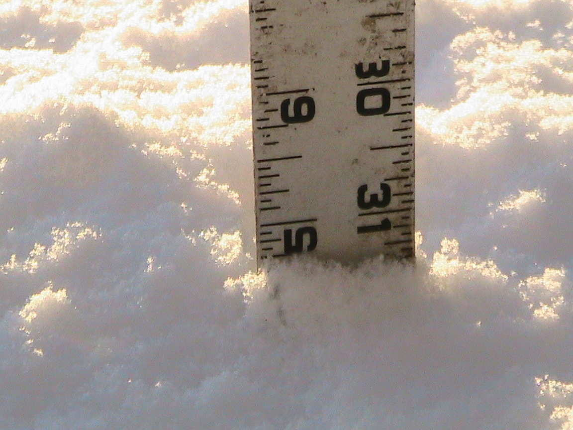
A strong weather system raced across the region early Sunday morning and blanketed southern Kansas with one to four inches of wet snow. A few locations witnessed even higher totals of five and six inches. Even though the period of snow fall was brief last night, it came down at a high rate due to embedded thunder snow at times. |
 Caption |
|
|
|
Photos & Video:
Header
 |
 |
 |
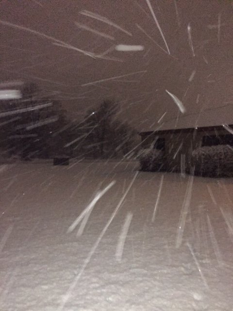 |
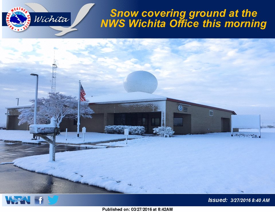
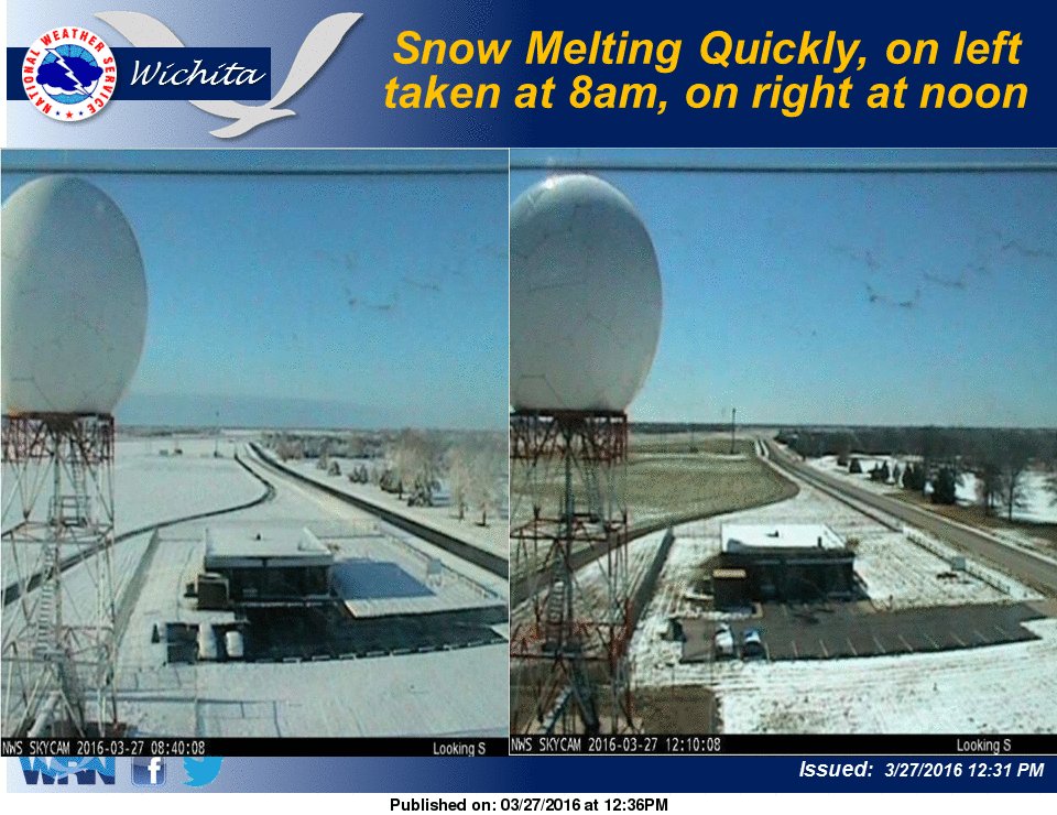
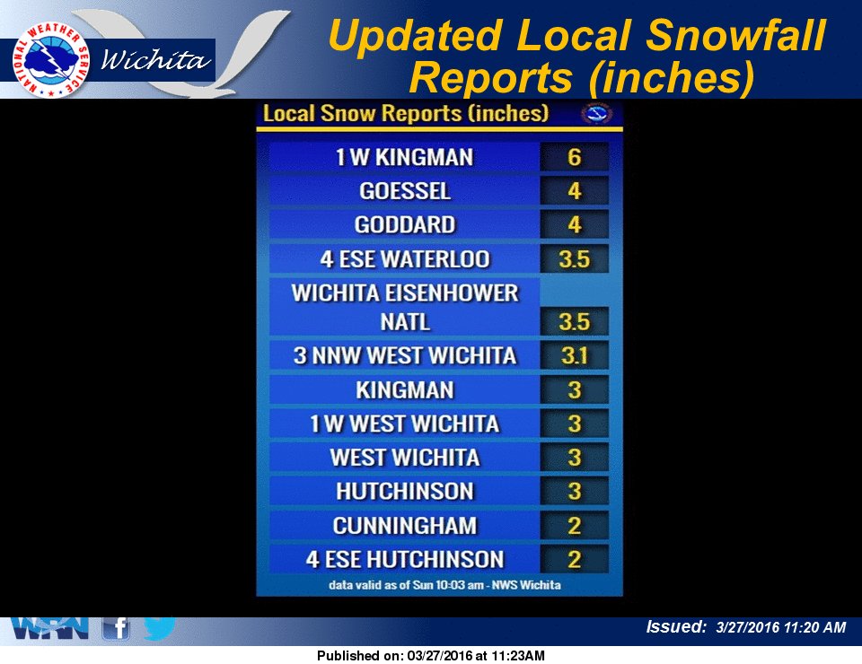
| NWS Wichita skycam pic showing how quickly the snow melted | Snowfall amounts from March 27th 2016 | Snowfall reports | Picture taken by meteorologist Mick McGuire while out measuring snow at the NWS office early Sunday morning |
 |
|
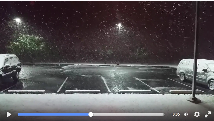 |
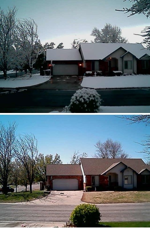
| Morning vs afternoon picture showing how fast the snow melted. Pic taken by Kevin Darmofal | Morning vs afternoon picture showing how quickly the snow melted. Pic by TJ Rigg (@TJ_Rigg) | Video from the NWS Wichita during some of the heaviest snow |
 |
 |
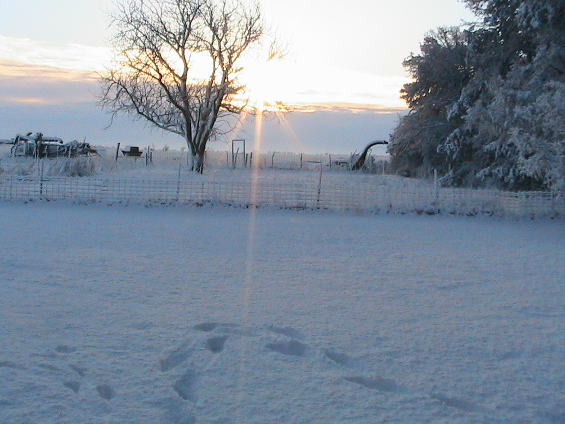
| Morning snow over Kingman county. Pic by JD Stewart | Snowfall measurement in Kingman county taken by JD Stewart |
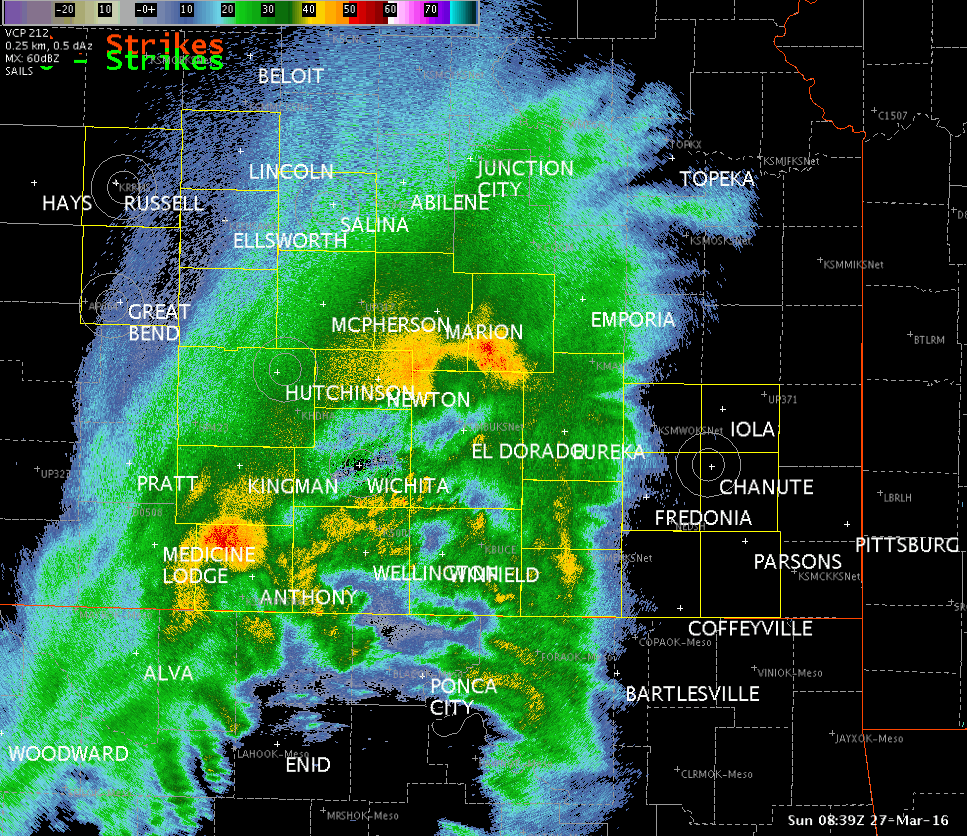
Radar & Satellite:
 |
 |
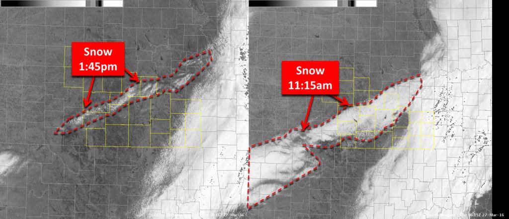 |
| Satellite animation showing the swath of snow and how quickly it started to melt | Radar animation as the heavy snow was affecting south central Kansas | Side by side satellite images showing how quickly the snow melted across south central Kansas |
 |
Media use of NWS Web News Stories is encouraged! Please acknowledge the NWS as the source of any news information accessed from this site. |
|
Hazards
Briefing pages
Local weather story
Submit a storm report
Storm Prediction Center
Enhanced Hazardous Weather Outlook
Hazardous Weather Outlook Text
Current Conditions
Local Radar
National Radar
Satellite
Hourly weather(text)
Precip Analysis
Snowfall analysis
This day in weather history
7 Day Lightning Archive
Forecasts
Forecast Discussion
Weather Story
Fire Weather
Activity Planner
Aviation Weather
Soaring Forecast
Hurricane Center
Graphical Forecasts
Regional Weather Summary
Probabilistic Snow
Probabilistic QPF
Wet Bulb Globe temp
Climate
Local Climate Page
Daily/Monthly data(F6)
Daily Records
Climate Normals
Local drought page
Latest Climate Report(ICT)
Latest Climate Report(SLN)
Latest Climate Report(CNU)
CoCoRaHS
7 Day Lightning Archive
US Dept of Commerce
National Oceanic and Atmospheric Administration
National Weather Service
Wichita, Kansas
2142 S. Tyler Road
Wichita, KS 67209-3016
316-942-3102
Comments? Questions? Please Contact Us.

