September 2020 Climate Summary and Highlights
|
Overall, September 2020 was cooler and drier than normal across the region. Below are some monthly climate highlights for Wichita, Salina and Chanute. WICHITA SALINA CHANUTE |
September Temperatures
| Monthly Average Temperature | Monthly Departure from Normal |
 |
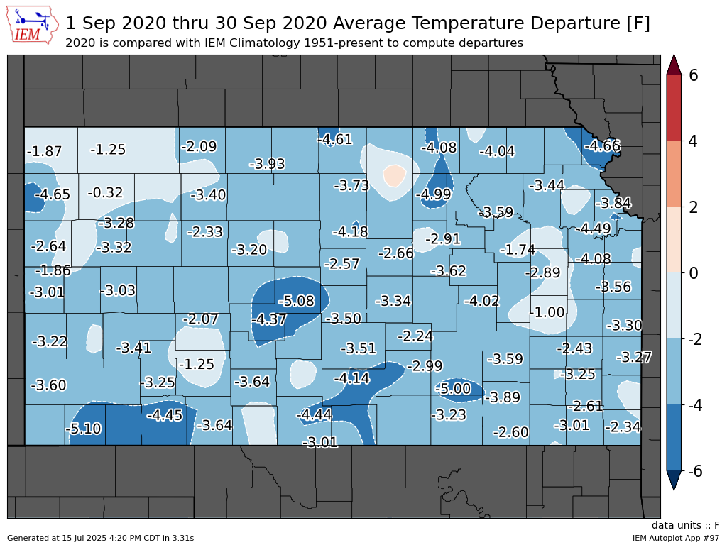 |
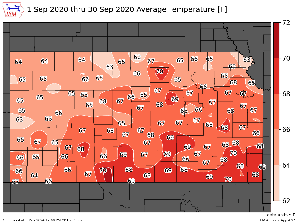
| September 2020 average temperatures across Kansas (the average of each daily high and low temperature). | September 2020 average temperature departure from normal across Kansas. It was a cooler than normal month statewide. |
| Kansas September Temperature Rankings |
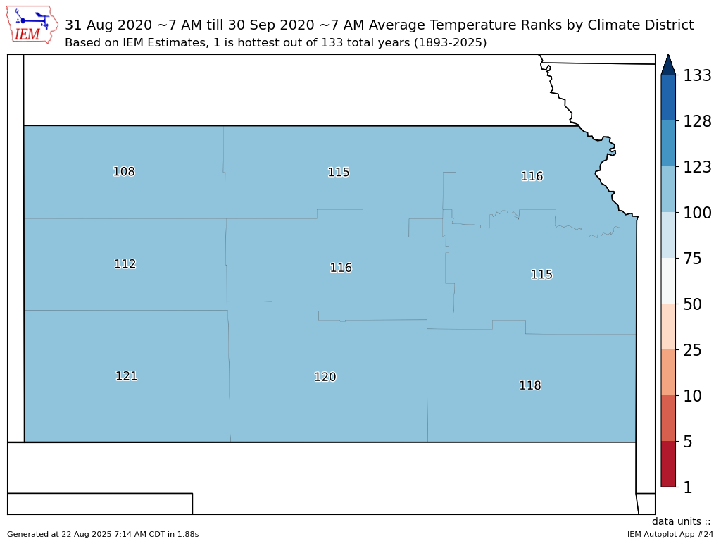 |
| Kansas September 2020 temperature rankings by division. One denotes the warmest September on record (since 1893), 128 denotes the coolest. Much of the state was much cooler than normal. |
September Precipitation
| Monthly Precipitation | Monthly Departure from Normal |
 |
 |
| September 2020 precipitation across Kansas. This map constitutes a mix of observations and radar estimates. | September 2020 precipitation departure from normal across Kansas. With the exception of a few small pockets across the southeast, much of the state was drier than normal for the month, especially the east. |
|
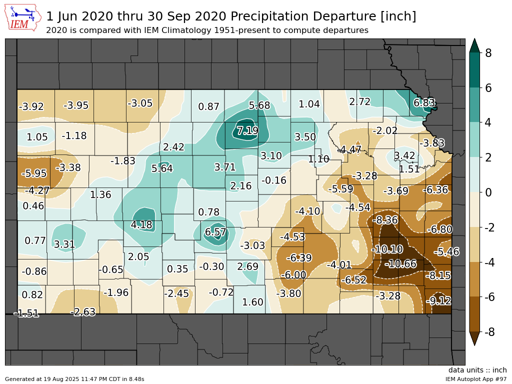
Kansas Precipitation Departure from Normal June-September |
Kansas Precipitation Departure from Normal August-September |
 |
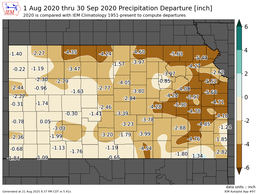 |
| Portions of southeast Kansas are around 10 inches drier than normal since June 1st. | Much of the state is much drier than normal since August 1st, especially the northeast half. |
|
Kansas September Precipitation Rankings |
 |
| Kansas September 2020 precipitation rankings by division. One denotes the wettest September on record (since 1893), 128 denotes the driest. The entire state saw a drier than normal month. |
Miscellaneous Climate Information
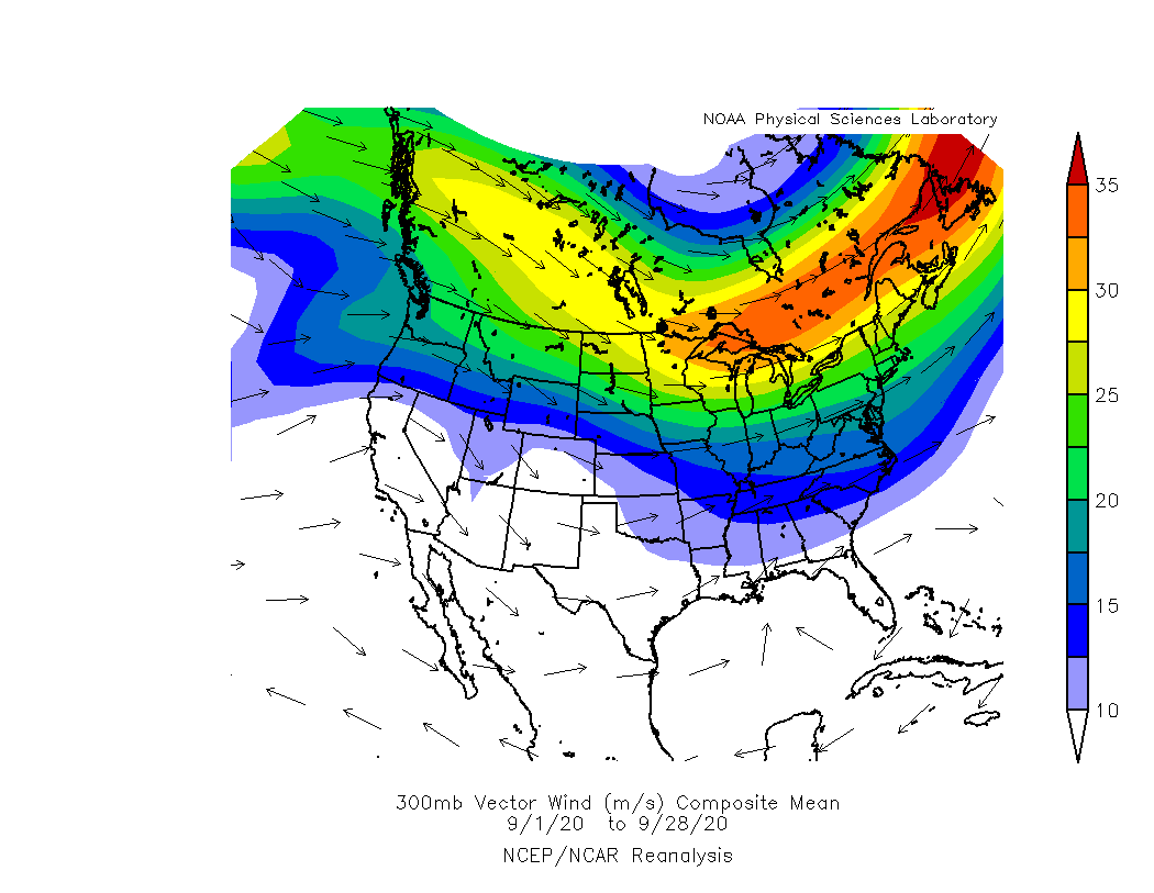
| Mean Jet Stream Location | Moisture Anomaly |
 |
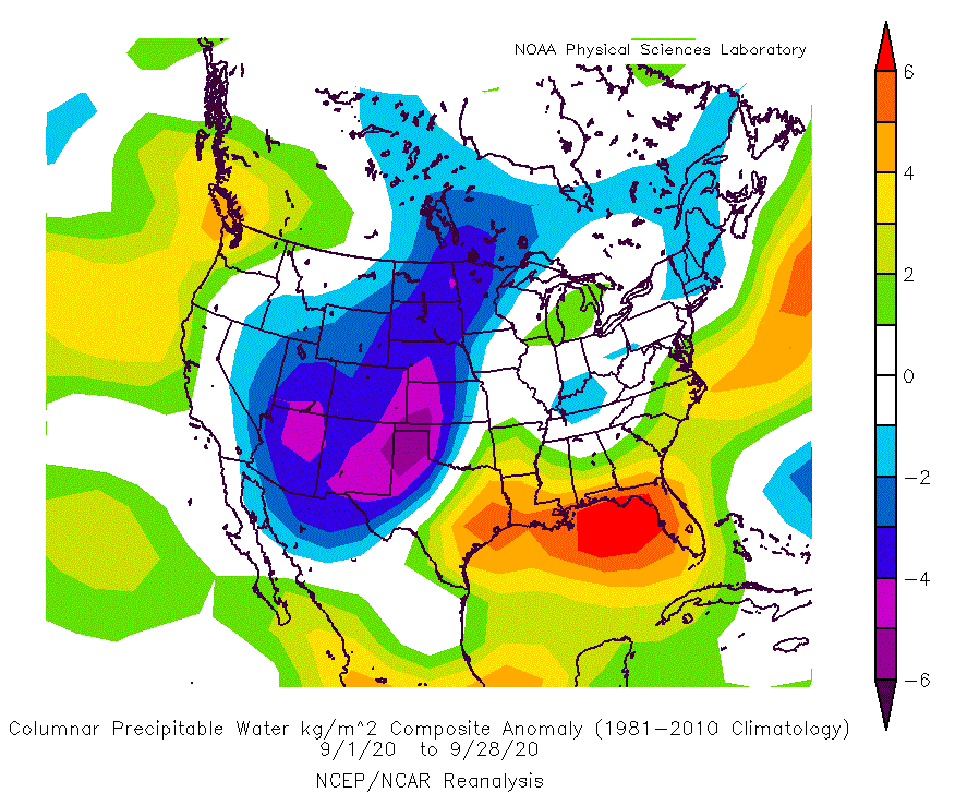 |
| During the month of September, the jet stream continued to mainly be focused across the northern U.S. However, towards the end of the month, it started to dip south into the eastern U.S., which helped bring some cooler air to the Central Plains. | The amount of moisture in the atmosphere was well below normal during the month of September, which continues the dry trend from August. |
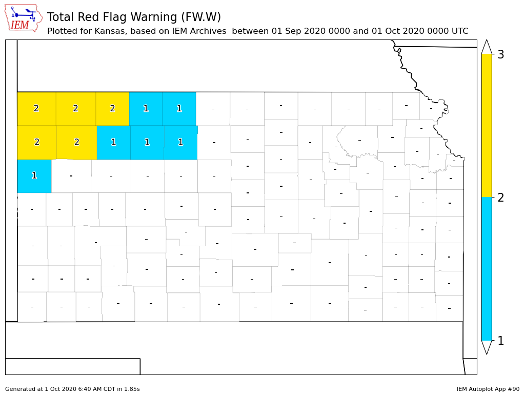
| September Red Flag Warnings | September Severe Thunderstorm Warnings |
 |
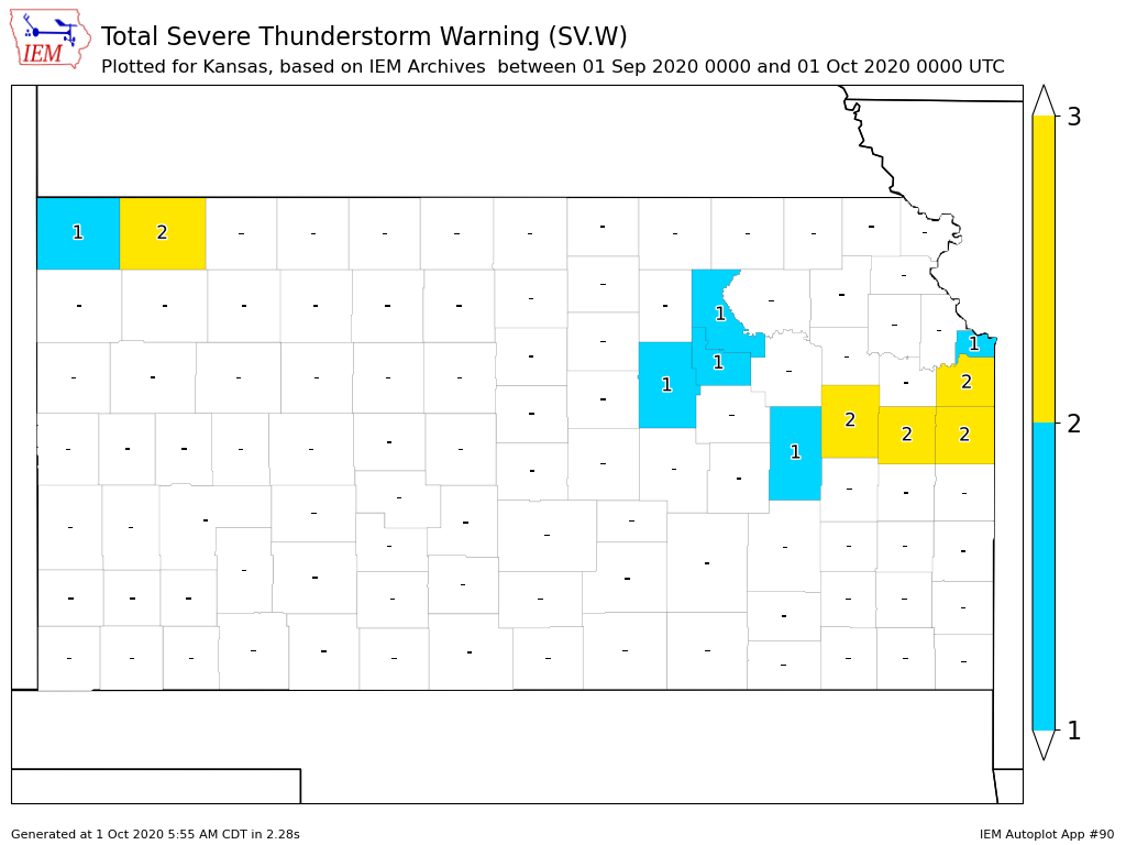 |
| Due to the recent dry weather, fire weather concerns increased some across parts of the state, especially northwest Kansas. The map above shows the number of Red Flag Warnings issued during the month of September. | The above map shows the number of Severe Thunderstorm Warnings issued for each county in Kansas during the month of September. Overall, it was a very quiet month across the state for severe weather. |
 |
Media use of NWS Web News Stories is encouraged! Please acknowledge the NWS as the source of any news information accessed from this site. |
|

