Wichita, Kansas
Weather Forecast Office
Overview
|
One of the most significant hail storms to affect the Wichita area took place during the morning rush hour on Monday April 24th. Supercells rapidly developed around 6:30 am just west of Wichita and carved a path through town during the morning commute. Widespread baseball size hail caused 70 million dollars in damage across Wichita. |
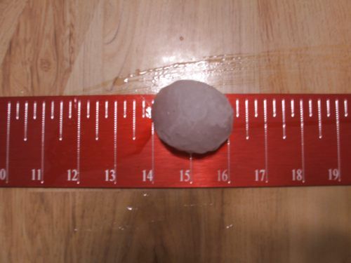
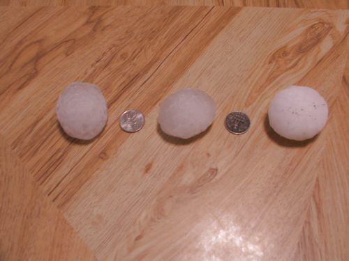 Large hail from the Maple and Maize area of Wichita |
Photos
 |
 |
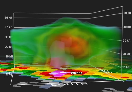 |
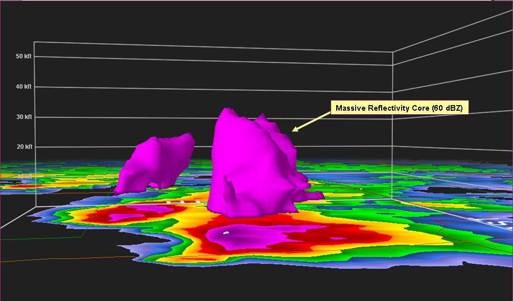
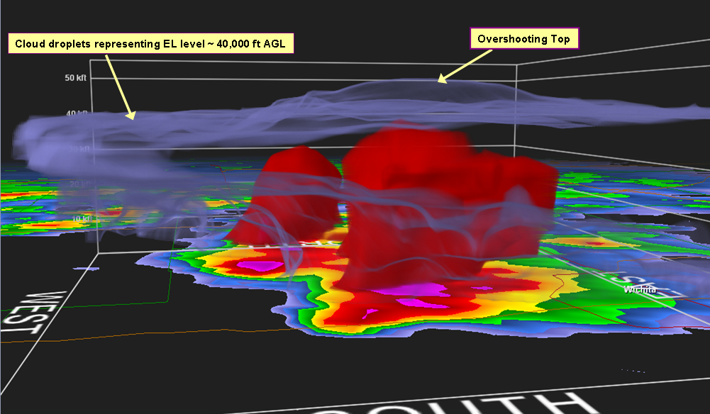
| 2 inch hail from the Maple and Maize area in Wichita | Radar from the radar located at Vance AFB | 3-D radar image of the storm |
 |
 |
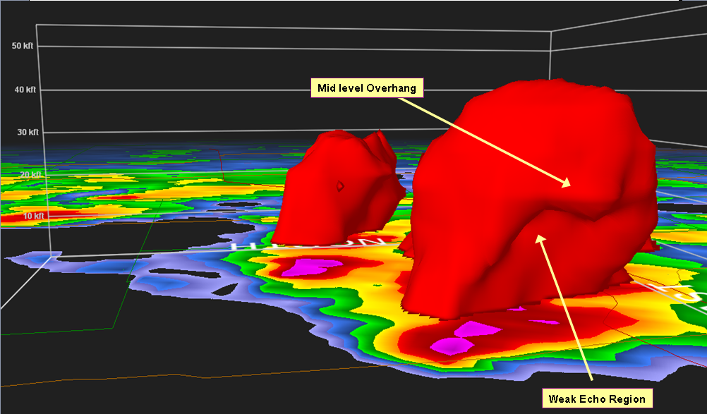 |
| 3-D radar image of the storm | 3-D radar image of the storm | 3-D radar image of the storm |
|
A more detailed description of this event from Storm Data |
||
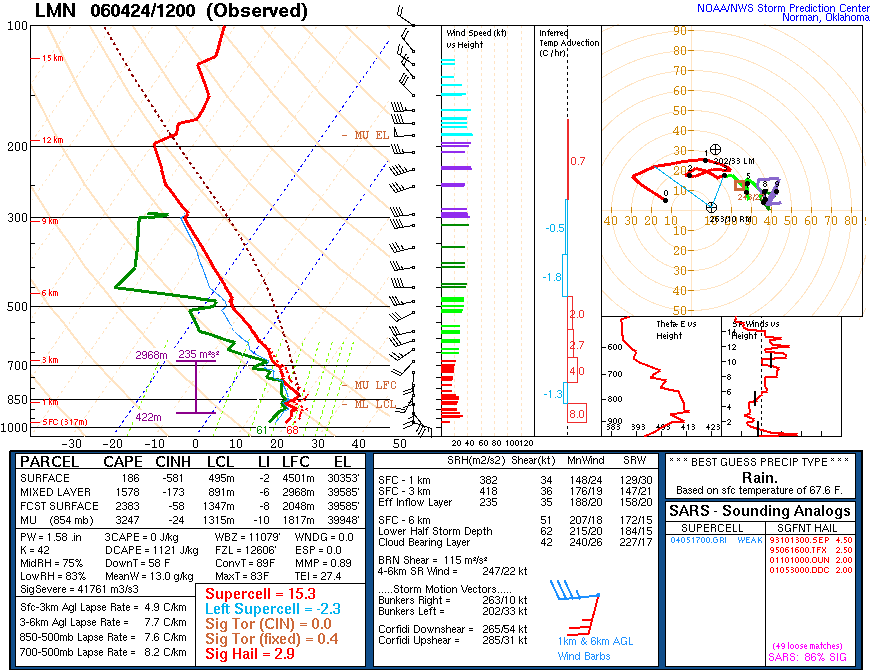
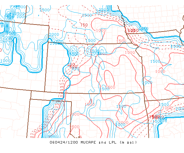
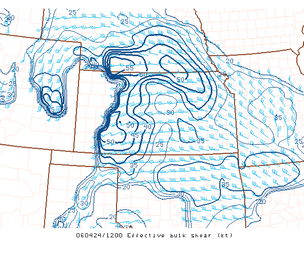
Environment
 |
 |
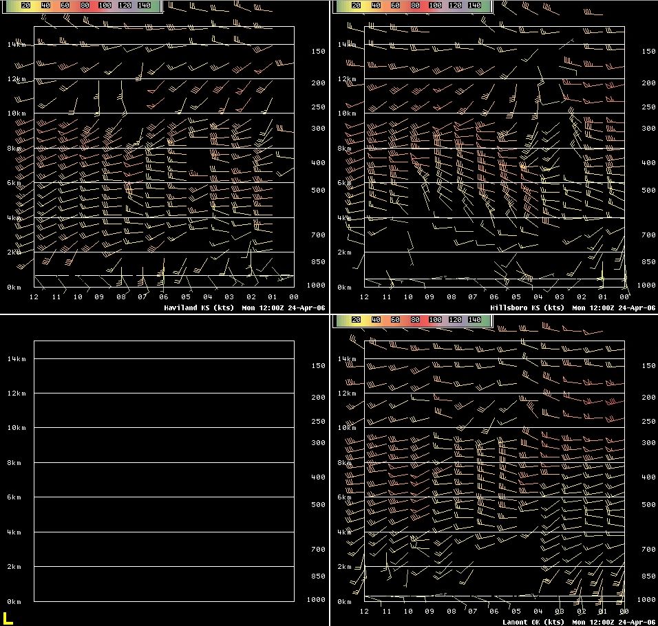 |
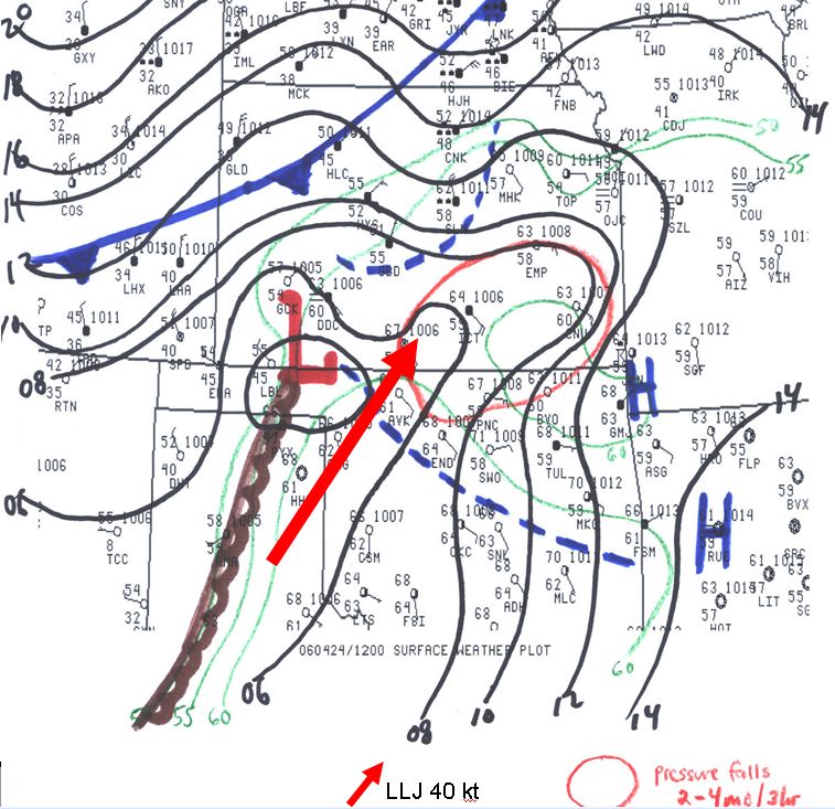
| surface map | Lamont Oklahoma sounding | Wind profiler data |
 |
 |
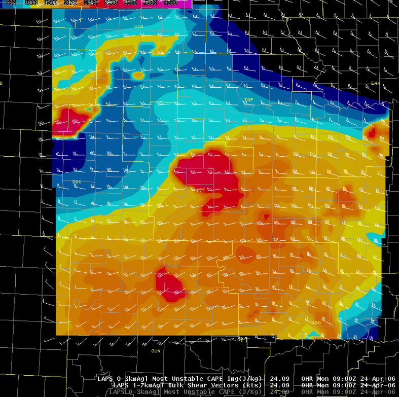 |
| Most Unstable CAPE | Effective Bulk Shear | Bulk shear with most unstable CAPE |
 |
Media use of NWS Web News Stories is encouraged! Please acknowledge the NWS as the source of any news information accessed from this site. |
|
Hazards
Briefing pages
Local weather story
Submit a storm report
Storm Prediction Center
Enhanced Hazardous Weather Outlook
Hazardous Weather Outlook Text
Current Conditions
Local Radar
National Radar
Satellite
Hourly weather(text)
Precip Analysis
Snowfall analysis
This day in weather history
7 Day Lightning Archive
Forecasts
Forecast Discussion
Weather Story
Fire Weather
Activity Planner
Aviation Weather
Soaring Forecast
Hurricane Center
Graphical Forecasts
Regional Weather Summary
Probabilistic Snow
Probabilistic QPF
Wet Bulb Globe temp
Climate
Local Climate Page
Daily/Monthly data(F6)
Daily Records
Climate Normals
Local drought page
Latest Climate Report(ICT)
Latest Climate Report(SLN)
Latest Climate Report(CNU)
CoCoRaHS
7 Day Lightning Archive
US Dept of Commerce
National Oceanic and Atmospheric Administration
National Weather Service
Wichita, Kansas
2142 S. Tyler Road
Wichita, KS 67209-3016
316-942-3102
Comments? Questions? Please Contact Us.