Wichita, Kansas
Weather Forecast Office
April 3rd, 2011
|
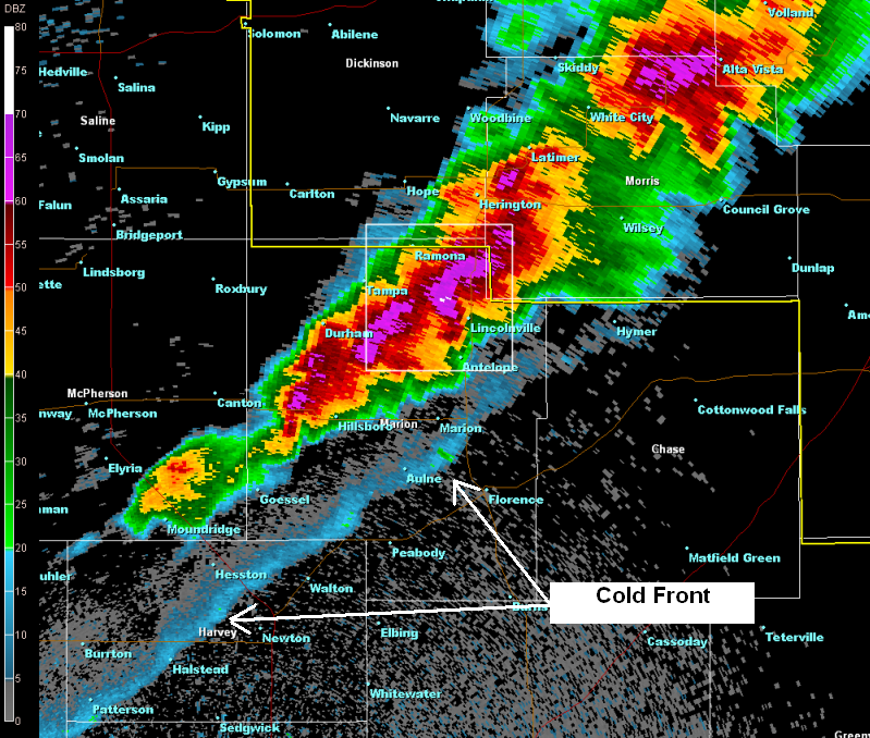
What happened: Severe storms brought hail up to hen egg size and 70 mph winds to parts of East-Central Kansas. In Marion County up to two inch diameter hail was reported. Meanwhile severe straight-line winds knocked down multiple power poles northwest of El Dorado. Behind the cold front, northwest winds (not associated with storms) gusted to around 50 mph across Central and South Central Kansas.
|
|
|
|
|
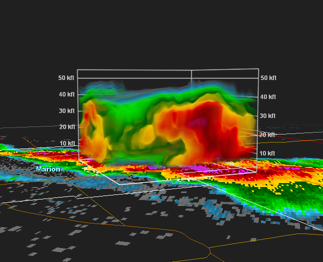
3-D view of the storm over Marion County showing the core of the storm extending over 40,000 ft |
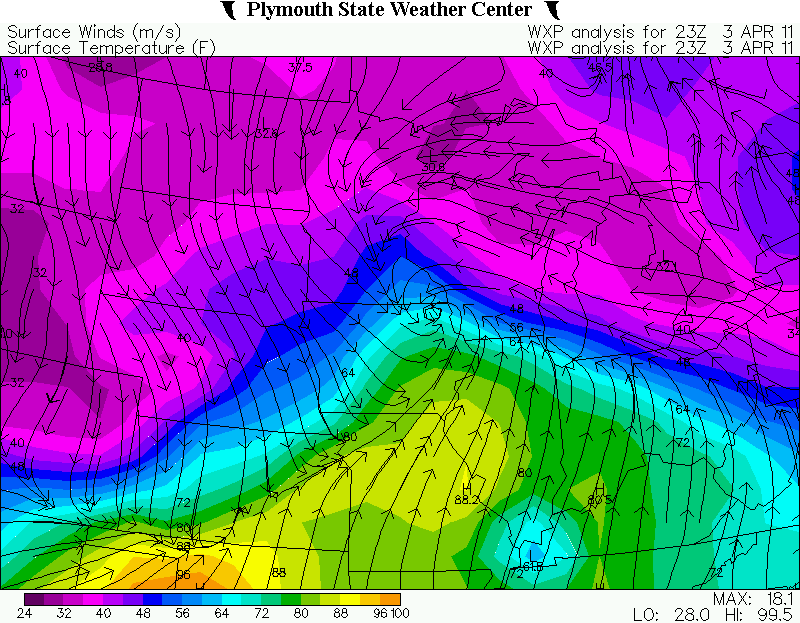
Surface analysis from 6 pm on April 3rd showing the strong cold front surging through Kansas |
|
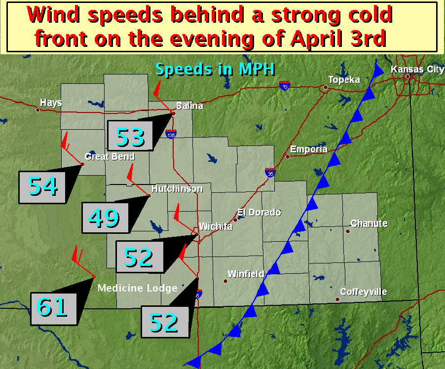
Winds behind the cold front, not associated with storms, often gusted to around 50 mph. |
Photos
|
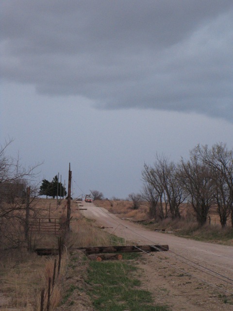
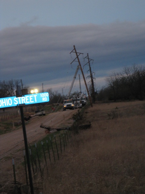
Power poles blown down northwest of El Dorado. Picture courtesy Butler County Emergency Management. |
Power poles blown down northwest of El Dorado. Picture courtesy Butler County Emergency Management. |
Hazards
Briefing pages
Local weather story
Submit a storm report
Storm Prediction Center
Enhanced Hazardous Weather Outlook
Hazardous Weather Outlook Text
Current Conditions
Local Radar
National Radar
Satellite
Hourly weather(text)
Precip Analysis
Snowfall analysis
This day in weather history
7 Day Lightning Archive
Forecasts
Forecast Discussion
Weather Story
Fire Weather
Activity Planner
Aviation Weather
Soaring Forecast
Hurricane Center
Graphical Forecasts
Regional Weather Summary
Probabilistic Snow
Probabilistic QPF
Wet Bulb Globe temp
Climate
Local Climate Page
Daily/Monthly data(F6)
Daily Records
Climate Normals
Local drought page
Latest Climate Report(ICT)
Latest Climate Report(SLN)
Latest Climate Report(CNU)
CoCoRaHS
7 Day Lightning Archive
US Dept of Commerce
National Oceanic and Atmospheric Administration
National Weather Service
Wichita, Kansas
2142 S. Tyler Road
Wichita, KS 67209-3016
316-942-3102
Comments? Questions? Please Contact Us.