|
June 27th, 2013 Severe Damaging Wind Event
|
The combination of a very HOT afternoon (highs ranged from 110 to 104), mixed with a cold front to cause severe thunderstorms to develop during the late afternoon hours in central and western Kansas. Thunderstorms developed along the front, in central Kansas, and moved southeast during the evening hours. Due to relatively dry low levels, strong cold pools developed with these storms to cause very strong winds and a quick propagation of the storms across central and south central Kansas. As the initial discrete storms developed, large hail was also observed, but eventually it became a progressive, severe damaging wind event. As the squall line dove southeast, winds behind the gust front were extreme with speeds of 70 to 90 mph.
This storm system caused a wide swath of damage from Lincoln County in central Kansas, south through McPherson, and Wichita and finally exited the state near Interstate 35 into Oklahoma.
|
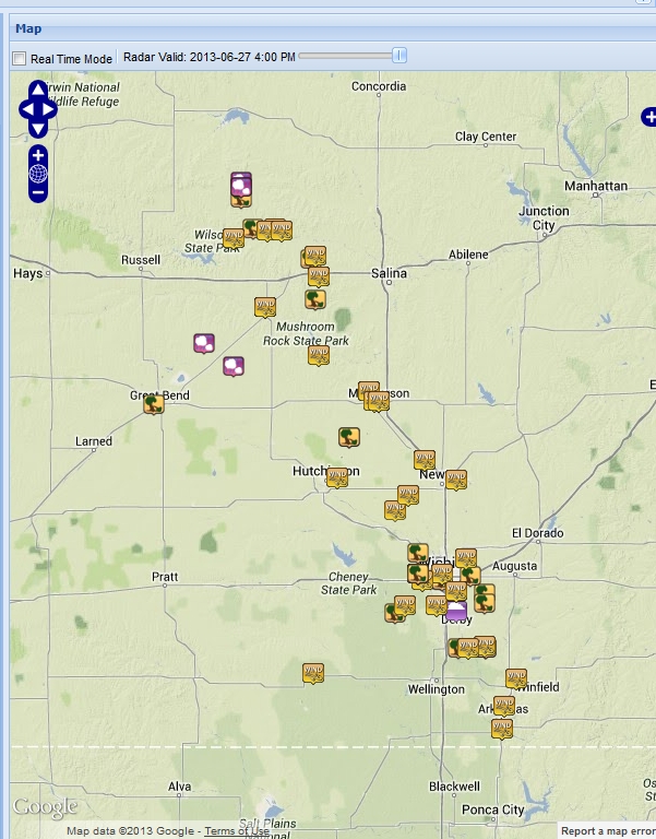
Map of Reports as of 9:15 am June 28th
Damage Images from Central Kansas
|

Damage near McPherson, KS.
Picture courtesy of Jeremy Cate
|

Damage near McPherson, KS.
Picture courtesy of Jeremy Cate.
|

Damage near McPherson, KS.
Picture courtesy of Jeremy Cate.
|
|

. Picture of an anemometer that was broken in McPherson, KS. Picture courtesy of Jeremy Cate.
|
|
|
|
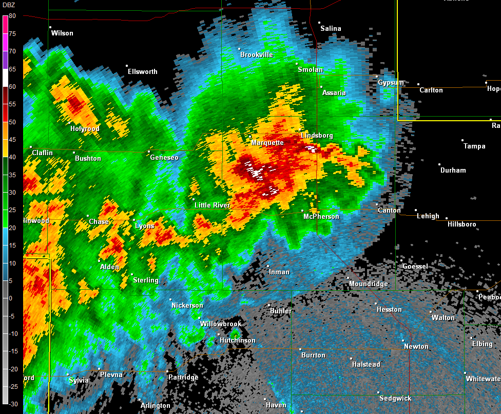
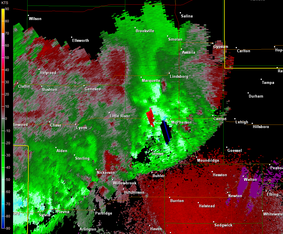
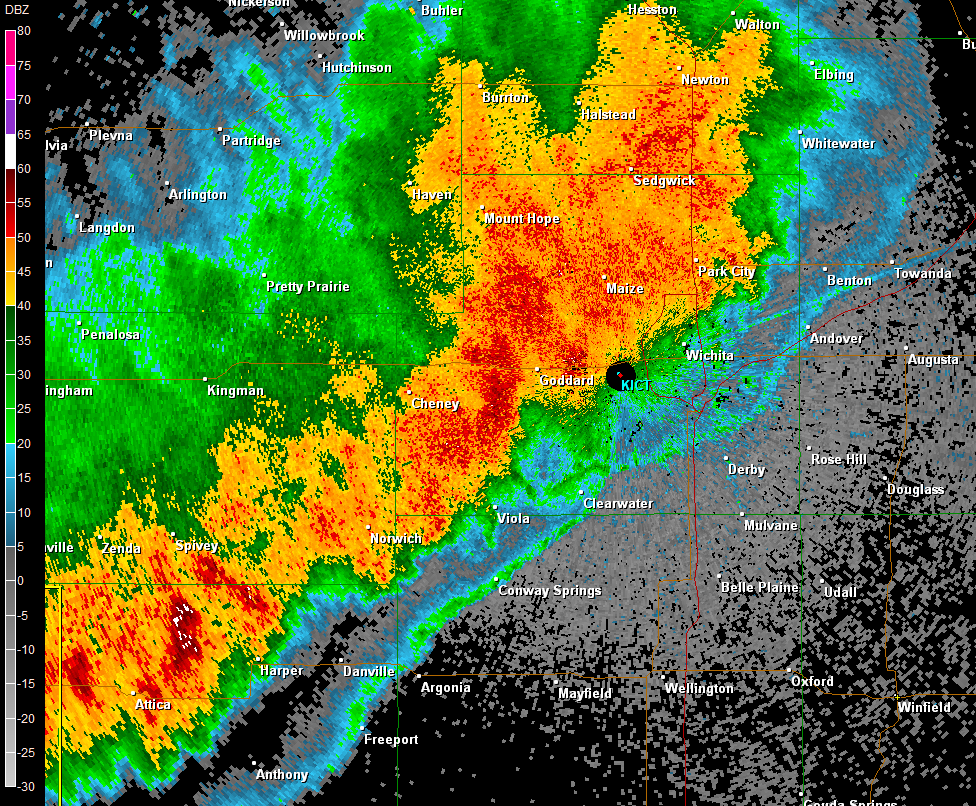
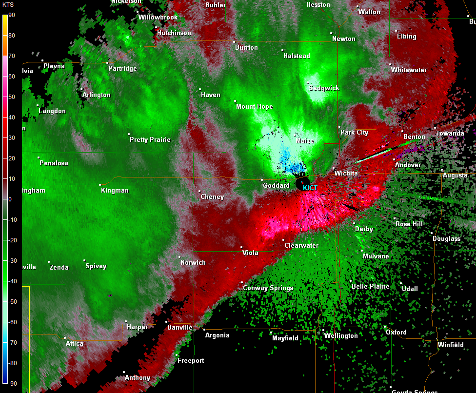
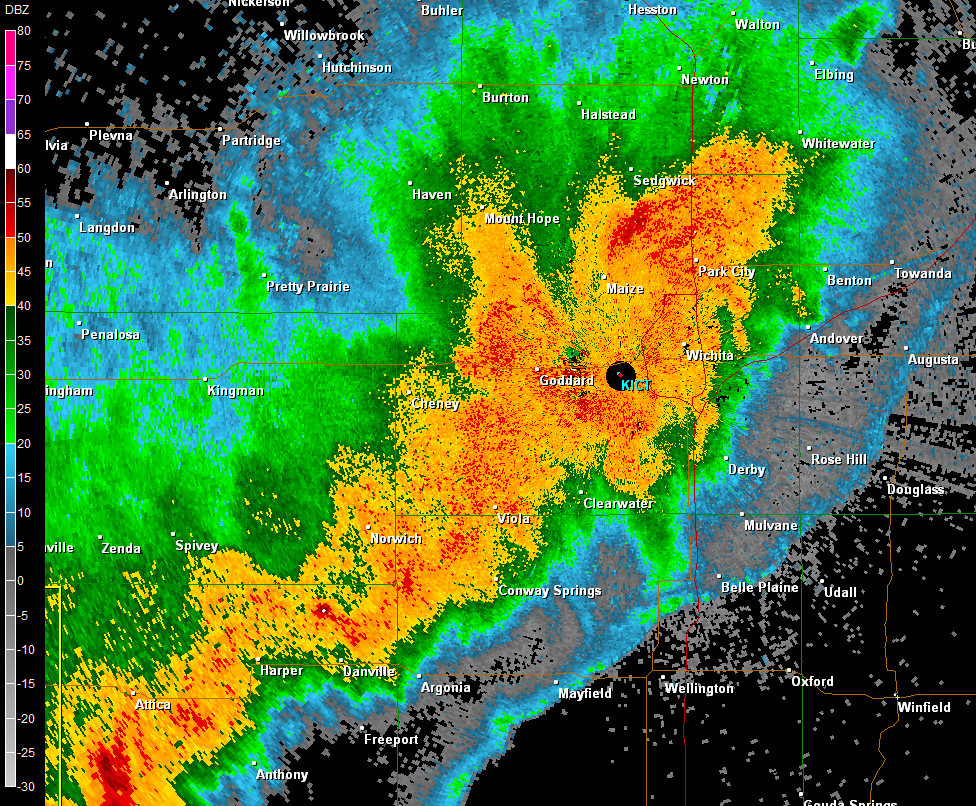
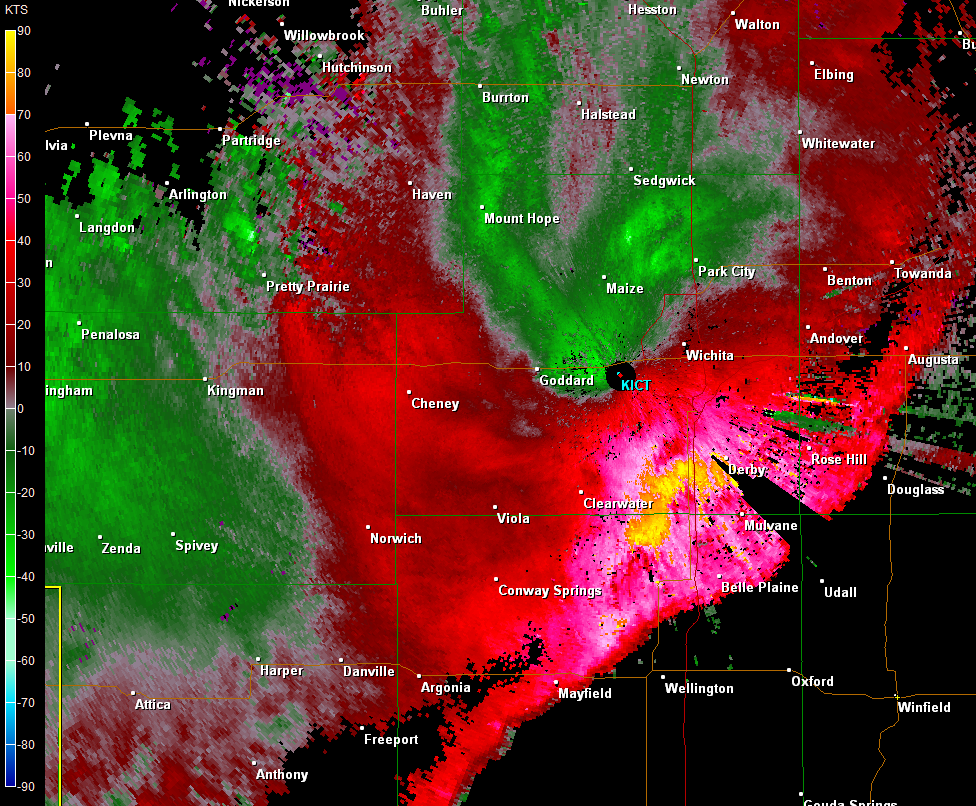
Radar images of the squall line moving across the area
|
Wind Damage and other Images near Wichita, KS
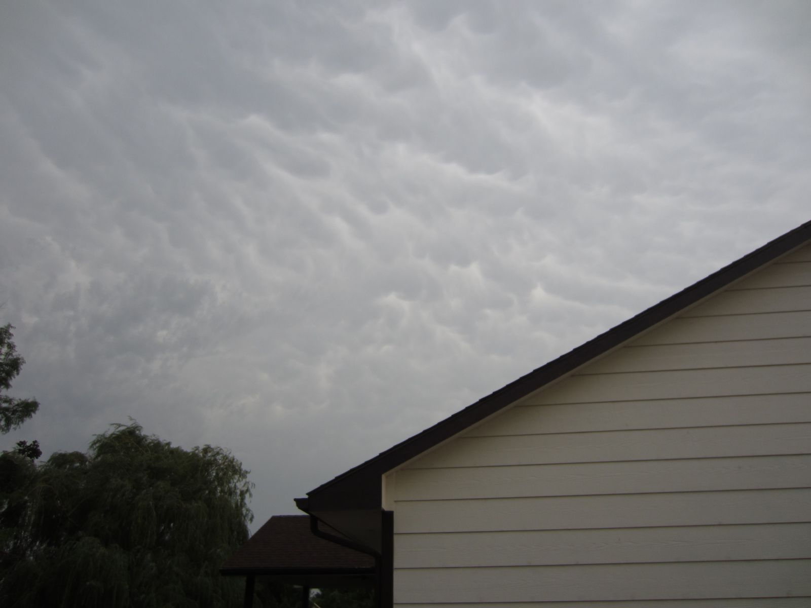 Mammatus clouds before the storms arrived in Northwest Wichita. Picture courtesy of Brad Ketcham Mammatus clouds before the storms arrived in Northwest Wichita. Picture courtesy of Brad Ketcham |

Tree down in Botanica, in Wichita. Picture courtesy of Brad and Denise Ketcham
|

Fireworks tent collapsed at 167th and West Kellogg just east of Goddard, KS. Picture courtesy of Brad and Denise Ketcham.
|
Fireworks tent collapsed at 167th and West Kellogg just east of Goddard, KS. Picture courtesy of Brad and Denise Ketcham.
|
|

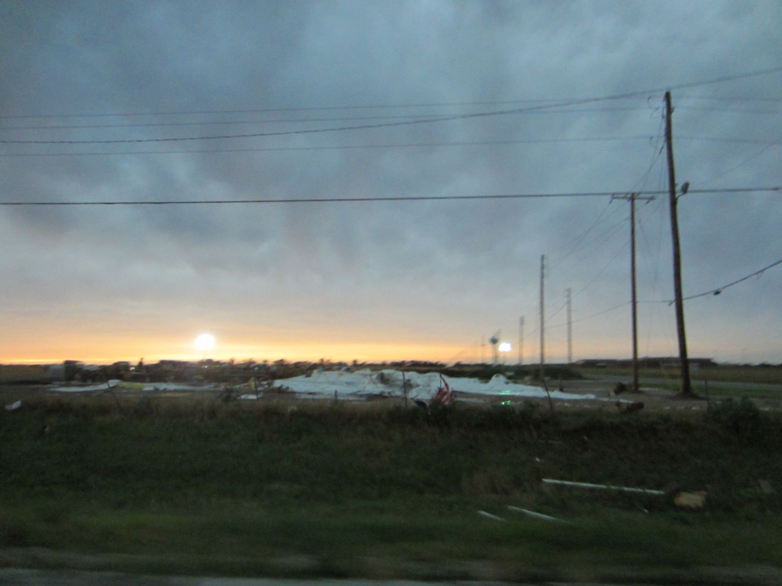
Large utility pole tilted over just south of S. Tyler Rd and West Kellogg, Wichita. Picture courtesy of Brad Ketcham.
|

Roof peeled off a building just east of S. Ridge road and W. Kellogg along the frontage road. At the Dugan shopping center, Wichita. Picture courtesy of Brad Ketcham.
|
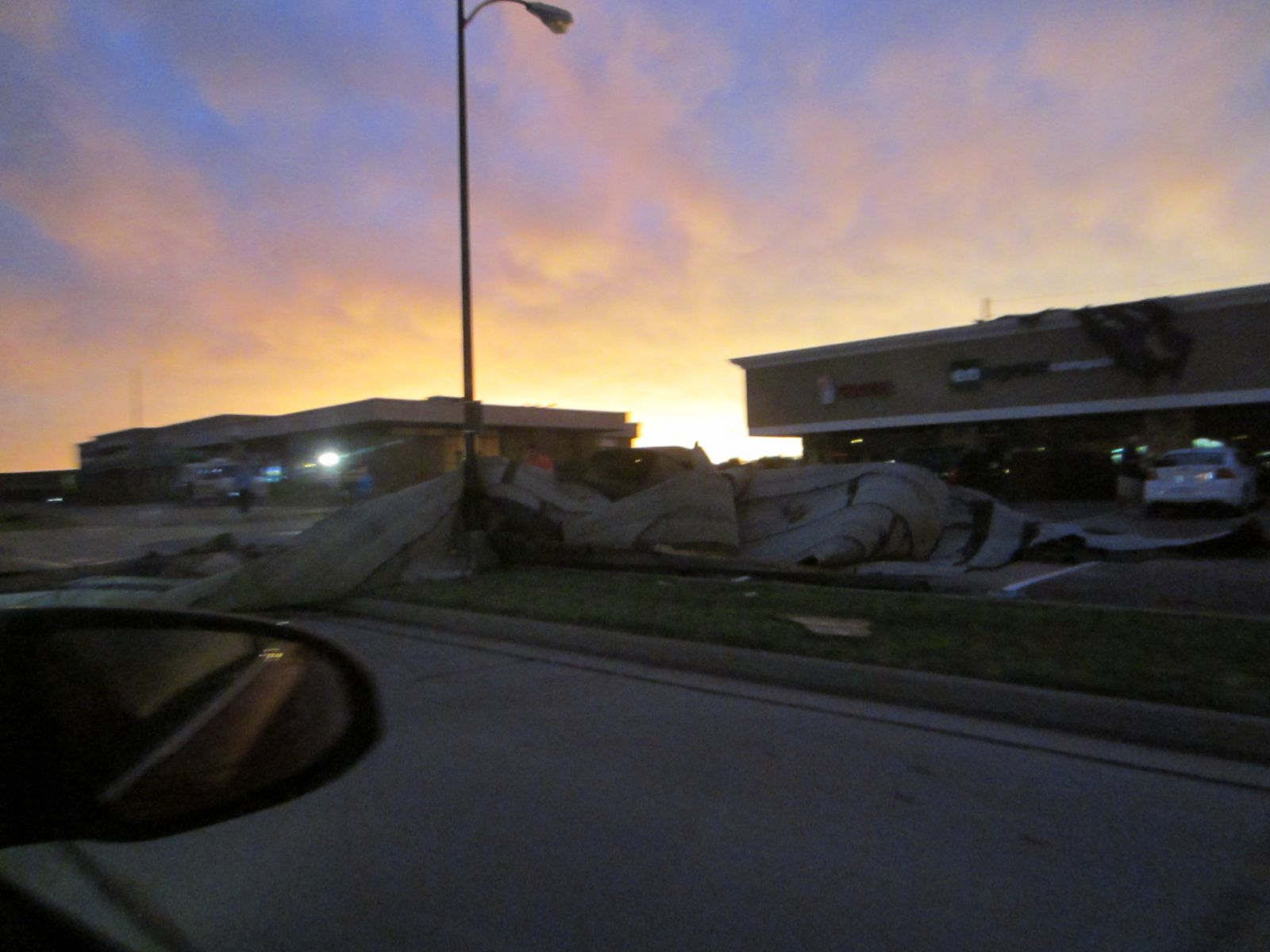
Roof peeled off a building just east of S. Ridge road and W. Kellogg along the frontage road. At the Dugan shopping center, Wichita. Picture courtesy of Brad and Denise Ketcham.
|
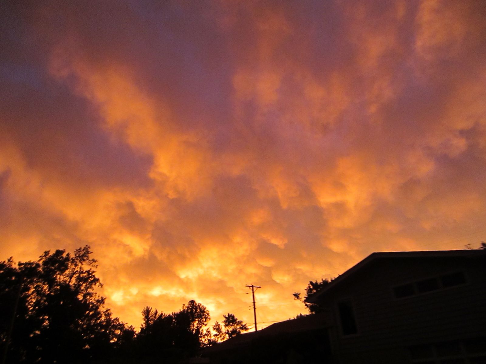
Spectacular sunset after the storm complex passed south of the area. West Wichita. Picture courtesy of Denise Ketcham
|
|

2 foot diameter tree down across the road, West Wichita, near S. Tyler and Rolling Hills Dr., West Wichita. Picture courtesy of Brad and Denise Ketcham.
|

Picture of the orange sunset after the storms passed. Picture by NWS Wichita
|
|
|
|