National Weather Service United States Department of Commerce

Multiple Rounds of Heavy Rain Lead to Flooding

A stationary front was situated near the Oklahoma state line for several days leading to below normal temperatures across much of the central plains.  A series of subtle upper level disturbances moving over the Rockies allowed very most air from the Gulf of Mexico to be lifted north of the front resulting in multiple rounds of showers and thunderstorms across eastern Kansas.  Weekly rainfall amounts of 5-10+ inches resulted in areas of flooding Sunday-Tuesday across portions of the central plains.  Numerous roads remained closed on the morning of July 30, 2013 while multiple rivers remain out of their banks.


Surface Map as of 7:00 am July 26-28th, 2013


7:00 AM EST July 26, 2013

7:00 AM EST July 27, 2013

7:00 AM EST July 28, 2013


Precipitation Estimates Over the Past 5 Days


 Images of Flooding Across the Area


 Gypsum Creek looking south toward the K-4/Gypsum Valley Road intersection.  Photo taken at 7:45 AM on July 30, 2013 by Lyman Bearden.

Gypsum Creek looking south toward the K-4/Gypsum Valley Road intersection.  Photo taken at 7:45 AM on July 30, 2013 by Lyman Bearden.


Hydrographs

Current hydrologic information can be found here


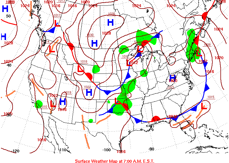
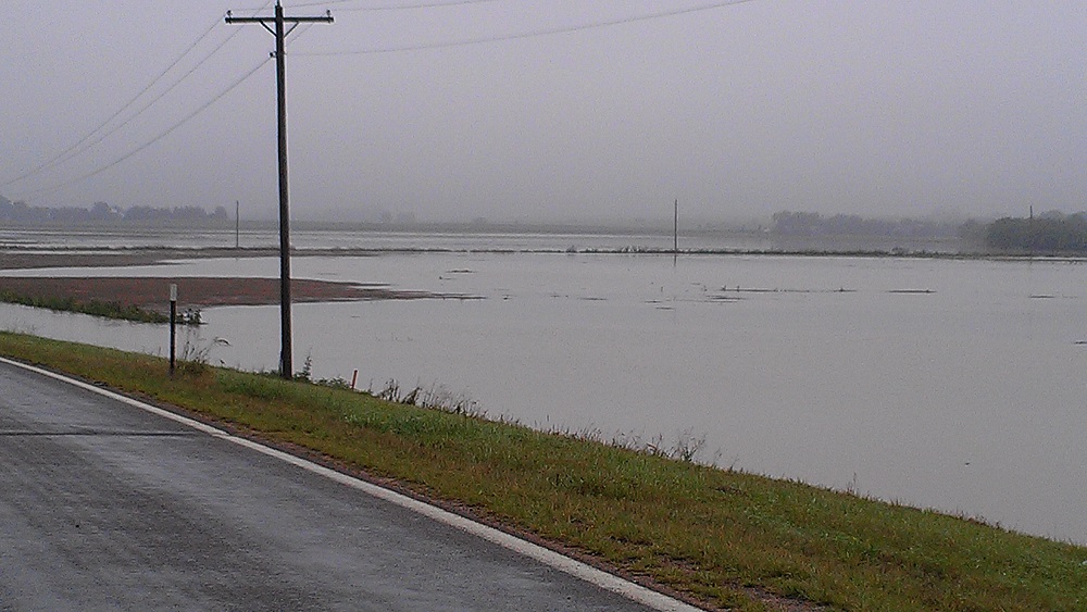
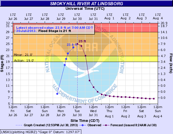
A hydrograph of the Smoky Hill River at Lindsborg on the morning of 7-30-2013.

Minor flooding was occurring


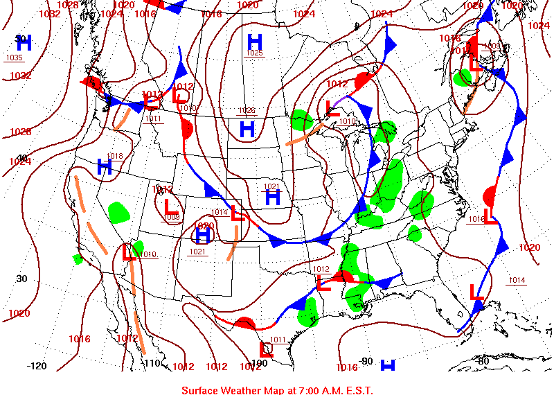
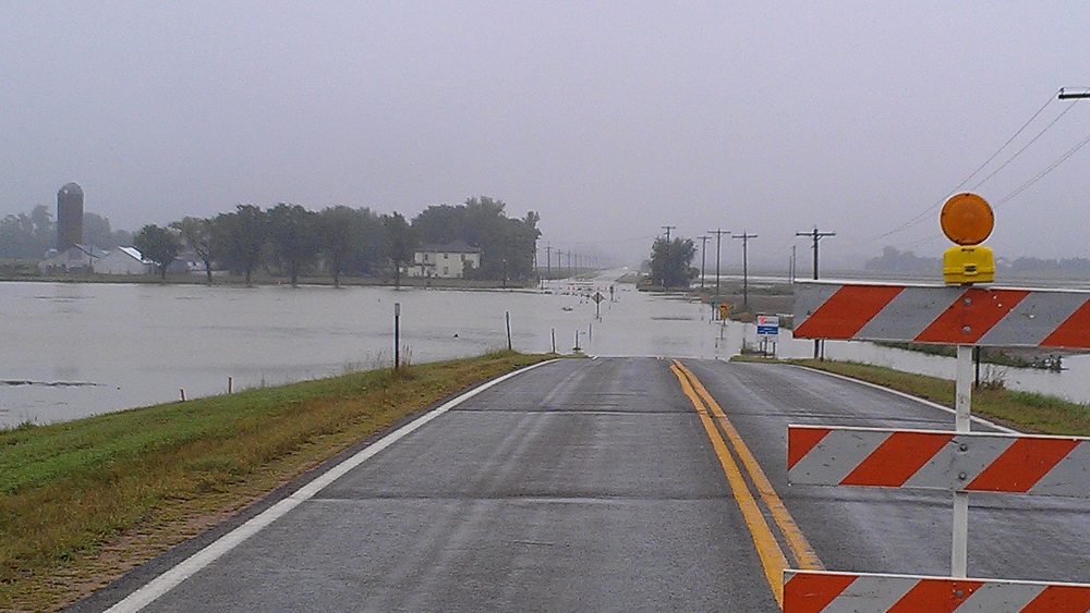
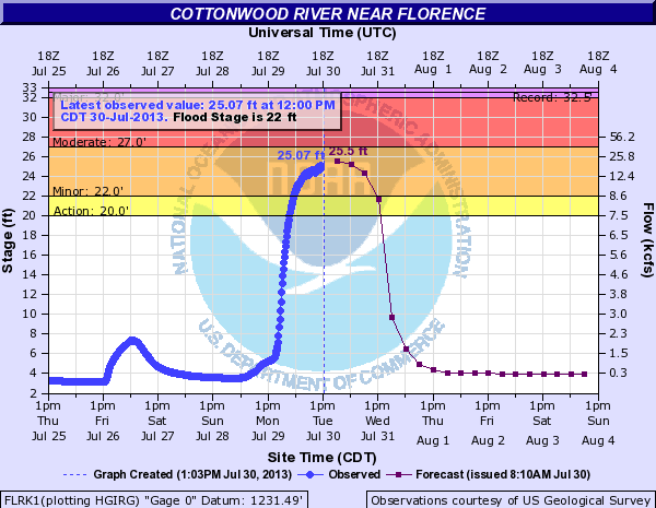
A hydrograph of the Cottonwood river near Florence, KS on the morning of 7-30-2013.

Minor flooding was occurring


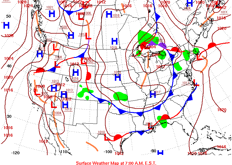
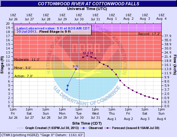
A hydrograph of the Cottonwood River at Cottonwood Falls on the morning of 7-30-2013.


Moderate flooding was forecast