|
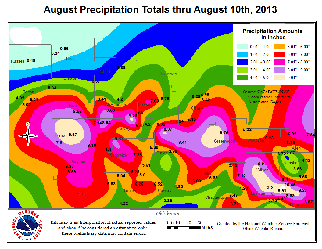
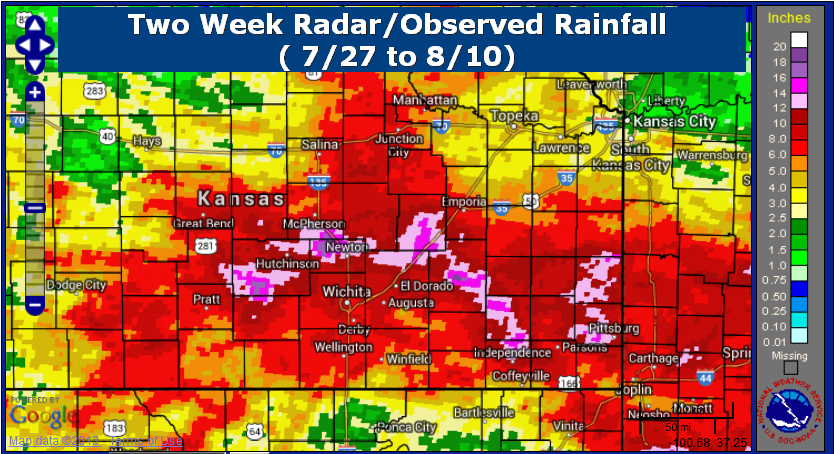
Several Rounds of Torrential Rain Leads to Significant Flooding
|
A stalled front along with favorable atmospheric conditions caused torrential rainfall to occur on the night of August 3rd, continuing into the early morning hours of August 4th. Rainfall amounts of more than 3 inches were reported in many areas. Hutchinson was the hardest hit with a large area of more than 5 inches over rain reported. Flash flooding along Cow Creek and its tributaries was a big concern, especially in the Hutchinson area.
Periods of heavy rain affected the same areas through August 9th continuing the flooding threat.
|
|
|
Event precipitation
|
Images of Flooding Across the Area
|
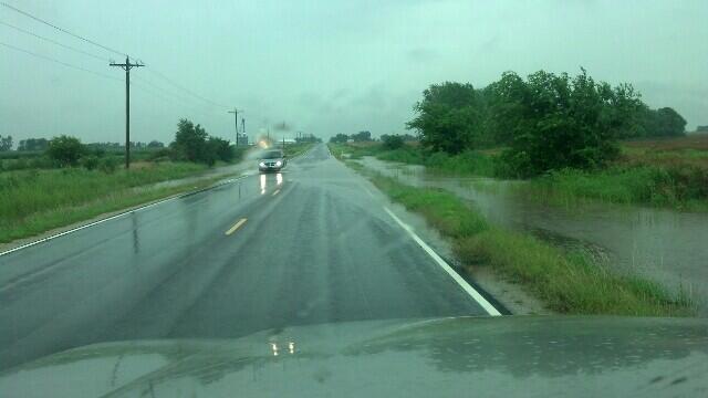
Flooding near Clonmel, KS - Courtesy @chinook_
|
|
|
|
|
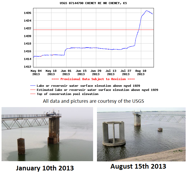
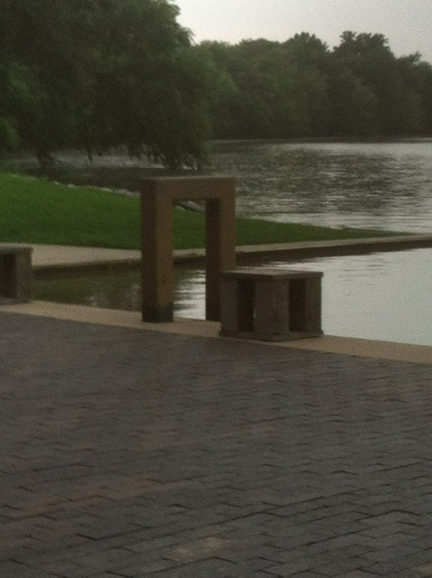
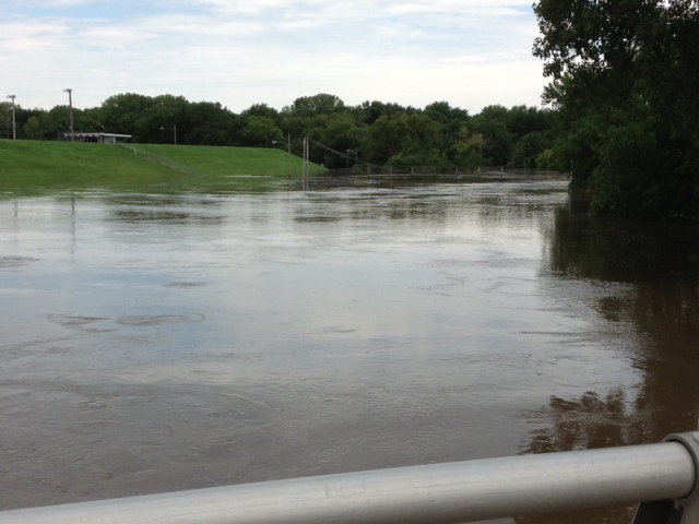
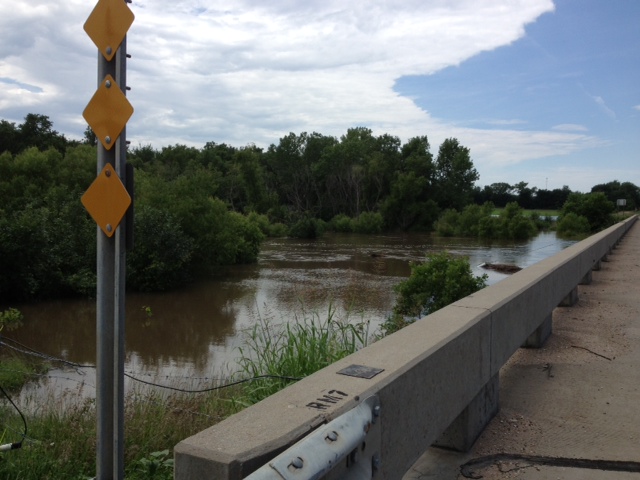
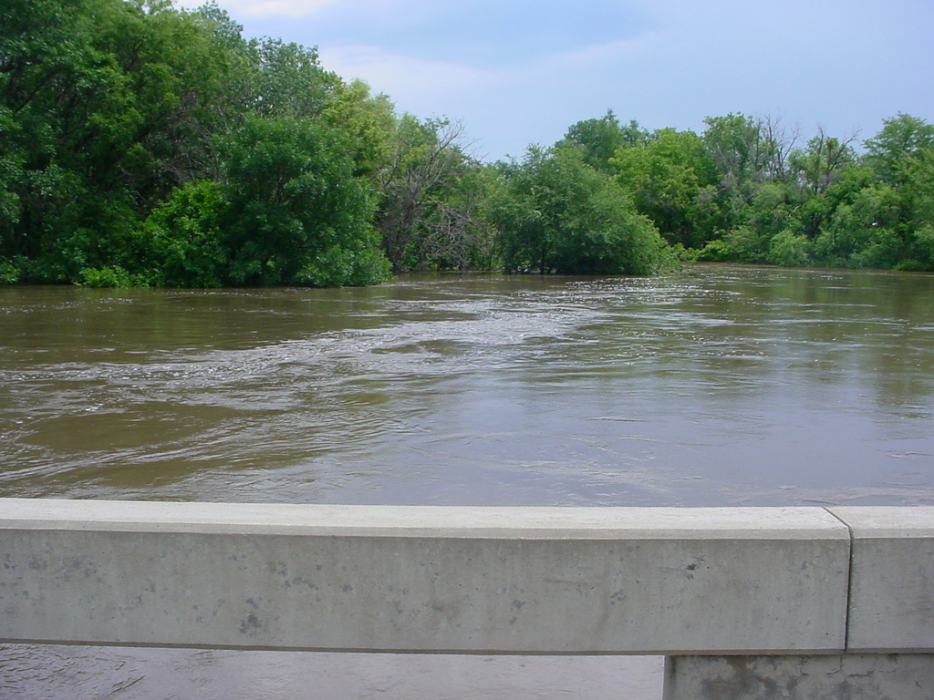
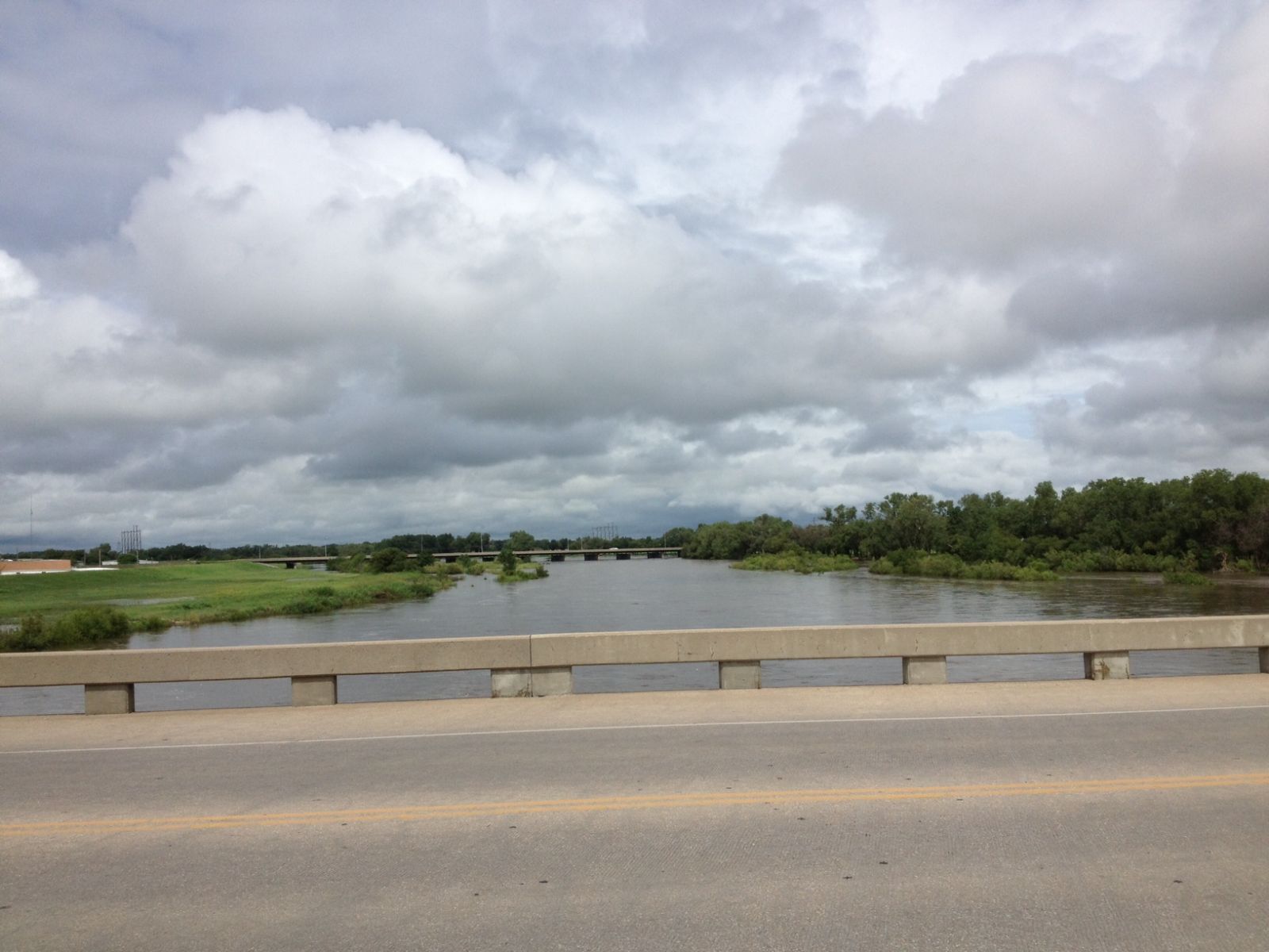
River change in Wichita
The following pictures were taken at the Murdock Bridge in Wichita by Jan Doran
|
Taken July 29th
|
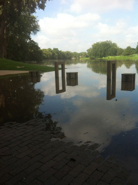
Taken July 30th
|
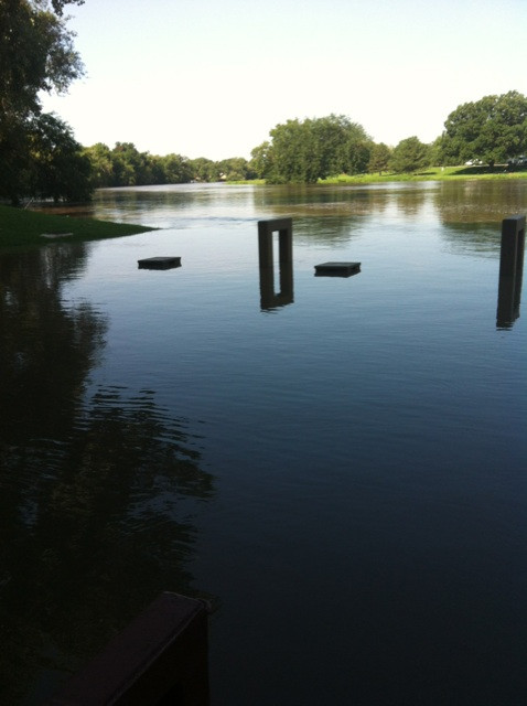
Taken August 5th
|
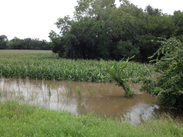
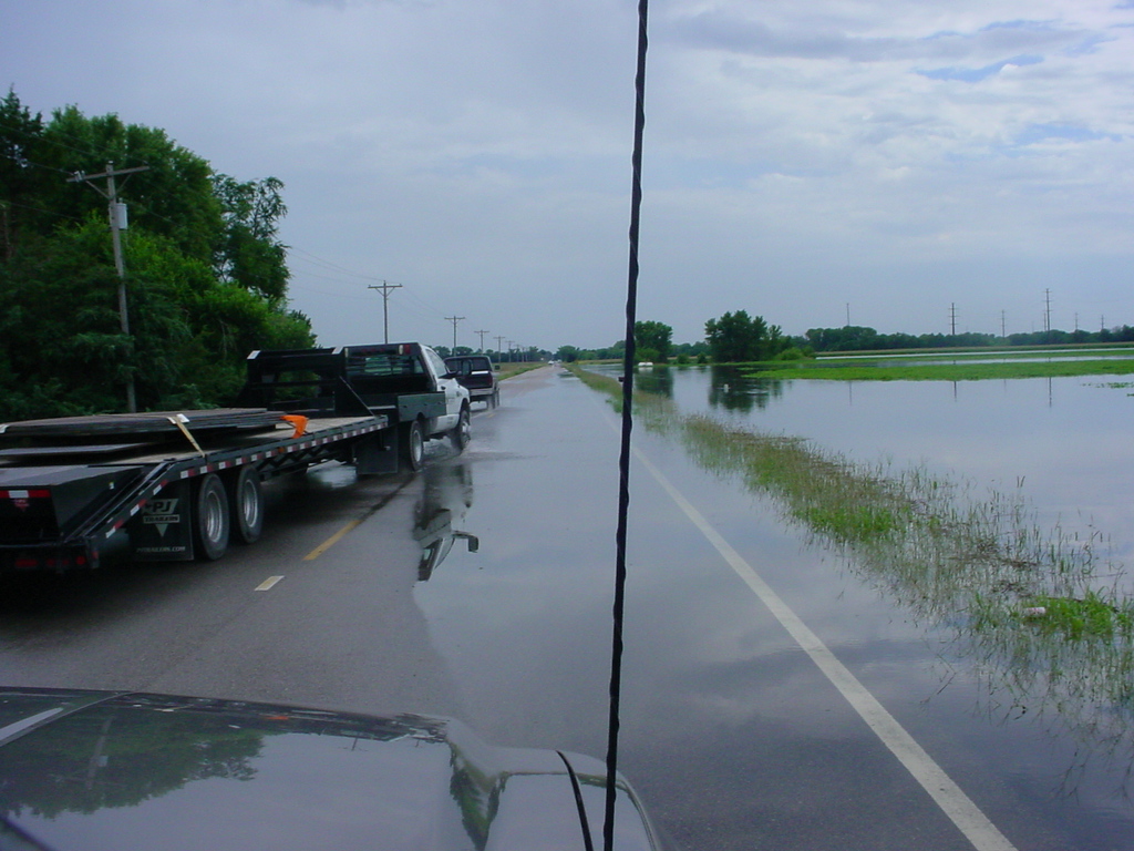
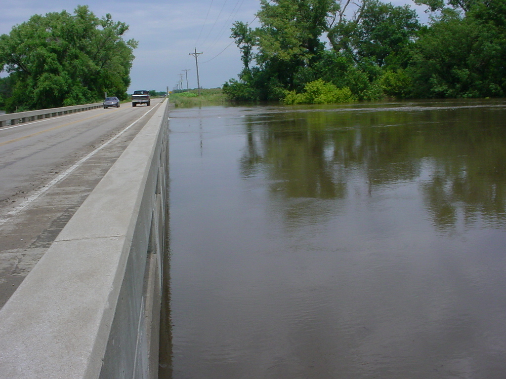
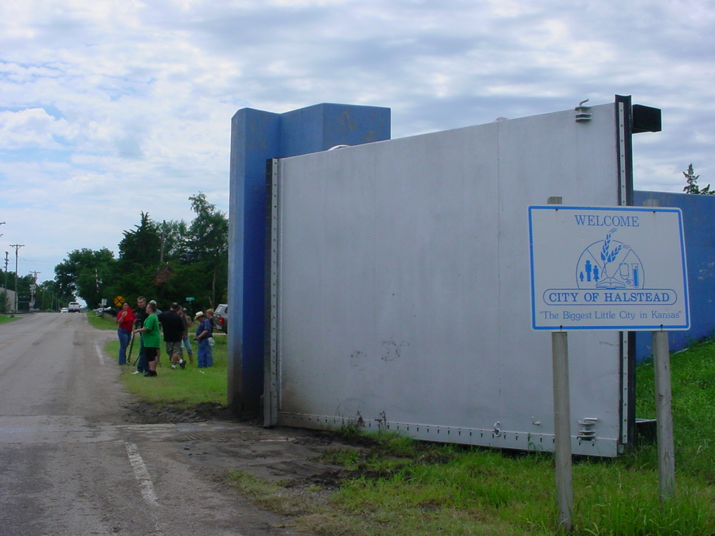
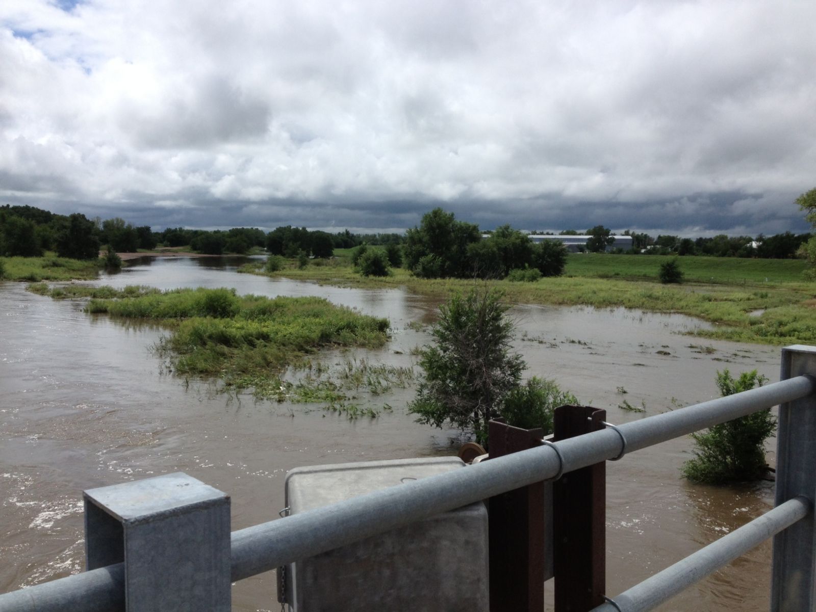
Flooding along the Little Arkansas River near Halstead
All pictures below were taken 8-7-13 by NWS Service Hydrologist Janet Salazar.
|
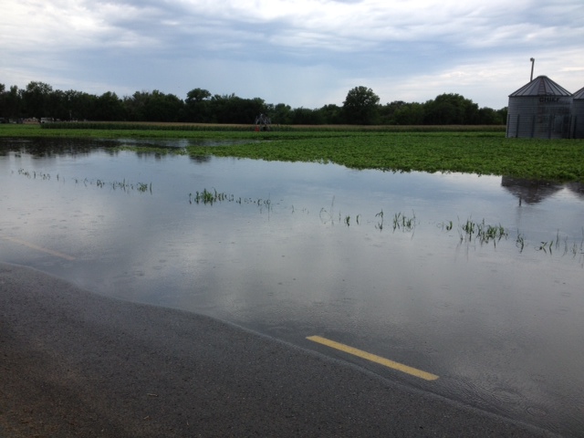 Flooding in a Field near highway K-89 Flooding in a Field near highway K-89
|
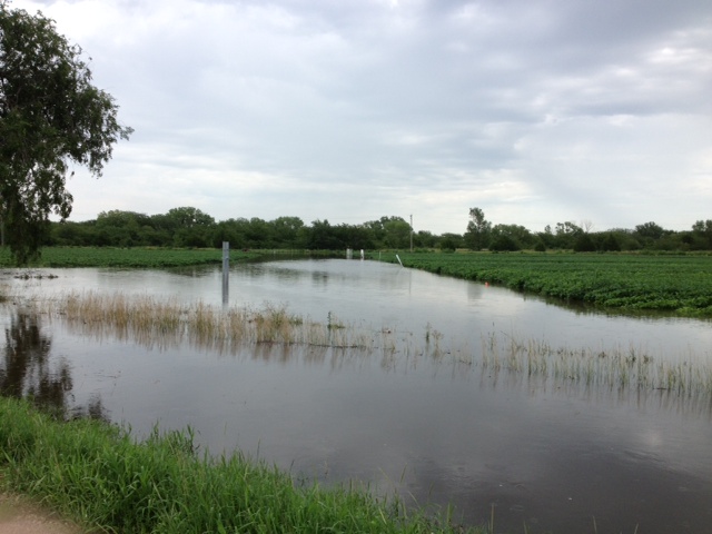 Crop land field flooding near highway K-89 Crop land field flooding near highway K-89
|
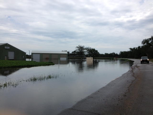 Water near buildings near highway K-89 Water near buildings near highway K-89
|
 Water less than 0.5 miles from highway 50 Water less than 0.5 miles from highway 50
|
|
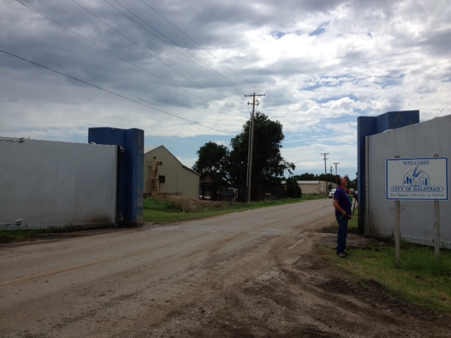 Halstead flood gate Halstead flood gate
|
 Looking upstream on Main Street in Halstead Looking upstream on Main Street in Halstead
|
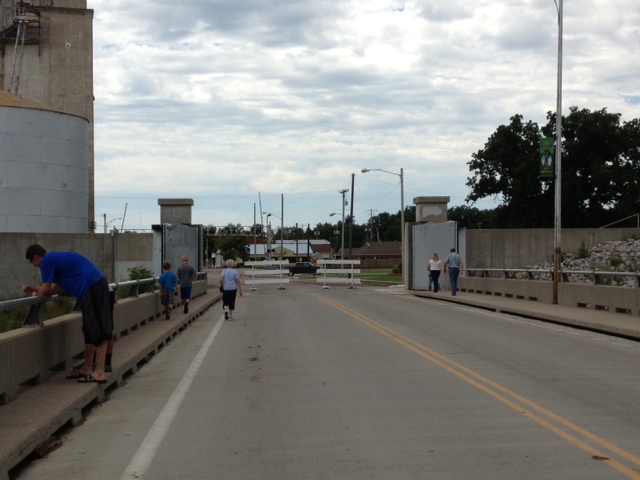 Looking south towards town at Main Street flood gate Looking south towards town at Main Street flood gate
|
 Highway 50 at Halstead looding west Highway 50 at Halstead looding west
|
|
 Little Arkansas River at Highway 50 looking west Little Arkansas River at Highway 50 looking west
|
 Crop land flooding near Highway 50 near gauge site Crop land flooding near Highway 50 near gauge site
|
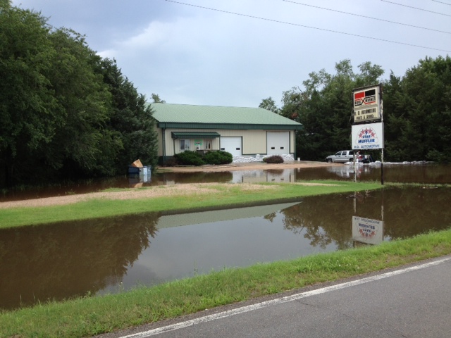
 Water over the road on Halstead Road by the R.D. Automotive. Water over the road on Halstead Road by the R.D. Automotive.
|
 Little Arkansas River looking downstream Little Arkansas River looking downstream
|
|
 Looking northward on Halstead Road bridge Looking northward on Halstead Road bridge
|
 Halstead Road flood gate Halstead Road flood gate
|
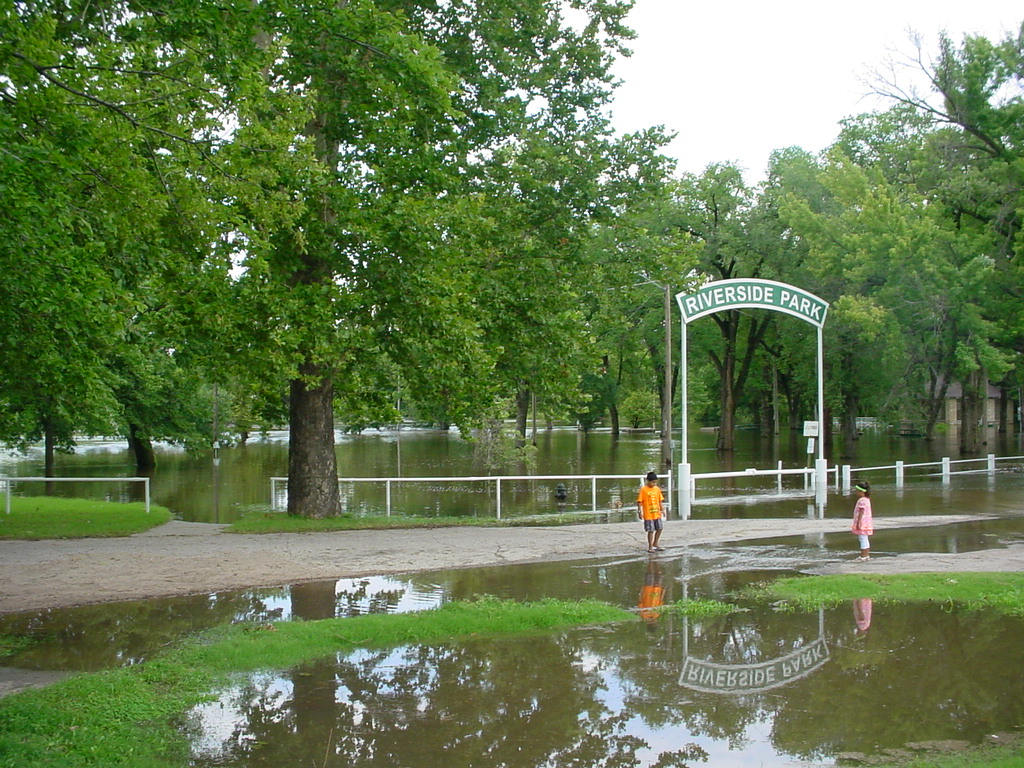 Riverside park on the north bank of the Little Arkansas river north of Halstead. Riverside park on the north bank of the Little Arkansas river north of Halstead.
|
|
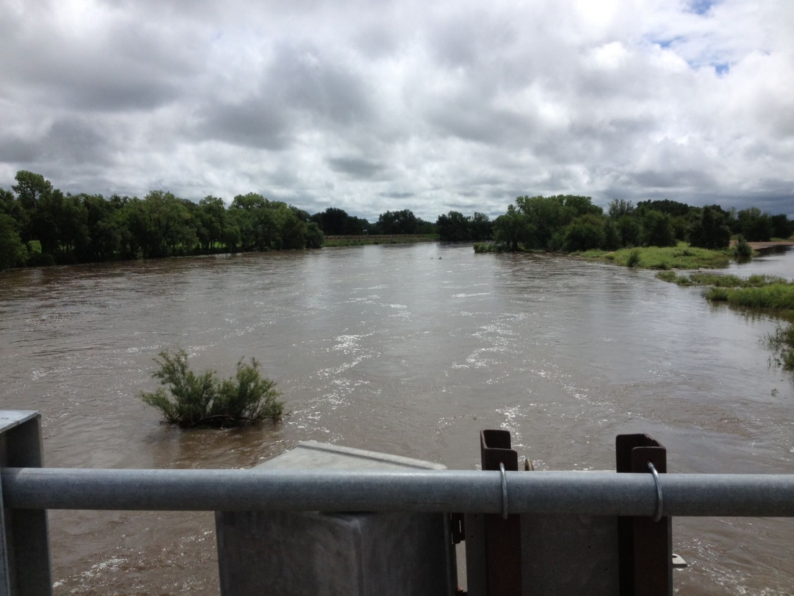
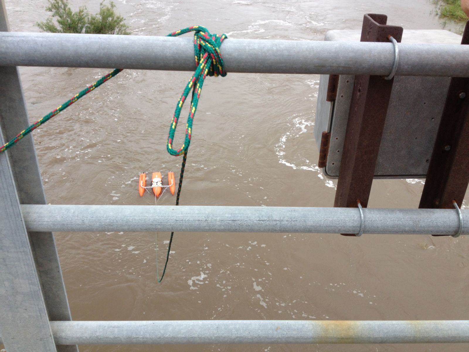
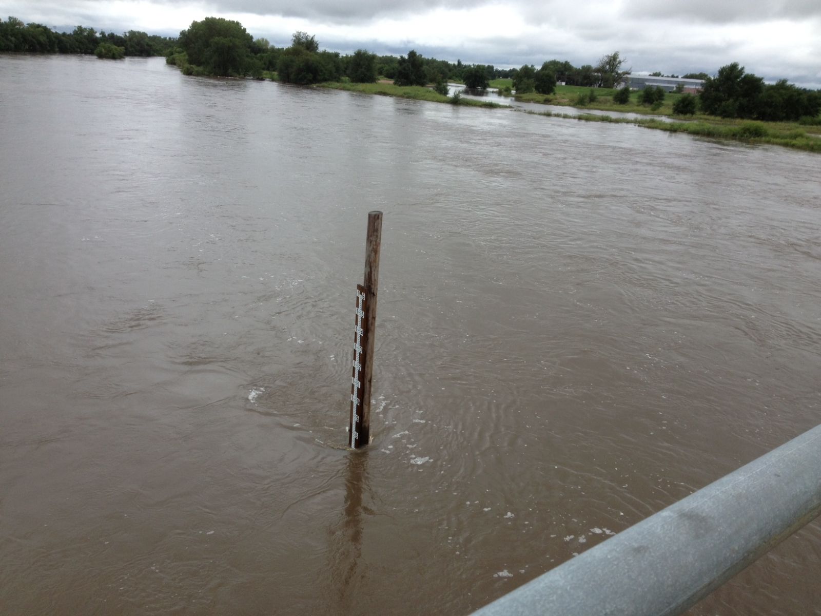
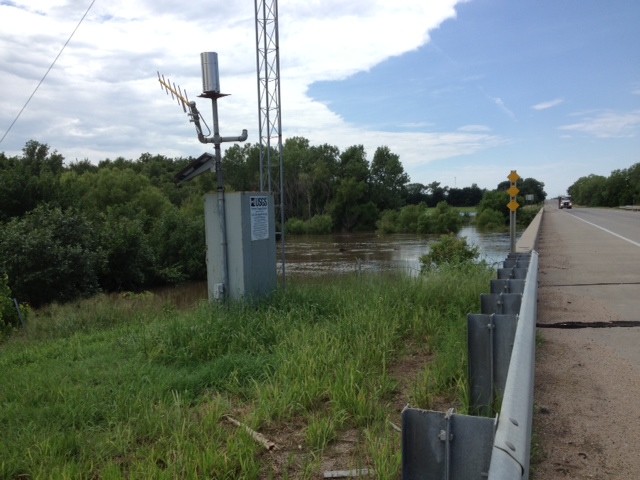
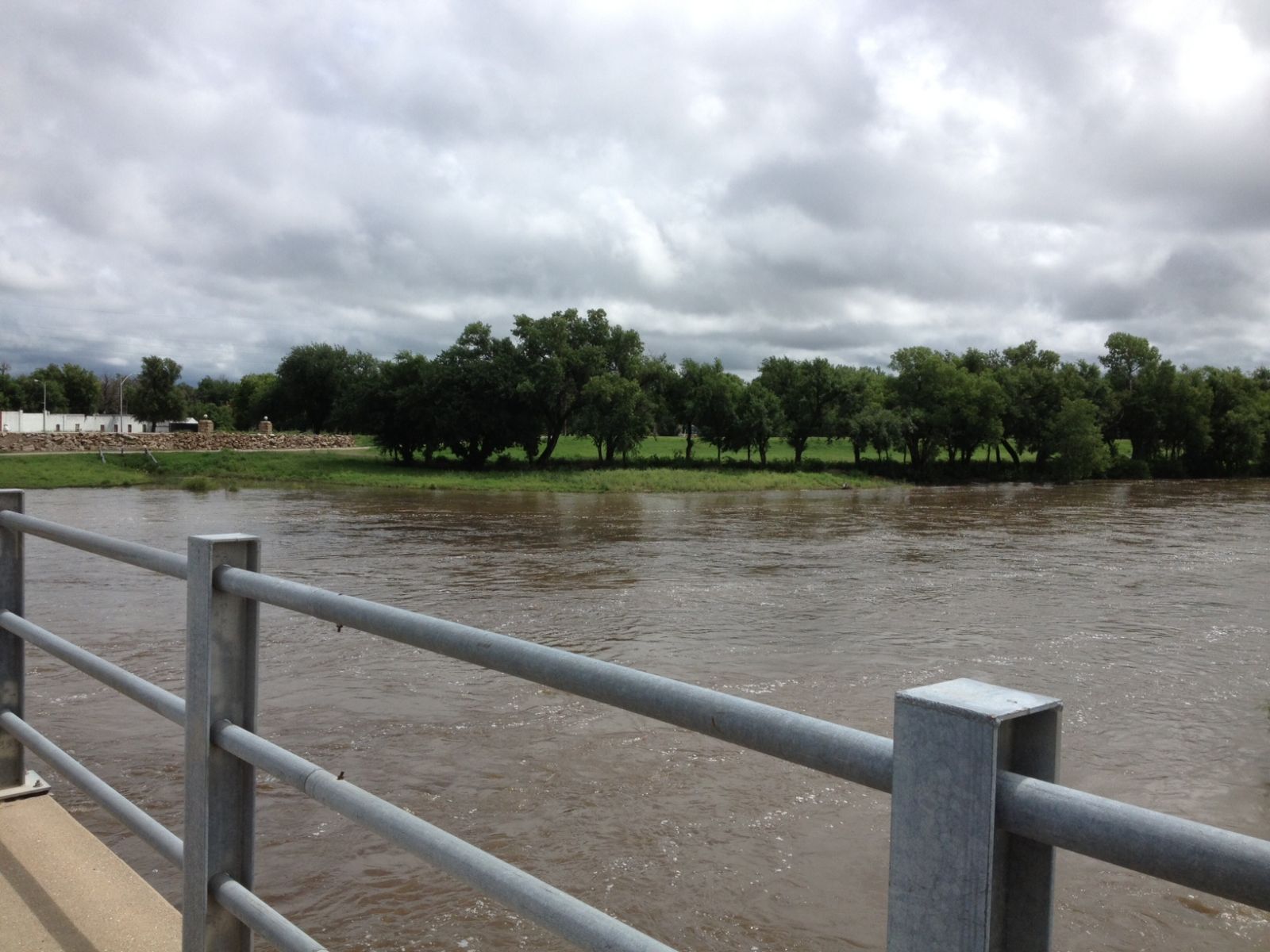
Flooding along the Arkansas River at Hutchinson
All pictures below were taken 8-8-13 by NWS Service Hydrologist Janet Salazar.
|
 The swollen Arkansas River, looking downstream. The river had crested on August 7th at a stage of 8.25 ft. Water now receding. The swollen Arkansas River, looking downstream. The river had crested on August 7th at a stage of 8.25 ft. Water now receding.
|
 The U.S. Geological Survey using sonar type instrument to take a river flow measurement. Gathering this type of flow measurement produces a rating table for the river. This amount of known flow can then correlate with a stage. The U.S. Geological Survey using sonar type instrument to take a river flow measurement. Gathering this type of flow measurement produces a rating table for the river. This amount of known flow can then correlate with a stage.
|
 Arkansas River on Main St Bridge/Frank Hart Bridge looking downstream on left bank. Gage reading 7.18 ft on 8/8/13 late morning. Arkansas River on Main St Bridge/Frank Hart Bridge looking downstream on left bank. Gage reading 7.18 ft on 8/8/13 late morning.
|
 Arkansas River...seeing overflows on downstream right bank/south bank. Arkansas River...seeing overflows on downstream right bank/south bank.
|
|
 Viewing the Arkansas River upstream from the Main St Bridge. Viewing the Arkansas River upstream from the Main St Bridge.
|
 Staff gage used as another type of instrument to gauge the height of the river. Staff gage used as another type of instrument to gauge the height of the river.
|