|
Another round of tornado producing supercells moved across areas just south of Wichita on June 12th, 2004. Five confirmed tornadoes skipped along the Sumner/Sedgwick and Butler/Cowley county lines during the early evening hours.
The supercell thunderstorms formed along a dry line in Southern Kansas in Harper County, Kansas. Radar signature shows the dry line and initial thunderstorm development.
The storms rapidly intensified once they moved into northeastern sections of Sumner County, with the first touchdown reported at aproximately 7:10 pm just southwest of Mulvane. The supercell thunderstorm continued to cycle, or strengthen and weaken, as it moved slowly east, producing and dissipating tornadoes as it went. At approximately, 7:25 pm the supercell produced a longer track tornado that produced damage at the Mulvane Saddle Club as it crossed Kansas Highway 15 near Greenwich Road.
The Damage at this location was rated F1 and F2 respectively. The tornado continued eastward causing very little damage in it's path, until it began to drift southeast. At this time the tornado produced significant damage as the white rope tornado leveled a frame house in which 2 occupants survived by taking shelter under the basement stairs. The tornado was rated as a strong F3.
Three other tornadoes in Cowley county produced little damage, however, the tornado near Rock was quite picturesque with the sun setting off on the western horizon. The other two tornadoes were just south of Atlanta and were rated an F0.
As the supercell continued on into Elk County, it produced two very weak rope tornadoes that only caused damage to a corn crop.
|
WSR-88d KICT (Wichita) base reflectivity at 502pm, showing thunderstorm development in Harper County, Kansas just east of the a dry line (circled in red).
|
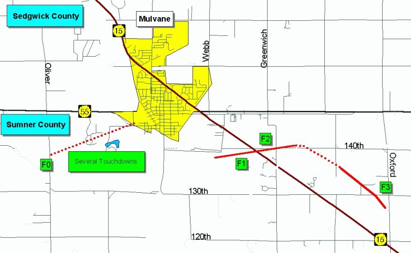
Damage Survey map for June 12th, 2004, showing the touchdown of 2 tornadoes just south and east of Mulvane, Kansas. Green boxes show the F scale rating to each touchdown with the red line showing the longest tornado track.
|
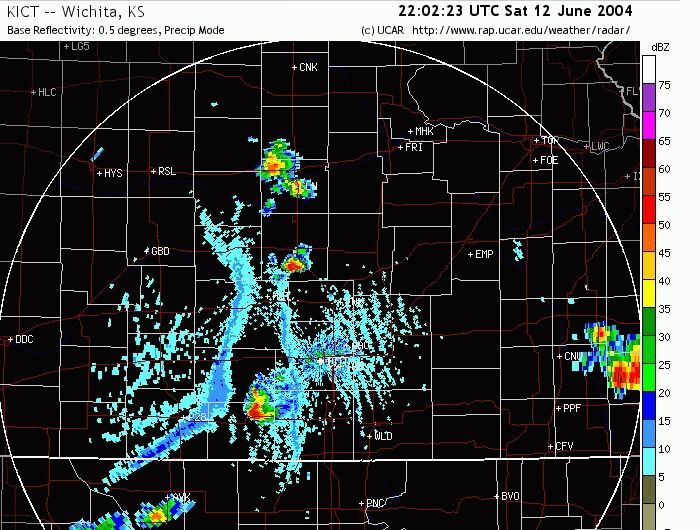
WSR-88d from KICT (Wichita) base reflectivity at 727 pm, showing supercell thunderstorm with pronounced 'hook echo' near the Mulvane Saddle Club (F1 and F2 damage).
|
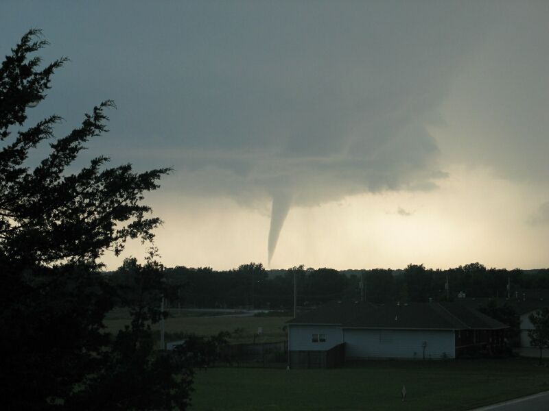
Picture of the tornado near Mulvane, Kansas. (Picture taken from Douglass, Kansas by NWS ICT MIC Richard Elder).
|
|
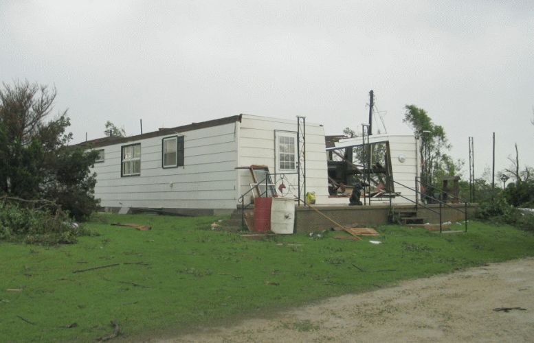
Damage to the house (rated F1 damage) located at the Mulvane Saddle Club near K15 and Greenwich Road.
|
Damage to the house (rated F2 damage) across the street from the Mulvane Saddle Club near K15 and Greenwich Road.
|
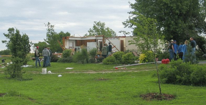
Frame house totally destroyed with 2 survivors (rated high F3 damage) 4 miles southeast of Mulvane, Kansas.
|
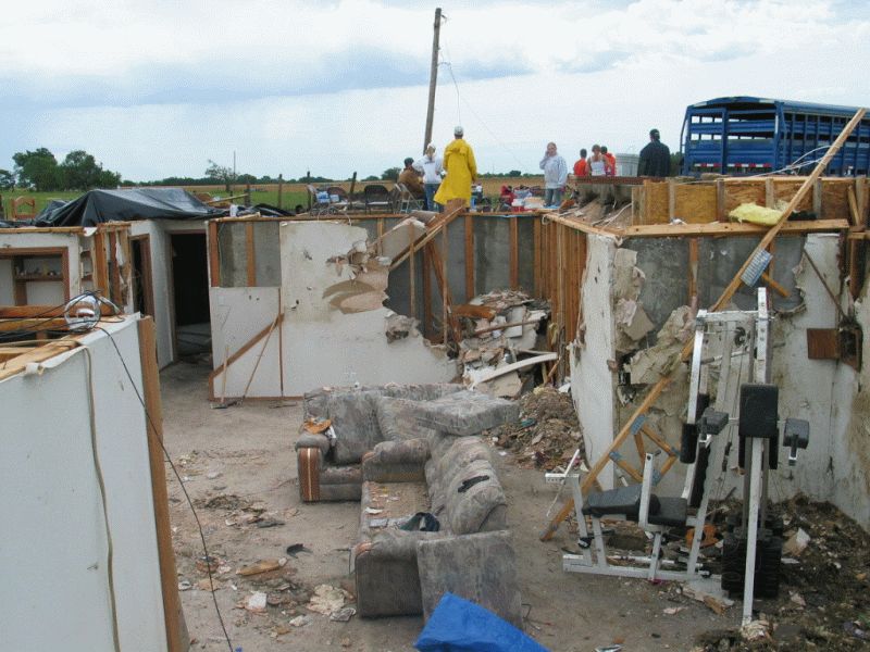
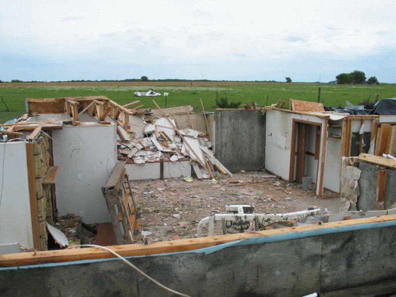
View 2 of Frame house totally destroyed with 2 survivors (rated high F3 damage) 4 miles southeast of Mulvane, Kansas.
|
|
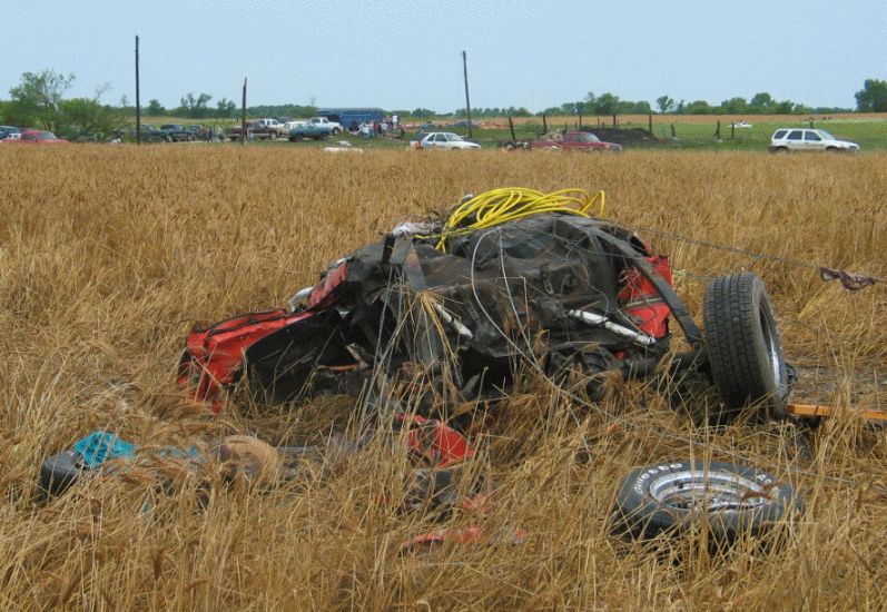
Remnants of a 1967 Shelby Mustang thrown 1/4 mile, from a garage destroyed 4 miles southeast of Mulvane, Kansas.
|
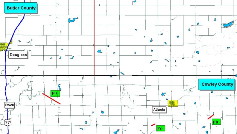
Tornado track map for Cowley County. All three tornadoes rated F0.
|
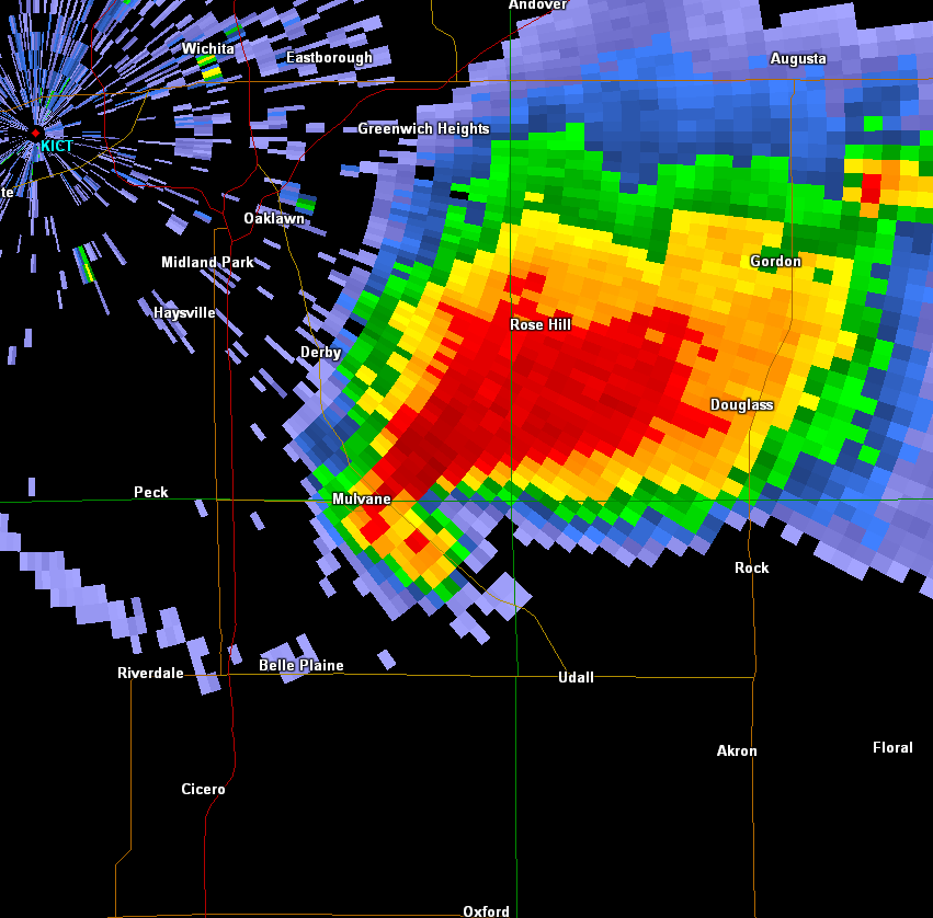
Zoomed-in radar image of the supercell around the time it produced the F3 tornado.
|
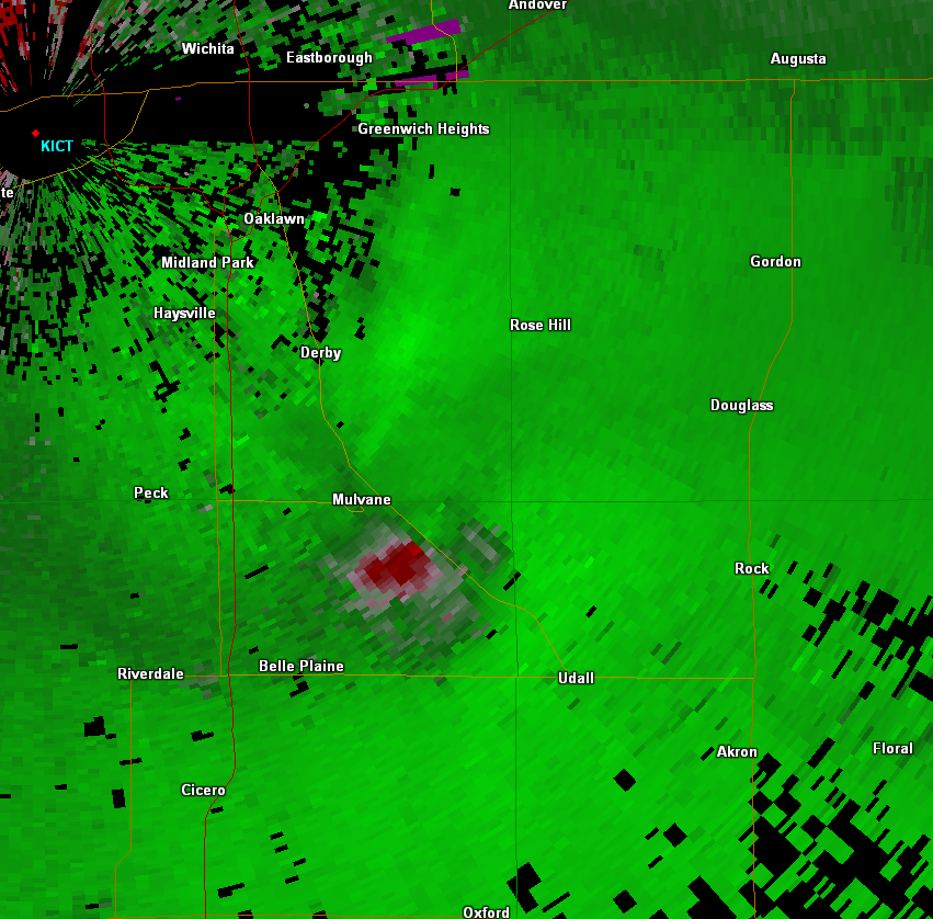
Zoomed-in storm relative velocity image of the supercell around the time it produced the F3 tornado.
|
|

