Wichita, Kansas
Weather Forecast Office
May 8th 2009 long lived derecho
|
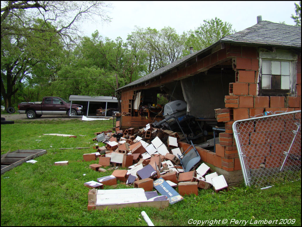
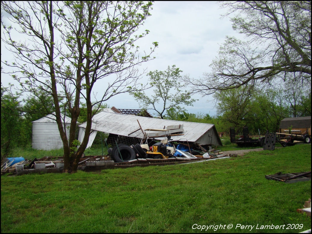
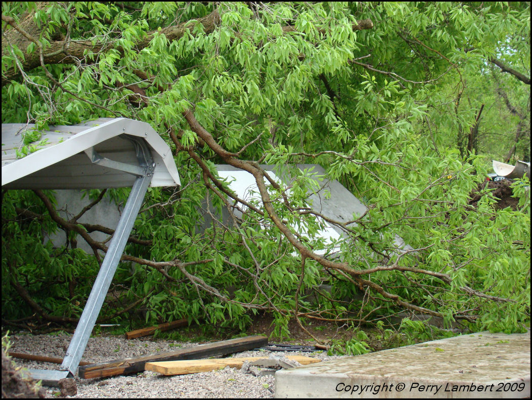
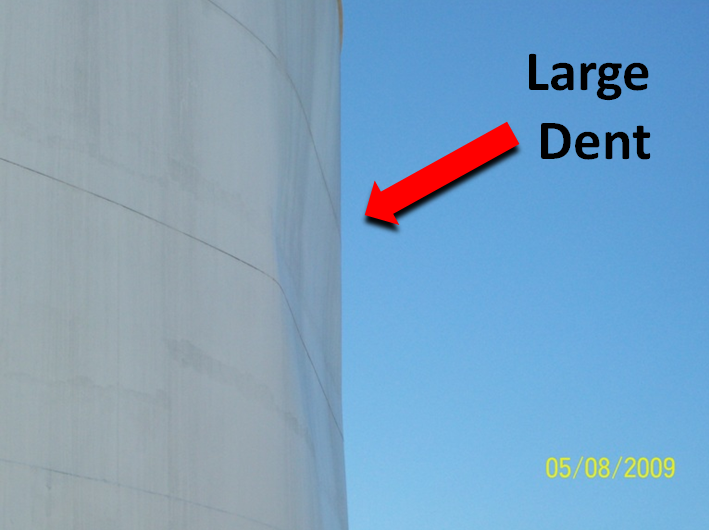
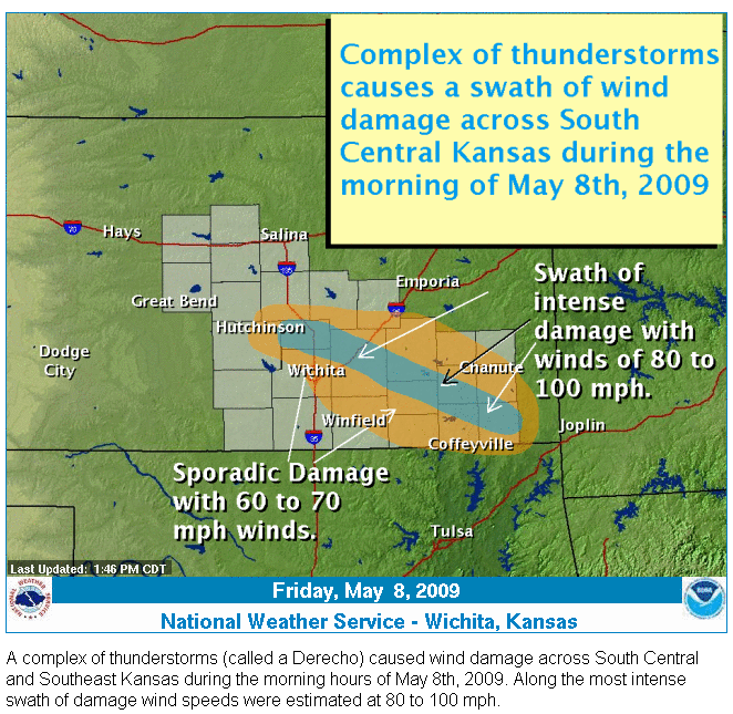
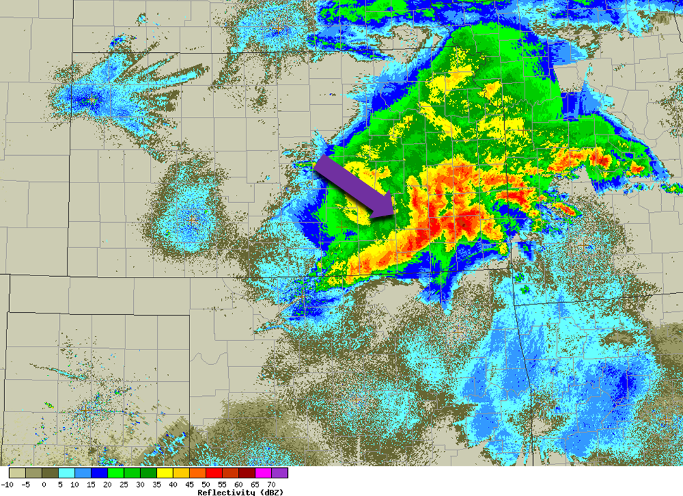
Warm and muggy conditions late Thursday night set the stage for severe thunderstorms as rich gulf moisture pooled across southern Kansas. A complex of thunderstorms developed over northwest Kansas Thursday night and intensified once it reached the juicy gulf moisture residing over southern Kansas. The stronger winds aloft combined with very unstable air over the area to create a rare derecho type thunderstorm complex. A derecho (from Spanish: "derecho" meaning "straight") is a widespread and long-lived, violent convectively induced straight-line windstorm that is associated with a fast-moving band of severe thunderstorms in the form of a squall line usually taking the form of a bow echo. The derecho caused a swath of destructive straight-line winds which began near Harvey county and tracked southeast across the state...see image 1 for the damage path. Also see image 2 for swath of power outages. Violent winds speeds of 80-100mph knocked down power lines, uprooted large trees, and caused significant structural damage to some buildings...see image 3 for radar image. The thunderstorms also produced large hail and flooding across the region overnight. Damage Pictures
|
Hazards
Briefing pages
Local weather story
Submit a storm report
Storm Prediction Center
Enhanced Hazardous Weather Outlook
Hazardous Weather Outlook Text
Current Conditions
Local Radar
National Radar
Satellite
Hourly weather(text)
Precip Analysis
Snowfall analysis
This day in weather history
7 Day Lightning Archive
Forecasts
Forecast Discussion
Weather Story
Fire Weather
Activity Planner
Aviation Weather
Soaring Forecast
Hurricane Center
Graphical Forecasts
Regional Weather Summary
Probabilistic Snow
Probabilistic QPF
Wet Bulb Globe temp
Climate
Local Climate Page
Daily/Monthly data(F6)
Daily Records
Climate Normals
Local drought page
Latest Climate Report(ICT)
Latest Climate Report(SLN)
Latest Climate Report(CNU)
CoCoRaHS
7 Day Lightning Archive
US Dept of Commerce
National Oceanic and Atmospheric Administration
National Weather Service
Wichita, Kansas
2142 S. Tyler Road
Wichita, KS 67209-3016
316-942-3102
Comments? Questions? Please Contact Us.


