|
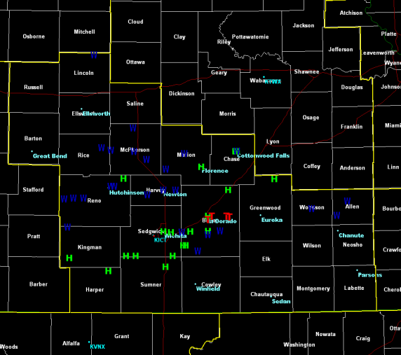
An extremely moist air mass was in place across all of Kansas on Monday June 15th along with unseasonably strong mid and upper level winds. A weak surface boundary combined with an approaching upper disturbance to ignite severe storms across much of Kansas. Supercell thunderstorms first erupted over Western Kansas and as these storms progressed east the threat transitioned from tornadoes to severe straight line winds. These winds caused damage and power outages across much of Reno, Harvey, Marion, McPherson and Butler Counties. Supercells also developed during the late afternoon hours just east of Wichita in Western Butler County. These storms produced several weak tornadoes along with large hail. Below is a map showing where severe weather occurred across the area(click image to enlarge).
|
|
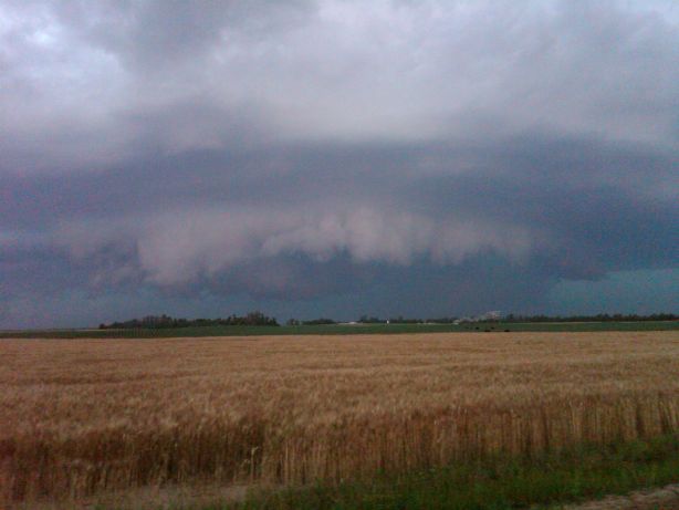
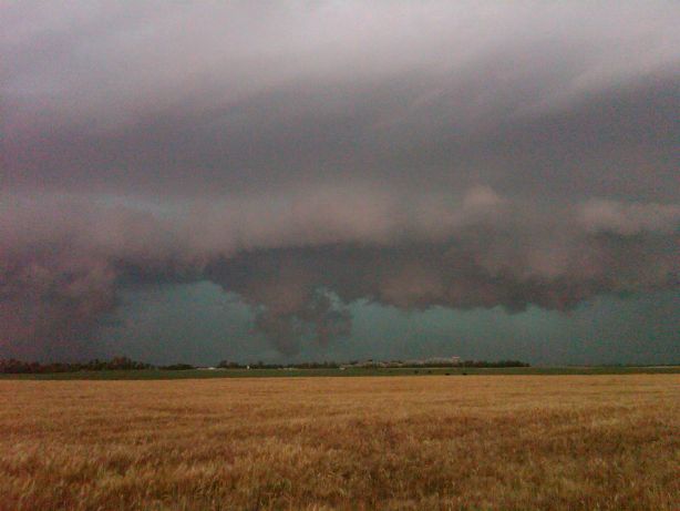
Supercell thunderstorm transitioning to more of a squall line as it enters Western Reno Co. Picture by Stephanie Dunten. |
Supercell thunderstorm transitioning to more of a squall line as it enters Western Reno Co. Picture by Stephanie Dunten. |
|
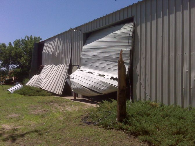
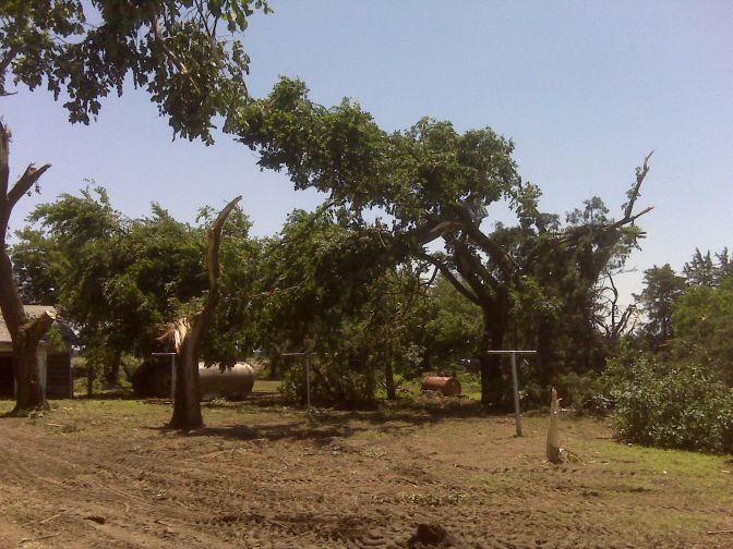
Wind damage Northwest of Halstead in Harvey County. |
Wind damage Northwest of Halstead in Harvey County. |
|
Wind damage Northwest of Halstead in Harvey County. |
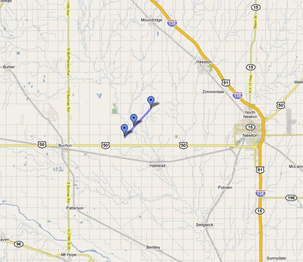
Map of wind damage Northwest of Halstead. Winds estimated around 100 mph. |
|
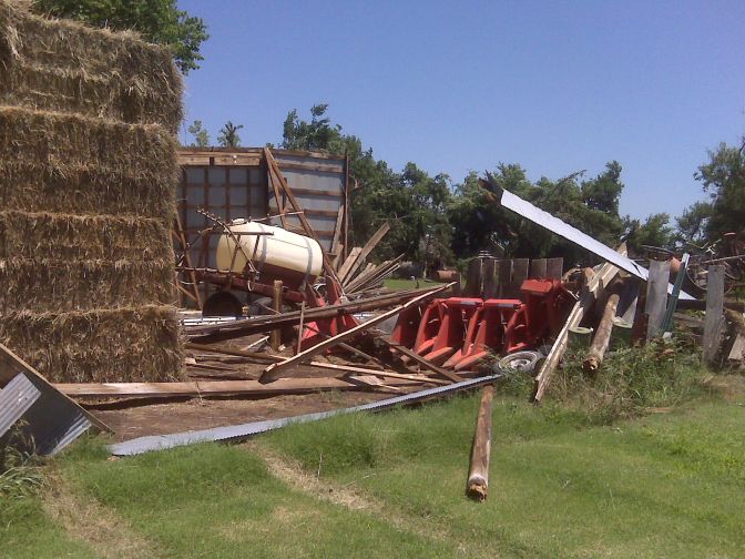
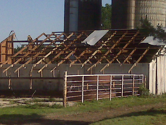
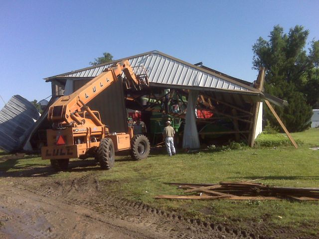
Wind damage 3-6 miles South of Canton in Eastern McPherson County. |
Wind damage 3-6 miles South of Canton in Eastern McPherson County. |
|
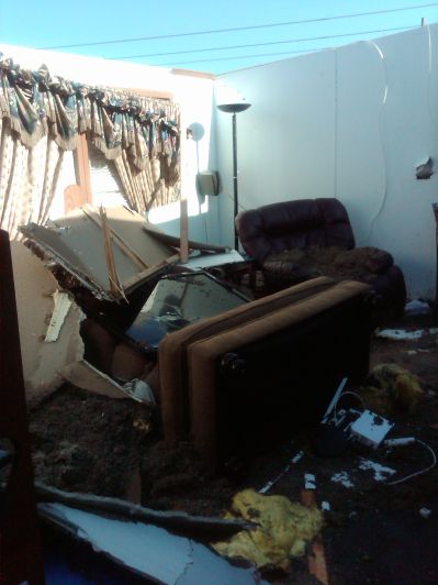
Wind damage to a moblie home 3 miles East of Leon. Picture courtesy Butler Co. Emergency Management. |
Wind damage to a moblie home 3 miles East of Leon. Picture courtesy Butler Co. Emergency Management. |
|
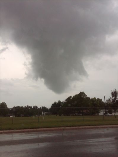
Large funnel cloud just to the Southwest of El Dorado. Picture courtesy Butler Co. Emergency Management. |
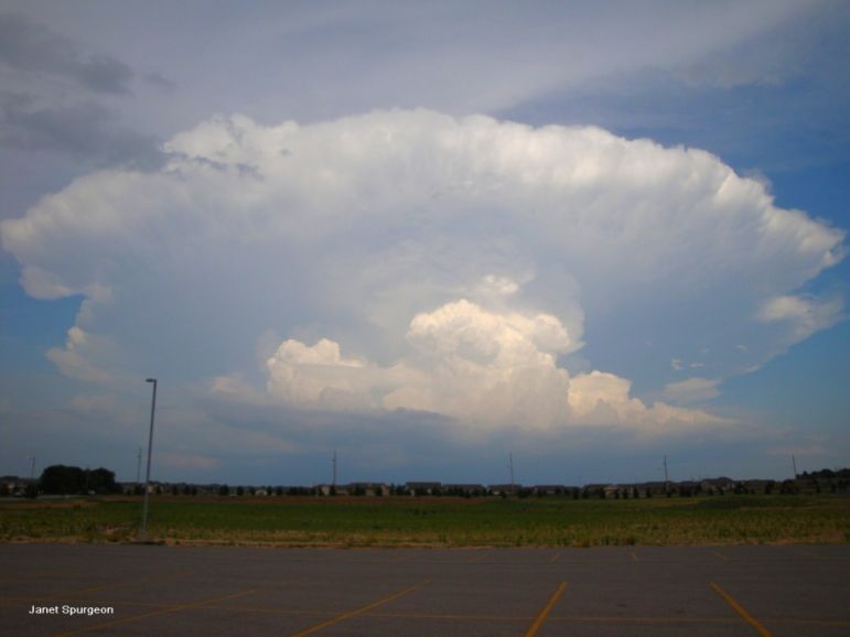
Picture of the Butler County supercell thunderstorm that produced numerous brief tornadoes. This picture was taken from the northwest side of Wichita by Janet Spurgeon. |
Radar Images(click on images to enlarge)
|
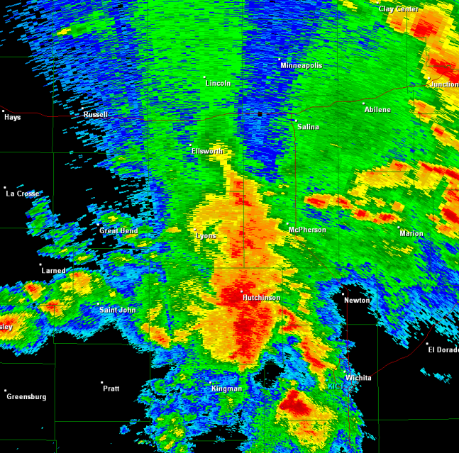
Radar image(Dodge City) showing the storm that produced the destructive winds across Reno and Harvey Counties. |
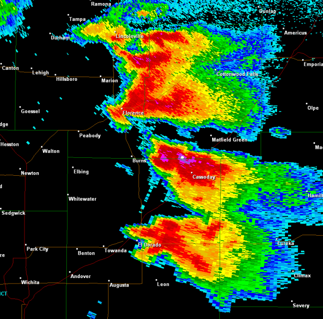
Radar image(Topeka) showing two supercells. One just east of El Dorado(Butler County) with another near Florence(Marion County). |