Giant Hail, Wind and Tornadoes
Wallop South Central and Southeastern Kansas
September 15th, 2010
|
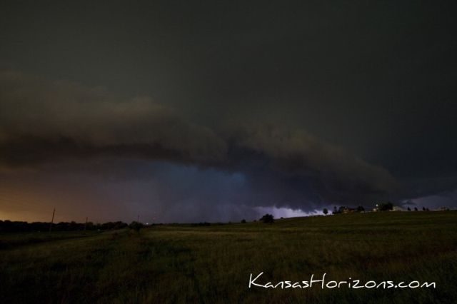
Overview: Severe thunderstorms which developed late afternoon on September 15th, 2010, produced six confirmed tornadoes, extensive wind damage and record setting hail. Hail measuring 7.75 inches in diameter and weighing 1.1 pounds fell in southwest Wichita (CLICK HERE for more information on the record hailstone). This was part of a large hail swath that extended from Goddard to Udall. Numerous cars and homes were damaged by the baseball to larger than softball sized hail. The supercell responsible for this hail transitioned as it exited Sedgwick County and produced extensive wind damage across a large part of Cowley County. Another supercell which produced a brief tornado in Greenwood County, transitioned into a bow echo (a line of storms) that produced 65 to 75 mph winds across parts of Wilson, Montgomery and Labette Counties.
Meteorological Background: During the morning of September 15, 2010, a line of convection moved across central and eastern Kansas which created a cold pool over much of the same area. The cloud cover associated with these early thunderstorms along with a surface low pressure system helped set the stage for the later monster thunderstorms. As the clouds started to clear across southern Kansas ahead (east) of the surface low, temperatures started to climb as did dewpoint temperatures. The combination of the surface boundaries from the early morning cold pool and the cold front associated with the surface low pressure aided in creating an area of convergence which helped to initiate thunderstorms. Thunderstorms developed in Reno County just before 4 pm. The high dewpoints and surface temperatures were ripe conditions for explosive and intense thunderstorm development. |
|
|
|
Sedgwick and Cowley Counties
Hail and Tornado Damage
|
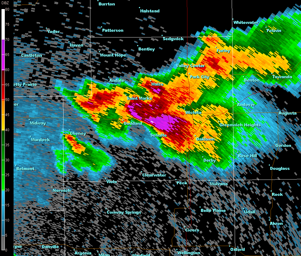
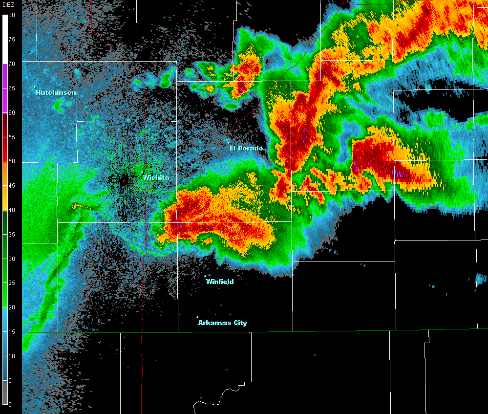
The storms that developed in Reno County quickly became supercells with the largest moving over Cheney Lake before taking a right turn and moving southeast across Maize, Goddard and Western Wichita. As it moved over these areas, baseball to softball and even larger sized hail damaged homes, vehicles, lawns and everything else in its way. However, the storm wasn't over with the large hail. Tornadoes also touched down across southern Sedgwick County and Cowley Counties. The supercell continued on a southeasterly trek moving near Haysville, Derby, and eventually moving just to the northeast of Winfield. The extreme power in these supercells allowed for hail up to at least seven inches, if not larger, to be created before they fell to the ground. There were up to five tornado touchdowns with this supercell as it moved across southern Sedgwick County and across Cowley County. |
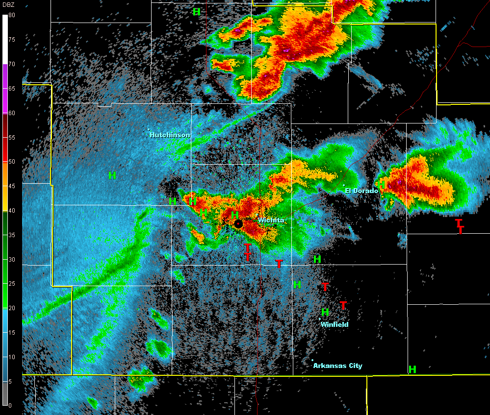
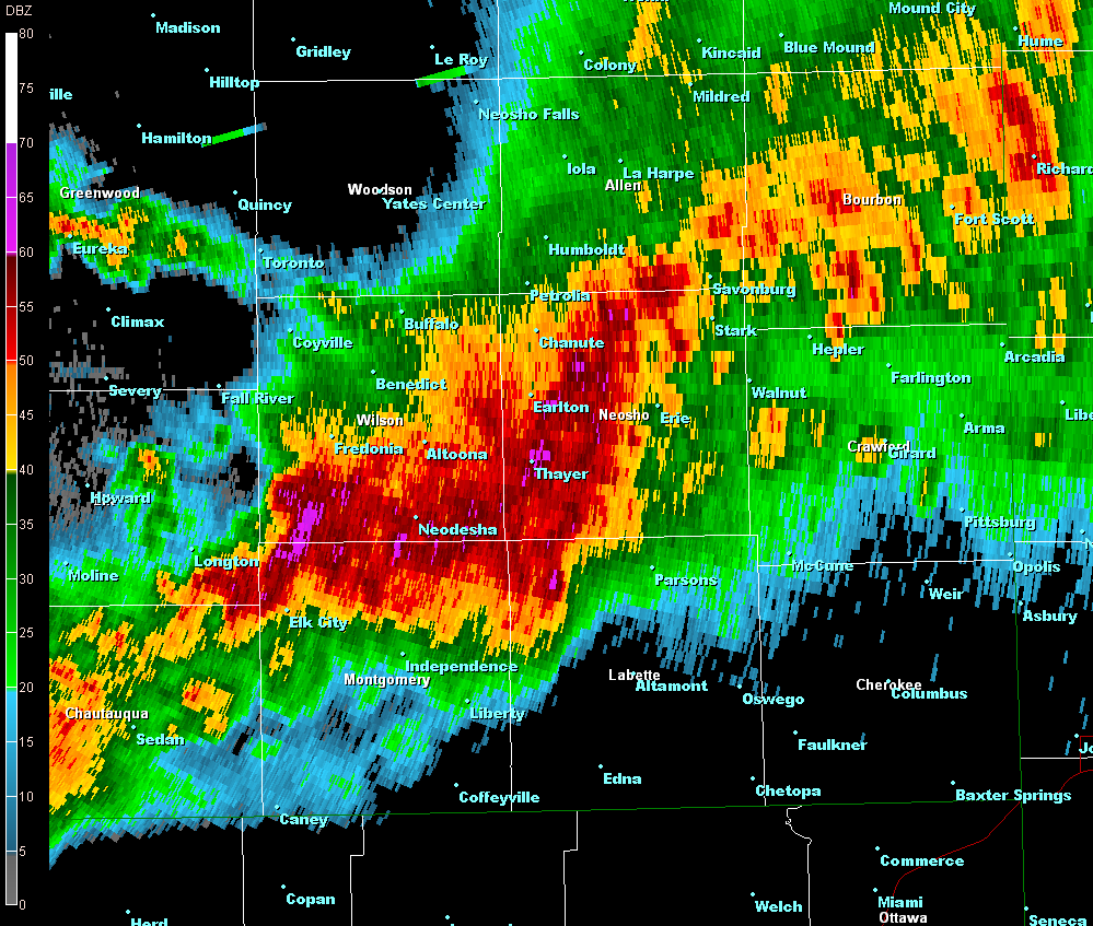
Radar image at 549 pm. Baseball and larger hail was occurring in the dark pink and purple areas.
|
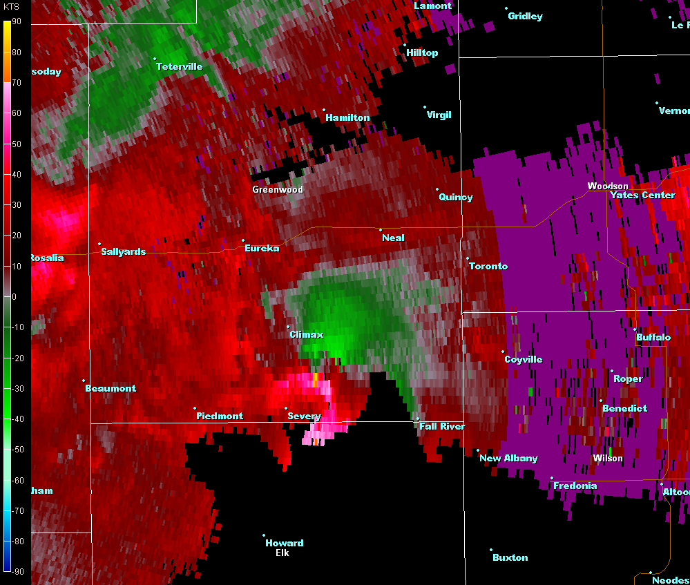
 Radar image of a supercell moving into Cowley County and two in Greenwood County. |
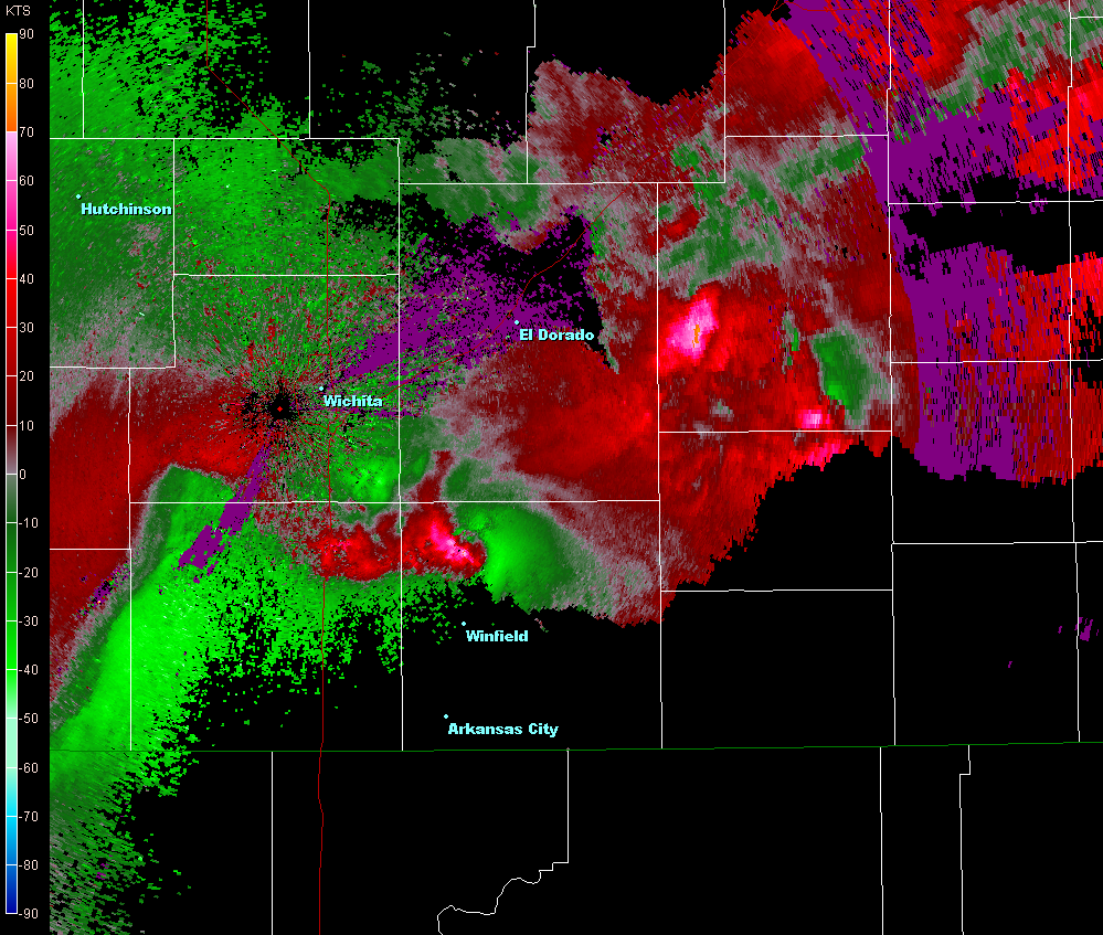
Radar image of doppler wind velocities. Strong rotation occurs where bright red and green are close together. One supercell is north of Winfield and two are in Greenwood County.
|
|
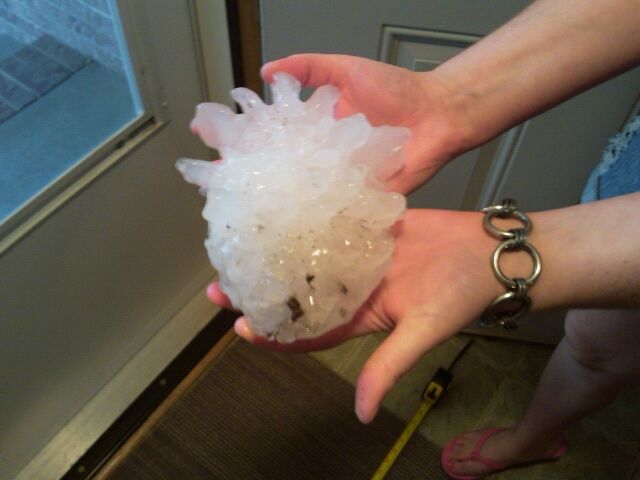
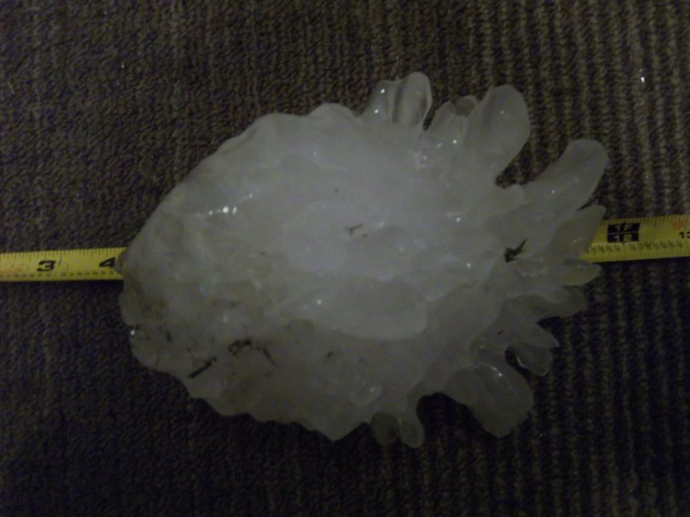
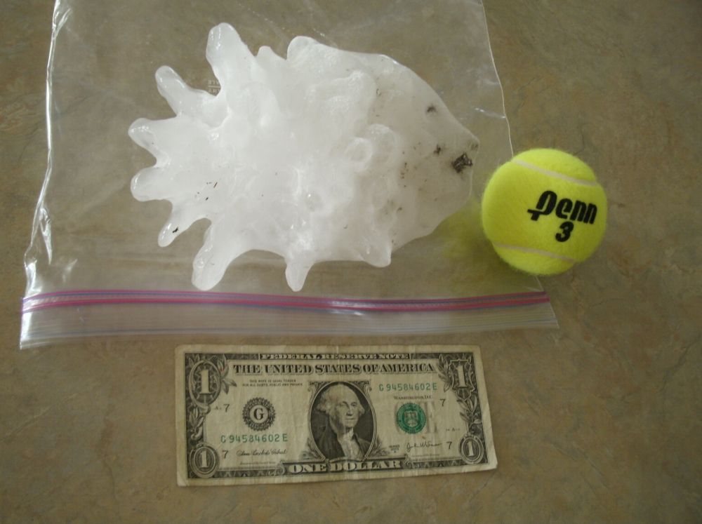
New State Record The hailstone (pictured below) which fell around 6 pm near Pawnee and 119th Street in West Wichita, may set a record for the largest diameter hailstone in Kansas. This hailstone was 7.75 inches in diameter, 15.5 inches in circumference, and weighed 1.1 pounds. The circumference and weight were officially measured 15 hours after it fell. The previous Kansas record hail fell in Coffeyville, on September 3, 1970 was 5.7 inches in diameter, 17.6 inches in circumference, and 1.65 lbs. |
|
7.75 inch hail that fell near Pawnee and 119th Street. Picture from Melissa McCarter. |
7.75 inch hail fell near Pawnee and 119th Street. Picture from Melissa McCarter. |
Photo courtesy of KSN. |
|
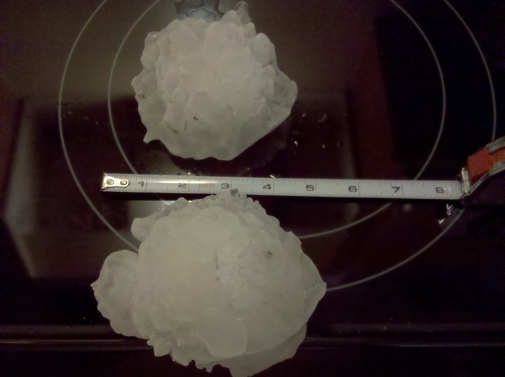
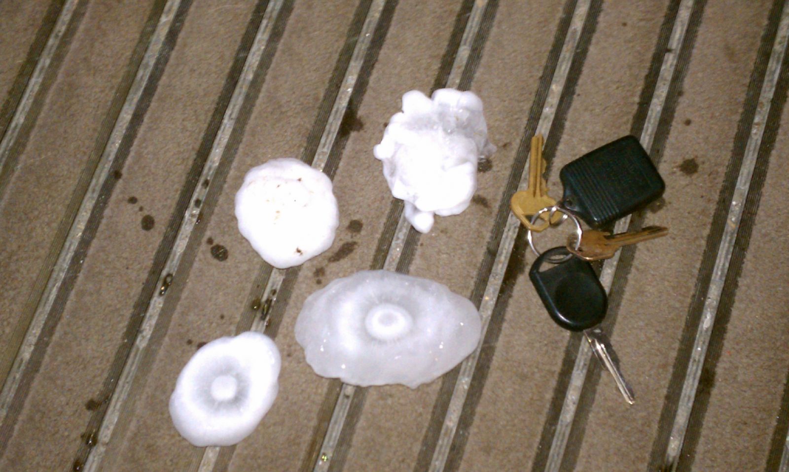
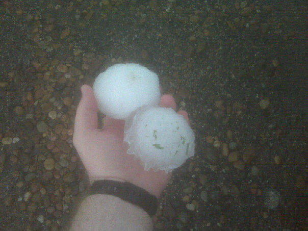
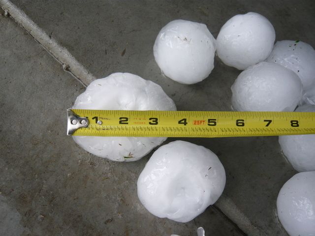
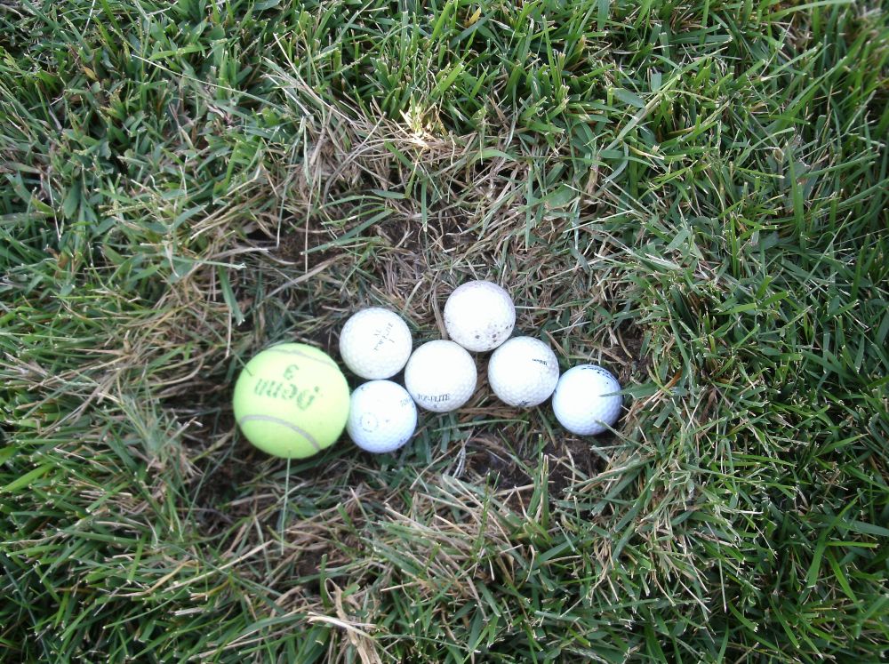
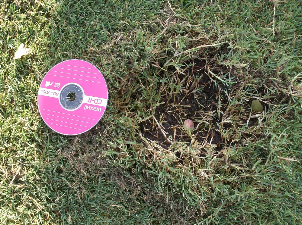
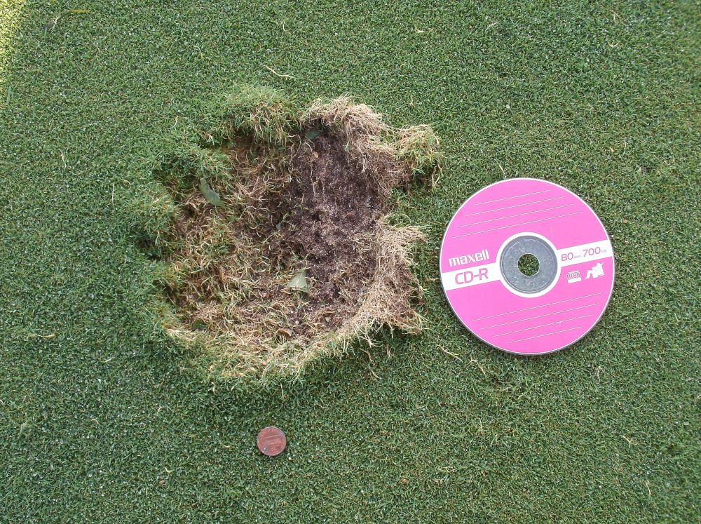
Hail Pictures
|
Picture courtesy of Jordan Henion |
Picture courtesy of Jerilyn |
|
|
 Picture courtesy of Matt Harding |
|
|
|
|
|
Picture courtesy of NWS Wichita |
Picture courtesy of NWS Wichita |
Picture courtesy of NWS Wichita |
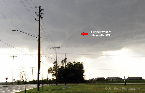
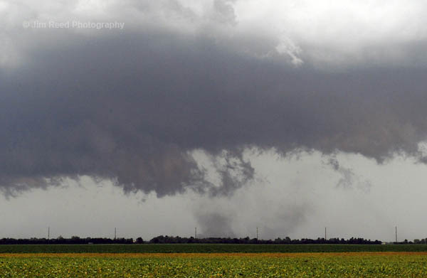
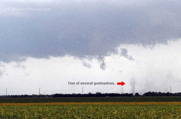
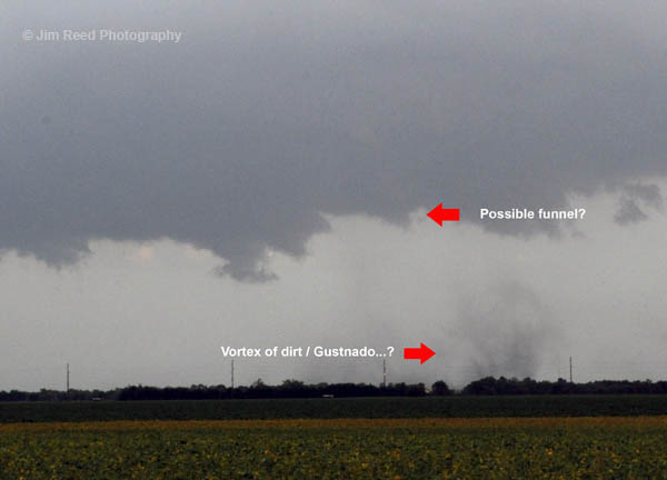
Tornado/Funnel Photos
|
Photo courtesy of Jim Reed |
Photo courtesy of Jim Reed |
Photo courtesy of Jim Reed |
Photo courtesy of Jim Reed |
|
Wind Damage Photos
 |
 |
.jpg) |
.jpg) |
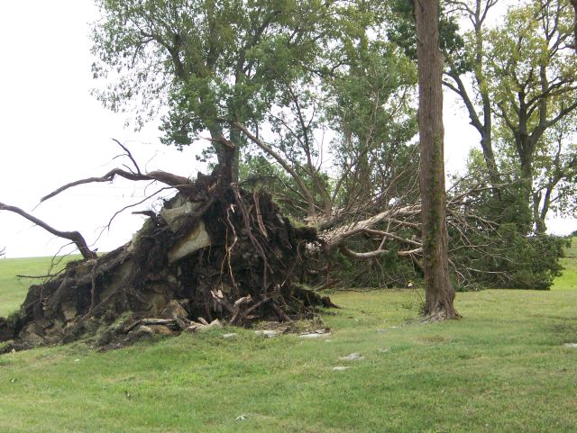
| Tree damage at the Winfield Veteran's Administration Property. Picture by Brian Stone |
A mobile home is damaged in Cowley Co. Picture by Brian Stone |
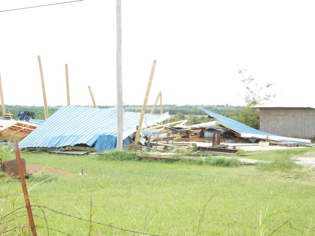
Damage to the Winfield Correctional Facility. Picture by Brian Stone | Barn debris in Cowley Co. Picture by Brian Stone |
|
Another supercell developed near El Dorado, which also became large and strong. This supercell continued to track southeast across Greenwood and into Elk Counties. A funnel was first spotted in southwestern Greenwood County and a touchdown occurred near the town of Severy. |
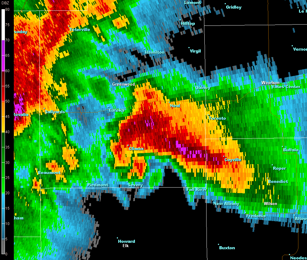
Radar Images
|
Radar image of a supercell in Greenwood County. |
Radar image of velocity showing the strong rotation on between Severy and Climax in Greenwood County. |
|
 |
| Funnel cloud located near Severy, KS at 7:23pm. Picture taken by Jim Saueressig II. |
|
Severe thunderstorms continued to track southeast and developed into a line. A surge of stronger winds developed on the line as the storms moved across portions of Montgomery and Labette Counties. Winds of 66 mph were measured at the Parsons Tri-City Airport before the measuring equipment failed. Estimated winds around 70 mph resulted in widespread wind damage in Parsons. Winds of 60 to 70 mph were also estimated in Coffeyville. |
Radar Images
|
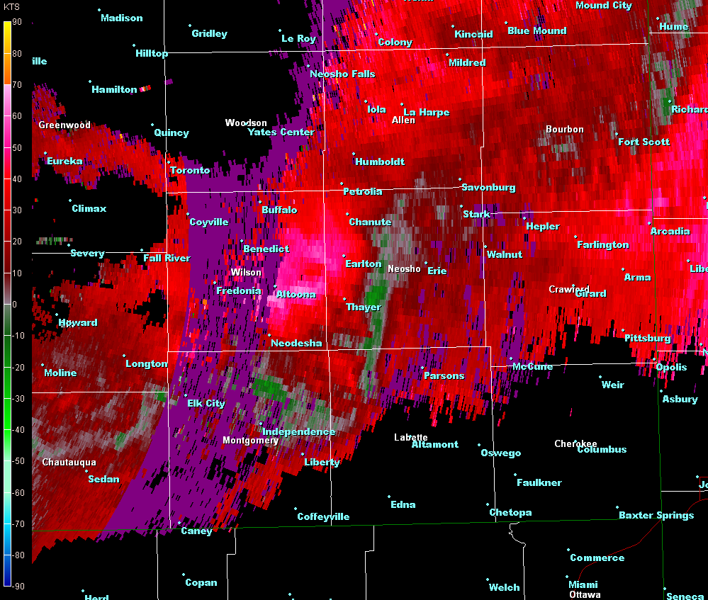
Radar image of the bow echo as it approached Labette County with strong straight line wind damage. |
Radar image of velocity of the bow echo as it approached Labette County. The bright colored red shows the strongest wind speeds approaching Labette County. |
|
| Summary of Most Significant Severe Reports |
|
Large Hail:
Damaging Wind:
|